
Recent snow and cold the table setter for Sunday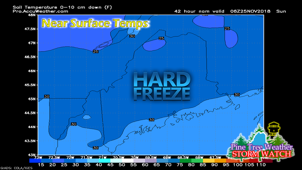 Pardon me for being Captain Obvious to start this update off about the recent cold. However, it is important to note going forward that this will be a factor in the forecast going forward. We have a firm snow pack over the vast majority of the state. Anything that comes in liquid form may cause some problems, and that idea is on the table for Sunday. A very complicated set up to end the weekend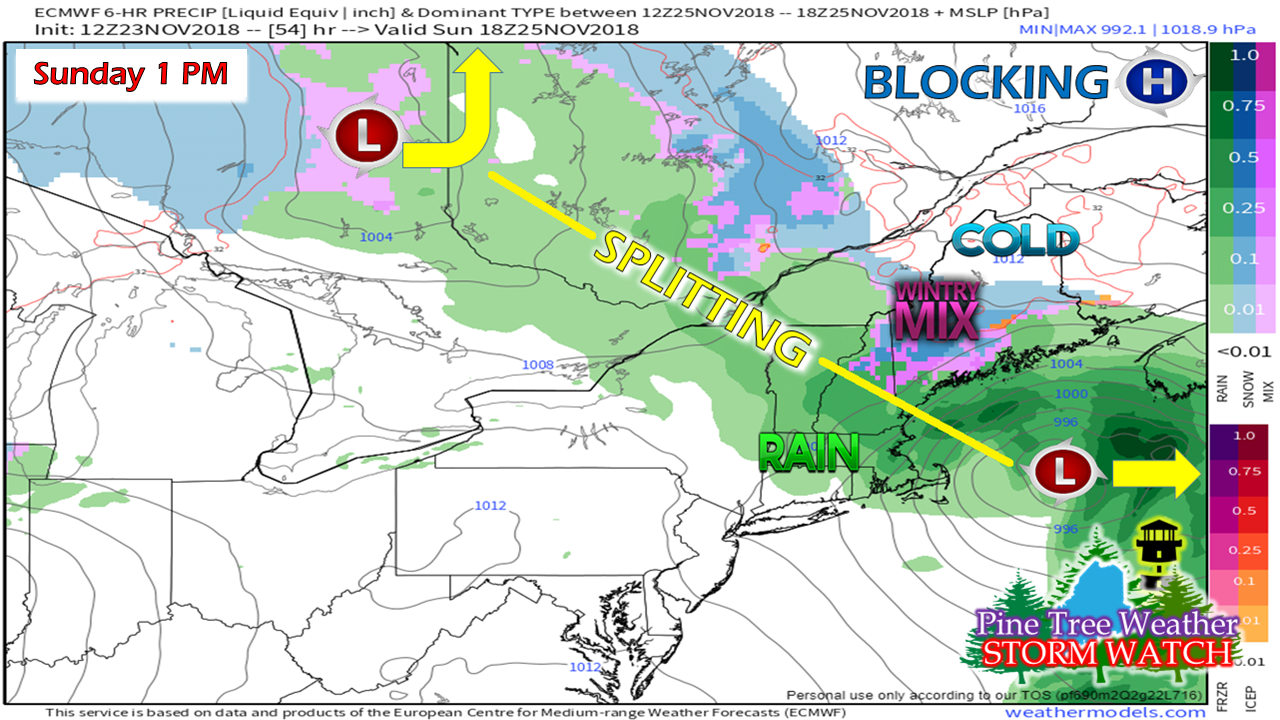 A warm front is going to try to nose into the region late Saturday. A coastal low forms to the southwest and runs into the blocking high to the northeast. Maine is caught in between two storms splitting off with cold air locked in. A cold surface, a warm atmosphere, liquid precipitation freezes on contact. This is going to be one of those "wait and see" situations for Sunday morning. The temperatures by Sunday morning will dictate icing risks. Given the nature of the system, there is a chance for measurable sleet with the system. There is also the chance for snow in the mountains where a couple inches are possible. The game at this point is not only in surface temperatures, but also where the split occurs. Some model ideas split it off early, bringing little to no accumulation. Others like this one bring enough to be concerned about. I am siding with concern at this point. There likely will be enough precipitation to slick surfaces in areas, and for travel in areas away from the shorelines Sunday morning. Then there is snow likely Monday into Tuesday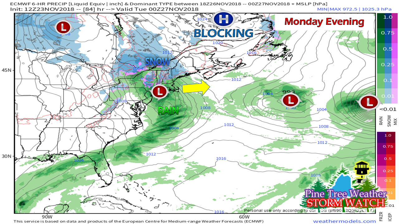 That blocking high is still stuck over Labrador. A stronger frontal boundary and intensifying low pressure moves eastward Monday into Tuesday. This is a track game for coastal areas of whether this falls as rain/mix to snow, a mix to snow, or all snow. Interior areas should plan on all snow, and a plowable event at that. It could be plowable for all areas by the time Tuesday morning rolls around. 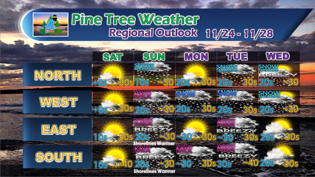 Your support is valued and appreciated!Please consider making a donation to keep Pine Tree Weather going through the year ahead. My data cost expense is increasing. The operation is 75% funded and needs your help to get through the winter. You can set up a monthly pledge on my Patreon page or send me a message from the Facebook page or direct message on Twitter to get my address to mail a check or set up bill pay.
For the latest official forecasts, bulletins and advisories, please check in with the National Weather Service in Gray for western and southern areas, or Caribou for northern and eastern parts of Maine. For more information from me, please follow the Pine Tree Weather Facebook page and my Twitter feed. Always stay weather aware, and thank you for your support! - Mike |

Mike Haggett
|


