
Friday Night: Mild Low Temperatures and Potential Rain Showers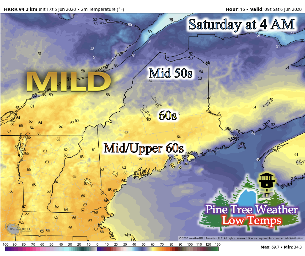 Heading into the weekend, rain is in the forecast. Before the main rain event on Saturday, a weak warm front associated with the oncoming low pressure system gives an increase to nighttime low temperatures statewide and some instability to create some weak nighttime showers. These showers, if they are to occur, would pass over southern and Down East Maine. Patchy fog in the area is likely in the early morning hours after these showers. Lows in the mid-50s are expected for northern Maine, 60s for central Maine, and mid- to upper-60s for western and the Portland area. Saturday: Scattered Thunderstorms and Cooler Temperatures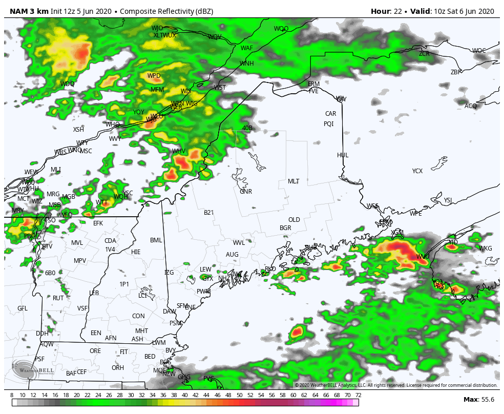 The GIF above runs from 5 AM Saturday to 11 PM Saturday. Overnight Friday and into Saturday, a cold front will be pushing through, bringing rain showers and scattered thunderstorms across the state. In previous model runs, the thunderstorms were in a more pristine line, but as we get closer to the event, it seems these thunderstorms will be scattered statewide. Keep an eye on the local radar to see if your specific area looks to be expecting one of these storms tomorrow. 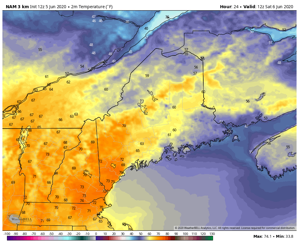 The GIF above runs from 7 AM Saturday to 11 PM Saturday. When the cold front moves through the state, cooler temperatures from the air to the north is likely. Winds look to shift northerly, so it'll be a cooler for the first weekend of June. Saturday Night: Cooler Temperatures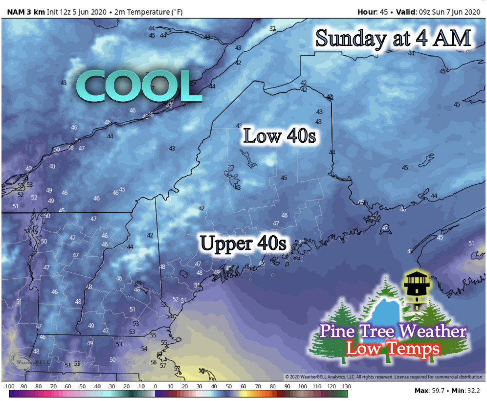 Taking a look into Saturday night's low temperatures tells us that there are pockets of elevated areas that are likely to get quite cool. Uncertainty still surrounds how cold certain areas will get, and if there is any sort of frost potential. Mostly cloudy cloud cover and increased wind speeds give confidence that temperatures may not dip to frost potential temperatures, but we will be monitoring the low temperatures tonight and tomorrow. Sunday: Cooler Daytime Temperatures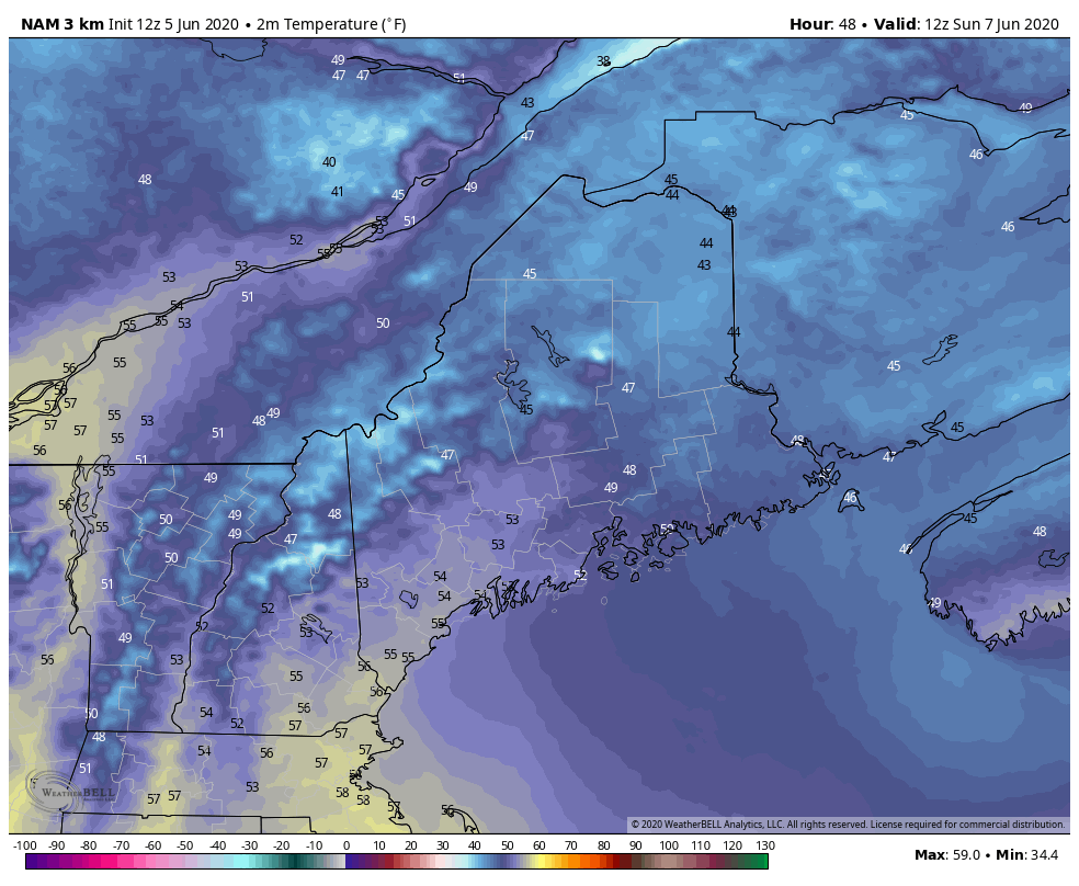 Northerly winds will keep daytime temperatures cooler than previous days. Any leftover instability from the frontal boundary passage has potential to create weak rain showers over central Maine in the morning, and quickly dissipate once afternoon arrives. Mostly cloudy skies will blanket statewide for most of the day. Looking Ahead into Next Week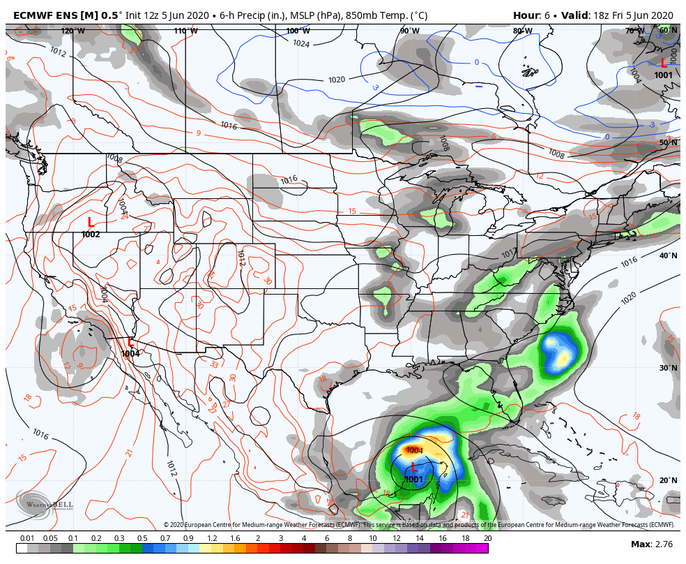 The GIF above runs from 1 PM Friday, June 5th to 7 AM Friday, June 12th. This precipitation probability forecast from a long-range model shows the remnants of Tropical Storm Cristobal moving up the continental United States and forming into an extra-tropical cyclone that looks to track northeast and above Maine. Timing, location, and intensity of this potential system is forthcoming until newer model runs make themselves available, but this may be the next system to give Maine rain showers statewide. Severe Weather Safety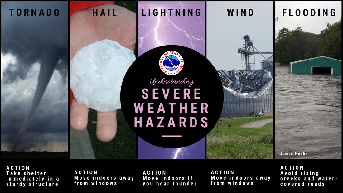 Summer is here, and with its warmer temperatures comes severe weather. Severe weather is categorized as a thunderstorm with the ability to produce hail, strong winds, or tornadoes. It is important to take action during a severe weather event for the protection of your life. The National Weather Service has a webpage dedicated to educating individuals on safety procedures regarding severe weather events. Stay informed!
For more information, please follow Pine Tree Weather on Facebook and Twitter.
Thank you for supporting this community based weather information source that is funded by your financial contributions. Stay on alert, stay updated, and stay safe! Have a great rest of your Friday! The weekend is here! - Kaitlyn |

Mike Haggett
|


