
|
Given the potential impacts of this storm and the complexity of it around a major holiday, I have reversed flow of this post. Tuesday's outlook is near the bottom, so that will come. The elephant in the room is Christmas, and there is much to talk about. Prepare for power loss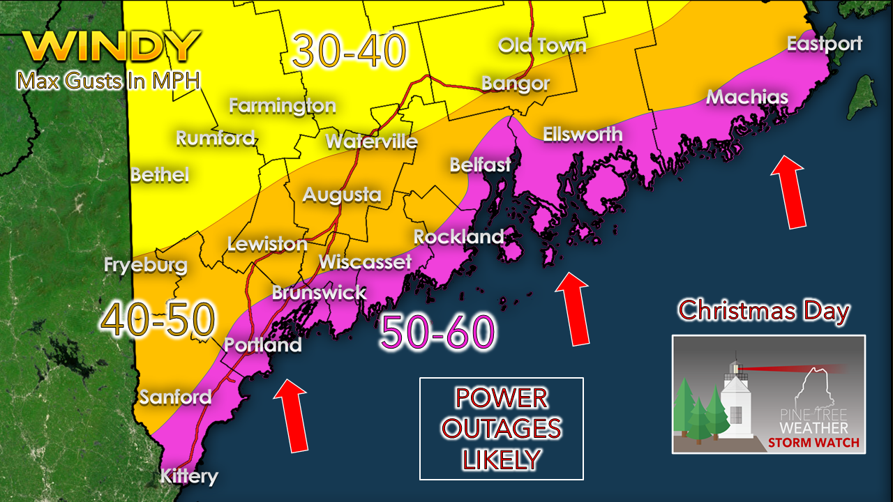 Confidence is growing in a high wind event here. With the south/southeast tropical fire hose set up which has been a common occurrence in the past couple of months, coastal areas are likely to get the brunt of this. It is important that you prepare your yard of Christmas lights and ornaments accordingly, as they could become airborne or destroyed. If you are planning food, unless you have a generator hook up with your stove, prepare food ahead. For those with shoreline interests, thankfully the tide cycle is not an issue for major flooding, but some minor flooding, splash-over and beach erosion is likely here. 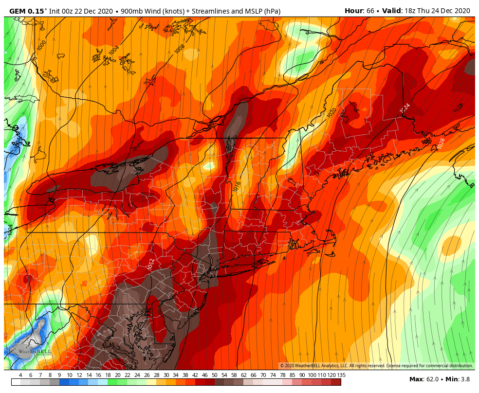 GEM idea of 900mb level wind from 1 PM Thursday to 1 PM Saturday .Wind speeds at ~2,500 feet show a low level jet pushing 85 knots (98 mph). Add the fact this is an intensifying storm, it's a fairly safe bet that surface speeds along the coast could reach 50-60 mph, or higher. The train moves in overnight Christmas Eve into Christmas morning. Baring any slow down in advance of the frontal boundary (that is a possibility), southern and western areas see the high wind threat diminish in the afternoon, and for northern and eastern areas by midnight Saturday. Our battle tested power line crews, tree removal companies and public works crews will likely give up their Christmas with their families for recovery efforts. Pray for them. Heavy rain, fog and snowmelt also a concern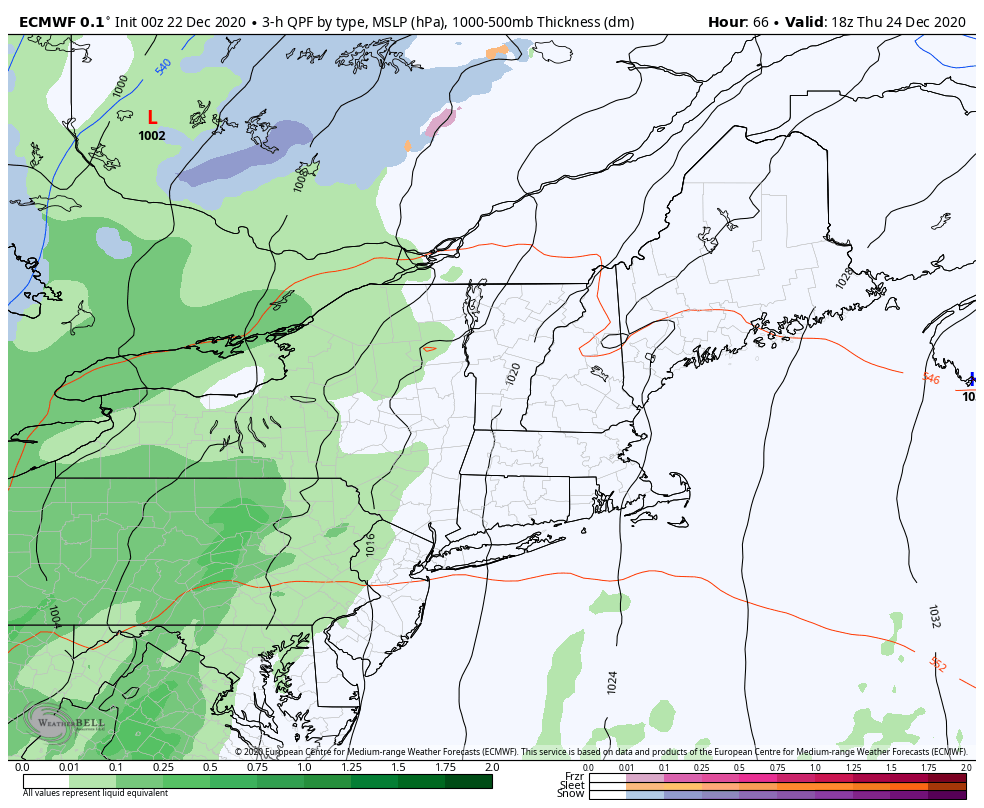 European idea of surface pressure and precipitation type from 1 PM Thursday to 10 AM Saturday As far as the timing of this storm goes, western and southern areas may see some outflow showers Thursday afternoon. Heavy rain moves in from west to east Thursday night into Christmas Day. The model idea depicted here shows the front moving steadily through the region. My hope is that is the case. I did see a reliable piece of data that indicates that the front may stall for a couple hours. That would not be good. For now, the end of precipitation comes by Christmas evening for southern and western areas, and in the wee hours of Saturday for northern and eastern areas. Snow showers are possible on the backside of the front for the western mountains and northern areas. Timing will be updated, so stay tuned on that. Now, onto flood potential... 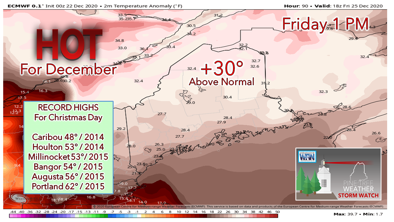 We've had a warm Christmas in recent times. New record highs could be established in Caribou and Houlton, and perhaps Millinocket and Bangor. The 2015 record highs for Augusta and Portland appear to hold. 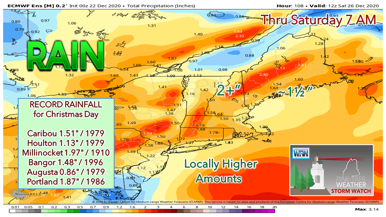 I expect several record rainfalls to be established from this event. The 110 year record for Millinocket may fall here. This European ensemble idea is nudging northward for the mountains. I can see 3-4" falling in the mountains. If the front stalls for a few hours, 4-5". There may be embedded claps of thunder in the heavy rain which will add higher amounts in areas. 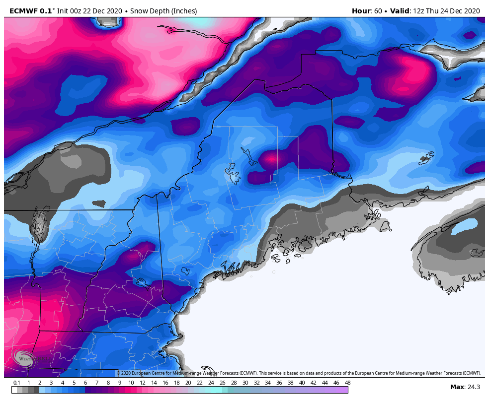 European model idea of snow depth on the surface from 7 AM Thursday to 7 AM Saturday Between the heavy rain, fog, and far above normal temperatures, the snow pack is likely to vanish. With 1-2" of water captured in the current snow pack, roughly 1½-3" of additional rainfall on the way, flooding of small rivers and streams are likely. Urban street flooding from clogged drains along with ponding on roadways and melting of snow could make a mess in our bigger towns and low lying areas. Hydroplaning on the highways. With all of that, there is the likelihood of flooded basements. If you depend on a sump pump to keep your basement dry, and you do not have a generator, and you lose power, you could have a big mess on your hands. Then on the back side of this, the sucker punch... 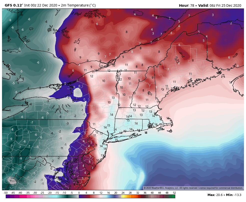 GFS idea of 2m temperatures in C° from 1 AM Friday to 7 AM Saturday Temperatures shown here in Celsius to make the point that all of this is going to freeze up and create a skating rink by Saturday morning. Temperatures could stay below freezing for the mountains and north into next week, southern and eastern areas may see the mercury nudge above freezing by the first of next week. Bottom line: It appears The Grinch is going to steal Christmas 2020.  And now for Tuesday...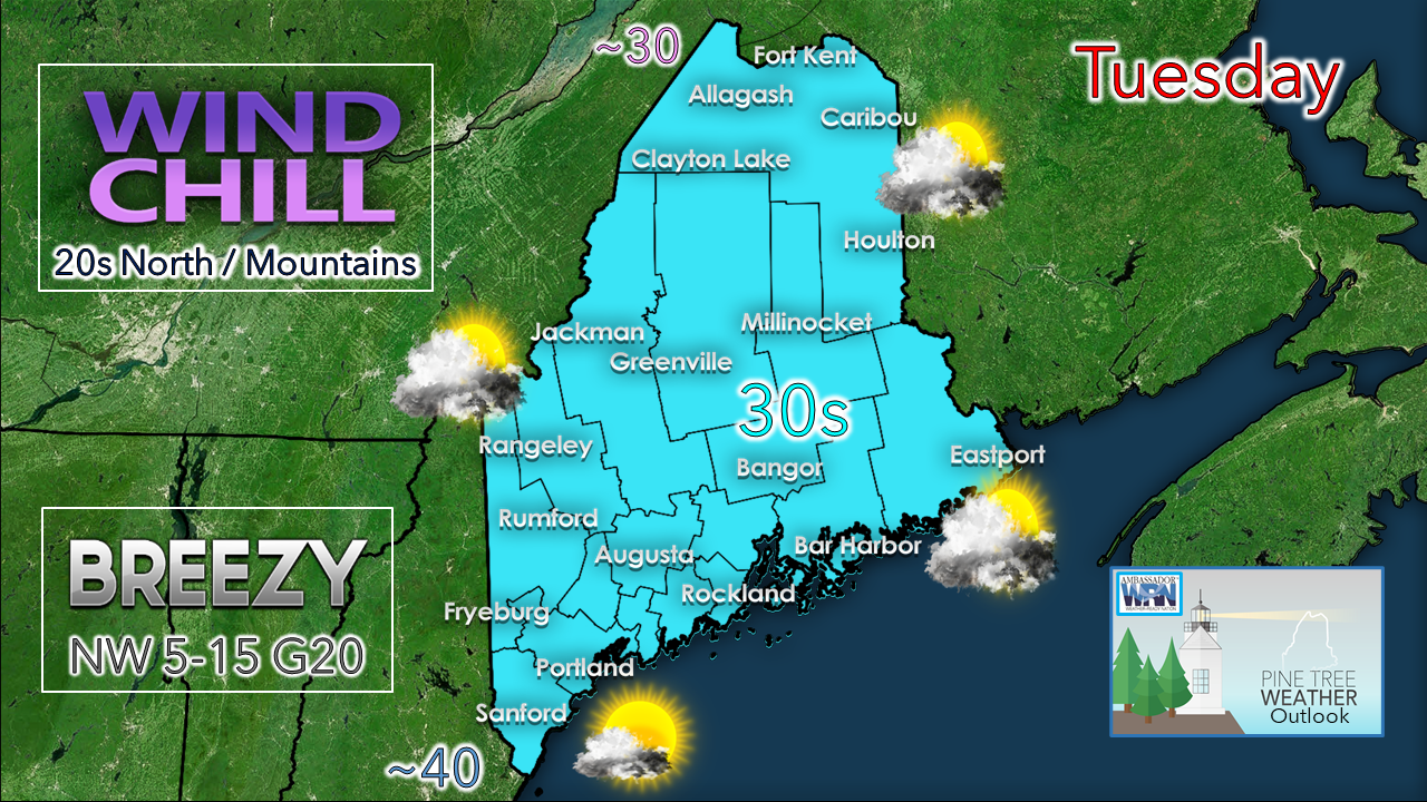 Add an extra layer if you are spending time outside for the day. Southern areas have the best chance for sun. High pressure settles in for Wednesday and settles the wind. Most areas away from the shorelines will stay below freezing for the day. Flood warning versus flood watch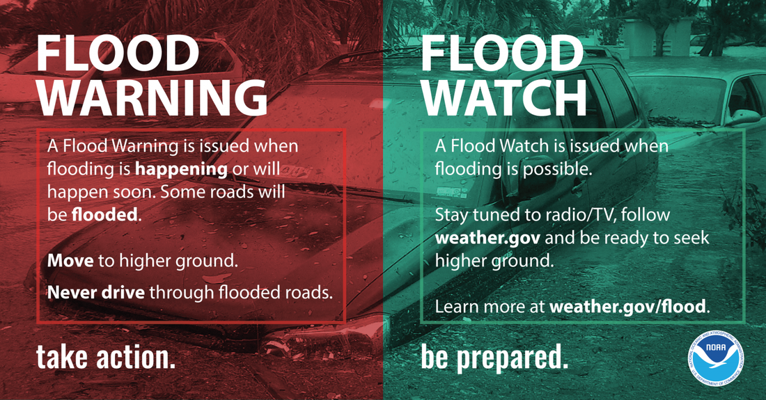 A flood WARNING means TAKE ACTION. A flood WATCH means BE PREPARED. When a Warning occurs, it means flooding is imminent or already occurring. When a Flood Watch is in effect, it means flooding is possible in your area. weather.gov/safety/flood-watch-warning Temperature outlook through MondayIdeas are mixed on when the next storm comes and what type of precipitation could be involved. Expect something Tuesday / Wednesday for now. That will be updated. 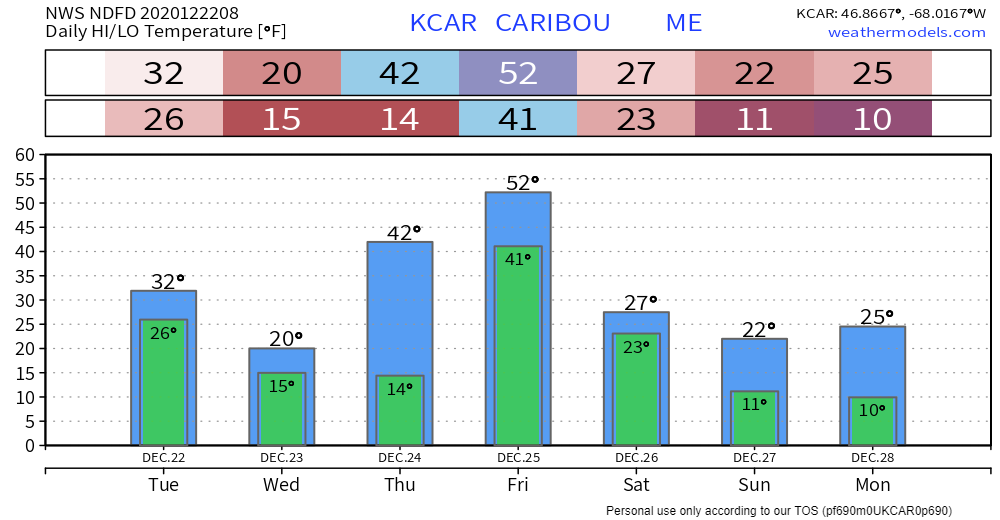 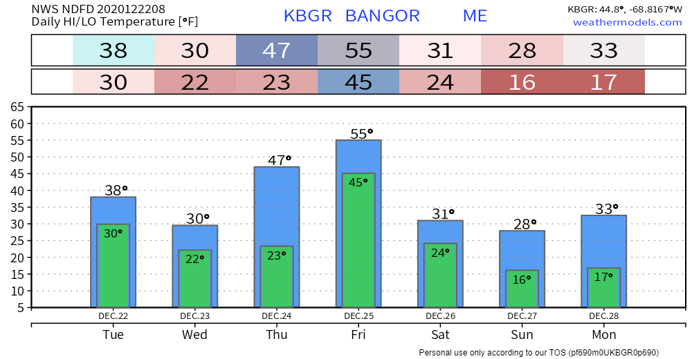 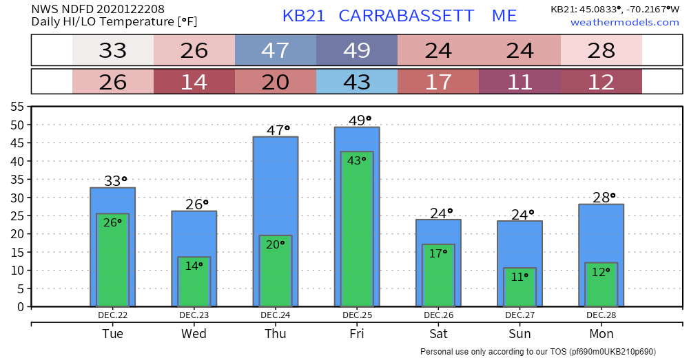 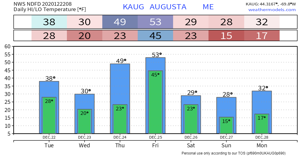 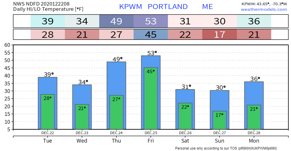 Be prepared to receive alerts and stay updated!
For more information, please follow Pine Tree Weather on Facebook and Twitter.
** FUNDING NEEDED FOR 2021 ** Thank you for supporting this community based weather information source that is funded by your financial contributions. Stay updated, stay on alert, and stay safe! - Mike |

Mike Haggett
|


