Higher totals stay south of the regionIt has been interesting to watch the model handling of this storm over the past few days. As I mentioned here previously, there are blind spots of data gathering by radiosondes (weather balloons) in certain areas in northwestern Canada as well as the Pacific Ocean, and that at times causes jerks in model ideas, and that came into play here. Now as we approach the event, consensus is coming together. 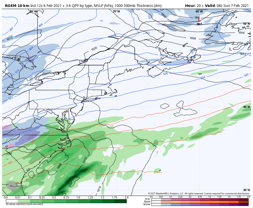 In my opinion, where the difficulty to predict has come into play is the timing of the phasing and where. The idea at this point is that while the storm begins to come together off the DelMarVa in the wee hours of Sunday, it does not appear to get into rapid intensification until it passes east of the benchmark point (40° N / 70° W) south of Nantucket. The storm appears at this point to track due east of there, which would make it an all snow event for Maine. 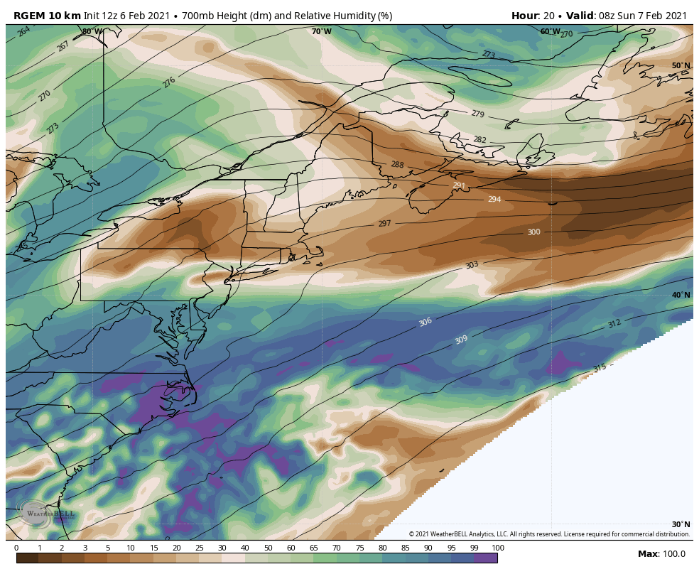 Another important piece in this it the development of the 700mb low. What goes on at 9,900 feet above sea level is what drives and steers the moisture. While the surface low is fairly well organized, the upper levels appear rather flat until after the storm moves towards Nova Scotia late Sunday afternoon. In this case, the development of the low at that level is slow coming, and relatively flat during the time snow begins to fall in the region. Had this been a bit better organized, winter storm watches would be hoisted and there would be 6"+ plus on the way. For this reason I have been rather skeptical on the snow amounts models have been producing. 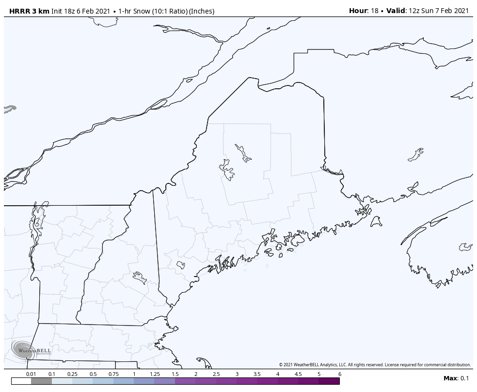 The first flakes reach southwestern areas by around 1-2 PM and expand northeast, reaching the mountains and eastern areas by roughly 3-4 PM, and northern areas by around 9-10 PM. By the time the first flakes fall in the north, the last of the flakes are over in southern areas by around midnight - 1 AM. Western areas are done by 1-2 AM, eastern areas by 2-3 AM. The forecast is a bit tricky for the north as an inverted trough may set up to keep snow showers going into Monday morning, but the steadier snow appears over with around 7-8 AM. 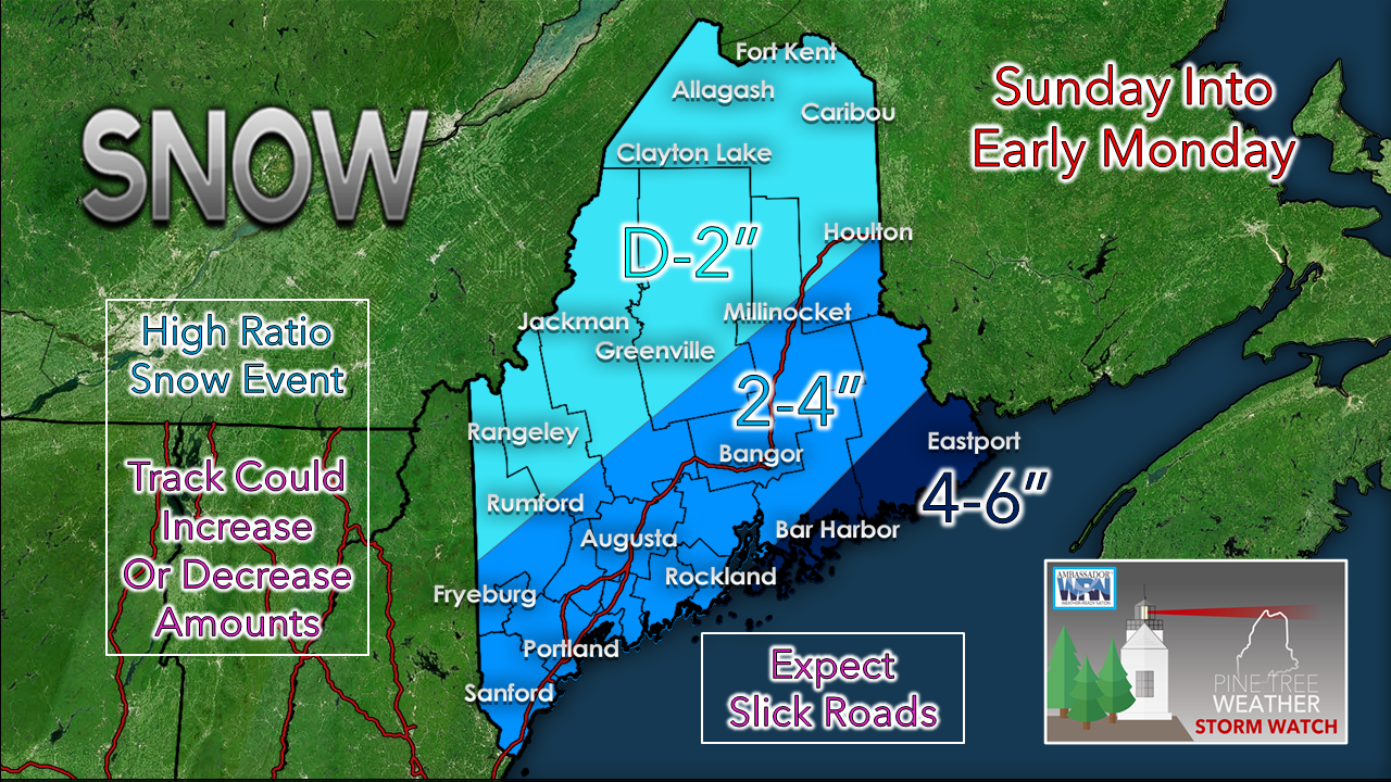 My forecast amounts have not changed. If the storm moves a bit closer, the lines move a bit further inland. If the storm tracks further south, a bit less. Given the data I have seen, I have good confidence in this forecast. I am not expecting a whole lot of wind with this. Coastal areas may see gusts in the 20-25 mph range, but that will be about it. The wind does appear to pick up on the backside of the storm on Monday, which could cause some blowing and drifting of snow as what falls here appears to be fluffy. This may cause slick spots through the day until the storm moves further east, dropping the wind Monday night. Two more potential storms in the pipeline Tuesday and again Friday. Stay tuned for more on those. Posting statusI do have some family matters and school work to attend to. Please watch the Facebook page for any further updates from me on this storm. I will update here again Monday morning.  mPING your weather reports! Check out mPING (Meteorological Phenomena Identification Near the Ground) project. Weird name, cool app! You can report the type of precipitation you see where you are. No need to measure! Use the free mobile app to send reports anonymously. Reports are automatically recorded into a database, which improves weather computer models. The information is even used by road maintenance operations and the aviation industry to diagnose areas of icing. mping.nssl.noaa.gov Be prepared to receive alerts and stay updated!
For more information in between posts, please follow Pine Tree Weather on Facebook and Twitter.
Thank you for supporting this community based weather information source operates by financial contributions. Stay updated, stay on alert, and stay safe! Thank you as always for your support! - Mike |

Mike Haggett
|