
Temperature roller coaster ride continues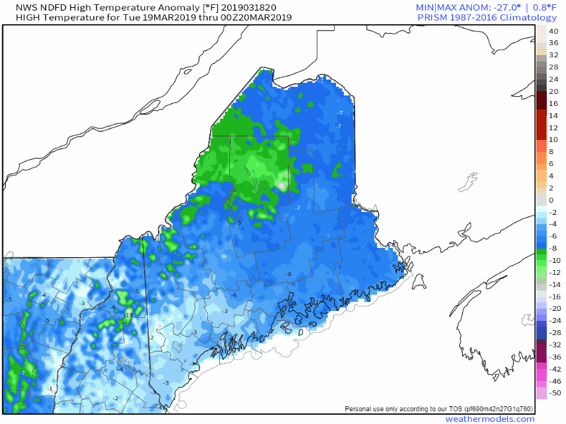 A look at high temperature departure from normal forecast from the National Weather Service shows spring will arrive on schedule. The darker blues and greens indicate below normal, the oranges indicate above normal. This is the time of year where we get temperature whiplash at times. The region stays cool for Tuesday. After a well below normal cold Wednesday, temperatures rise to at or above normal. Temperatures stay slightly above on Thursday before they begin to fall Friday and then crash on Saturday. Sunday shows temperatures bouncing back above normal for the southern two thirds of the state to round out the weekend. Many questions on late week potential storm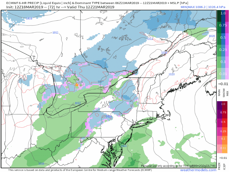 Spring officially begins on Wednesday astrologically. Models have been acting like it since March 1st, which is typical due to that being the start of meteorological spring. The European model here is indicating a potential NorEaster late week which could bring copious amounts of snow for the mountains and north, a potential for some mixing for the western foothills on up into southern Aroostook, and rain for the coast Friday, changing to snow everywhere Friday night before ending on Saturday. For those cheering for one more winter blast, or those who are D-O-N-E done with winter, read this out. Again, we are seeing a jump in this particular model idea from what it has been pitching through the weekend until this one run Monday morning. so we need to tread with skepticism. I would like to see some sort of consistency before I take the bait. Digging under the hood a bit deeper... 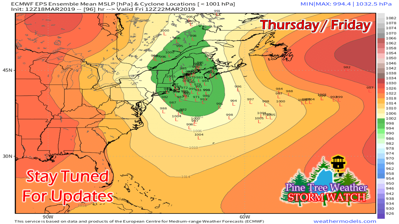 For a storm only four days out, this is quite a spread on individual ensemble ideas. This is rather uncharacteristic, which ads to my skepticism. 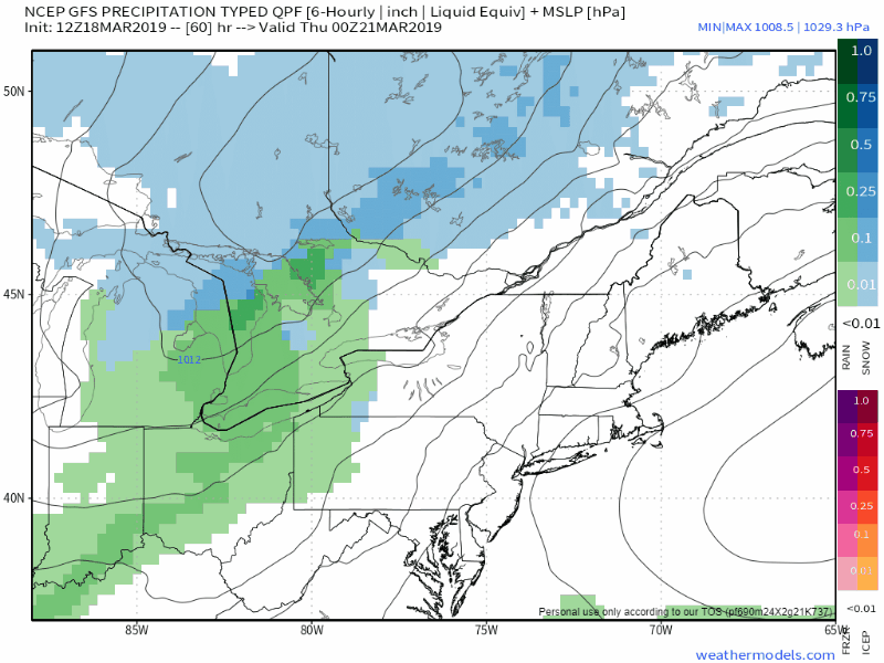 A look at the GFS model which has done a better job in the 4-7 day term shows a much different outcome. A NorEaster gets kicked out to sea by an approaching cold front. Along the frontal boundary is a rain and wet snow. The combination of the two combine and blows up a storm over the Canadian Maritimes and brings some scattered snow showers Friday into Saturday. For the record, this model idea has been consistent and mirrored the European model more or less until the separated Monday morning. The only thing models agree on beyond Wednesday is the wind is going to crank on Saturday, and it's likely to be a cold day. Regional outlook through Saturday... for now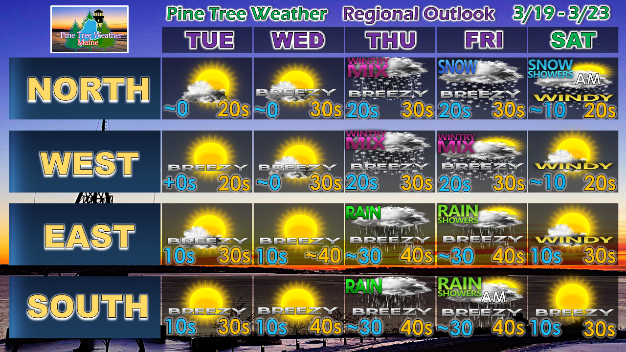 This is my idea for now. I am definitely going to put asterisks on Thursday and Friday for now, but having seen this movie before in the past few weeks, I have reasonable confidence that this forecast will hold up.
That said, we'll see what happens on Tuesday. Welcome to spring... where forecasting weather is truly an art form, and not hinged on one specific model, a particular run or idea... and forecasts can change quickly. Stay tuned... ► ► For the latest official forecasts, bulletins and advisories, please check in with the National Weather Service in Gray for western and southern areas, or Caribou for northern and eastern parts of Maine. ► ► Your financial donations are much appreciated to keep this site funded and for further development. I sincerely appreciate your support not only financially, but also in sharing my efforts with others. Always stay weather aware! - Mike |

Mike Haggett
|


