|
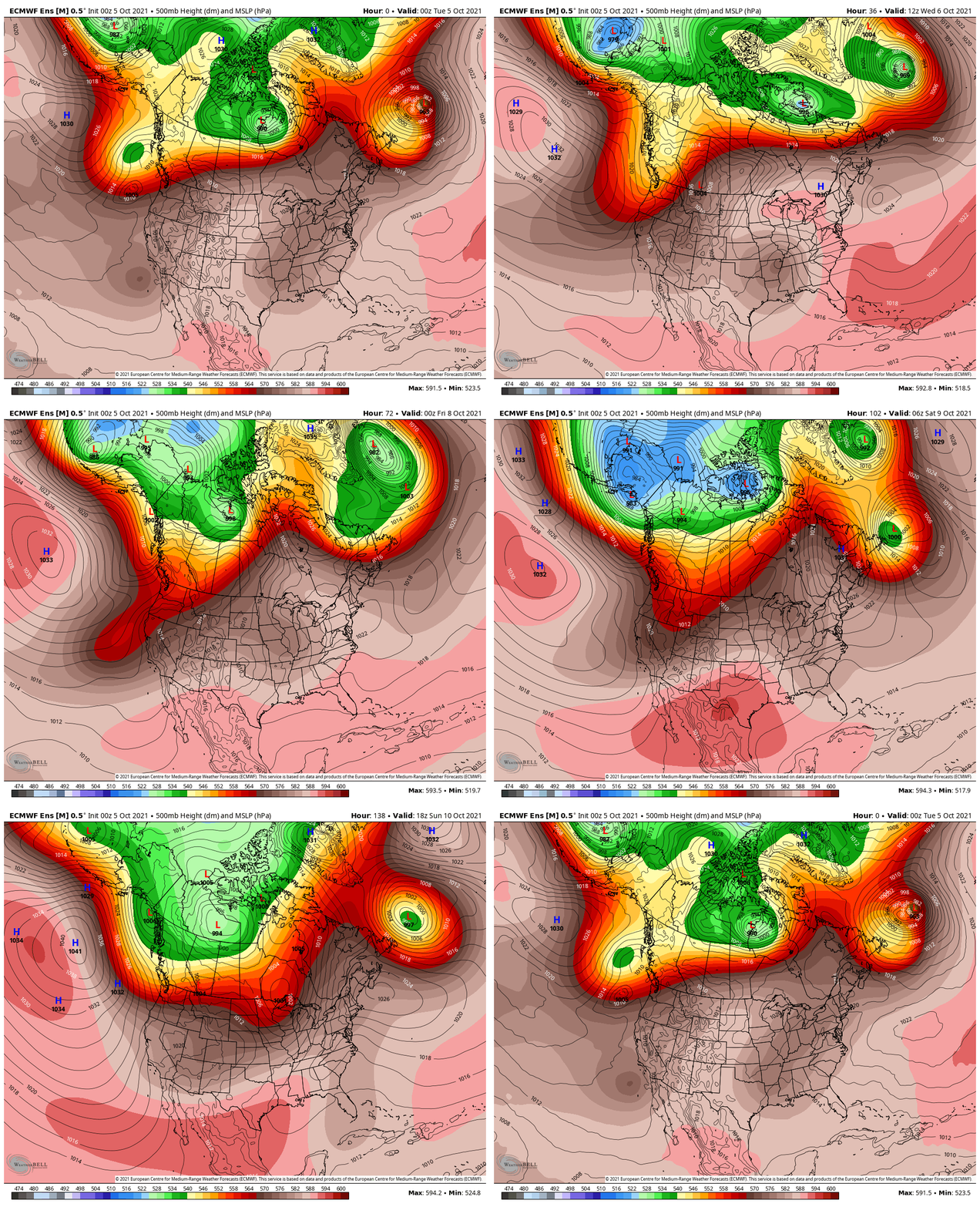
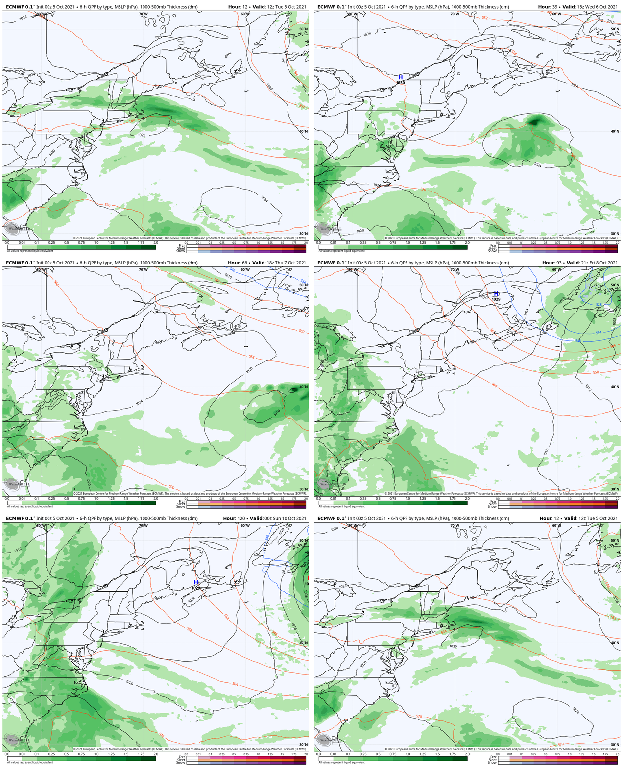
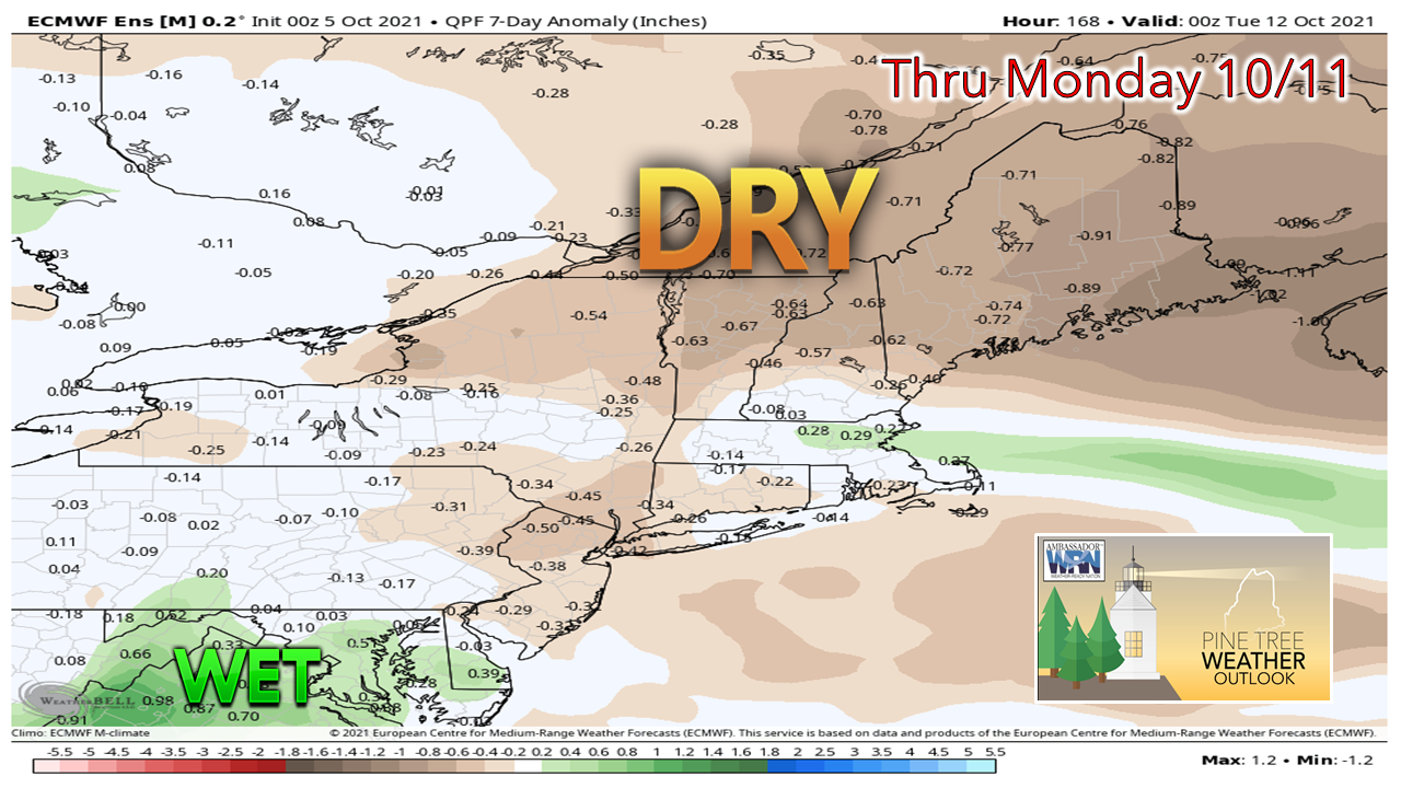
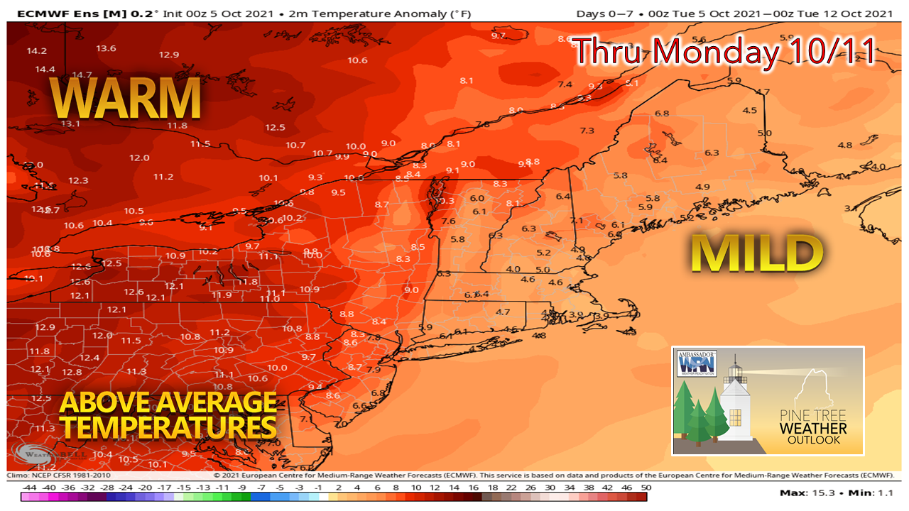
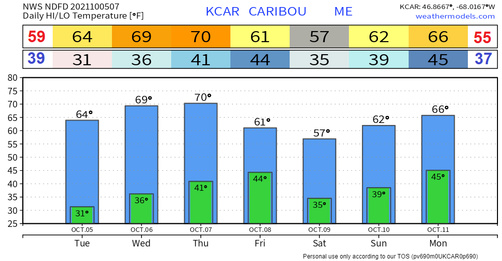
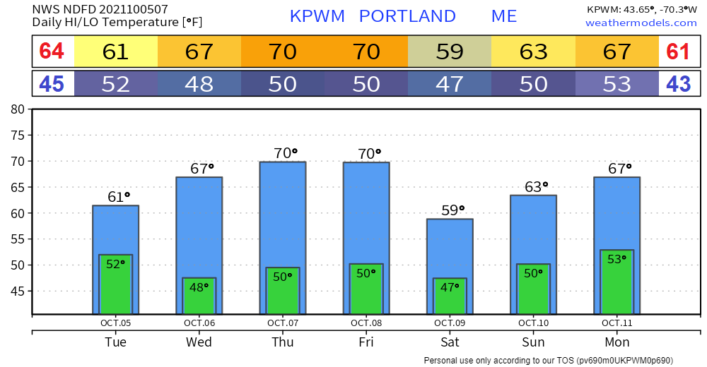
Greetings, everyone! I am taking time to recharge my batteries a bit after a very busy summer and dealing with high demands with the day job and family. I am keeping watch on what is going on and will chime in when impactful weather is in the forecast. I need your financial support to keep this operation going into 2022. For more information, please click on the DONATE link or the banner below to access options. For those who have contributed already, thank you! Blocking pattern keeps the region mild and dryLooking at upper-level pattern and surface pressure shows a strong ridge building into the region that will stick around through early next week. The northwestern part of the hemisphere could see a big charge of winter develop heading into the weekend, with snow as far south as Colorado possible heading into next week. A closer look at the region shows high pressure being the dominant feature over New England through the period. The high, generated from the ridge, drops down from eastern Quebec and sits over the area until late week. While typically these types of highs generate cooler conditions in trough form, in ridge form as in this case brings mild temperatures with an uptick of humidity. A weak backdoor cold front is on tap to pass through the region on Friday which brings cooler, but continued mild temperatures for the weekend. The next threat for rain may come the second half of the weekend as a frontal boundary approaches from the west. It's a bit early to get into details on that at this point. The weather is likely to optimal for the foliage seekers with generally dry conditions expected through early next week. Temperatures will generally be on the mild side through early next week as the strong blocking ridge controls the pattern. At this point, Saturday is the best chance for temperatures to be close to daily averages (anointed on the left and right of the above and below images). For those still gardening, you're getting bonus time. Looking at long range outlooks to the latter part of the month, it appears the pattern could become cooler and stormier, typical for late October. Be prepared to receive alerts and stay updated!
For more information in between posts, please follow Pine Tree Weather on Facebook and Twitter.
Thank you for supporting this community-based weather information source which operates by reader supported financial contributions. Stay updated, stay on alert, and stay safe! - Mike |
Mike Haggett
|

