
Mostly sunny start, clouds and showers north through the afternoon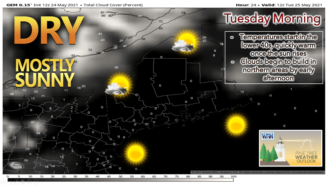 High pressure will continue to push off the coast throughout the overnight hours tonight. It will still be close enough to keep us dry and clear throughout the overnight hours. Temperatures will fall back close to 50 degrees along the immediate coast, with places inland dropping back into the 40s. I wouldn't rule out some of the colder valley locations seeing temperatures fall back into the upper 30s, so keep that in mind especially if you have started gardening this season. Once the sun rises tomorrow morning, temperatures will be quick to warm up. 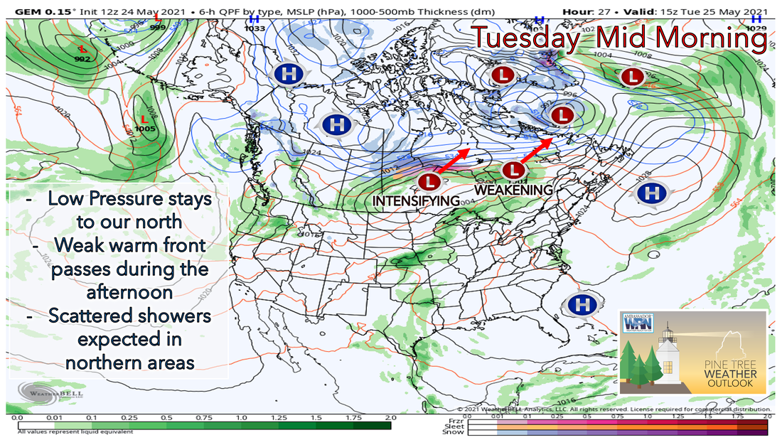 As we head into the late morning and early afternoon hours, a weak warm front will approach the region from the west ahead of a strengthening low pressure system to our northwest in Canada. This will allow for some showers and storms to be sparked off heading into the afternoon hours Tuesday. Currently the greatest threat for these showers remains over Aroostook, northern Penobscot, northern Piscataquis, and northern Somerset counties. 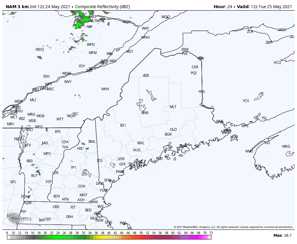 As we head throughout the rest of the afternoon, expect more clouds to filter the sunshine. Temperatures tomorrow will be warmer than they were today, with highs making it into the mid to upper 70s for most places throughout the state. We will continue to see a southwesterly wind throughout the day Tuesday, which will keep temperatures along the mid-coast and DownEast coast in the upper 50s to lower 60s. The dew points will continue to rise throughout the day on Tuesday, so by the evening expect dewpoints to be in the mid to upper 50s. This will start to make things feel sticky heading into the day on Wednesday. Better chance of showers and storms Wednesday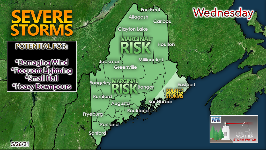 Heading into Wednesday, the strengthening low pressure system to our north will continue to push its way to the east throughout day. A weak cold front will develop thanks to a mid-level trough over the great lakes during the day. As this makes its way into our area, it will help to produce popup showers and thunderstorms heading into the afternoon on Wednesday. Expect them to start through northern parts of the state during the early afternoon, before making it to the coastline by the early evening hours on Wednesday. 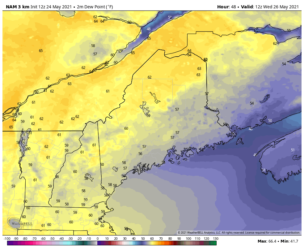 The other big story on Wednesday will be the dew point and muggy air. A return to feeling like summer will be in store for the day on Wednesday. Most places across the state will see temperatures climb into the lower to mid 80s heading into the afternoon before any popup showers and storms. This combined with dew points in the 60s throughout much of the day will make it feel like summer once again. For people who don't like the heat, this appears to be short-lived for now. As we head throughout the rest of the week and into the weekend, temperatures will cool off with highs only making it into the 60s by the time we get to Friday and Saturday, this means we'll have to watch the low temperatures during this stretch, as they're currently forecast to be in the 30s. Be aware that we still have the possibility to see one more frost heading into this weekend. Check back here or on Facebook for more updates as we get closer. 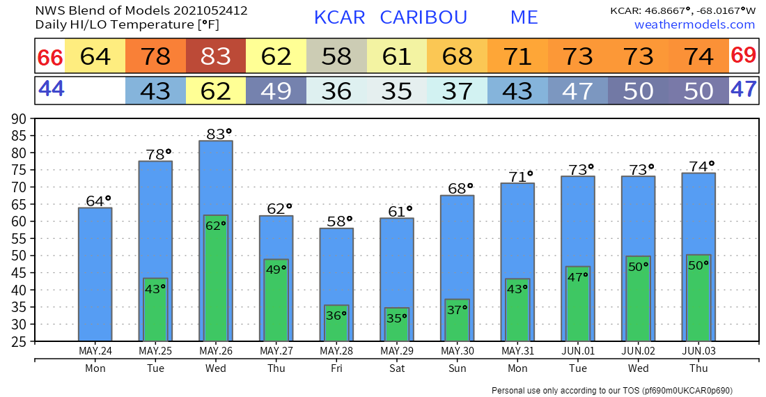 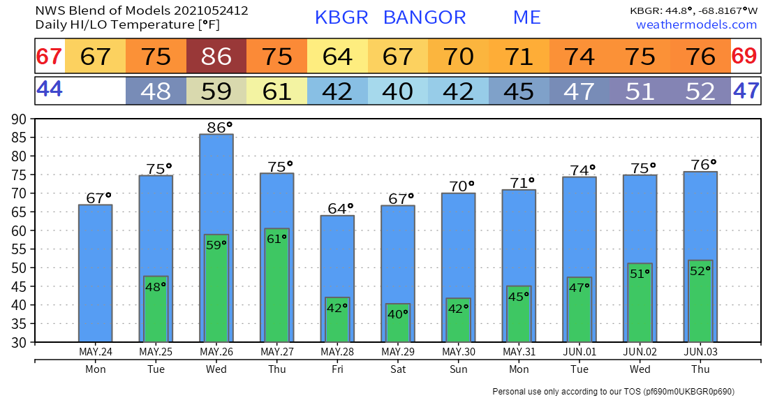 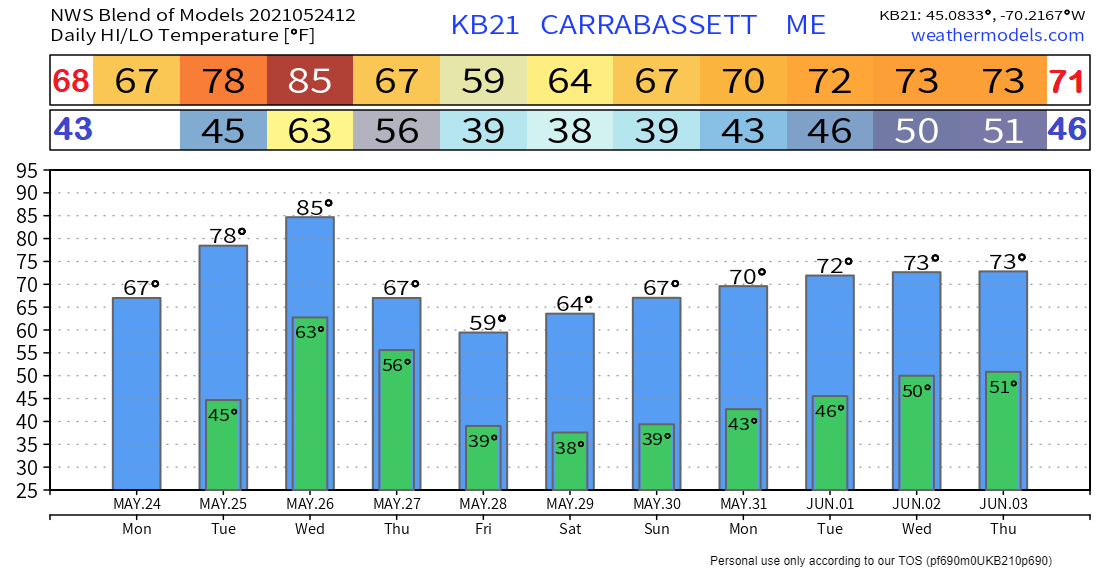 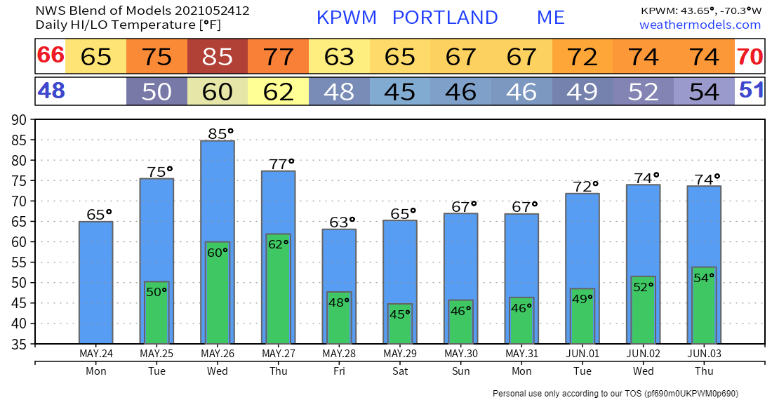 Join the weather community as a storm spotter!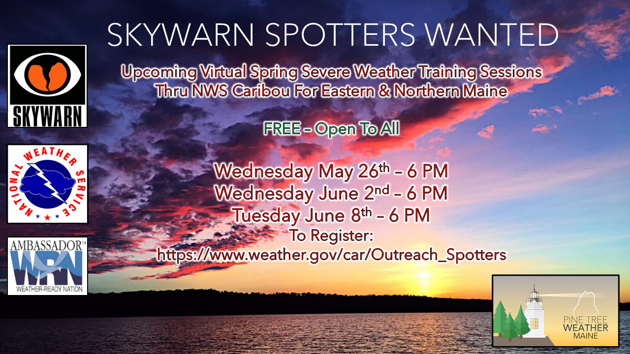 Here's a wonderful way to become active in the weather community and help the broadcast media and forecasters like myself with storm reports. This information is vital during and after an event for forecasting and alerting purposes. I can't tell you how many times I have seen the importance of these reports in the past 9+ years I have been involved. Pine Tree Weather followers have stepped up in the past and participated, and with the readership base continuing to grow, I know there are more out there. This is the spring/summer session which discusses severe weather, what to look for, and how to report it. These sessions run for about 90 minutes. They are fact filled, educational and interesting. You can get the whole family involved from the comfort and safety of home. Once completed, you will get your spotter ID, and will be ready for the season ahead. For those who trained for the winter session, this will complete your full year training. It's important to have both sessions done. The link to register is here ► https://www.weather.gov/car/Outreach_Spotters Be prepared to receive alerts and stay updated!
For more information in between posts, please follow Pine Tree Weather on Facebook and Twitter. Thank you for supporting this community-based weather information source which operates by reader supported financial contributions. Stay updated, stay on alert, and stay safe! 
|

Mike Haggett
|


