
Latest on the recoveryRestoration of power from the Late October Gale continues. Central Maine Power reported outages are down to 15,261 and Emera Maine indicated 2,316 remaining in the dark as of 7 AM Sunday. Recovery efforts will hit a bit of a snag weather wise through Monday before drier weather returns for most of the week. Some areas see light snow / mix Sunday morning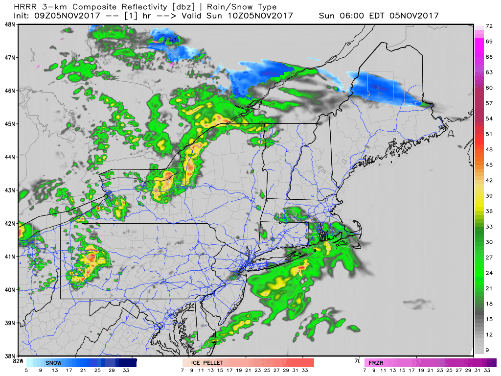 Futurecast radar idea supplied by the HRRR model shows a band of light to moderate snow passing through the Great North Woods into the crown of the state this morning. Accumulations appear light to a coating at best. A warm front enters the state to bring off and on showers, drizzle, and areas of fog. Heavier, steadier rain with a chance of a thunderstorm holds off until Monday. Wind concerns minimalThe wind idea certainly isn't as bad as the storm last week. This isn't to say it won't be gusty at times. It does not appear to be as much of a concern as it appeared in the Friday and Saturday model suites. 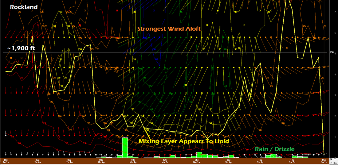 Taking a look at Rockland, the low level jet stream can be seen in the 40-50 kt range dipping down to around 800 feet above the surface. 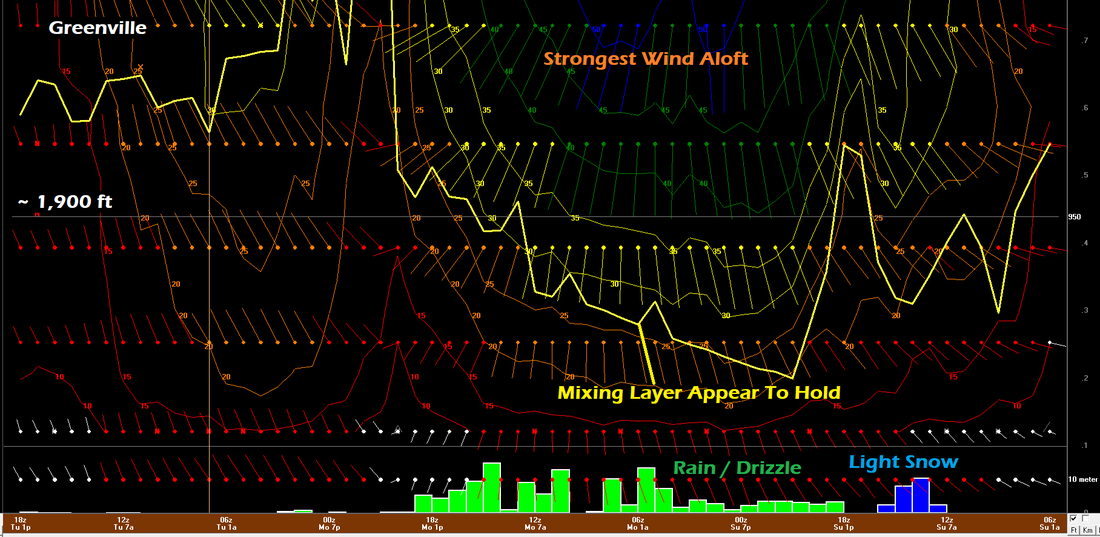 Further north in Greenville, the wind appears to range in the 30 kt range at its strongest near the 1,000 foot level. 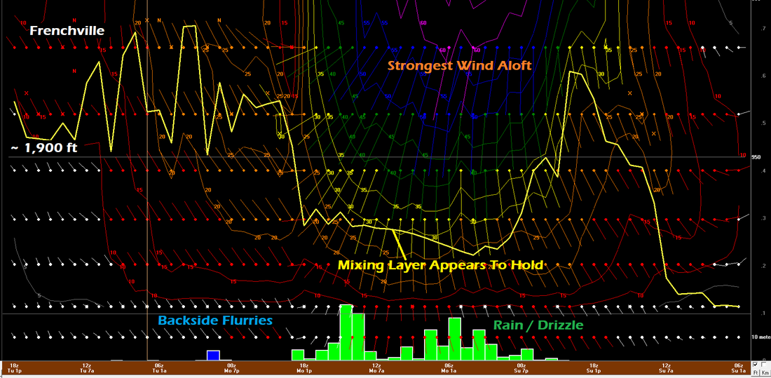 At the tip of the crown of the state in Frenchville, 40-50 kts are possible at around 1,000 feet. It is the idea of the NAM model of which these profiles are from that the mixing layer (buffer) appears to hold and keep the higher end wind aloft. All in all, the wind may gust in the 20-30 mph range. Higher elevations may hit the 30-40 mph plateau. Power outages, if any, are likely to be minimal. As I mentioned in yesterday's discussion, the trees are likely stressed from the recent high wind event. The good news is the wind direction is more from the south than southeast. As the cold front approaches on Monday, a few thunderstorms are possible. Given the proximity of the low level jet, downdraft wind may cause some isolated areas of wind damage. Astronomical tides may cause splash-over in areas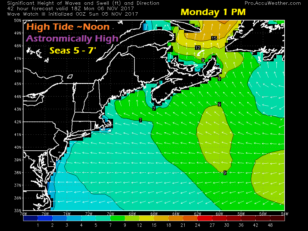 The moon is full right now, and at one of the closer points to the Earth all year. As a result, tides are running high. With the wind driving the ocean water toward the shorelines, it may cause some minor issues. 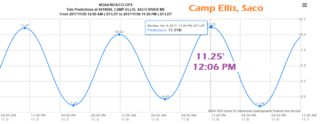 Camp Ellis is always a concern. Tides that normally run in the 8-8½ range without moon influence are roughly 3 feet higher in this astronomical phase. Splash-over is possible there. Low lying areas along the southwest shorelines may see some very minor flooding. 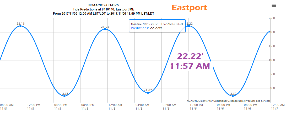 Way Down East, Eastport, which normally runs a tide at 18½ feet during off moon peak, is roughly 4 feet higher. As with the southwest coast, any low lying areas from the MidCoast on up to New Brunswick may see some splash-over and very minor flooding issues. It would be wise for all areas along the coast to monitor for statements from the National Weather Service. Precipitation Accumulation Outlook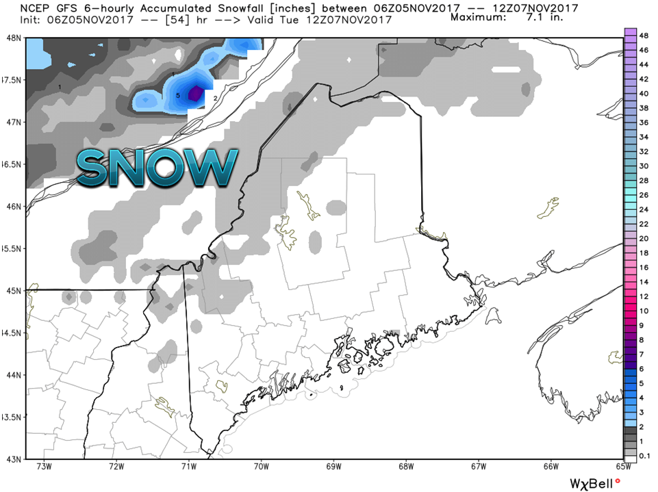 As I have mentioned previously, the best chance for any amount of snow accumulation will be for the mountains on up into northern Maine, and confined to the higher elevations. I do not expect any travel issues. This chart takes into consideration of any snowfall for Sunday, and backside flurries that may develop behind the front Monday night into Tuesday morning. 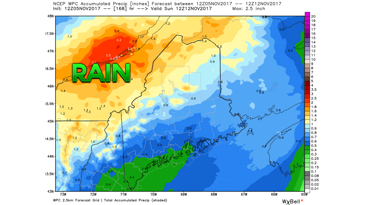 The latest rainfall forecast from the Weather Prediction Center indicates the bulk of the rainfall over the High Peaks Region on up through the crown. This is a general idea. In the case of thunderstorms, locally higher amounts are possible. While the rivers are running high from the recent rainfall from last weekend, flooding does not appear to be an issue.
I will update on this Sunday afternoon. - Mike |

Mike Haggett
|


