Rainy and potentially stormy Friday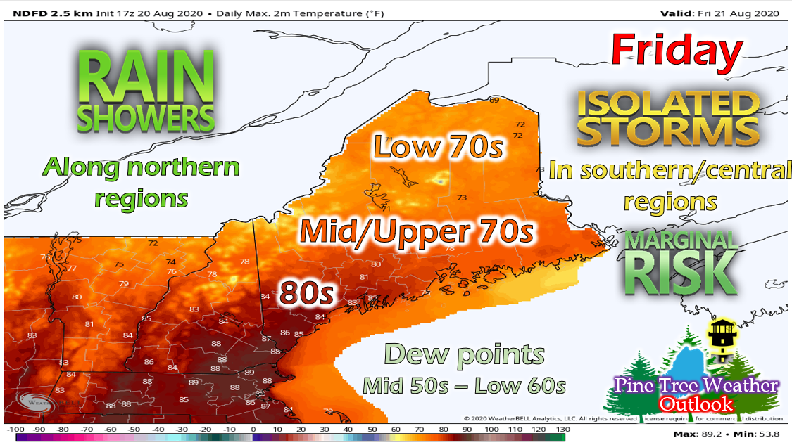 Tomorrow will be a warm but rainy day in Maine. Temperatures will range from the low 70s in northern regions to the low/mid 80s in southern regions. We will continue the low humidity trend, with dew points in the mid 50s in northern regions and increasing to the low 60s as you head south. A warm front will cross the region on Friday, bringing a band of showers along with it that will mainly impact the northern regions of the state. Most of the state will remain mostly cloudy throughout the day, with the exception of southern regions that may just see a passing thunderstorm. 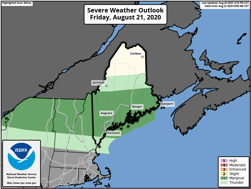 Much of Downeast Maine and the Upper Penobscot Valley in a marginal risk for severe thunderstorms tomorrow. As I mentioned above, most of the rain will be confined to northern regions, so southern regions may stay mainly clear until a storm pops up. This gives more time for the surface to heat up and help to fuel some thunderstorms, some of which could be strong or severe. The main threat for these storms is localized gusty winds. Be sure to keep an eye on local weather and news tomorrow! Weekend Outlook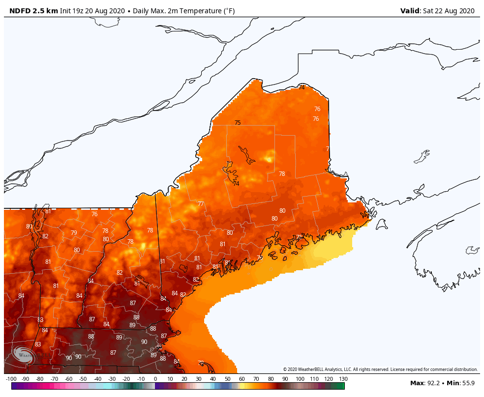 Northern regions will warm back up for the weekend, seeing mid to upper 70s. The rest of the state will stay fairly similar, with temperatures in the low to mid 80s. It will also remain dry this weekend, with dew points in the mid 50s to low 60s. Minimal clouds will make for a nice day on Saturday, but clouds may move back in for Sunday as a system moves into the area. 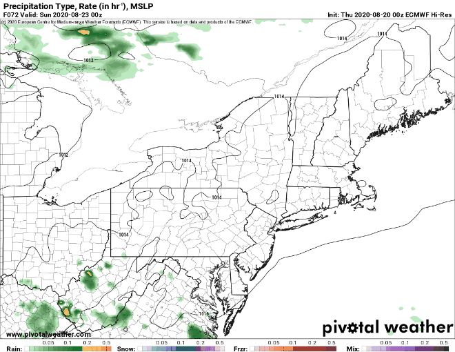 Though there's a slight chance for a pop-up shower or thunderstorm on Saturday, the main threat comes Sunday as a warm front passes the region during the day. The front will bring showers and the chance for a few storms along with it, and stay confined to mainly northern and central regions throughout the day. The showers should dissipate by the evening hours, but with the passage of the the cold front, a few lingering showers are possible overnight. After the passage of the cold front, a quick break is in store for Monday before another system pushes it's way into the region by Tuesday. Keep an eye on the tropics!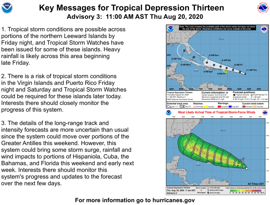 Tropical season is starting to ramp up, as now Tropical Depression 13 and Tropical Depression 14 have formed in the Atlantic. Tropical Depression 13 will likely strengthen into a Tropical Storm as it approaches Puerto Rico and Hispaniola, and potentially into a hurricane as it approaches Florida. However, the details of the track, timing and intensity as it approaches the U.S. is still uncertain. 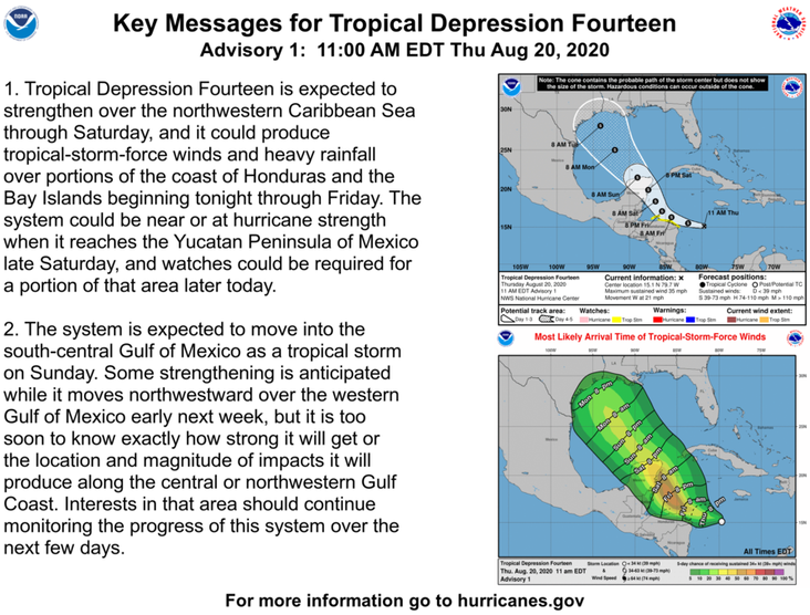 Tropical Depression 14 has also formed in the Atlantic and is currently located off the coast of Honduras. It will likely produce tropical storm force winds and heavy rain to areas of Honduras as early as tonight. As it makes its way towards Mexico and into the Gulf, it could increase to hurricane strength. However, as mentioned above the timing, intensity and track of the storm is uncertain at the moment and likely to change. Be sure to keep an eye on the tropics over the next few days! Help forecast verification, and stay informed!
For more information, please follow Pine Tree Weather on Facebook and Twitter.
Thank you for supporting this community based weather information source that is funded by your financial contributions. Stay updated, stay on alert, and stay safe! Have a great weekend! - Alex :) |

Mike Haggett
|