But first, a fair Wednesday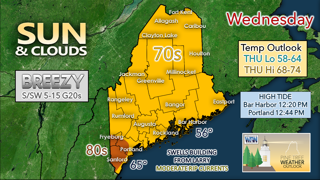 What will be noticed for southern and eastern areas for Wednesday will be in wind direction from the south / southwest which could be gusty at times, along with an increase of humidity. Dew points start off in the 40s and 50s are on track to nudge up into the low to mid-60s as the cold front from the west slowly moves eastward. With the building swells from Hurricane Larry, the shorelines are becoming more hazardous with rip currents at moderate levels up and down the coast. Unless you are a well experienced swimmer or surfer, it would be wise to stay out of the ocean until Sunday. Frontal boundary moving slower, heavy rain shifts east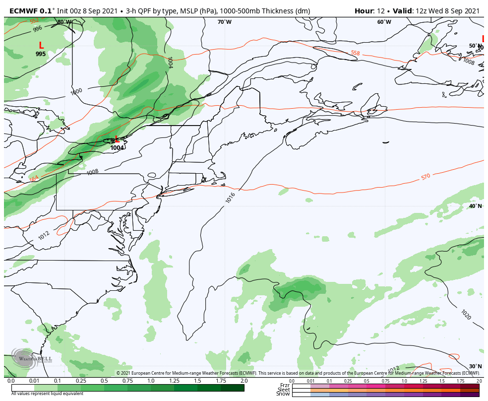 Low pressure over St. James Bay moves into northwestern Quebec. A long wave cold front attached to it slowly moves to the east. As a result, the heavier rains shift to the east. Along with the trough aloft that is dictating the upper-level flow, these two features are what will steer Larry well to the east. 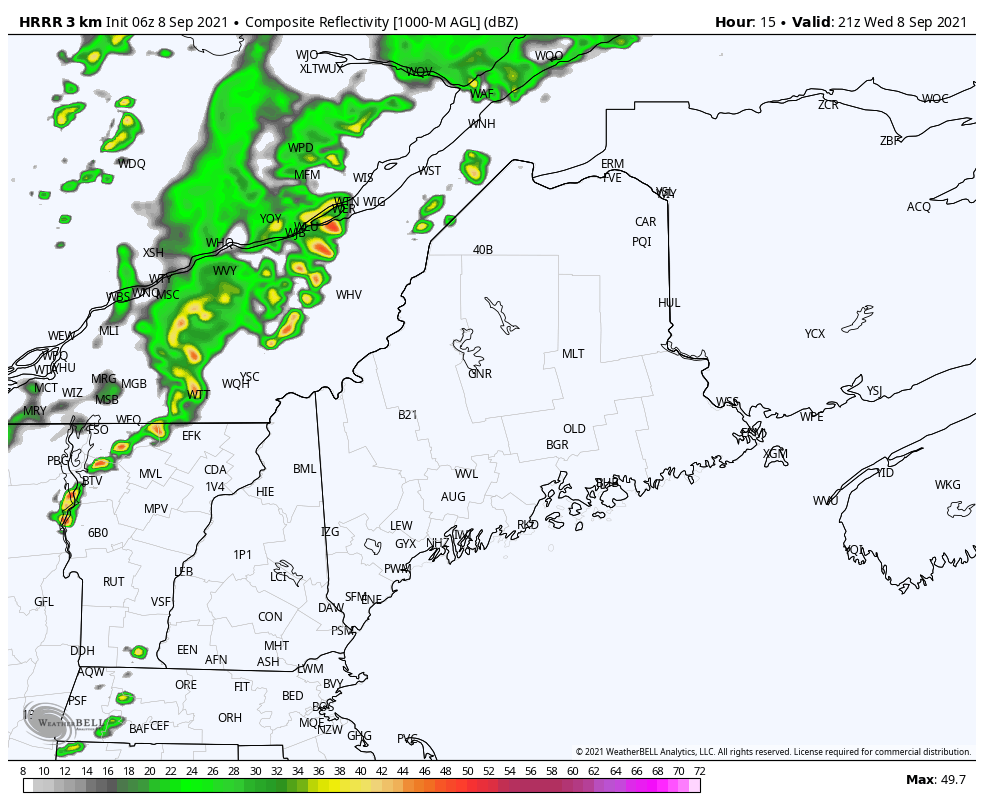 The border regions with Quebec have the best chance of seeing shower activity late in the day on Wednesday. Scattered showers with a chance of a thunderstorm are likely throughout the state Wednesday night into Thursday morning. As the boundary inches along, an area of low-pressure forms along the front, and brings showers and thunderstorms Thursday, and will continue Thursday night into Friday morning. Steady precipitation ends over northern and eastern area by around midday on Friday. Isolated showers are possible for the mountains and the north woods through Friday afternoon. 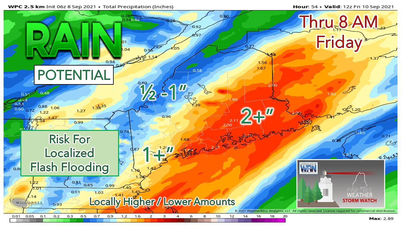 The amplification of the low-level jet ushering in moisture from the south in conjunction with upper-level energy is likely to play a key factor in total rainfall amounts. It appears to be a solid soaker for MidCoast and eastern Maine. If the boundary slows easterly progress a bit more, southern areas could see rain totals increase. For those in the mountains in severe drought who may be disappointed to see the rain totals drop, there is still some hope here of a decent event. The short-term model ideas tend to favor 1"+ amounts in areas, with the mountains helping through orographic lift to get more moisture from the front for the southern facing slopes. Larry on a collision course with Newfoundland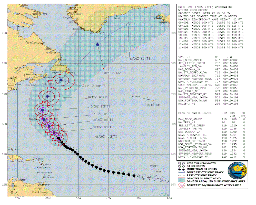 This forecast from the US Navy shows the track of Larry with the expanding wind field and impact wind area very well. An already large hurricane will become larger as the storm travels northeastward into higher latitudes. As the storm gains in latitude, it will gain in speed as well. This is likely to be a bad storm for the Avalon region of Newfoundland, and folks there should be prepared for power outages. The storm will be quick in passage, but it will pack a serious punch. 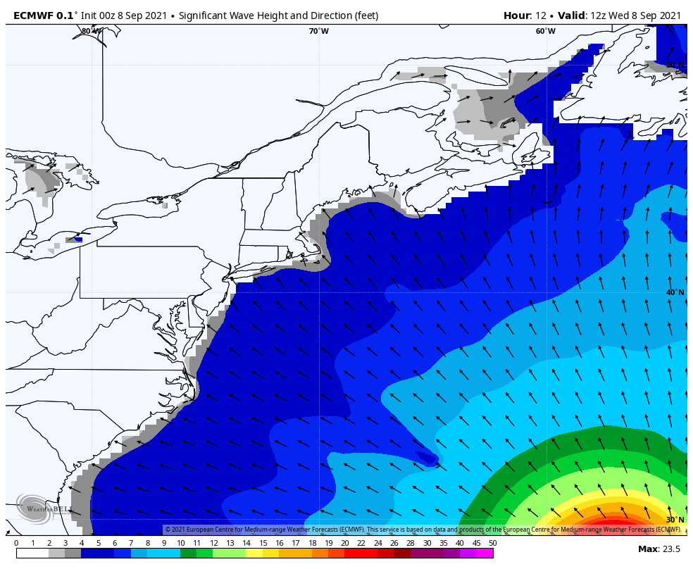 For New England and eastern Atlantic Canada, the impact of the surf will be the main story. For Maine interests, astronomical high tides from the new moon, swells reaching 5-10 feet in exposed areas are likely to bring splash-over, some minor flooding, beach erosion, and a high rip current threat. It will be a seaside spectacle, best to be viewed from a safe distance with respect given the power and unpredictability of the ocean. The ocean settles down on Saturday. For more information on Hurricane Larry, please check in with the National Hurricane Center and / or the Canadian Hurricane Center. Break the Grip of the Rip! The United States Lifesaving Association (USLA) estimates that over 100 people die each year due to rip currents in the US. Break the Grip of the Rip®! weather.gov/safety/ripcurrent  Temperature outlook through SundayThe weekend starts off with a dry Saturday statewide. Showers are possible for Sunday, with the better chance for the mountains and north as it appears for now. This will be updated. 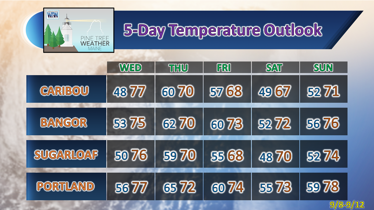 Be prepared to receive alerts and stay updated!
For more information in between posts, please follow Pine Tree Weather on Facebook and Twitter.
Thank you for supporting this community-based weather information source which operates by reader supported financial contributions. Stay updated, stay on alert, and stay safe! - Mike |

Mike Haggett
|