Tuesday: Rain and thunderstorms as a cold front passes through Maine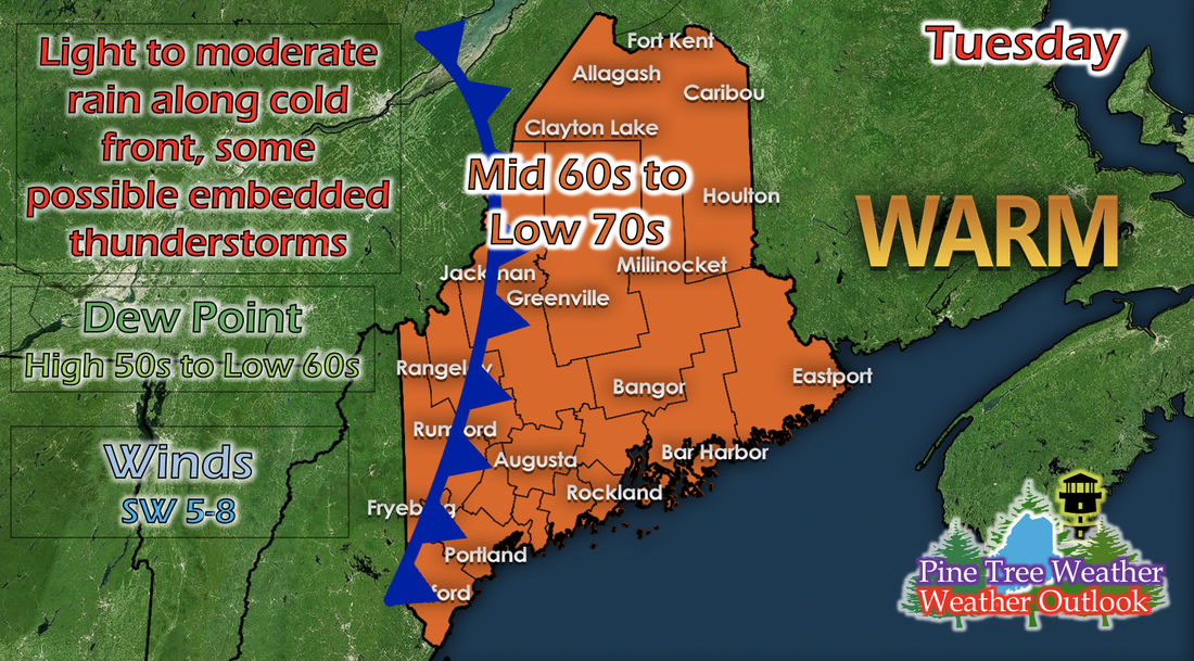 Tuesday will be rainy with potential embedded thunderstorms as a cold front sweeps across the state in the early morning hours of Tuesday. Temperatures drop slightly as a result of the passing cold front; ranging from mid 60s to low 70s. Dew points remain the same as Monday; ranging from high 50s to low 60s, but will change on Wednesday once the cold front fully passes through. 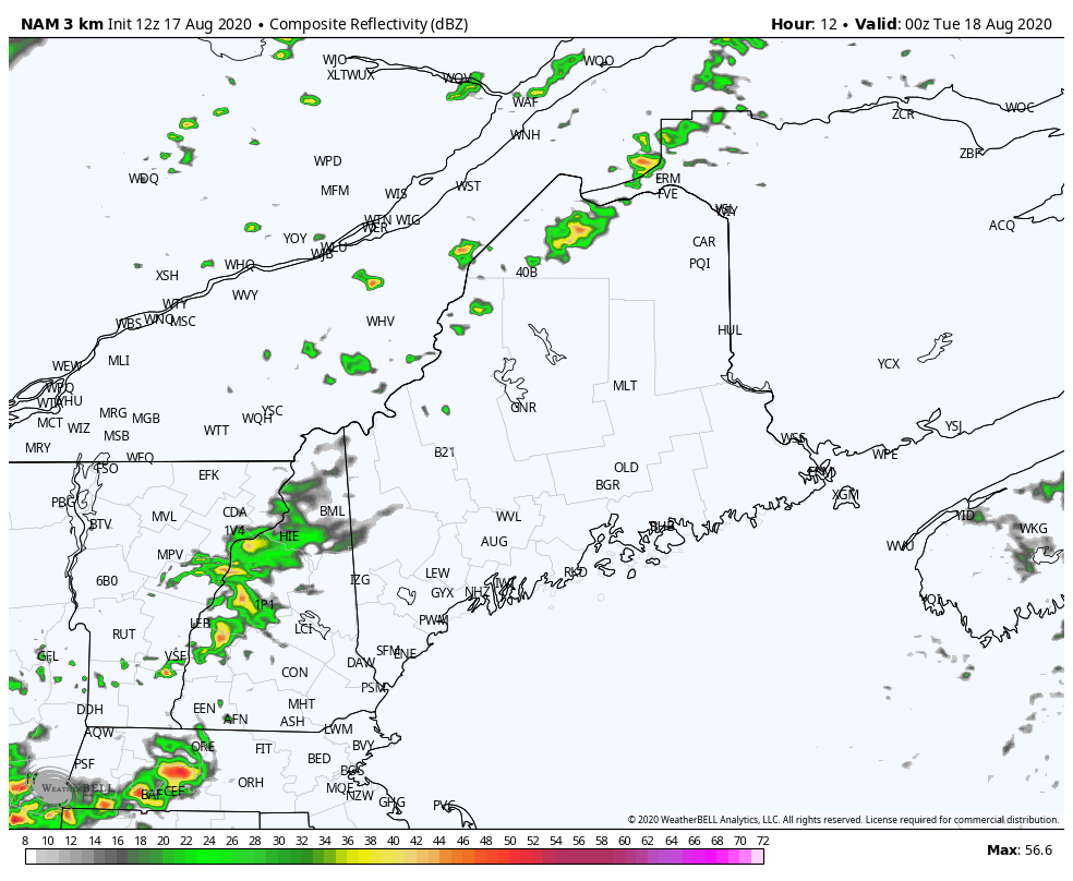 The GIF above runs from 8 AM Tuesday to 8 PM Tuesday and shows potential reflectivity from a short-range model. Since a few days ago, the model keeps outputting runs that suggest more widespread and heavier precipitation. This model tends to overpower potential reflectivity, but gives a good indication of the location of precipitation. I suspect any precipitation will be light to moderate, with, at times, being heavy and some embedded thunderstorms within. On the backside of the cold front, thunderstorms are more likely as the instability of the afternoon heat and from the cold front colliding. Wednesday: Warm and dry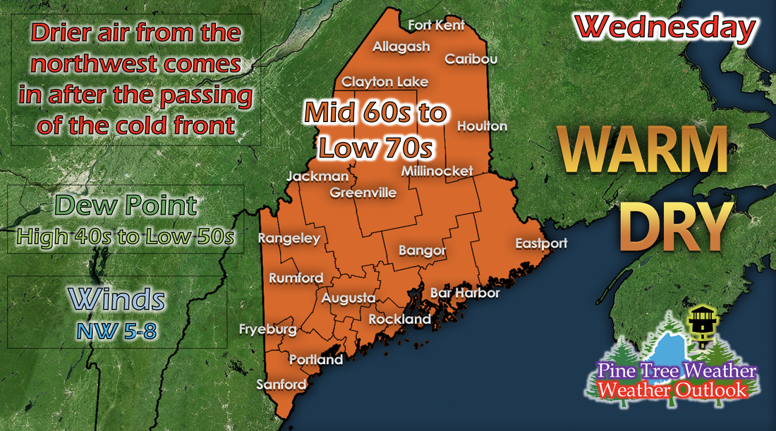 Once that cold front has fully passed through on Tuesday, Wednesday will be warm and dry. Temperatures remain similar to Tuesday; ranging from mid 60s to low 70s, but dew points drop statewide; ranging from high 40s to low 50s. This is a result of the new air flowing into Maine from the north and northwest as a low pressure system moved eastward north of Maine the previous day. This type of humidity is very comfortable when outside. Looking ahead: Relative humidity levels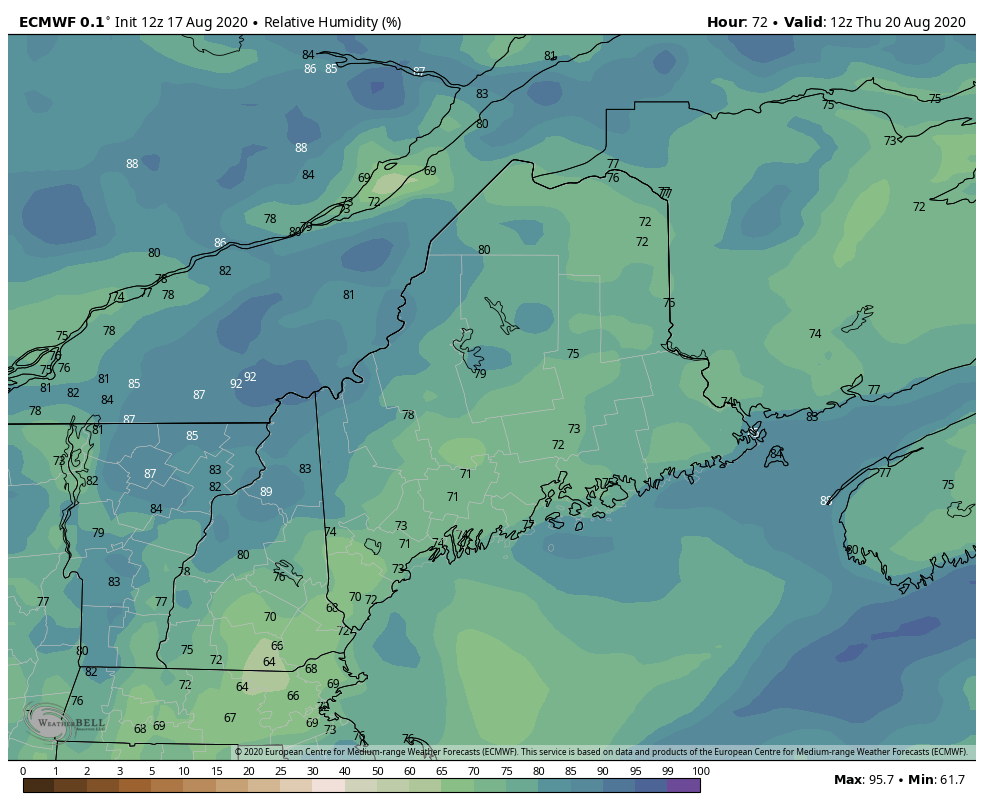 The GIF above runs from 8 AM Thursday to 8 PM Saturday and shows relative humidity values from a long-range model. The similar pattern of drier RH values in the daytime will continue through the rest of the week, thanks to an area of high pressure moving its way over the New England region on Wednesday. This will give a comfortable feel to the air if you do anything outdoors. The daytime RH values increase around Saturday, and this is because a weaker low pressure to the north comes down and into northern Maine, and typically on the east side of a low pressure is southerly winds, and southerly winds usually bring warmer temperatures and more moist air from the south. Thank you for all your support!  Alex and I have been extremely grateful for the opportunity to forecast for the lovely state of Maine! I wanted to thank each and every person who has said kind words, sent appreciation, and who have just read our forecasts, because without you all, we wouldn't have been able to reach out to Mike when our own summer internships fell through and forecast remotely for Maine. Thank you all so much, and if you'd like to contribute to our efforts, our Venmos are above (never expected, but always appreciated!). Help forecast verification, and stay informed!
For more information, please follow Pine Tree Weather on Facebook and Twitter.
Thank you for supporting this community based weather information source that is funded by your financial contributions. Stay updated, stay on alert, and stay safe! Have a great day! - Kaitlyn |

Mike Haggett
|