
Website improvements underwayFrom the "You Can Teach An Old Dog New Tricks" file, I've figured out website coding. As a result, I am making some improvements to the website that I have wanted to do for a very long time. There are a few new tabs to check out various items of weather interest. I will be adding and tweaking items as I go along here. Consider this all a work in progress. So long as financial donations roll in, I will continue to do this. You determine whether this grows or goes away. For those that have made the commitment, I sincerely thank you. For those that have not yet done so, I would appreciate your strong consideration to financially support what I do. A chilly Thursday before precipitation arrives later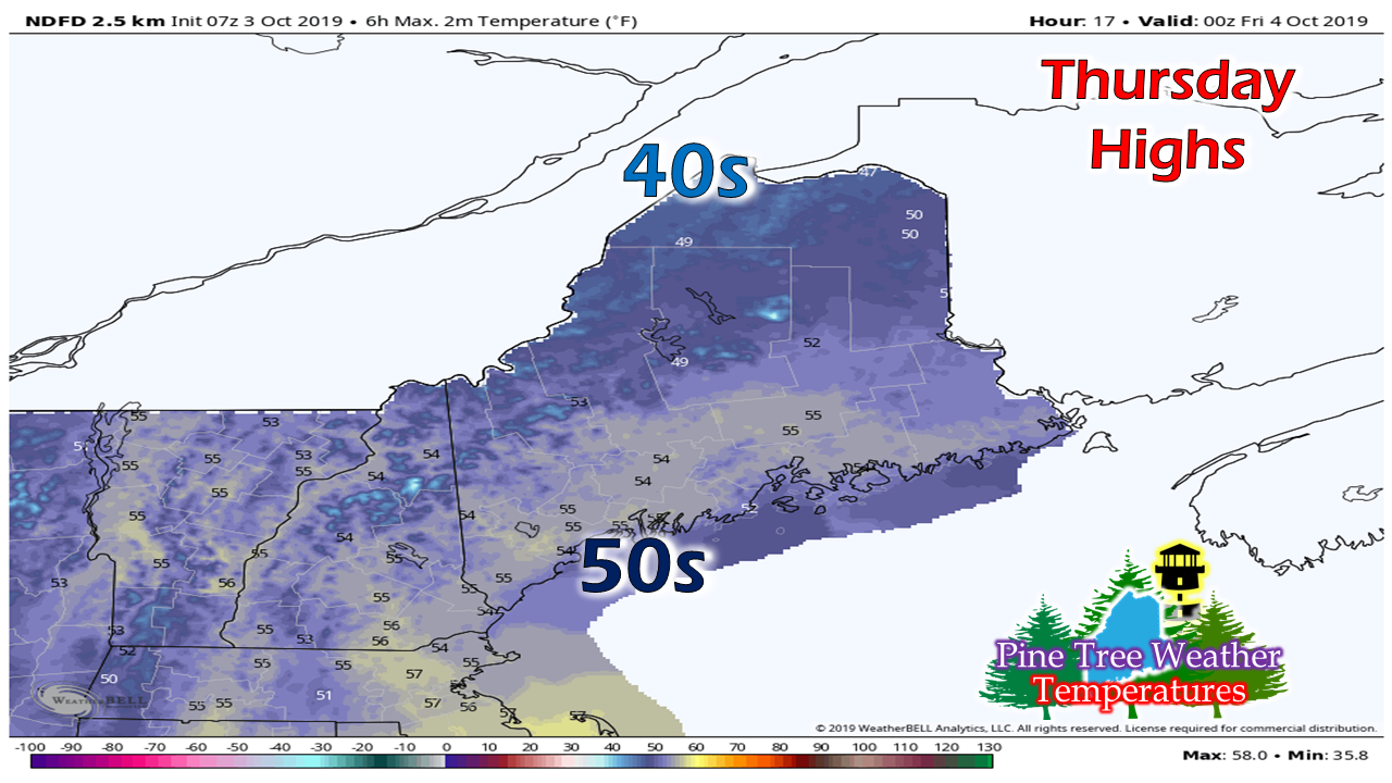 It will be mainly sunny to start off as high pressure pays a brief visit. As the high quickly slides east, clouds will be on the increase this afternoon as low pressure moves in from the west. 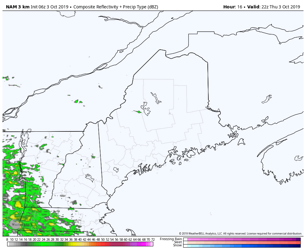 Steady precipitation holds off until Thursday evening. It will be a wet night with a chilly rain and wet snow for the higher elevations. Friday a cool but decent day overall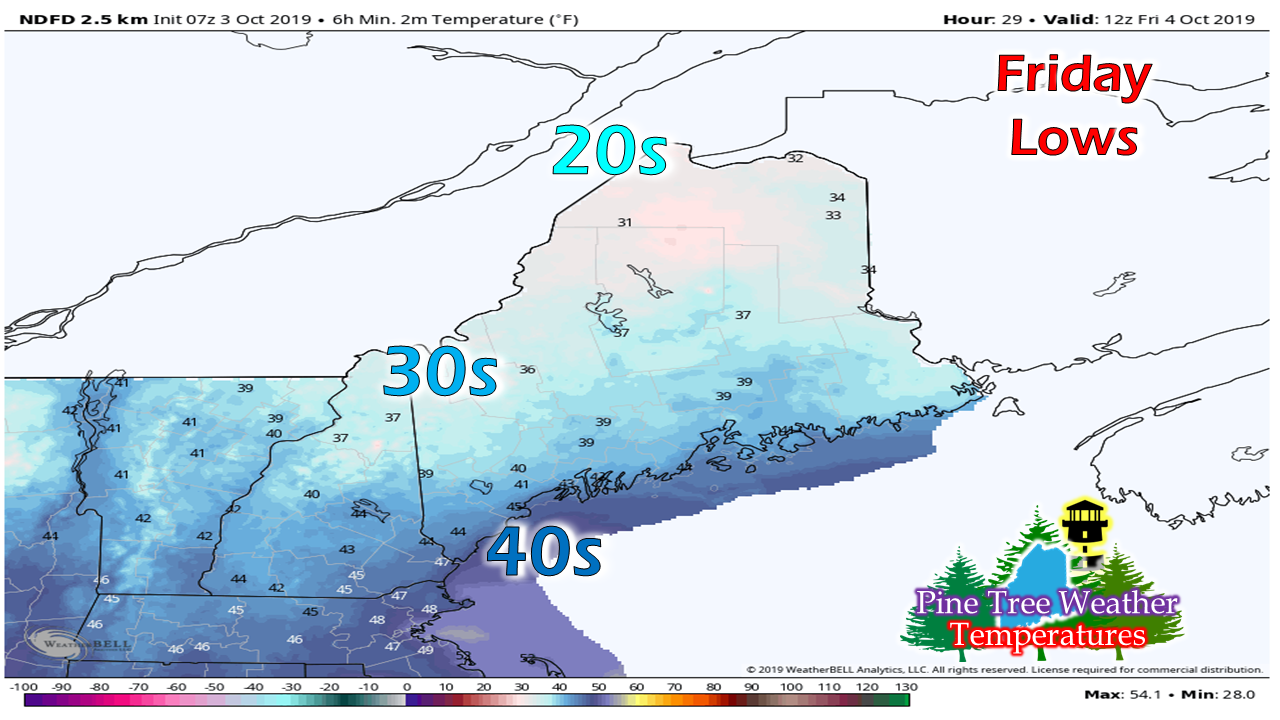 Temperatures start off mainly in the 30s and 40s with upper 20s possible in the higher terrain and far north. 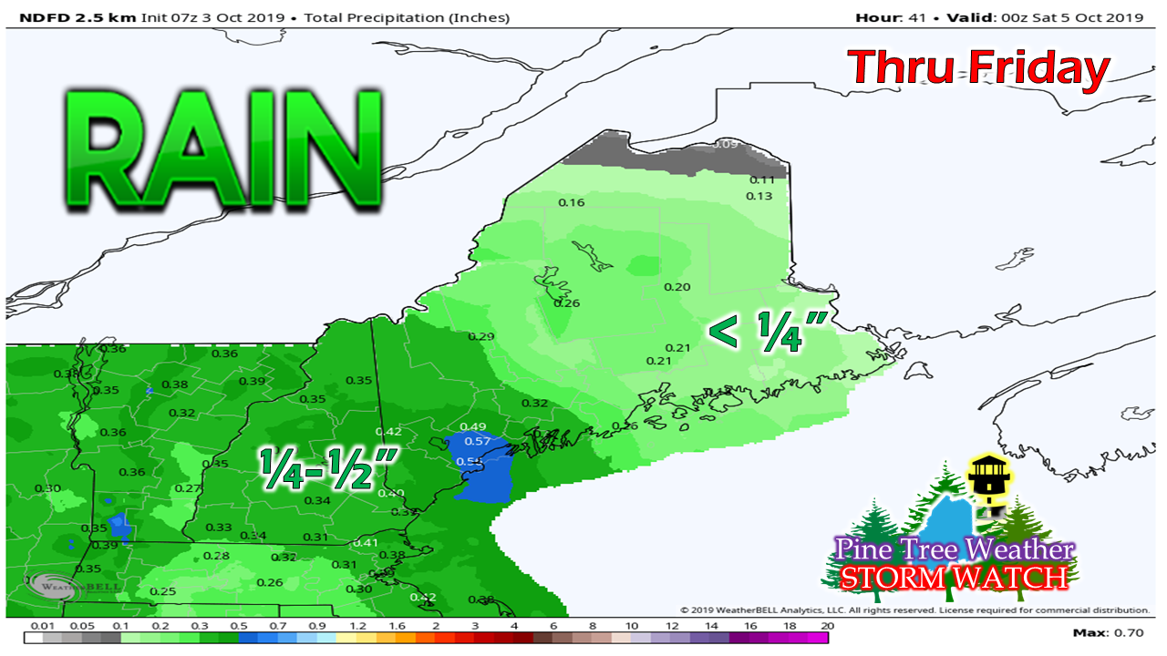 Rain ends for most areas by mid morning. Western and southern areas appear to get the higher totals, with lesser amounts to the north. 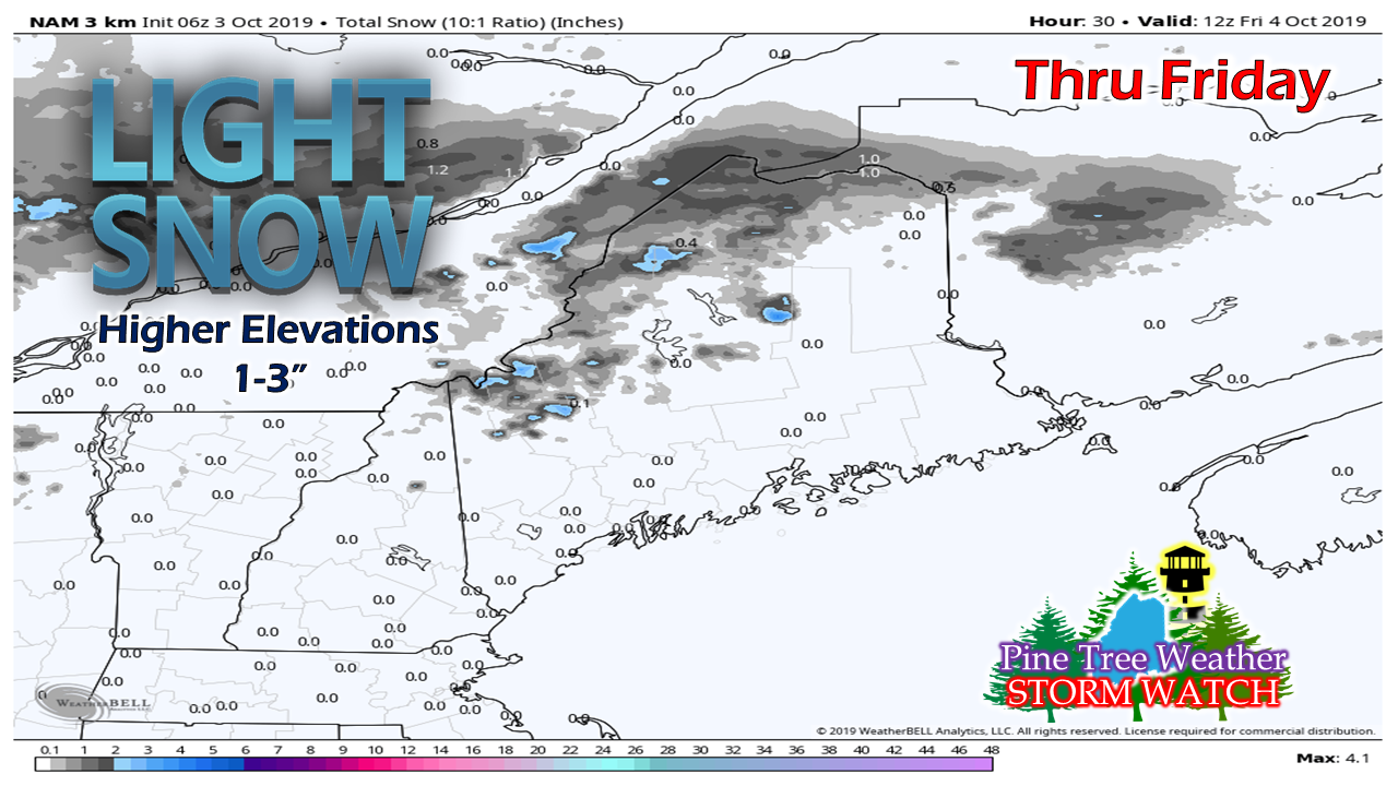 No real changes in snow ideas as guidance has been pretty consistent over the past couple of days. Accumulations will be light, accumulating on grassy surfaces primarily. Road crews may have to drop some sand in spots, but it won't be a big deal. 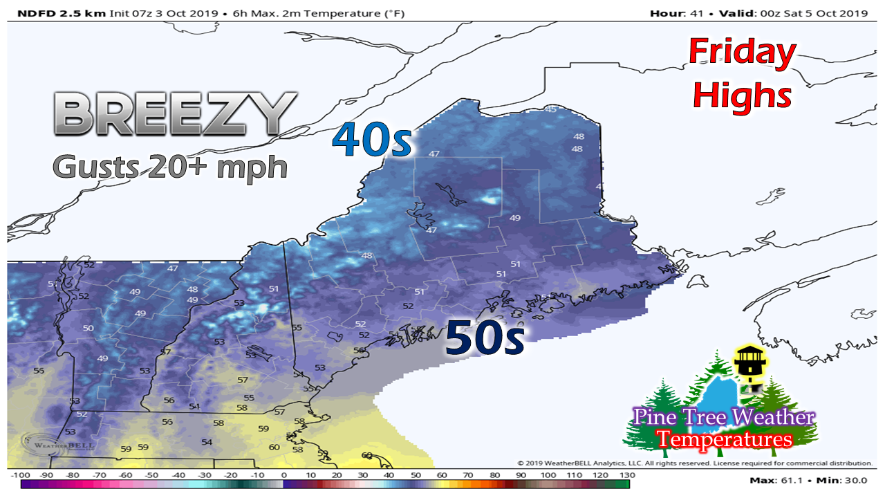 What snow falls will likely melt during the course of the day. It will be a breezy one, with wind chills in the 30s for western and northern areas as gusty north / northwest winds draw cool dry air in from Quebec. A frosty start to the weekend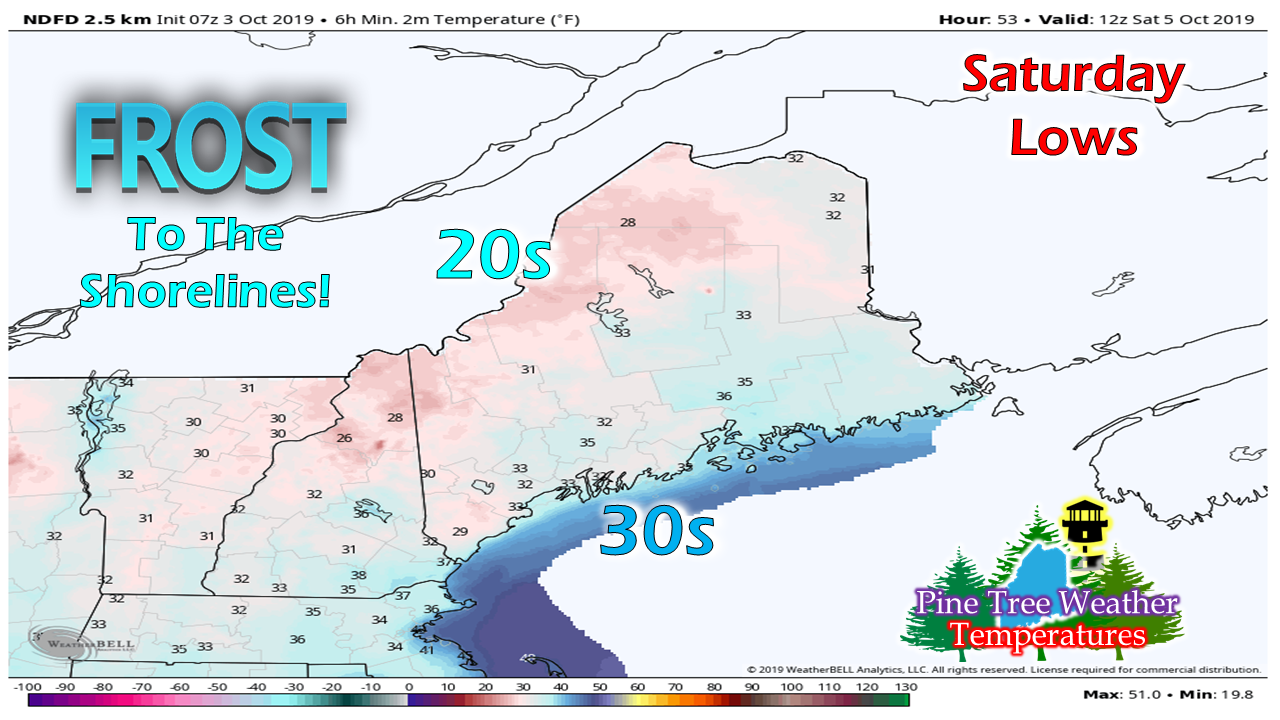 Coastal areas that may have escaped frost recently may not be so fortunate this time. The wind will settle down Friday night. With a clear sky, temperatures head south. Cover up the mums before you go to bed. Saturday will be a mostly sunny day with a bluebird sky. Highs for the day range from the low 50s north to upper 50s south. Sunday starts off frosty again with 20s and 30s. High pressure slowly moves to the east and brings temperatures up a bit, with 50s north and 60s south. A soaking rain event remains on track early next week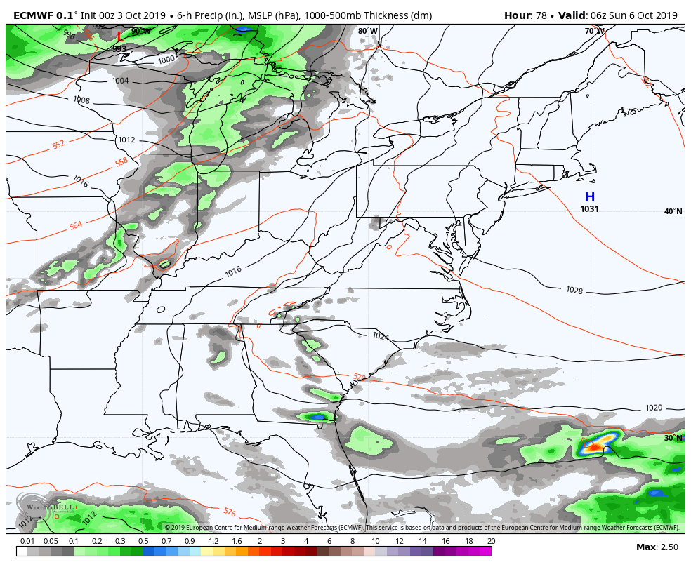 Timing is still to be worked out, but the idea remains consistent for a long wave frontal boundary working through the region Monday into Tuesday. For the parched areas of southwestern parts of the state, this is welcome news. Pending on how this comes together, there may be some flooding issues if the projected 1-3" of rain some guidance is indicating comes true. Details on this will get figured out over the weekend.
Stay tuned... ► ► For the latest official forecasts, bulletins and advisories, please check in with the National Weather Service in Gray for western and southern areas, or Caribou for northern and eastern parts of Maine. Donations are needed for the future of Pine Tree Weather. Thank you for your support! For more information from me, please check the Pine Tree Weather Facebook page as well as my Twitter feed. Always stay weather aware! - Mike |

Mike Haggett
|


