A damp, breezy midweek storm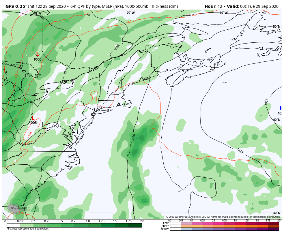 Dew points have come up and it will be sticky for the region through Wednesday. With the elevated humidity comes fog, which I know first hand has been stubborn over the MidCoast and DownEast areas over the past few mornings, and that will continue also. Once this cold front kicks through, it will drop the dew points, and temperatures.  Tuesday stays mainly dry outside of a remote chance of a light shower. Areas that are in the fog could get drizzle along the shorelines. Rain is expected to work into western and southern areas early Wednesday morning, then move into northern and eastern areas towards mid-morning. Showers taper off from west to east Wednesday afternoon, and clear out of far eastern areas by around mid-evening.  As the front approaches, wind speeds out of the south will increase. Gusts could range in 30-40 mph range. Consider it a "flying trash can alert day". The wind shifts to the west northwest behind the front. Thursday looks decent with a mix of sun and clouds, but looks breezy. Beneficial rain, but may not be a drought buster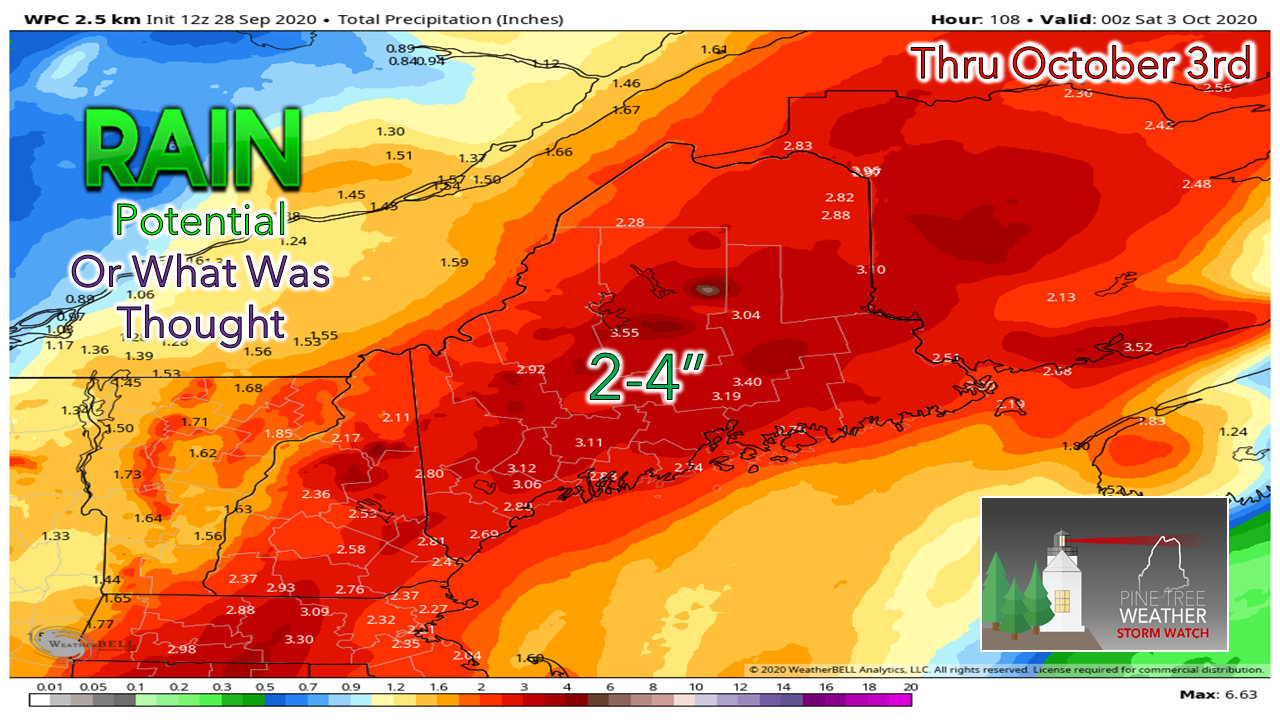 Guidance has struggled with the southern stream of this system. Rainfall amounts by certain models were looking like it could be a drought buster, but the skunk has been in the barnyard on this one since last week. What you see above was the 12z (8 AM) forecast from the Weather Prediction Center. 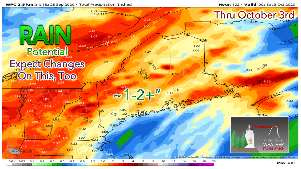 The shift of the heavy rain with guidance has been west over the past couple of days, and is what happened again today. WPC cut their prediction by roughly 50% with the 18z (2 PM) update. This is in line with guidance ideas. Confidence is good that the mountains and north should get the most rainfall out of this event. The coastal plain appears for now to come in third place. I am afraid this is going to be one of those events where some areas will get a quarter inch, other areas could see 2+". We'll take every precious drop we can get right now and be happy with it. Pardon me while I cheer for a more eastward shift in guidance to bring the 2-4" range back into thinking. Unfortunately, I am not betting on it.  Another chance for rain Saturday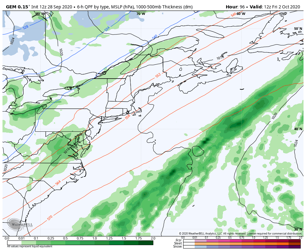 A trough drops down from central Canada on Friday. A weak disturbance runs up along the cold front and brings a chance for showers for the area Friday night into Saturday. Sunday looks good, but on the cool side. Temperatures going down hillFor those cheering for sweater weather, this is your time to rejoice. A strong ridge out west means cool times for the east. Until that ridge modifies, we could be unseasonably chilly well into the middle part of October. For northern and mountain areas, time will tell when the first snowflakes fly. 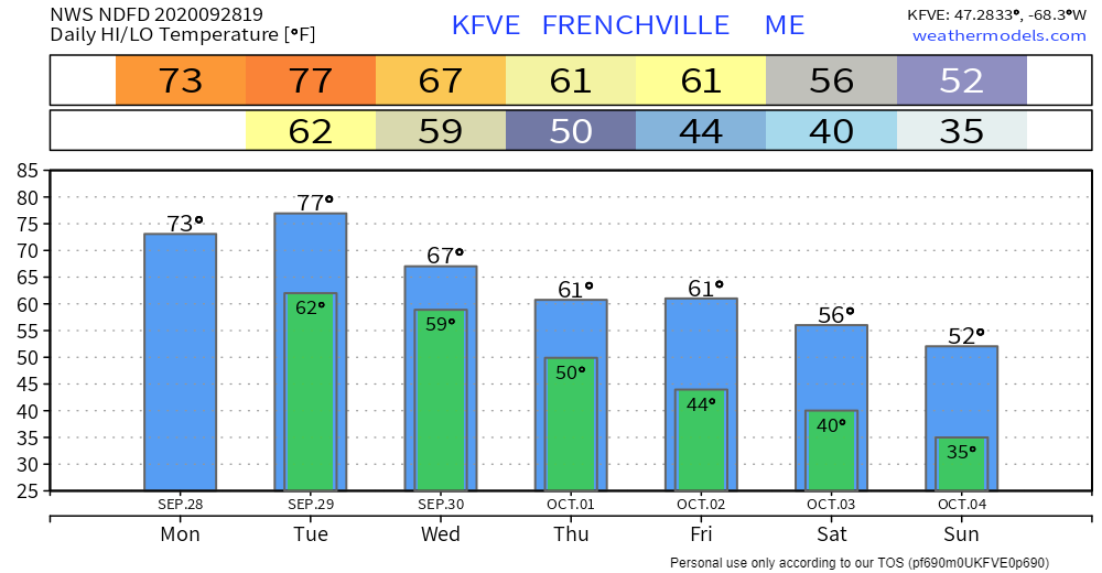 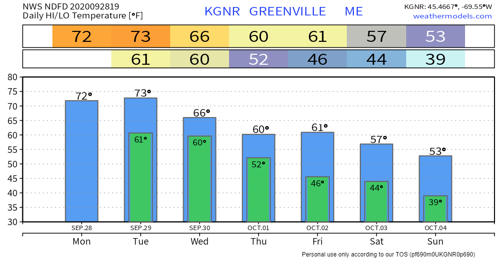 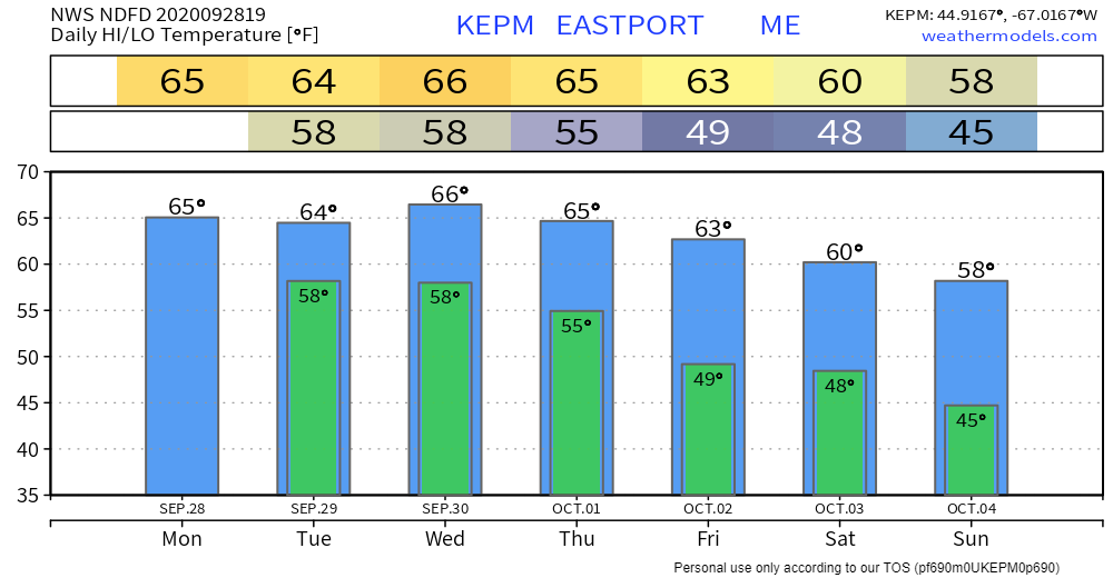 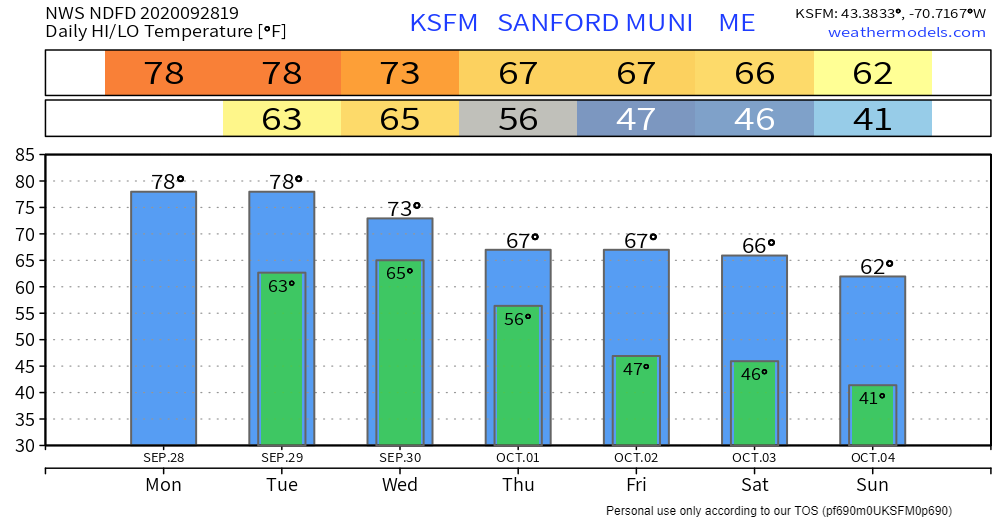 Stay on alert with fog conditions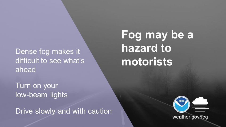 Fog reduces visibility and contributes to numerous motorist accidents every year. Dense Fog Advisories are issued when visibility is expected to drop to one quarter mile or less. Take caution and check to see if there are any Dense Fog Advisories issued for your commute before driving. Learn more about fog safety by visiting weather.gov/safety/fog Be prepared to receive alerts and stay updated!
For more information, please follow Pine Tree Weather on Facebook and Twitter.
** FUNDING NEEDED FOR 2021 ** Thank you for supporting this community based weather information source that is funded by your financial contributions. Stay updated, stay on alert, and stay safe! - Mike |

Mike Haggett
|