A bit cooler for Friday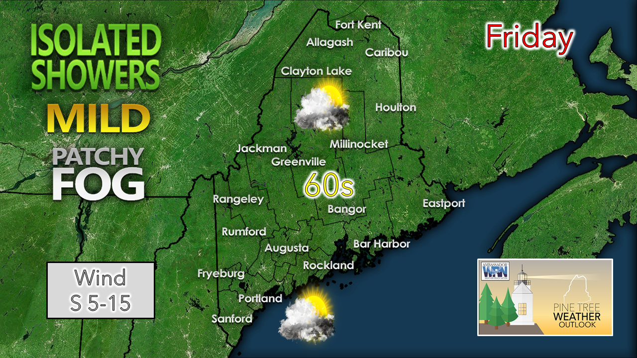 Clouds are likely to be more prevalent across Maine as the standard work week wraps ups. High temperatures will be a bit cooler for the region, but still 10-15° above normal for this time of year. Wind will gradually increase in the afternoon and appears to be a feature in the weather pattern for the next several days. 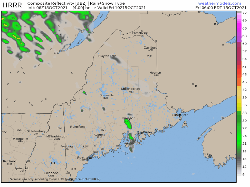 Friday 6 AM - Saturday Midnight: A weak warm front moves in from the southwest and may bring an isolated light shower / sprinkle during the daylight hours. Showers move in over the Great North Woods heading into the overnight. Showers and wind increase for Saturday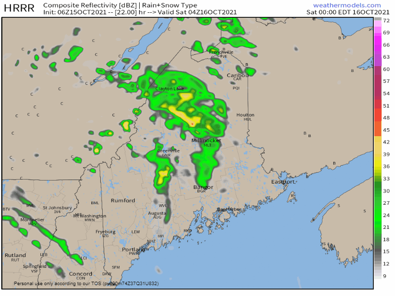 Saturday Midnight - Noon: The warm front continues to push northeastward. Disturbances along the upper-level ridge aloft bring a chance for showers and perhaps a rumble of thunder into the afternoon. 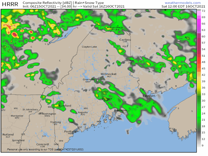 Saturday Noon - Sunday 2 AM: Chances for shower activity in the afternoon diminishes across the state before the frontal boundary with steadier rain approaches the region Saturday night. All areas have the chance to get rainfall heading into Sunday morning. Wind to strip leaves from trees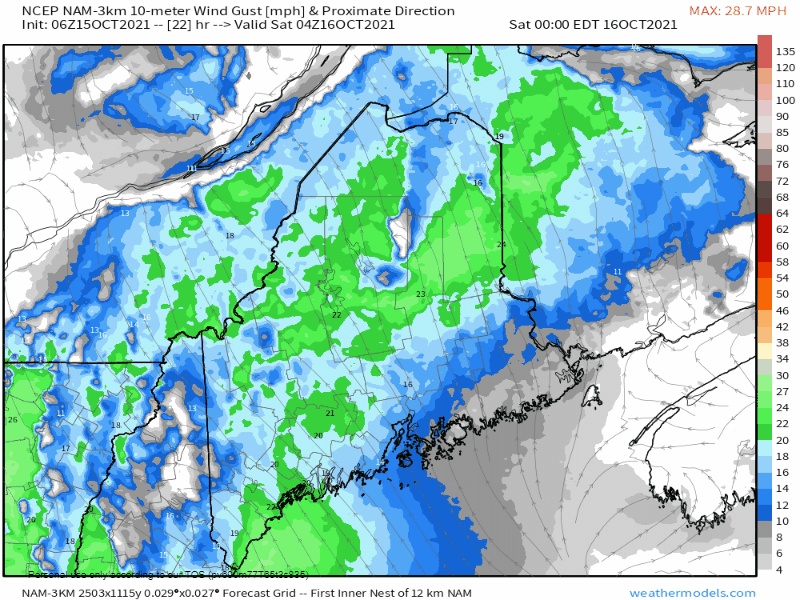 Saturday Midnight to Sunday 8 AM: Wind will be on the increase ahead of the frontal passage. Direction from the southeast ahead of the front may bring gusts in the 25-35 mph range, with gusts in the 40-mph range for the hilltops. This will strip leaves off trees, could bring down some limbs and bring spotty power outages heading into Sunday morning.. Securing Loose Items Even the most common items become dangerous objects when picked up and carried by the wind! When a High Wind Watch or a Severe Thunderstorm Watch is issued, secure outdoor items such as patio furniture, sports equipment and trash cans. When the weather is nice, remove dead tree branches near your home before the next strong storm system blows through. weather.gov/safety/wind-during Breeze continues into Sunday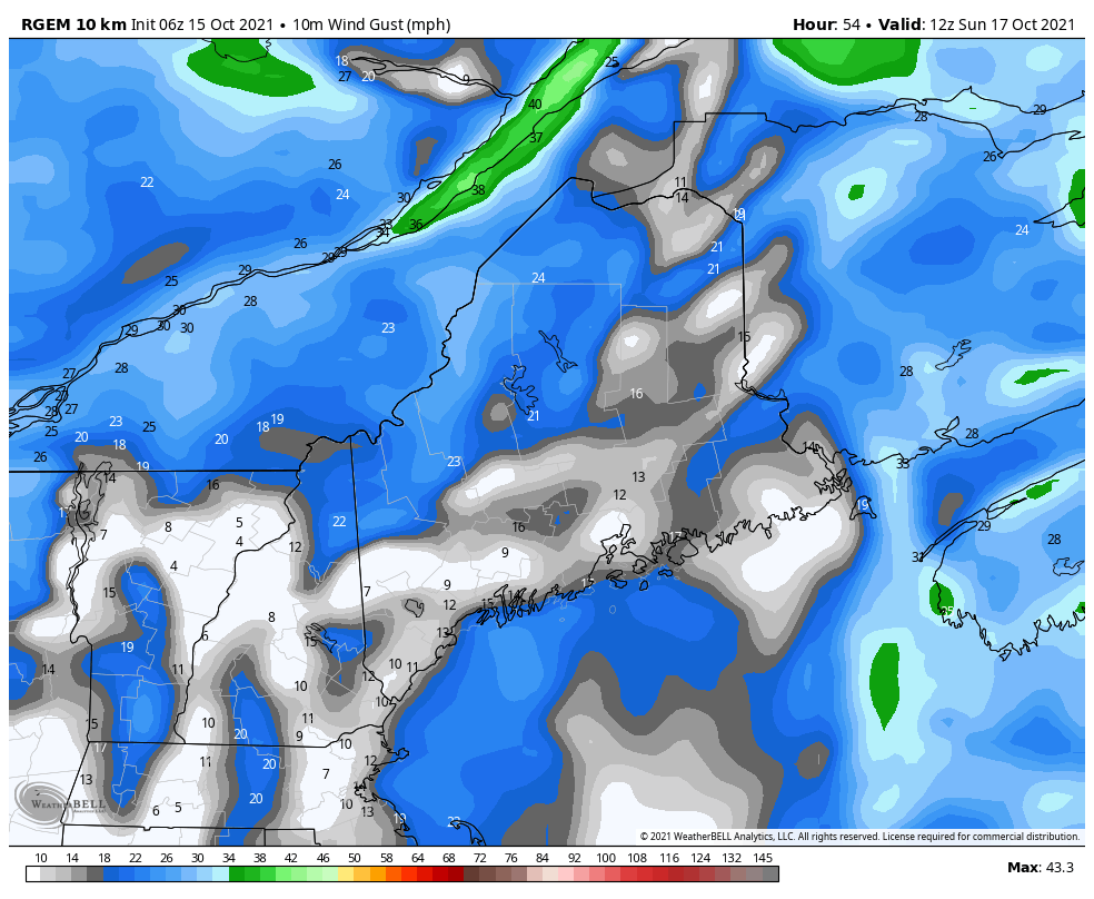 Sunday 8 AM - 8 PM: As the frontal boundary departs to the east, the wind shifts to the west / northwest during the day and gust in the 15-25 mph range, diminishing towards evening. Skies begin to clear out from southwest to northeast during the day. There is a slight chance for a sprinkle in the mountains in the afternoon. 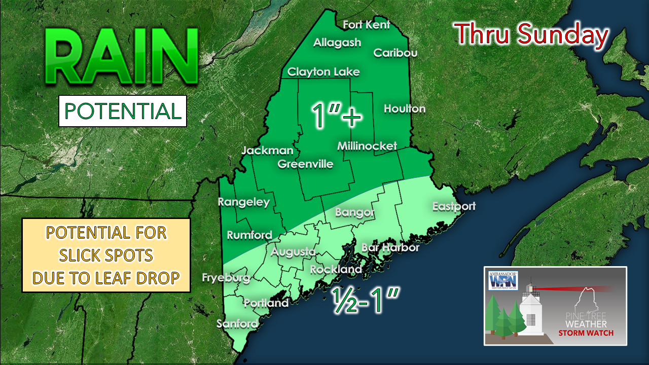 No changes in forecast rainfall. Far southern areas are likely to be close to a ½". The higher elevations may see upwards of 1½" total between Friday to early Sunday. Expect massive leaf drop with this storm. The abundance of wet leaves could make roadways slick. Driving during windy conditions with leaves falling may reduce visibility. Use caution while travelling through the weekend.  Unsettled with temperatures near normal next week 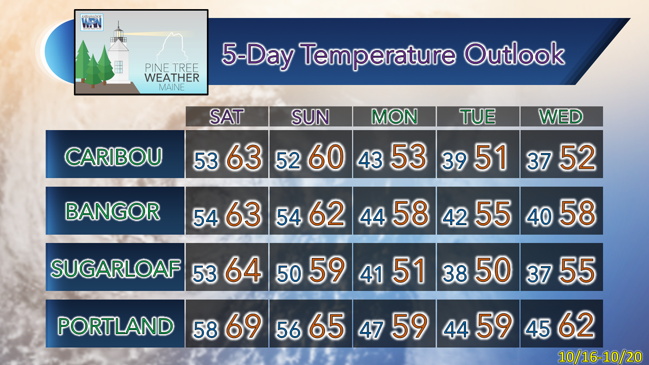 Be prepared to receive alerts and stay updated!
 For more information in between posts, please follow Pine Tree Weather on Facebook and Twitter.
Thank you for supporting this community-based weather information source which operates by reader supported financial contributions. Stay updated, stay on alert, and stay safe! - Mike |

Mike Haggett
|