
Some recent drought relief in areas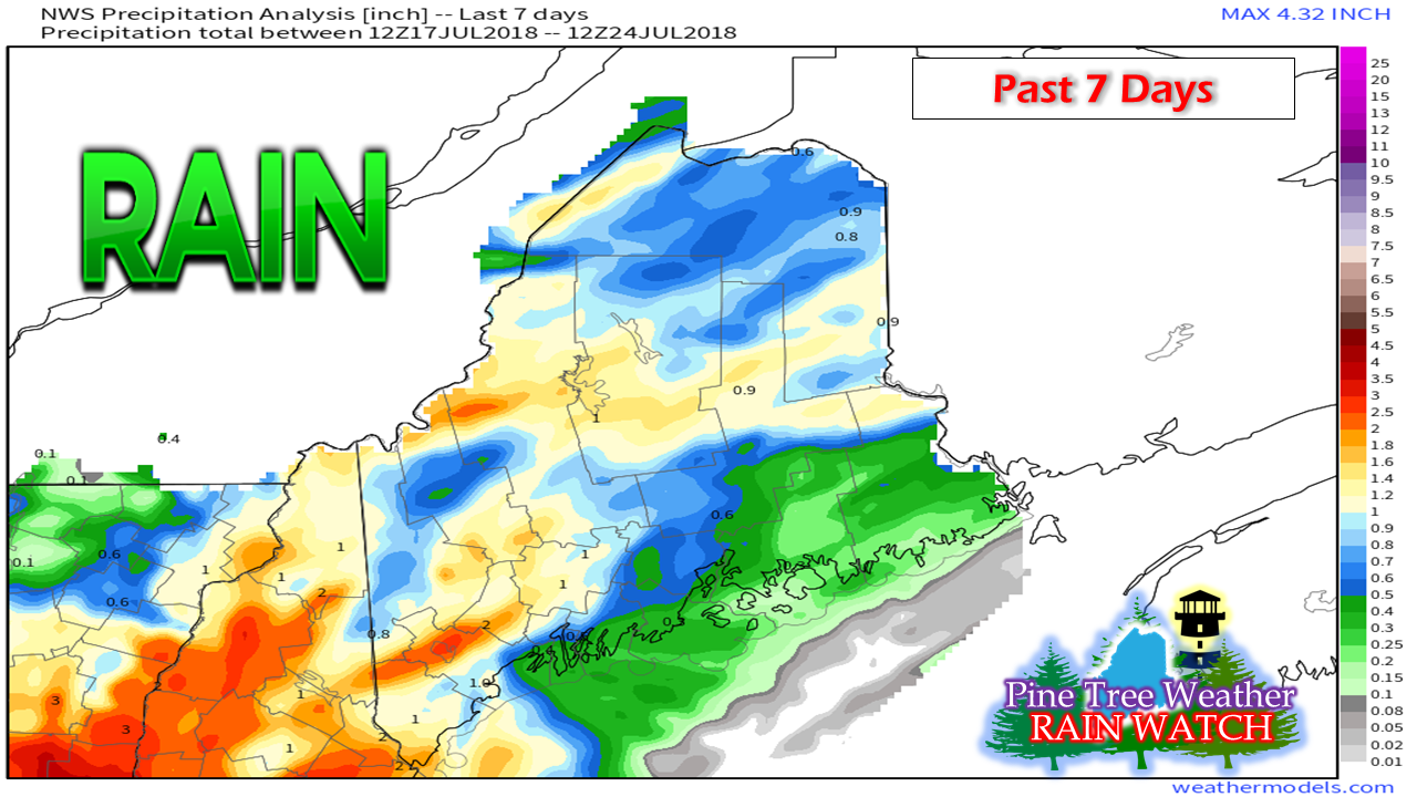 Most of the region has received some beneficial rainfall in the past week. DownEast and MidCoast areas, along with a few spotty areas over the interior are the only areas that haven't seen as much as the rest of the state. The weather pattern has shifted where the region can get rain, and that will continue for the next several days. Rain chances increase into Thursday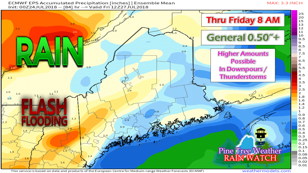 Wednesday is on track to feature some scattered showers and perhaps some isolated thunderstorms for western and southern areas. The state can expect a general half-inch of rainfall, with amounts increasing pending on region and conditions. The foothills of western areas appear to be the potential jackpot area, where 1"+ or more can be expected. The western half of the state will have to watch for flash flood potential due to the volume of water in the atmosphere, along with the potential training of heavy rain and storms. Localized amounts of rainfall could be higher or lower pending on how this plays out, but I think a half-inch of rain statewide is a reasonable outcome, with areas in the 1-2" range. Rain showers break out Wednesday afternoon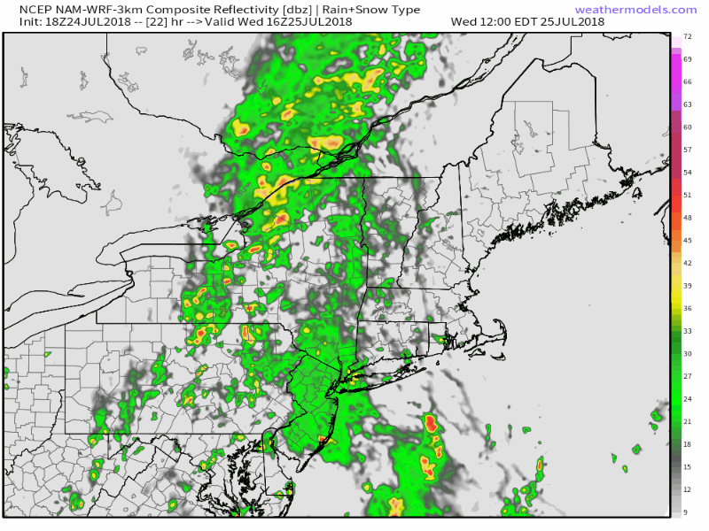 Western areas may see a brief shower or sprinkle Wednesday morning, but will become widely scattered to numerous as we head towards the evening. With much of the rainfall expected to come overnight into Thursday morning, this helps tone down the severe threat, outside of something embedded. As daylight increases, there will be plenty of fuel for thunderstorms to develop, even after the the the main rain line has departed. Storms that form will be dependent upon how much sun can get out. Thursday afternoon will be one where keeping an eye on the sky would be a wise decision. Humidity takes a break by Sunday, albeit a short one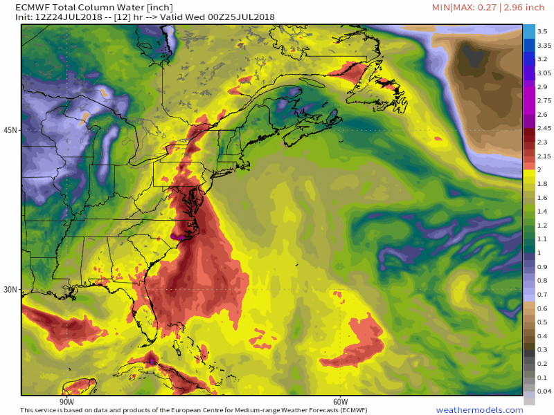 This loop of precipitable water tells the tale of the pattern over the next week. As the frontal boundary that has stalled to our west slides back east, oppressive humidity returns Wednesday night into Thursday. It will take another frontal boundary that pushes through the region on Saturday before drier air takes over on Sunday. As next week unfolds, we'll repeat the pattern all over again. Pattern is one to watch as we head into August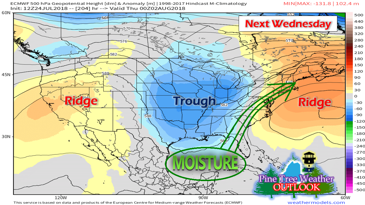 A few things come to mind as I look at a set up such as this. The positions of the two ridges and the trough keeps bouts of humidity and chances for rain in the forecast in the foreseeable future. This is also the perfect pattern for tropical storms to travel up the east coast, if they can get organized. There has not been a whole lot to talk about in the Atlantic since Chris passed by in early July. The main activity at this point is in the Pacific.  One of the factors that the Atlantic hurricane season has been so quiet is the amount of dust flowing westward from Africa. It's affected the entire alley way. Wind shear plays a role in this is as well. Disturbances coming off the shoreline of Africa are either being choked out by dust or torn apart by wind shear. We're still early in the season as far as the northeast is concerned, with peak still 7 weeks away. With the Bermuda high showing its presence, along with warm sea surface temperatures, the next few weeks will be something to stay updated on. We haven't had a significant tropical storm impact the region since Sandy in 2012. One could say "we're due". Time will tell if we get one, but the stage is set once the wind shear and dust settles.
For more information on what is going on in the tropics, check in with the National Hurricane Center. As always, stay in touch with the National Weather Service in Gray for western and southern Maine or Caribou for eastern and northern areas for official forecasts, bulletins and advisories. For more information from me, please follow the Pine Tree Weather Facebook page and on Twitter @WesternMEwx. Always stay weather aware! - Mike |

Mike Haggett
|


