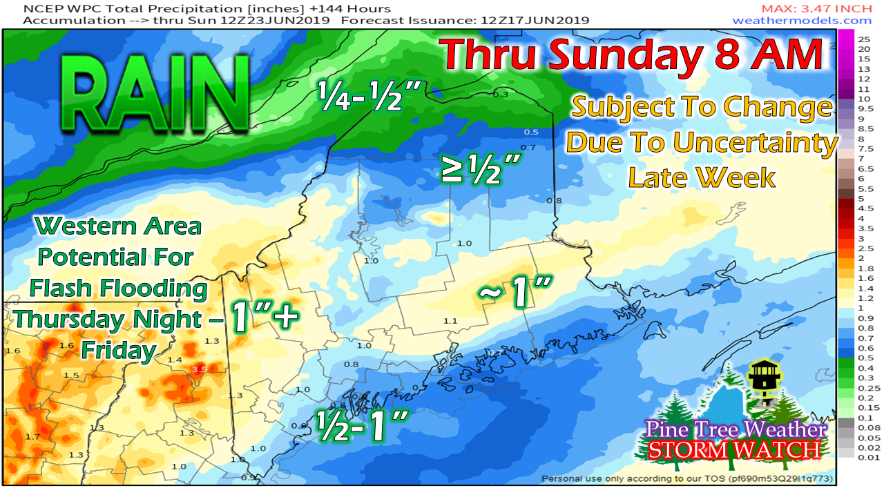
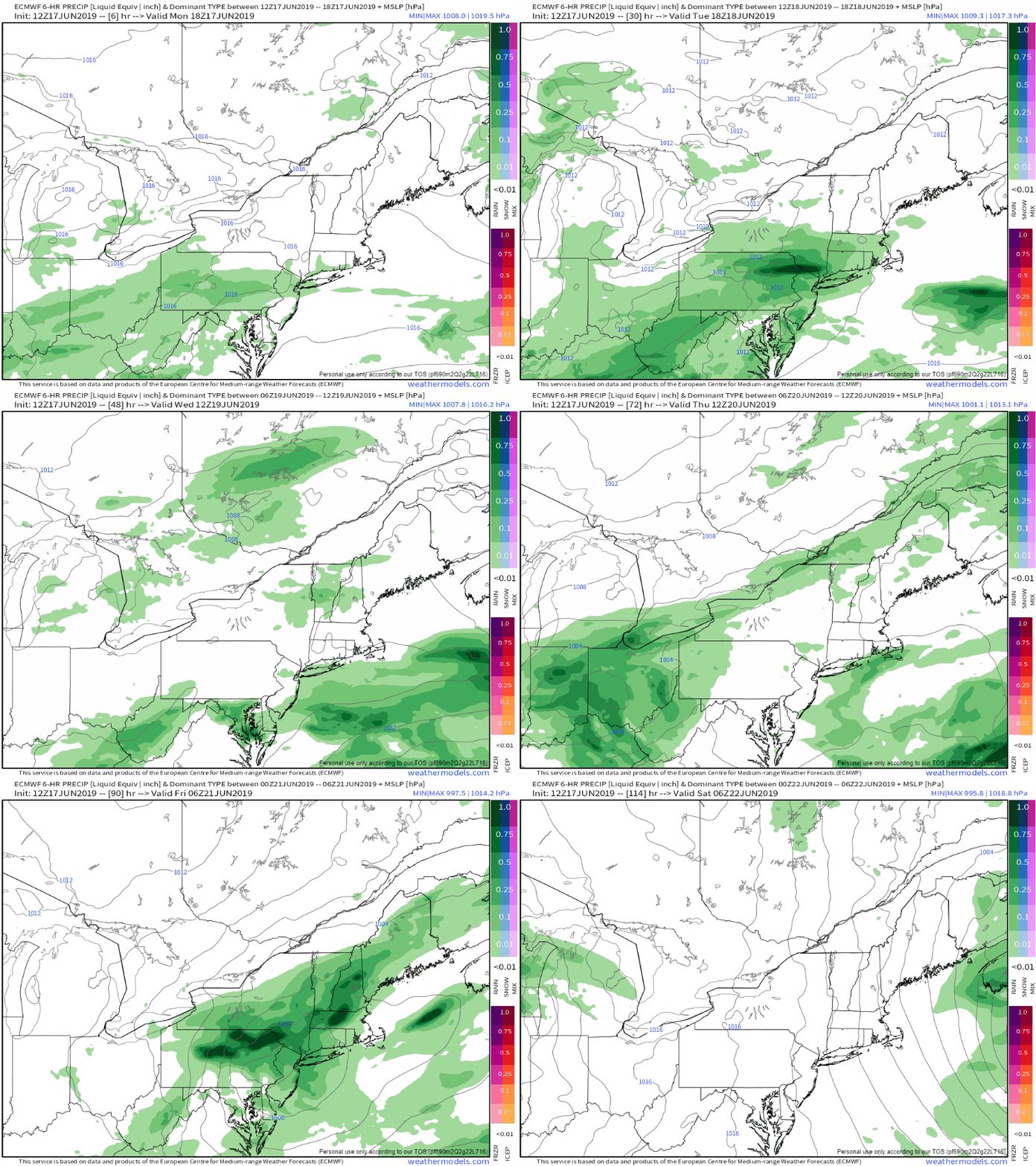
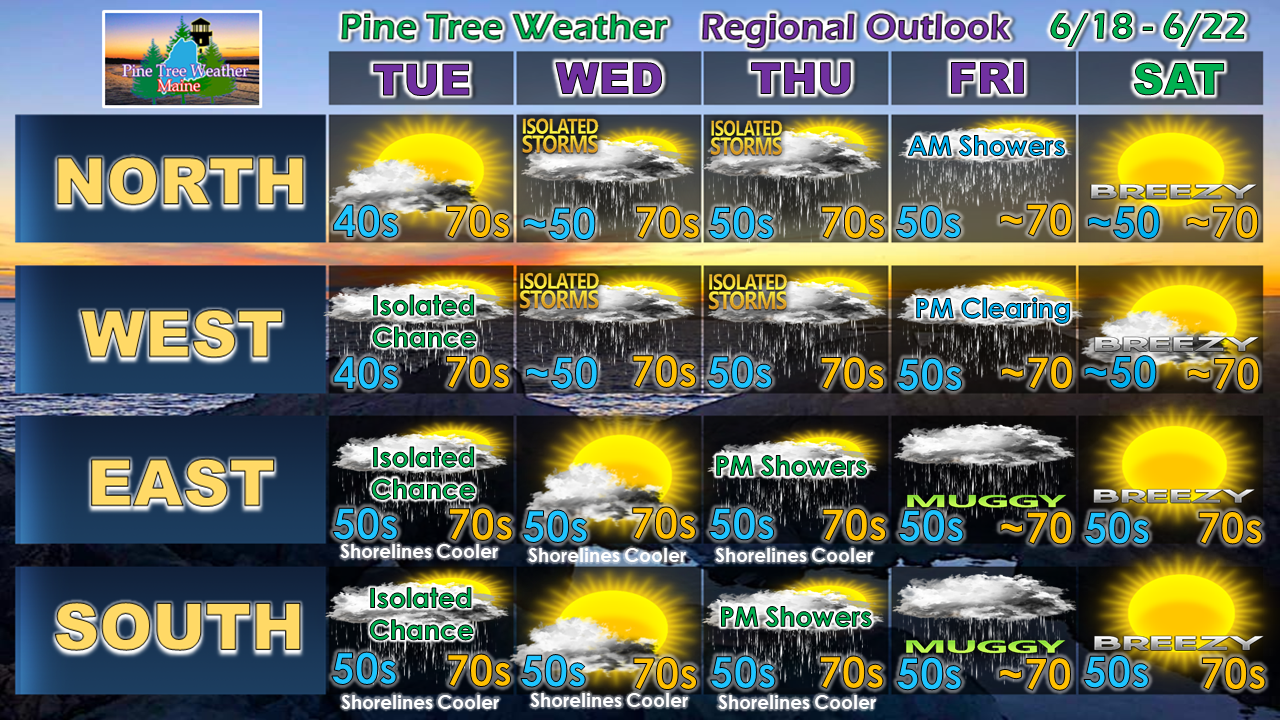
Some uncertainty remains on how much rain is to comeSince I have been contacted by some to supply rain estimates out of concern for lake level management, I will make every effort to include these ideas in my posts through the summer. My confidence in this forecast by the Weather Prediction Center is low. It's not because I question their fine work, but I question the pattern and how guidance is handling it. Both the American and the European models have made "upgrades" in the past week, so and I am watching them both closely for any changes in biases and performance. What is certain is a frontal boundary has stalled over Southern New England and the Mid-Atlantic. It will make an effort to move northeast on Tuesday, but will likely be thwarted by a large blocking high over Greenland. That said, a few isolated spot showers or sprinkles may pop up for all but northern areas on Tuesday. An upper low over Western Quebec tries to spin a cold front through on Wednesday, which may touch off a few showers and perhaps a thunderstorm for northern and western areas in the afternoon. It appears we'll see a repeat chance of that on Thursday as the upper low tracks towards Labrador. While that is going on, the front to the south noses northeast, which may bring showers late in the day for southern and eastern areas. Showers can be expected everywhere overnight Thursday. The uncertainty creeps in on rain amounts Thursday night into Friday as low pressure along the ridge moves through Southern New England. Models have gone back and forth on just how juicy this could be, which tells me they are having difficulty figuring out how much influence the southern stream is going to have on this, as well as the position of the ridge. Regardless, for those following who are camping or hiking, you can bet on rain. Make sure you pick a spot where you are safe from any rapid rise of brooks, streams or rivers just in case gully washer rains occur. Stay tuned for updates, and make sure you have a weather radio for alerts. Regional Outlook through SaturdayNot only will it be rainy on Friday, but it will be rather sticky as dew points appear to be well into the 60s for the coastal plain, along with precipitable water values pushing 2". Not only will it be sultry, but it also sets up potential for downpours, which could lead to hydroplaning and street flooding in the more populated towns.
As always, stay tuned. ► ► For the latest official forecasts, bulletins and advisories, please check in with the National Weather Service in Gray for western and southern areas, or Caribou for northern and eastern parts of Maine. Please consider supporting Pine Tree Weather ► ► Your financial donations are much appreciated to keep this site funded and for further development. I sincerely appreciate your support not only financially, but also in sharing my efforts with others. For more information from me, please check the Pine Tree Weather Facebook page as well as my Twitter feed. Always stay weather aware! - Mike |
Mike Haggett
|


