
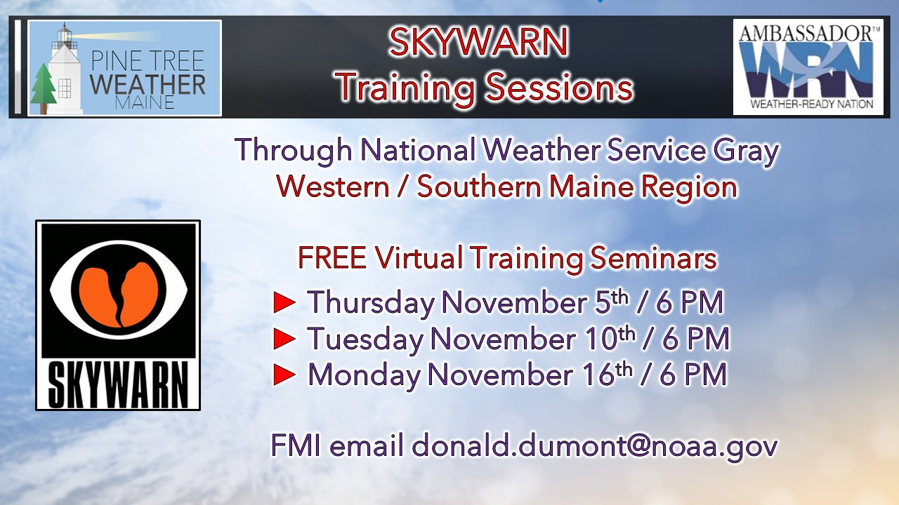
Another raw day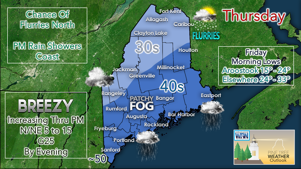 For you early birds heading out, be aware of patchy fog around in the valleys and waterways. In some areas freezing fog is possible, so watch the thermometer closely. Take 5° off your vehicle thermometer for a better read on surface temperature. As clouds increase and wind picks up, fog should clear out by around midday. 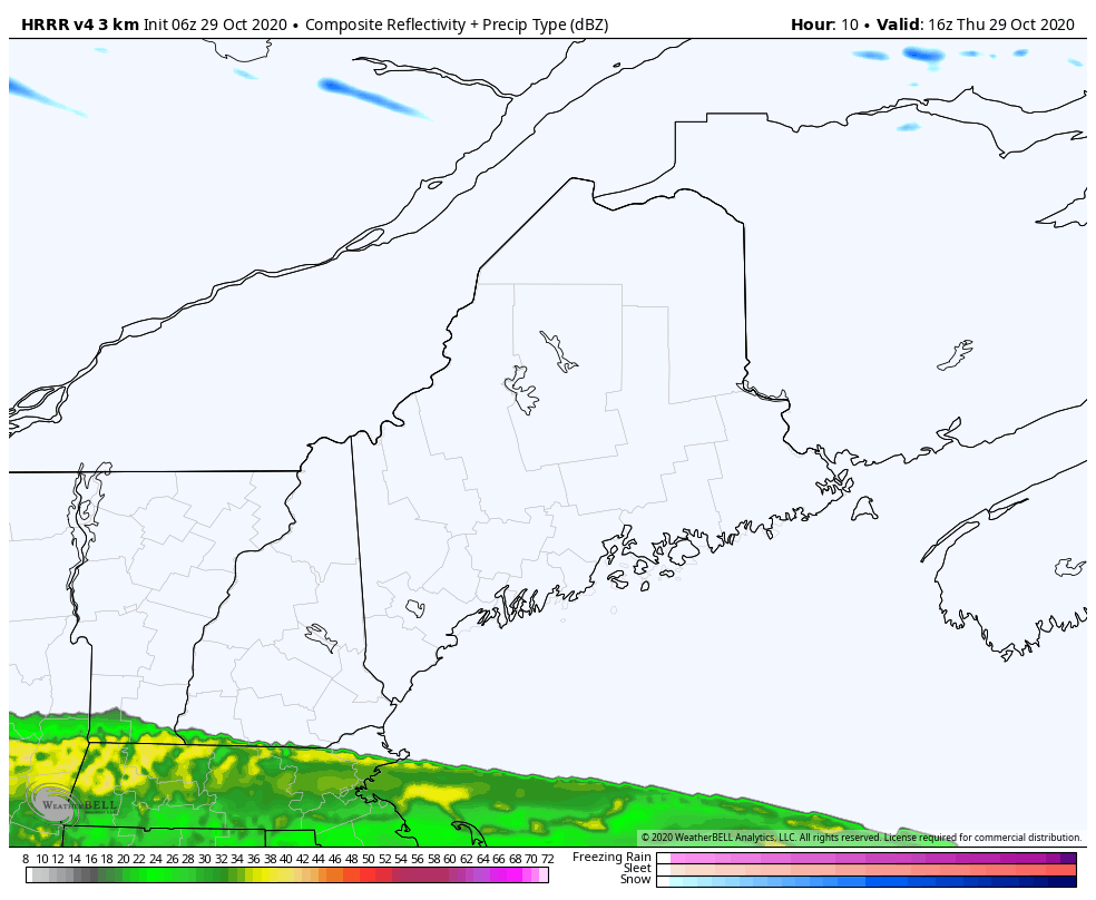 After a dry morning, showers break out over western and coastal areas this afternoon. As the cold air sinks in aloft, that will change rain over to a brief mix of freezing rain to snow by tonight. Precipitation tapers off Friday morning, ending by roughly noon. Since Maine is on the fringe of the storm, this sets up forecast challenges. Any deviation of track at this point makes the difference of how accumulations play out. 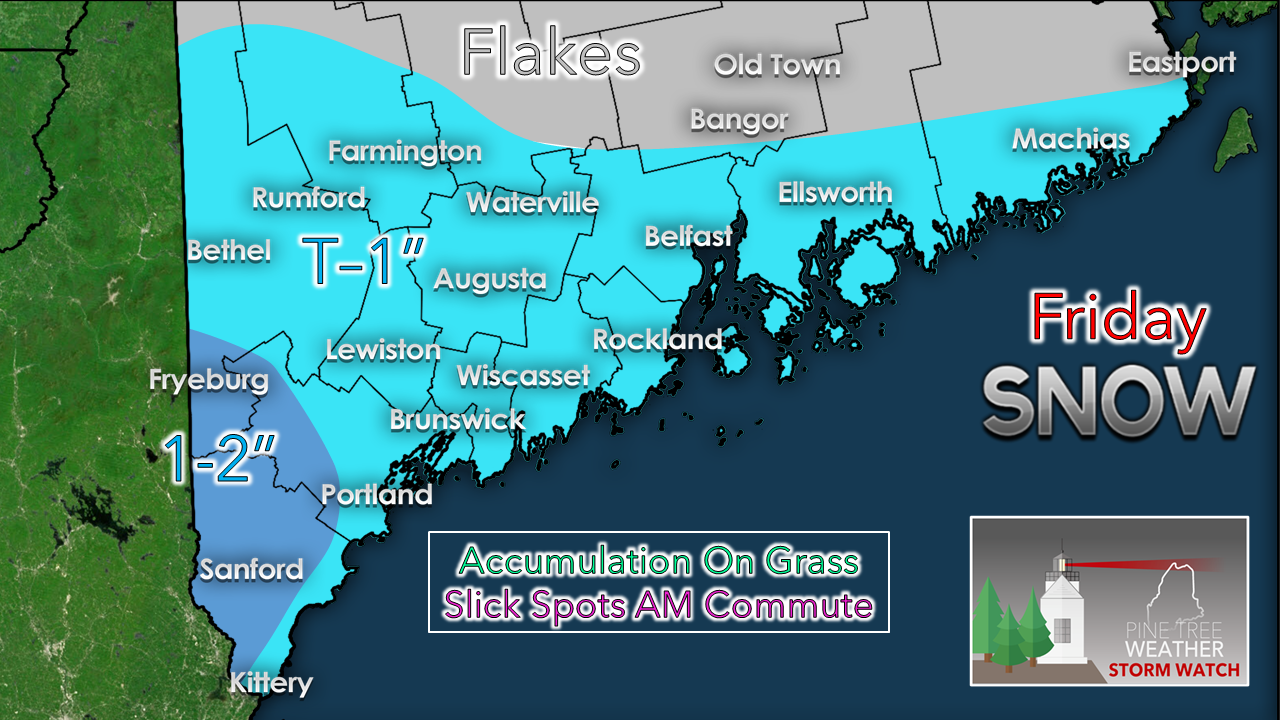 NOTE: There are still hints of both overperformance and under performance due to the subtle changes in track. Model outliers show as much as 6" of interior York County, to next to nothing for accumulation at all. Such is life on the fringe of storm. I made a slight adjustment to the map posted here yesterday. Southwestern areas have the best chance for accumulation from Fryeburg to Portland south, whichever way I look at it. If you are early out the door Friday morning, allow for plenty of extra time and take it slow. Hopefully the annual meeting of the Summer Tires Club doesn't screw up commute times too bad. As far as plowing and shoveling goes, this is going to melt. There is no need to tear up the yard.  Saturday dry and chilly, Sunday damp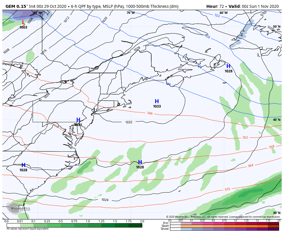 As the storm departs Friday, high pressure moves in for Saturday, and brings bluebird sky with temps in the 30s and 40s. As high pressure moves east Saturday night, clouds increase with the southwest flow heading into Sunday. Showers break out over the region during the day on Sunday with highs in the 40s and 50s. After the front passes through early Monday, the mountains and north may see snow shower activity through the day, ending early Tuesday. The pattern appears dry through most of next week. Temperature outlook through WednesdayBelow normal temperatures continue to be the rule through the period. Sunday will be above normal marginally. A warmer trend idea is being pitched for later next week. 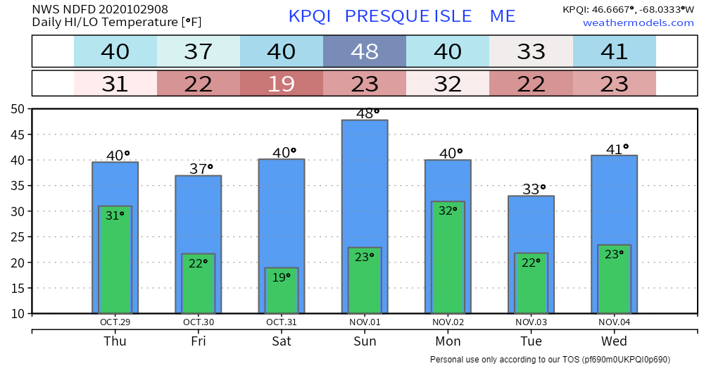 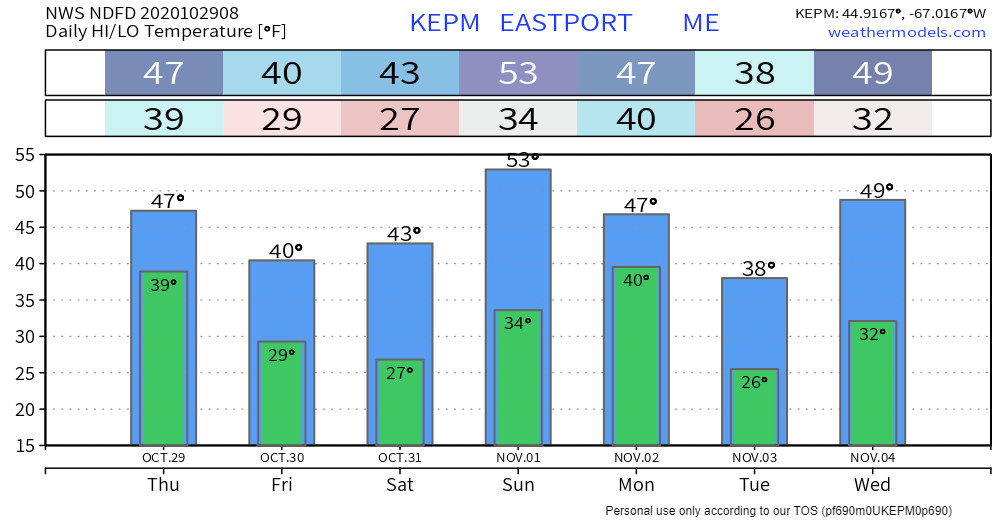 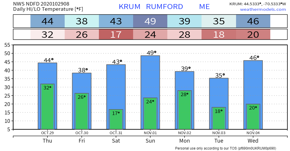 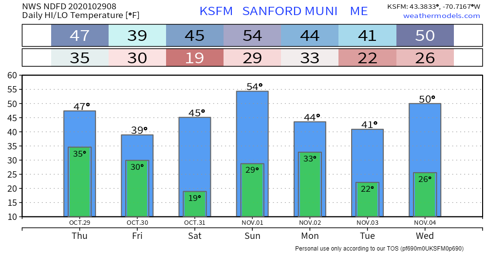 Winter SKYWARN Virtual Spotter Training in November |
| | BE PREPARED WITH A NOAA Weather Radio. For $20-$40, it could provide important information to you when you need it. The weather bands are standard on most public safety scanners, and newer scanner models. Weather radios can be programmed for auto alert. Click here for more information. |
| ► ► For the latest official forecasts, bulletins and advisories, please check in with the National Weather Service in Gray for western and southern areas, or Caribou for northern and eastern parts of Maine |  |
** FUNDING NEEDED FOR 2021 **
Thank you for supporting this community based weather information source that is funded by your financial contributions.
Stay updated, stay on alert, and stay safe!
- Mike

Mike Haggett
Kennebunk, ME
Weather-Ready Nation
Ambassador
Certified Weather
Forecaster
Penn State '21
American Meteorological Society
National Weather Association
SKYWARN-CWOP
Matthew 19:26
Please
Support
Pine Tree Weather
In 2024


Archives
July 2024
June 2024
May 2024
April 2024
March 2024
February 2024
January 2024
December 2023
November 2023
October 2023
September 2023
August 2023
July 2023
June 2023
May 2023
April 2023
March 2023
February 2023
January 2023
December 2022
November 2022
October 2022
September 2022
August 2022
July 2022
June 2022
May 2022
April 2022
March 2022
February 2022
January 2022
December 2021
November 2021
October 2021
September 2021
August 2021
July 2021
June 2021
May 2021
April 2021
March 2021
February 2021
January 2021
December 2020
November 2020
October 2020
September 2020
August 2020
July 2020
June 2020
May 2020
April 2020
March 2020
February 2020
January 2020
December 2019
November 2019
October 2019
September 2019
August 2019
July 2019
June 2019
May 2019
April 2019
March 2019
February 2019
January 2019
December 2018
November 2018
October 2018
September 2018
August 2018
July 2018
June 2018
May 2018
April 2018
March 2018
February 2018
January 2018
December 2017
November 2017
October 2017