
Rain continues into Monday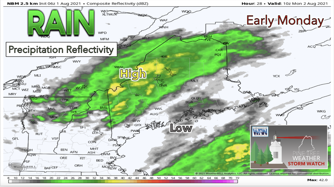 For Monday, the weather system that brought rain to the region late on Sunday gradually pushes eastward. Rainfall will likely be most intense during the morning hours on Monday and taper off soon after. Most of this system is expected to remain in the northern and western parts of the state. Once clearing begins late morning, areas across the southwest should have the most clearing overhead while the mountains into central Maine may still see spotty showers and even a few thunderstorms throughout the day. Temperatures for the day will likely remain on the lower end due to cloud cover with the north forecasted to see temperatures around the low 70s and the south only reaching temperatures into the mid 70s. 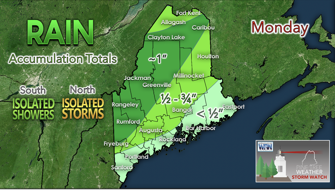 Since a low pressure system brought rain and storms to the region on Sunday and Monday rain accumulation totals are predicted to be relatively significant and have potential for quite a positive impact across the state. Areas that are expected to receive the most accumulations will likely be along the western mountain region. These places are currently forecasted to reach accumulations of about 1 inch maybe even a bit more. Elsewhere to the north will likely also receive enough rainfall to see accumulations of 1/2 to 3/4 of an inch. This is good news for the interior areas that have been dealing with severe drought this season as these areas have seen little of this type of rain accumulation so far. If this trend holds up, heavier rain stays north and the coast will likely experience a much needed break, as it has dealt with the wettest July in decades. Calmer on Tuesday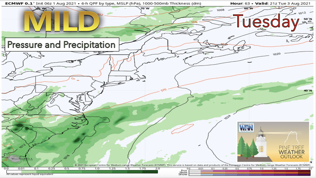 By Tuesday high pressure becomes apparent and holds over the northeast through most of the morning. By Tuesday afternoon two separate weather systems begin surrounding the state. To the north of Maine, a cold front makes its way in from the the northwest increasing cloud cover and potential to see precipitation. Areas most likely to see any rain from this system are the North Woods, St John Valley, and Central Aroostook. To the south a completely separate short-wave system will likely arrive at a similar time rising up from the Mid Atlantic into the gulf of Maine. This system is also likely to increase cloud coverage for southern areas, but rain will not be likely to affect Downeast until the overnight. 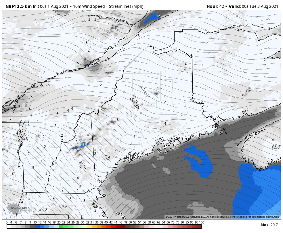 Seabreeze sets up at close to 10 mph Tuesday and should develop in the afternoon and will likely be accompanied by a drop in temperature along the coast. Clouds will likely also increase by the afternoon along the coast as a wave develops along an offshore stationary front, while winds pick up in the north to 15 mph at most. Temperatures Tuesday are expected to be higher than in previous days in the mid to high 70s with cooler temperatures along the coast. The warming trend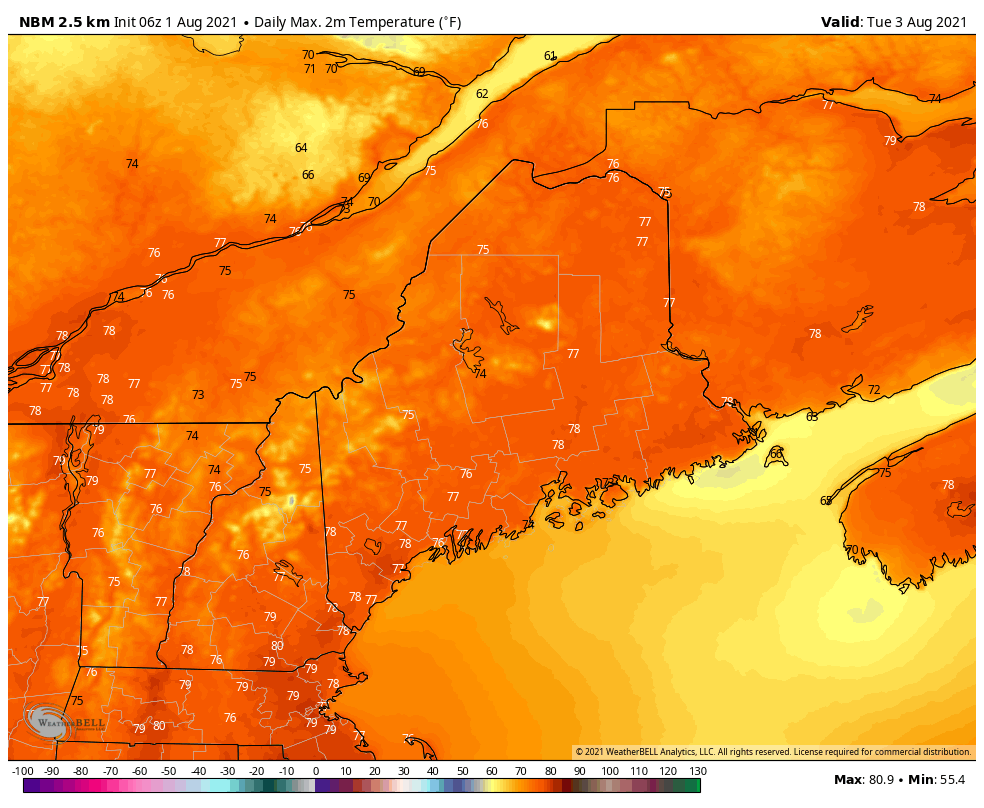 This upcoming week kicks off a warming trend for the beginning of August as temperatures begin to rise back up to what could be considered "normal" for this time of year. Monday and Tuesday's temperatures seem likely to remain in the below average range coming off the rainy weather and cooling trend from this past week. Temperatures for these days will struggle to rise above the high 70s range. As Wednesday approaches high pressure is dominant over the area which should lead to clearer skies and therefore significant surface level heating. Temperatures return to a more normal range and continue increasing beginning Wednesday. By the end of week this heating trend should allow for temperatures to surpass the near 80s to just above, across the state. With dew point temperatures averaging in the 60s for the end of this upcoming week air will likely feel quite comfortable if not a little dry. Smoke Watch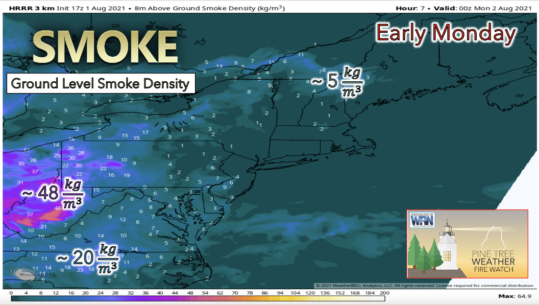 Keeping an eye on smoke density outlook this week we start to notice that smoke from wildfires farther to our west starts to creep into the area. If this wind pattern continues smoke will likely make it back into the region starting Monday morning and increasing in coverage thereafter. It would be diligent to keep up with the air quality forecasts in the coming days as air quality is likely to decline. Wildfires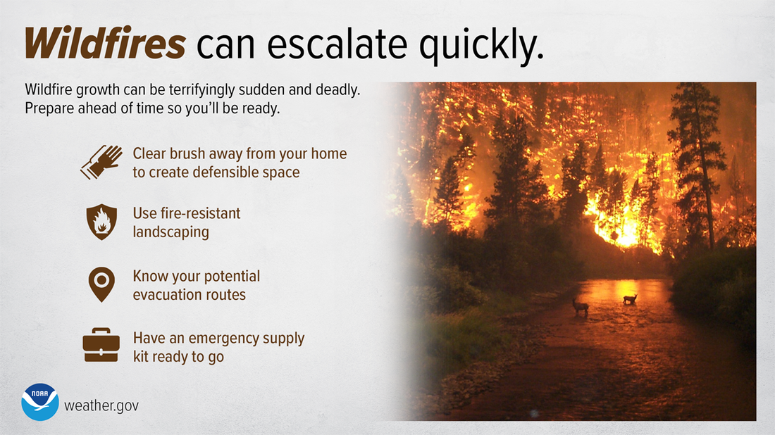 Wildfires can spread quickly — by the time one is nearby, you may not have much time. Stay Weather-Ready by preparing ahead of time. Ready your home, have an evacuation plan, and an emergency supply kit. weather.gov/safety/wildfire Temperature OutlookAccording to the 7 day outlook temperatures are likely to follow the forecasted warming trend giving us an average uptick in overall temperatures by next Sunday. Temperatures are currently expected to rise and therefore cause daily average temperatures to be about 1 to 2 degrees higher by the end of next week as compared to current temperatures. 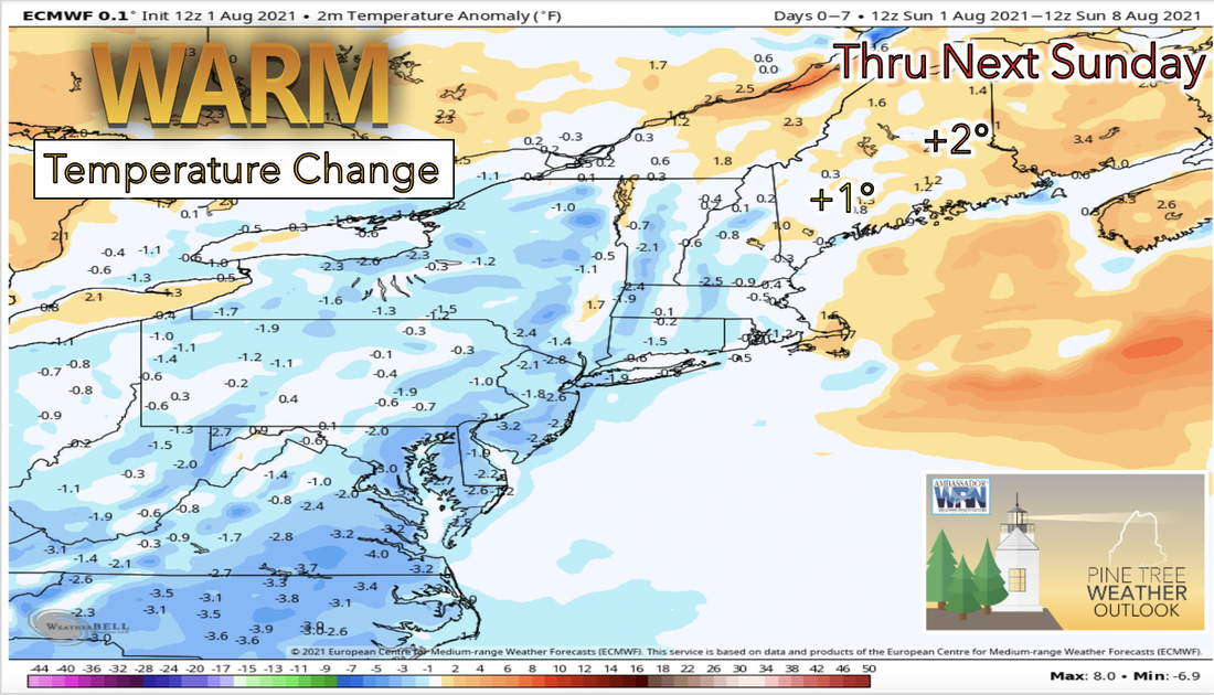 Be prepared to receive alerts and stay updated  BE PREPARED WITH A NOAA Weather Radio. For $20-$40, it could provide vital information to you when you need it. The weather bands are standard on most public safety scanners, and newer scanner models. Weather radios can be programmed for auto alert. Click here for more information.  ► ► For the latest official forecasts, bulletins, and advisories, please check in with the National Weather Service in Gray for western and southern areas, or Caribou for northern and eastern parts of Maine. 
|

Mike Haggett
|


