
Cold front passes through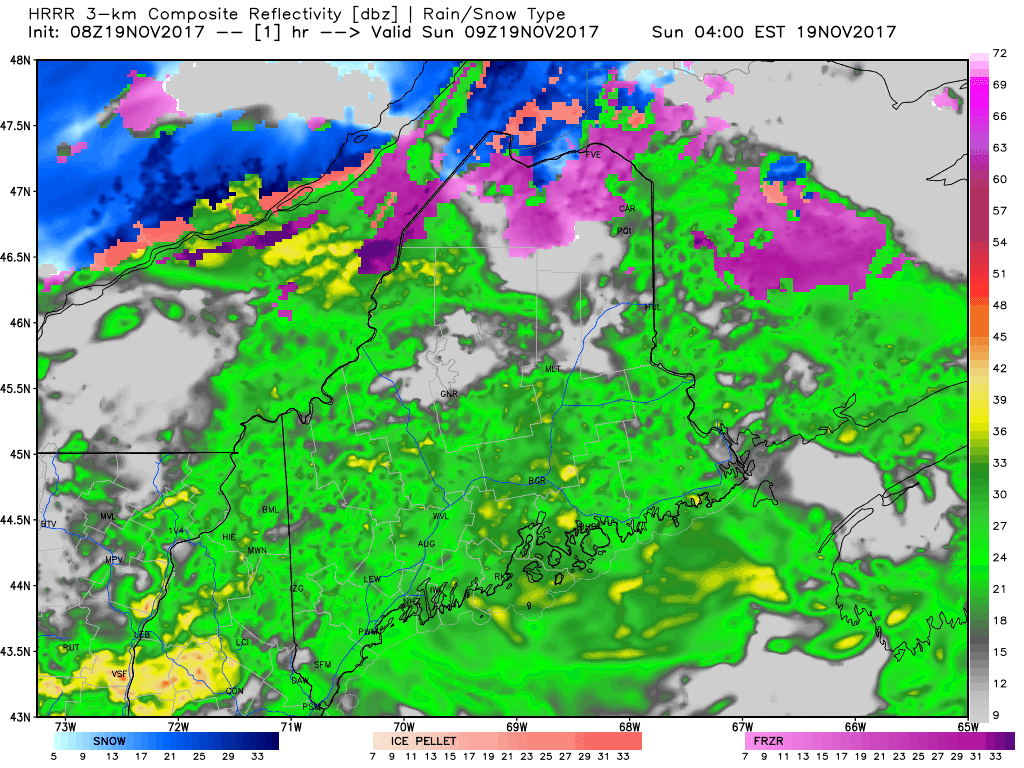 The frontal boundary responsible for the coastal rain and the light ice over the interior will pass through the region today. This HRRR idea of predictive radar does a good job overall on timing, but misses the idea of upslope snow showers forming in the mountains Sunday afternoon into the evening. Those snow showers may bring an inch of snow in spots of the higher elevations into the wee hours of Monday. Wind Advisories posted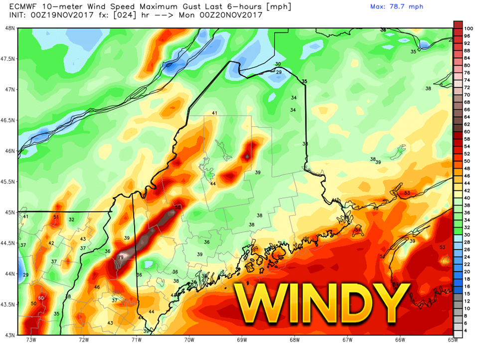 Upon passage of the front, west/northwest wind begin to pick up in the afternoon. Gusts in the 40-50 mph range are expected through Sunday night. This may cause spotty power outages in areas. Given the conditions of the trees from the impacts of the Late October Gale, any strong wind event is likely to cause some level of electrical service loss. 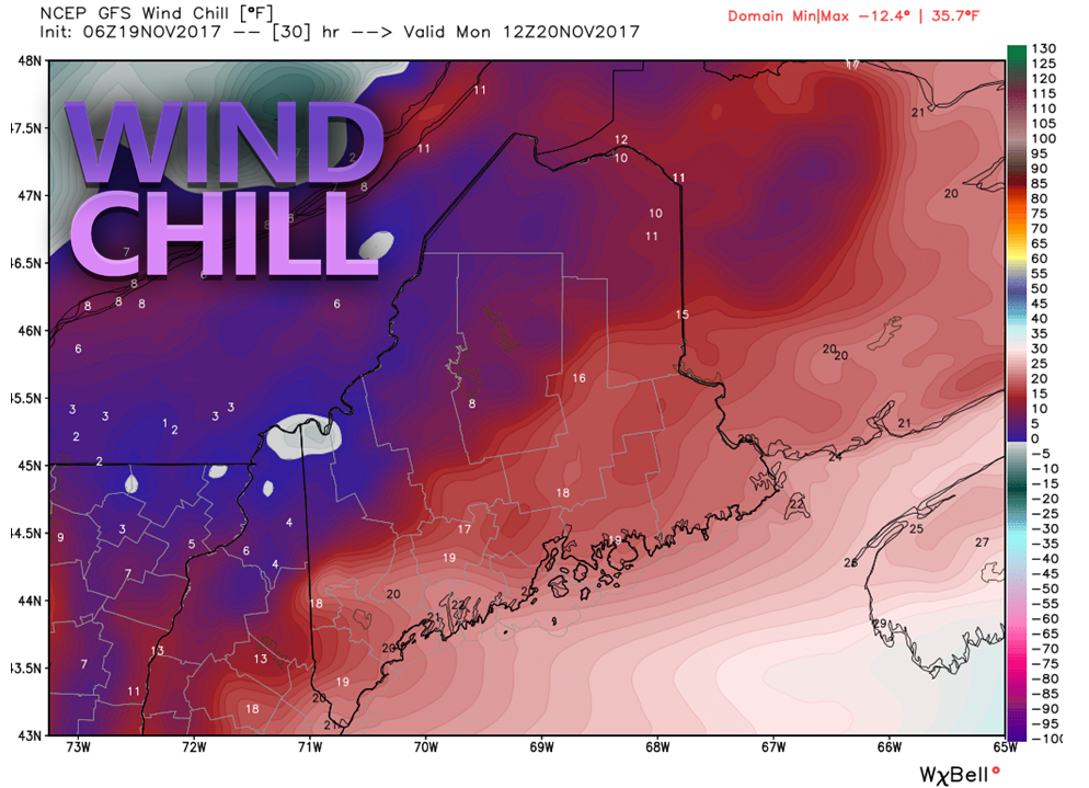 With the wind will come the wind chill. Temperatures are expected to drop from their morning highs in the afternoon. This may cause isolated areas of patchy ice to form from the rain in areas where it is stubborn to dry up. Wind gusts in the 20-30 mph range are expected for Monday and appear to drop off steadily through the day. What breeze is left Monday evening is expected to drop by Tuesday morning for most areas away from the mountains and north. A southerly flow returns Tuesday, bumping temperatures up a bit. Another cold front approaches the region on Wednesday. Wednesday appears damp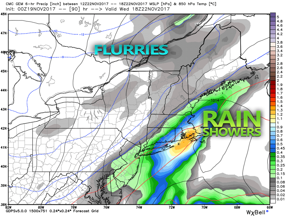 The only real weather obstacle to clear before Thanksgiving will be the passage of this front. The trough is on track to pass through on Wednesday. Moisture riding up along the front could enhance shower activity for the coast somewhat. The mountains and north may see some snow showers and flurries Wednesday afternoon and evening.
A weak front passes through the region Thursday evening which may cause some snow showers and flurries for the mountains and north. Black Friday appears to be a mainly sunny day statewide. The weekend is a toss up for now, and too far out to nail down what is possible there. - Mike |

Mike Haggett
|


