
We're having a meltdown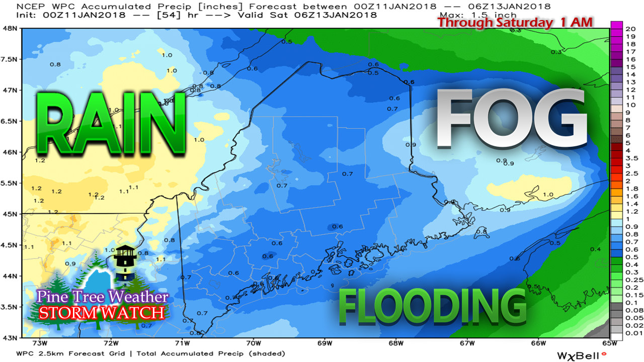 Three key words to get us through Friday will be rain, fog and flooding. While this Weather Prediction Center estimate shows roughly a half inch or more of liquid precipitation statewide through Saturday morning, to the eye it does not look like a big deal. With the warm air meeting the cold at the surface, fog will do its job and eat at the snow pack better than any style of warm rain event.  As far as Thursday goes, there is just scattered shower activity during the day as the area is in between the warm front that passed through overnight. It will be breezy as southwesterly winds will pick up, and will raise temperatures into the 40s for most areas, with low 50s likely for the southwest interior. The fog will be dense in areas, so be aware as you drive around that you could be heading into an abyss. Rain is on track to pick up with intensity overnight in Friday morning. Flooding from ice jams on rivers, brooks and streams, as well as urban street flooding are a real possibility. The set up for Saturday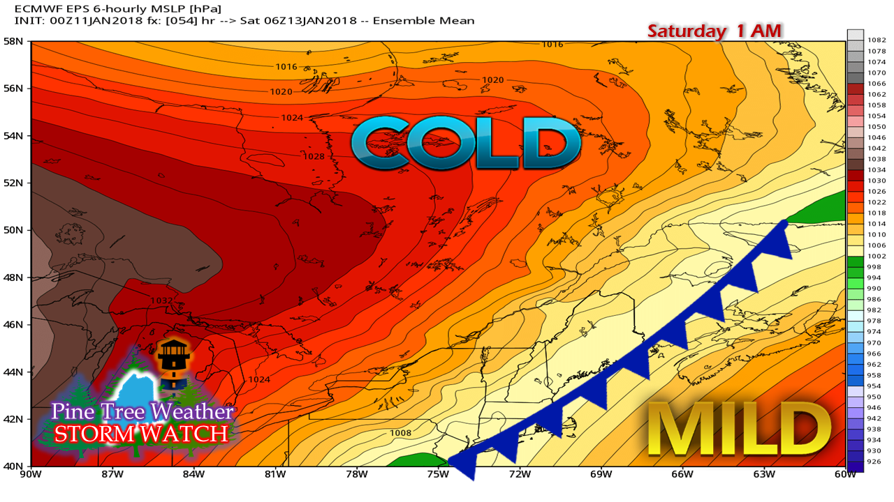 In the wee hours of Saturday, the cold front is on track to slowly sag into the Gulf of Maine and stall. Cold air associated with high pressure to the west will filter in and freeze everything up. Any standing water on roadways, sidewalks, and parking lots will turn into ice, and do so rapidly. Expect flash freezing heading towards daylight Saturday everywhere. Low pressure over the Mid-Atlantic moves northeast along the front, and that is where the sleet, freezing rain and snow come into play. 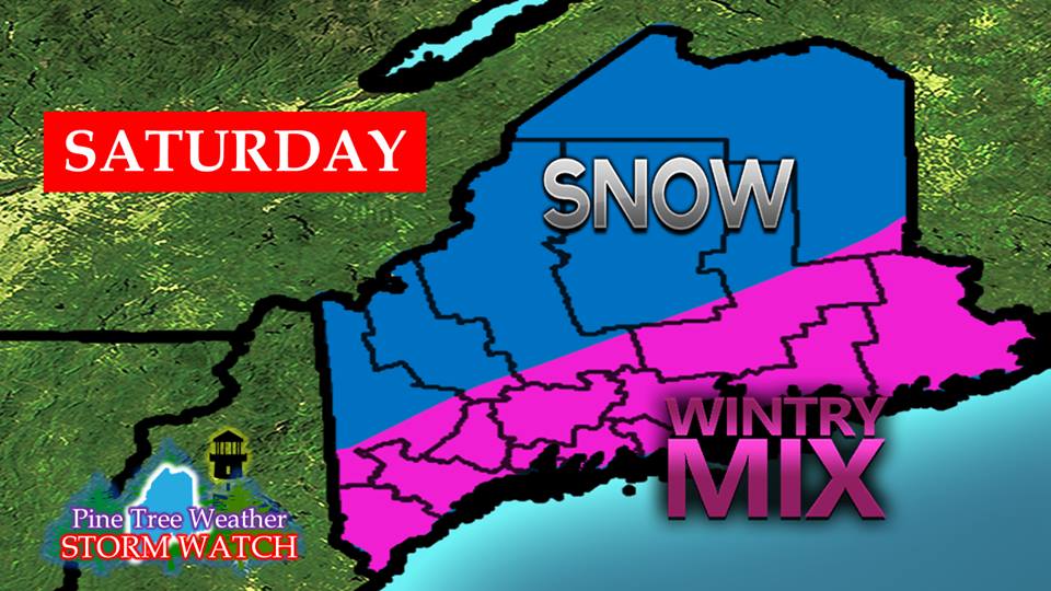 My rough idea posted on Facebook last evening is still on the discussion table as to how this will play out. The mountains and north will likely see some sleet and freezing rain, but snow is likely to be the dominating feature. For the south and east, rain changes to freezing rain and sleet, with perhaps a touch of snow as a parting gift before it ends Saturday evening.
I will provide an update on what to expect out of this for precipitation types and amounts in an update Thursday afternoon. - Mike |

Mike Haggett
|


