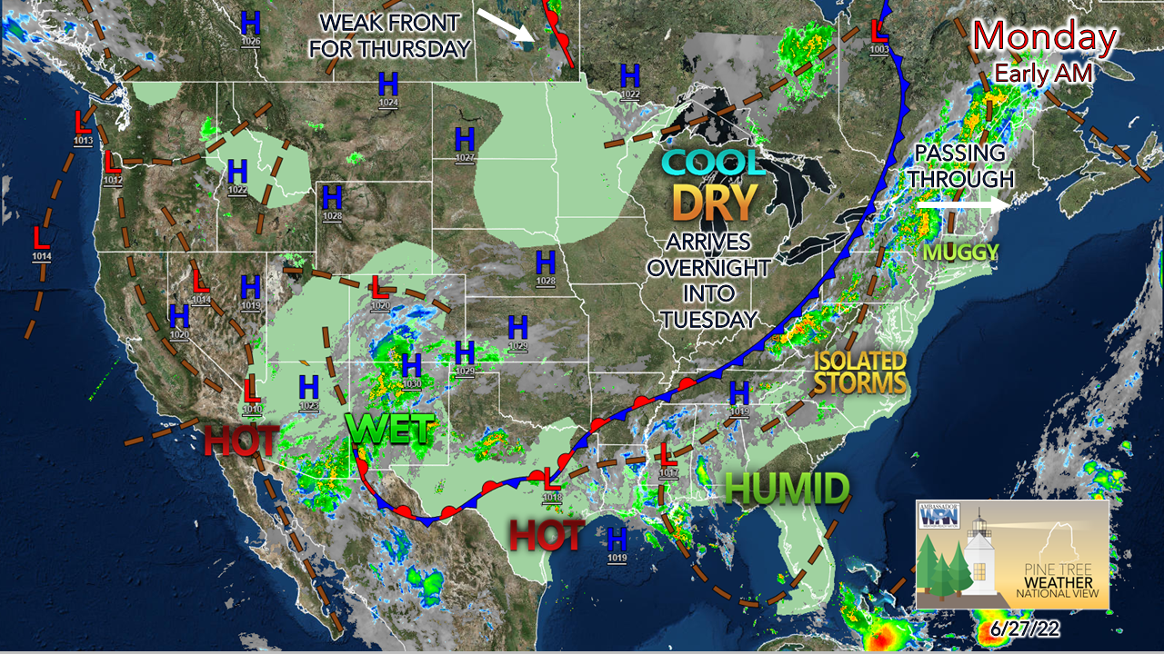
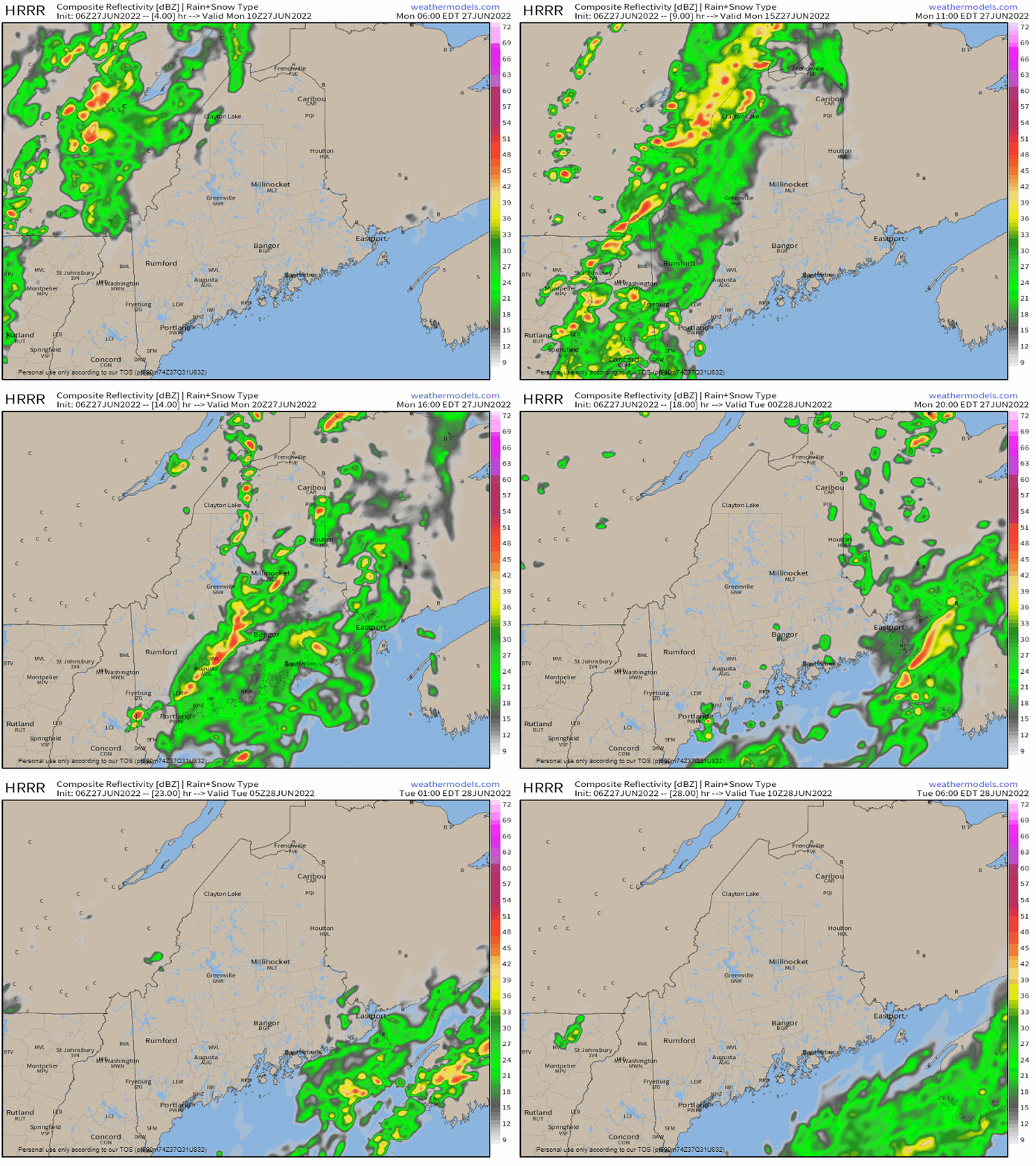
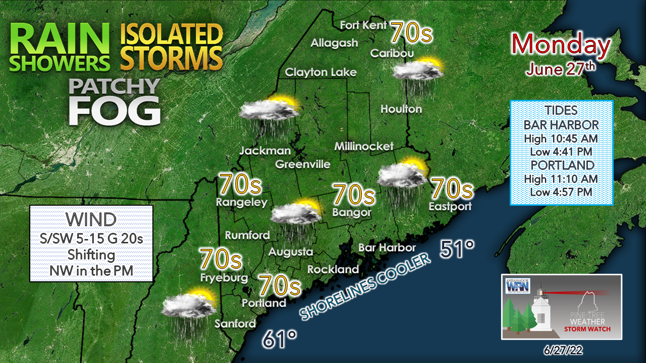
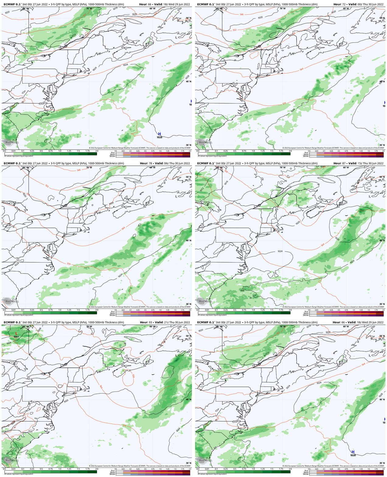
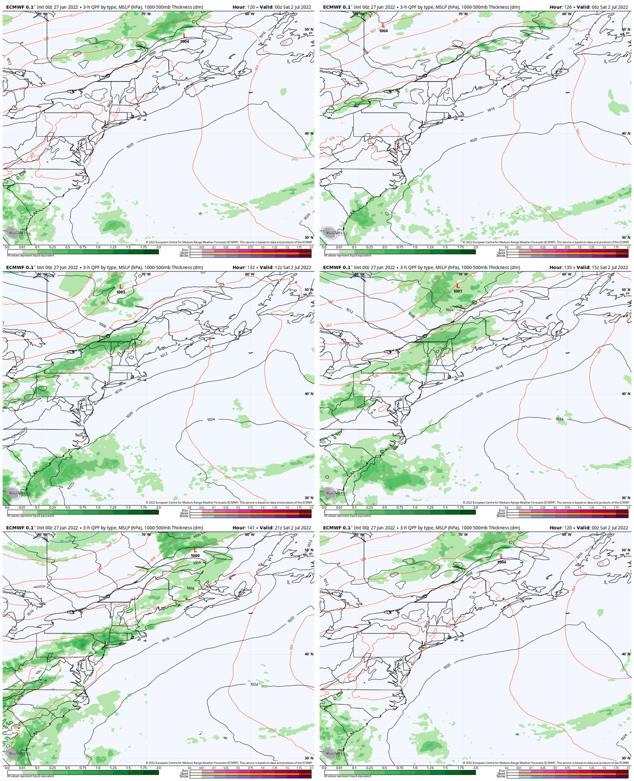
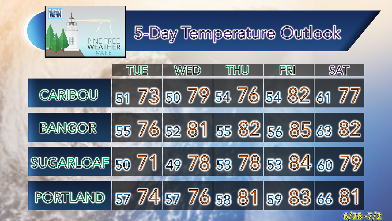
After the front, the pattern settles until late weekOnce the frontal boundary passes through the region on Monday, the region reverts back to "Maine summer" conditions with low humidity and comfortable temperatures through Wednesday. A wet day ahead of that is on tap first, which is a welcome relief for an area that is behind on rainfall. Showers, possibly a rumble for MondayMonday 6 AM to Tuesday 6 AM - With the high humidity thanks to precipitable water values reaching 2", rain could be locally heavy in spots as the frontal boundary passes through. While severe storm chances remain very low, cloud cover dictates the threat and will need to be watched. The dynamics aren't that great for storms that pop to get too out of hand but could provide a gully washer with torrential rainfall given the amount of moisture around. Just be aware of localized flash flooding, reduced visibility from rain and fog, and perhaps a quick stiff gust of wind as the heavens open up and dump, There is a hint that the front may slow down to a crawl later in the day which may keep shower activity going over eastern areas into early Tuesday. The sultry feel of the tropical air makes this an air-you-can-wear day and may feel oppressive at times. With cloud cover around, that keeps the heat in check. Areas where the sun pokes through may see temperatures get into the 80s for a brief period, but the showers will cool the air. Once the front passes and the wind shifts to the northwest later in the day, it will be time to shut off the air conditioner and open the windows to allow for natural refreshment Showers possible for ThursdayWednesday 2 PM to Thursday 8 PM - A weak frontal boundary approaches the region Wednesday night and may bring some scattered showers over interior areas on Thursday. The front fizzles out and a warm front from the southwest advances on Thursday afternoon, which will bring heat and humidity back to the region for Friday. Rain and storms possible to start the weekendFriday 8 PM to Saturday 8 PM - This is wait and see situation here on timing and storm potential. but with the long holiday weekend approaching and folks planning activities and trips, it is worth a mention to keep an eye on. A cold front is anticipated to pass through the region and usher out the next round of heat late week. Once this front passes through, the rest of the weekend appears dry with comfortable temperatures and sunny conditions as it appears for now. Temperatures through SaturdayThank you for supporting this community-based weather information source which operates by financial contributions from people like you. Stay updated, stay on alert, and stay safe! Have a great day! - Mike NOTE: The forecast information depicted on this platform is for general information purposes only for the public and is not designed or intended for commercial use. For those seeking pinpoint weather information for business operations, you should use a private sector source. For information about where to find commercial forecasters to assist your business, please message me and I will be happy to help you. |
Mike Haggett
|

