
A decent amount of rain on the way Sunday appears to be a mainly dry day for most. A few isolated showers are possible over the north and mountains in the afternoon. Showers become more numerous over the interior into Monday morning, then move southeast to the coast towards Monday afternoon and evening. The frontal boundary moves offshore early Tuesday, bringing dry conditions back to the region. 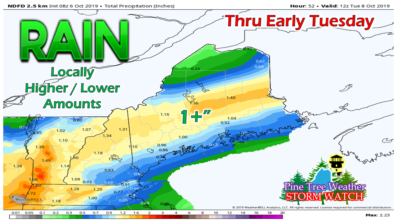 The general idea is for 1"+ of rainfall for western areas through the central highlands over to southern Aroostook County. With moisture from the Gulf of Mexico feeding into the front, any subtle slowdown of the progression of the boundary would lead to higher amounts. Since there is still a bit of uncertainty in my eyes, the idea proposed by the local National Weather Service offices above is a good basis point as to what to expect. Temperatures rising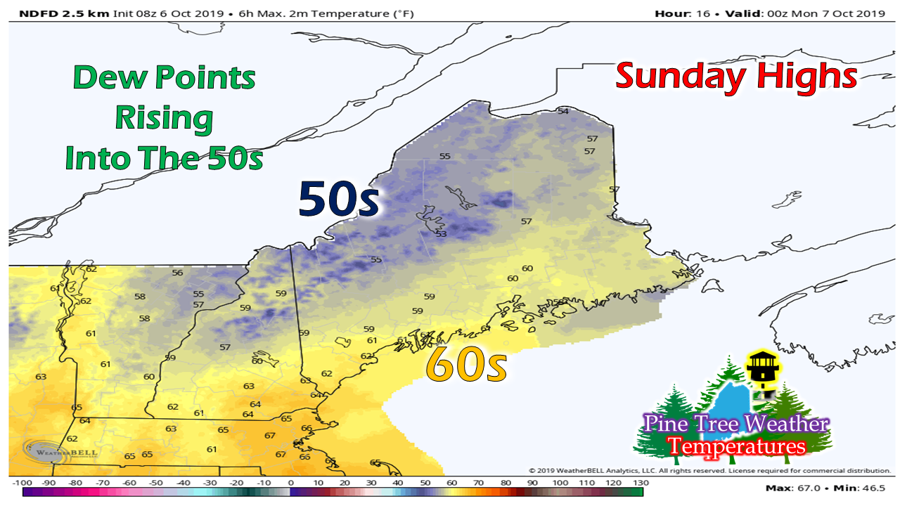 After the chill of Sunday morning, temperatures will be warming up as high pressure moves offshore and the frontal boundary moves in from the west. After a day with dew points in the 30s, the humidity levels will rise as moisture ahead of the front moves in. 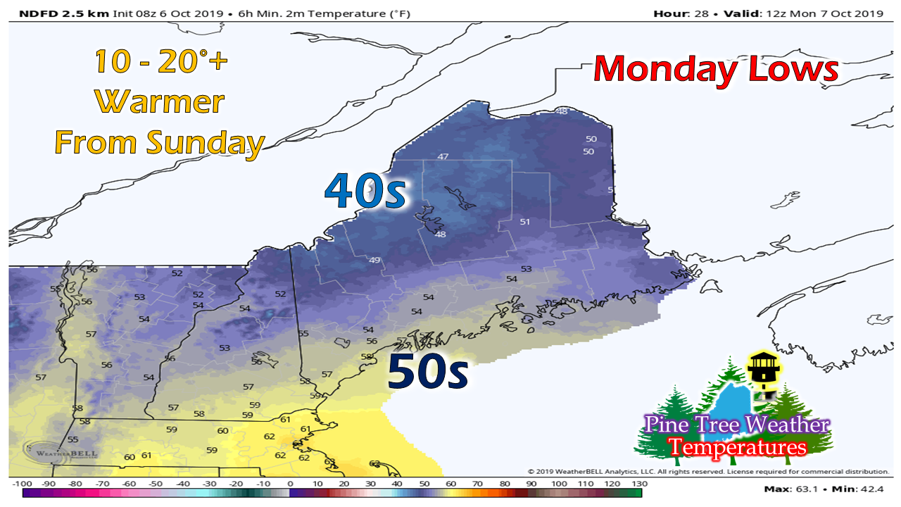 By Monday morning, temperatures will be noticeably warmer than Sunday by a significant margin, but with a chilly rain falling over the interior. 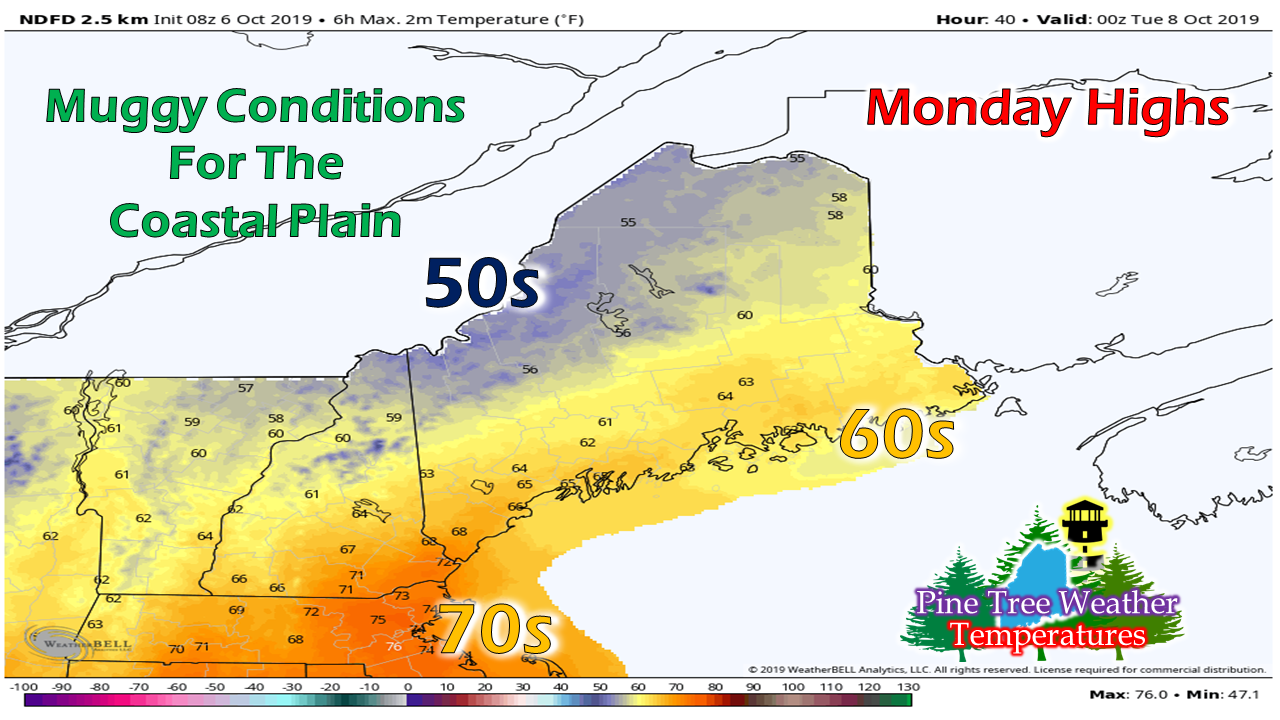 As the front slowly moves through the region, humidity levels continue to build as dew points rise near projected the high temperature forecast. After the front passes Monday night, dew points fall down to the 40s for most by Tuesday morning. Much uncertainty with ocean storm potential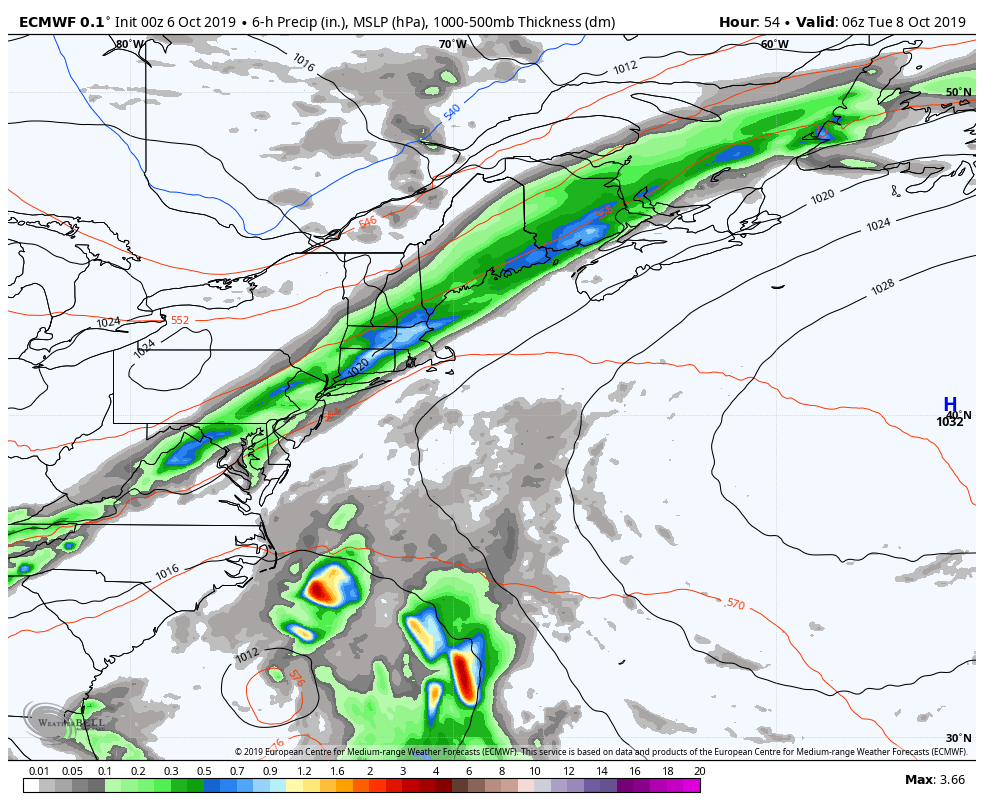 As the frontal boundary passes through the region Monday, an offshore tropical disturbance hitches a brief ride along the front and then splits off and intensifies over the Gulf stream. There is a great deal of uncertainty as to what happens after that. The general idea over the past few days is that it will retrograde westward for a time before a frontal boundary approaches later in the week and boots it out to sea. Any effects on Maine depends on the strength of the blocking high over eastern Canada and how far northwest the storm will track before departing. With it sitting over warm water, the storm could intensify. With blocking to the north and east, it could park itself and spin showers along the east coast for several days, into next weekend. 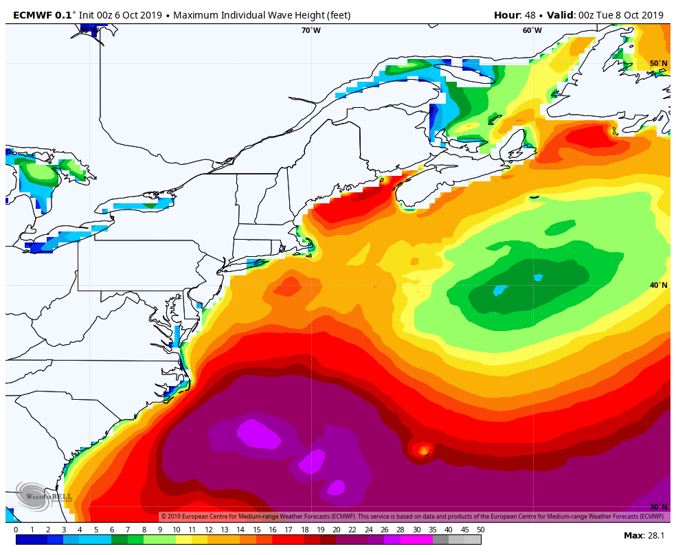 The one consistent idea associated with this projected storm idea is surf potential. Battering waves are a real possibility for the Mid-Atlantic and southern New England coastlines. Swells from the storm work in the Gulf of Maine Thursday and continue through the weekend. With a full moon on the way in a week, folks with shoreline interest should monitor this closely.
Stay tuned for updates on this through the week! ► ► For the latest official forecasts, bulletins and advisories, please check in with the National Weather Service in Gray for western and southern areas, or Caribou for northern and eastern parts of Maine. DONATION DRIVE UPDATE - $1200 shortfall for the year ahead! You can help keep Pine Tree Weather going with a donation of any amount now through VENMO @PineTreeWeather, a monthly donation on Patreon or messaging me on Facebook or Twitter to send a check in the mail. Thank you for your support! For more information from me, please check the Pine Tree Weather Facebook page as well as my Twitter feed. Always stay weather aware! - Mike |

Mike Haggett
|


