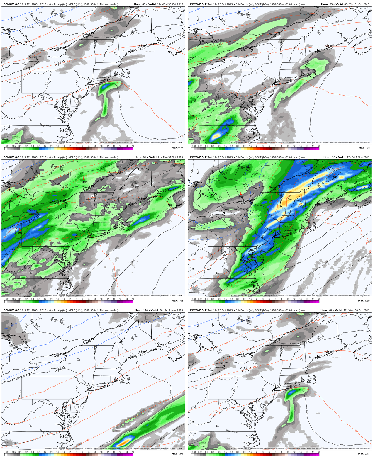
Wetober to likely end with a splashJust a quick update for this edition. I got word Saturday morning that my wife's mother lost her long time partner of 28 years due to cancer. The blessing is he went fast, but it is never easy to deal with. Add that one to the list of six family members we've lost since November, 2016. It's been a trial to say the least. Needless to say family comes first for now, but I will sneak in quick updates as we go through the week, then take a break over the weekend. I use the term "Wetober" because that is what this October has been. For where I live in Kennebunk, we've certainly needed it after a very dry September. My rain gauge has collected 7.81" of rain for the month, and it will record more by the time midnight Friday comes. Synopsis outlook through the rest of the weekTuesday will be a virtual repeat of Monday with areas of drizzle and fog as high pressure near the Canadian Maritimes sets up an easterly wind fetch and brings moisture in off the water. The further away from the ocean brings a better chance for drier conditions and perhaps a few pokes of sun.
Wednesday sees the coastal plain dealing with some rain showers and drizzle associated with continued onshore wind and moisture running up against a southwest flow aloft and sets up a weak frontal boundary. Thursday, a warm front races to the northeast and drags moisture up from the southwest. Low pressure to the west intensifies and another round of rain and wind affect the region Thursday into Friday. The wind could bring some concerns for at least spotty power outages Thursday night into Friday and should be monitored for more widespread potential issues. (Keep your storm supplies well stocked!) Friday sees rain racing northeast during the day, with wind gradually decreasing during the afternoon into Friday night. The weekend into early next week looks good. Next storm after this mess late week may be around Tuesday/Wednesday-ish but it is a bit early to know for sure. Thanks for your patience and support for my family as we deal with another loss. ► ► For the latest official forecasts, bulletins and advisories, please check in with the National Weather Service in Gray for western and southern areas, or Caribou for northern and eastern parts of Maine. ► ► DONATION DRIVE UPDATE - $840 shortfall for the year ahead! You can help keep Pine Tree Weather going with a donation of any amount now through VENMO @PineTreeWeather, a monthly donation on Patreon or messaging me on Facebook or Twitter to send a check in the mail. Thank you for your support! For more information from me, please check the Pine Tree Weather Facebook page as well as my Twitter feed. Always stay weather aware! - Mike |
Mike Haggett
|


