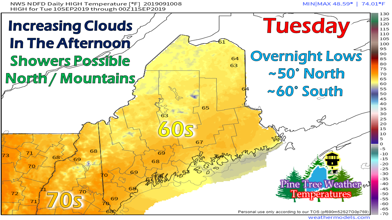
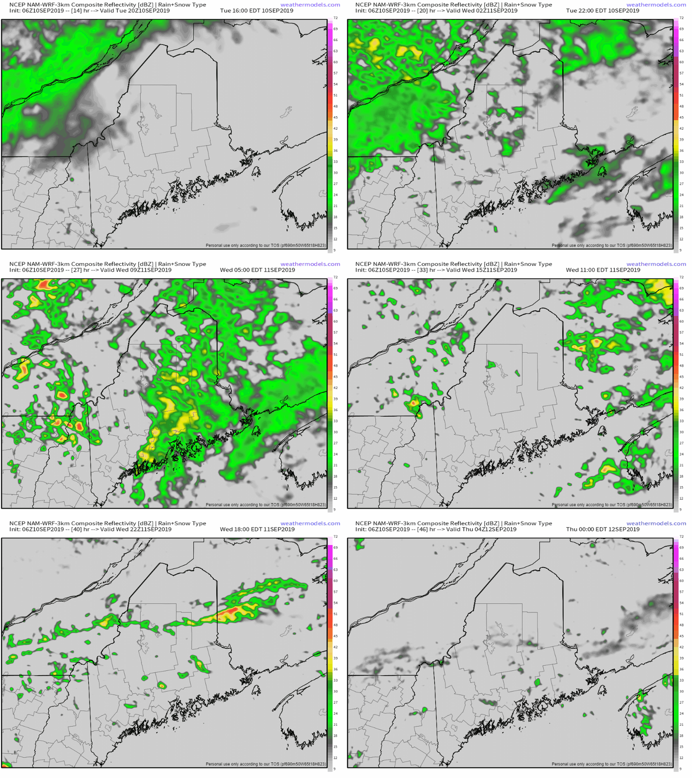
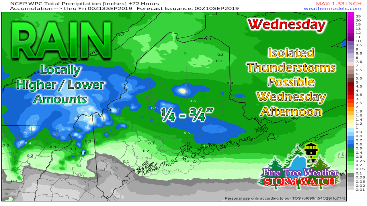
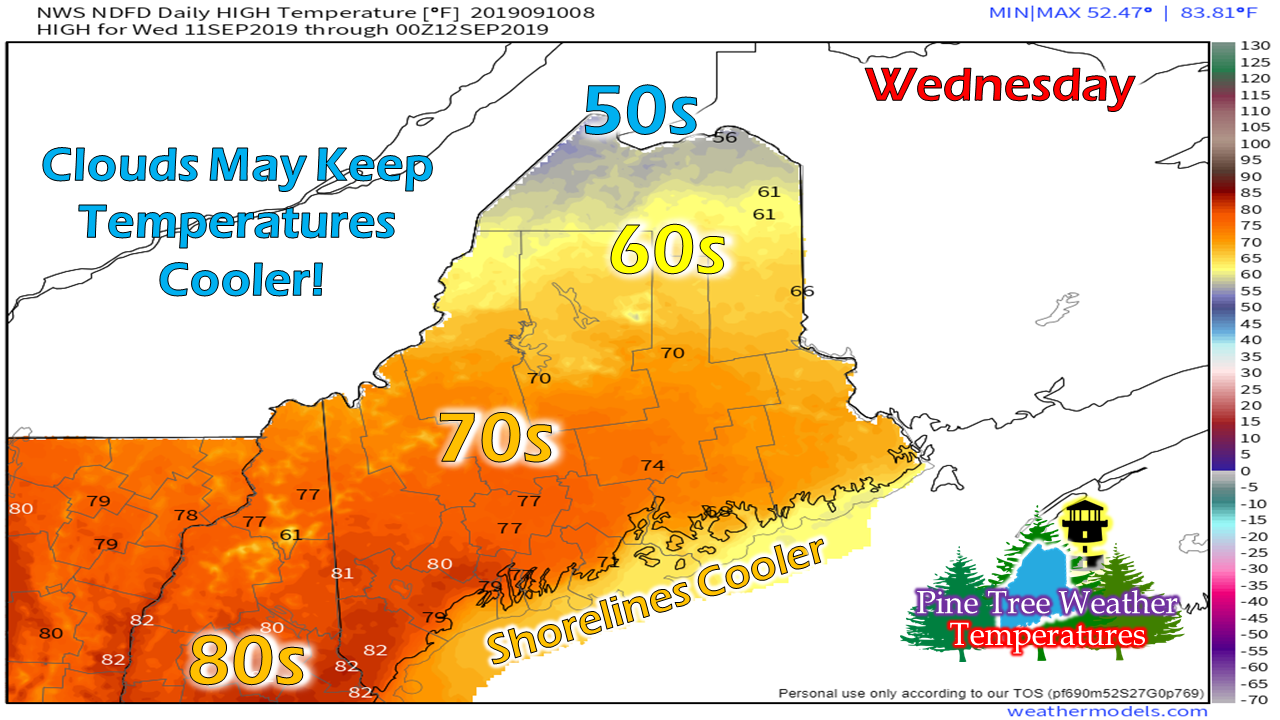
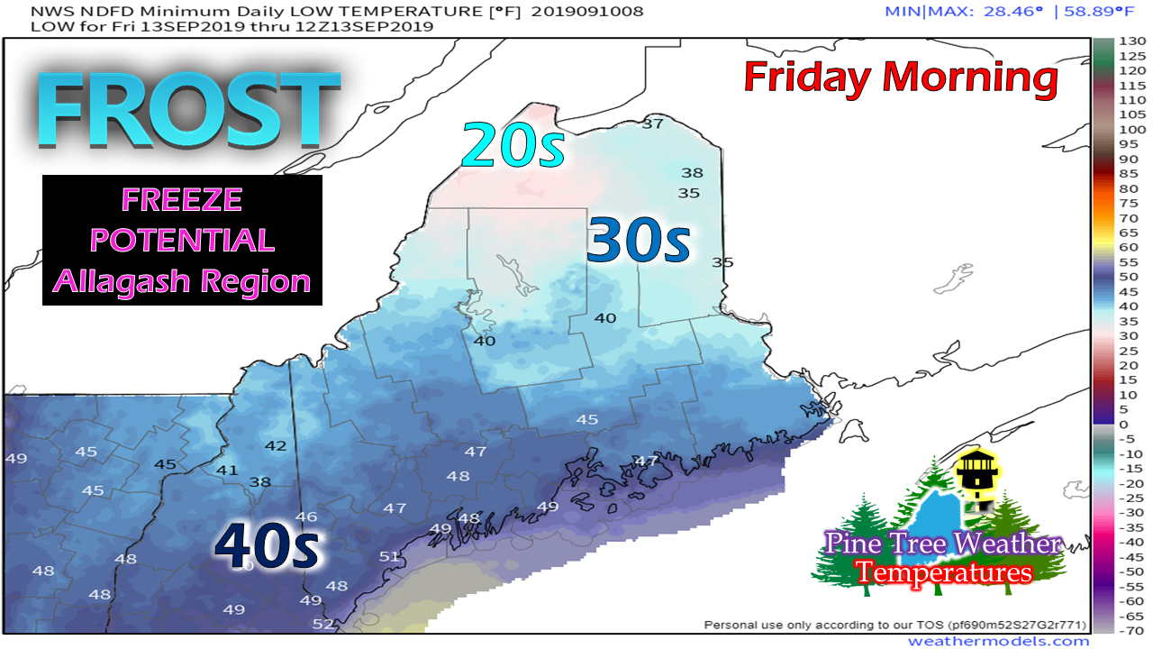
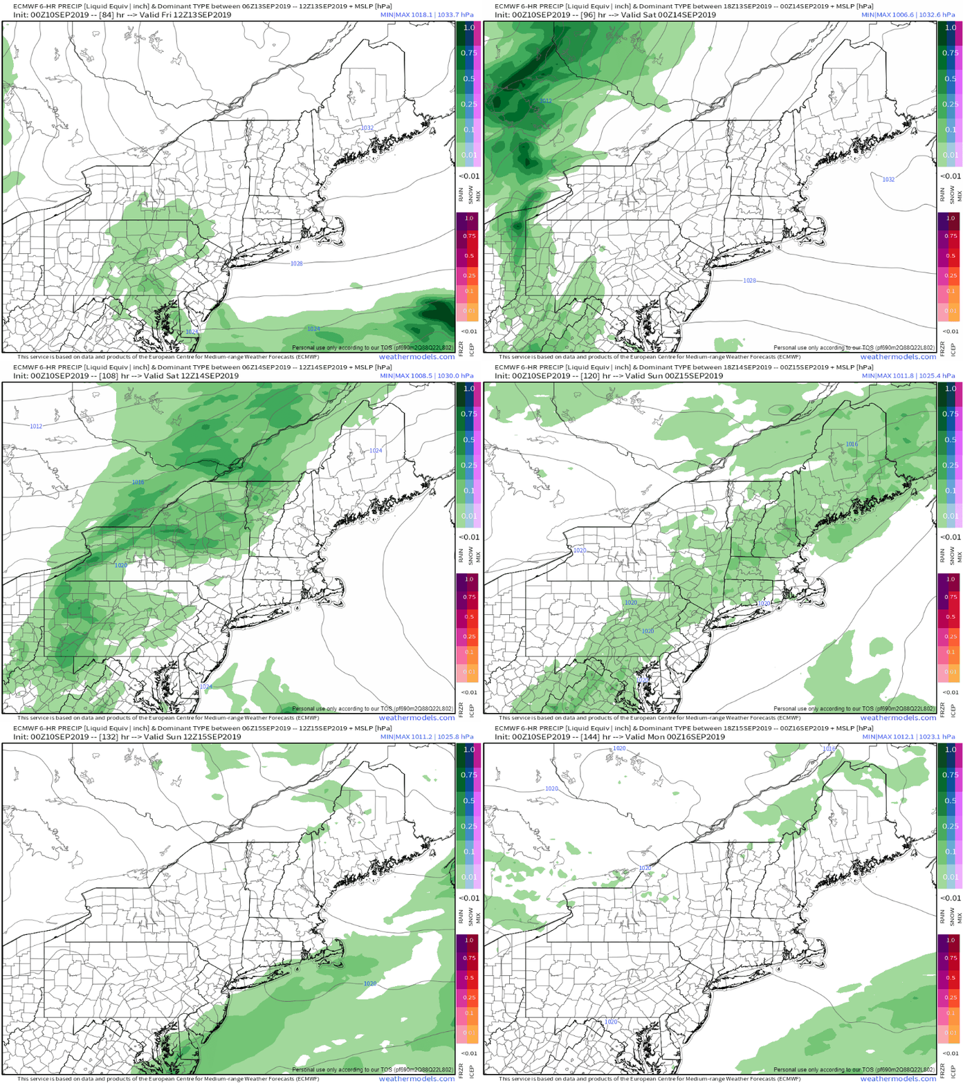
Tuesday a fair day for most areasAfter a cool start with some patchy fog around, temperatures should rebound fairly quickly Tuesday morning. Clouds will be on the increase as a warm front approaches from the west, and may touch off some showers along the Quebec border & Allagash region later this afternoon. With the clouds and rain showers moving in, it will help keep overnight lows a bit warmer Tuesday night, with 50s for most areas to start Wednesday. Showers overnight into Wednesday For all but eastern areas, most of the rainfall associated with the warm front will fall overnight. Steady showers taper to scattered showers Wednesday morning. The region dries out briefly before a cold front sinks southeast in the afternoon, which may bring a chance for a shower and/or an isolated thunderstorm. Shower activity appears to end statewide Wednesday night. The western mountains, central highlands and eastern areas appear to get the most rainfall with the frontal passage. Any isolated thunderstorms may bring totals a bit higher in areas. IF the sun can get out, it may feel like summer over southern areas. With the warm front, the humidity will rise and be noticeably sticky. The temperatures and humidity won't last long as the afternoon cold front sweeps it all way by Wednesday night. Frost threat Thursday night into Friday morningHigh pressure moves in Thursday. Skies will clear out, a light breeze settles, and that sets up frost potential once again for northern and western areas, and possibly freeze potential for the Allagash region. For areas susceptible to frost, get ready to cover the plants up again Thursday night. Showers Saturday, dry SundayThe weekend still looks like a 50/50 split with scattered showers around Saturday and dry conditions for Sunday. The trend towards warmer, more seasonable temperatures starts Saturday with 60s & 70s, with many areas reaching the 70s on Sunday. Financial donations needed to fund Pine Tree WeatherPine Tree Weather is funded through the support of people like you. To this point, I do not accept outside advertising, and would like to keep it that way. Thanks to the Patreon monthly donors and those that have mailed checks, the site is roughly 40% funded for the year. In order to continue, a total of $3,000 is needed to pay the bills. October and January are when most of the bills come due. I have spent over $10,000 of my own funds, and refuse to spend any more out of my own pocket to keep this going. If find value in what I do, I will humbly ask you to support it. Without the financial support, this site will cease. No amount is too small. I would appreciate your support!
► ► For the latest official forecasts, bulletins and advisories, please check in with the National Weather Service in Gray for western and southern areas, or Caribou for northern and eastern parts of Maine. Please consider supporting Pine Tree Weather ► ► Your financial donations are much appreciated to keep this site funded and for further development. I sincerely appreciate your support not only financially, but also in sharing my efforts with others. For more information from me, please check the Pine Tree Weather Facebook page as well as my Twitter feed. Always stay weather aware! - Mike |
Mike Haggett
|

