
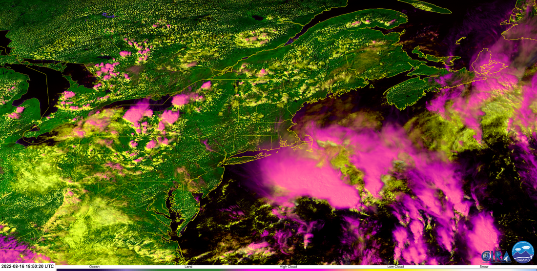
 Some cool satellite imagery here taken at just before 3 PM Monday. This is another way to view cloud tops other than infrared images. The pinks indicate higher clouds, yellows show lower clouds, with oranges in the middle of the range. The storm that Maine is most concerned with is organizing to the south and is expected to track into the Gulf of Maine Wednesday. Track / intensity dependent on rainfall amountsThis is a weak NorEaster set up which entails a strong block to the north, a negatively tilted trough, a bit of cold air moving in aloft, and a developing storm. This is August, these tend to be rare for this time of the year, but not out of the realm of possibility for those of us who dwell in the 40°-45° north latitude region here on the east coast. Granted, snow shovels won't be needed here, and if anything, it gives the region a much-needed widespread rain event, but I wouldn't consider this a "drought buster". 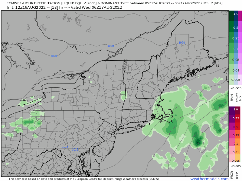 Wednesday 2 AM to 6 PM - The storm begins to intensify as the trough tilts and hooks the surface low to the north. Coastal areas are likely to see rain developing in the morning and then as the low tracks into the Gulf of Maine, showers advance into the mountains and north in the afternoon. 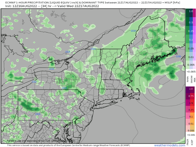 Wednesday 6 PM to Thursday 6 AM - This is where the forecast gets a bit tricky. Where the low tracks and how much intensity is has dictates how much of the heavy rain that falls overnight. Like a winter NorEaster, a jog a few miles east of Penobscot Bay cuts off the rain for western areas, which has my attention for areas south of Fryeburg and Portland. If the storm jogs west toward the MidCoast, then York and Cumberland Counties get a decent rain event. Since it's cold air with an injection of tropical moisture, a few rumbles of thunder are possible and may bring downpours and gusty wind along with it. 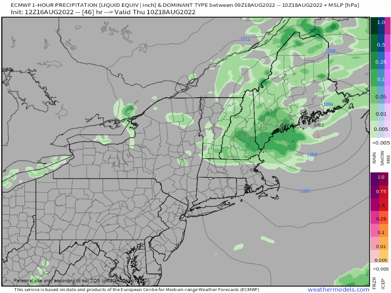 Thursday 6 AM to Friday Midnight - The storm becomes vertically stacked as the areas of low pressure aloft in the atmosphere align and at that point, the storm begins to weaken. A frontal boundary passes through to kick the storm to the east heading into Thursday night. 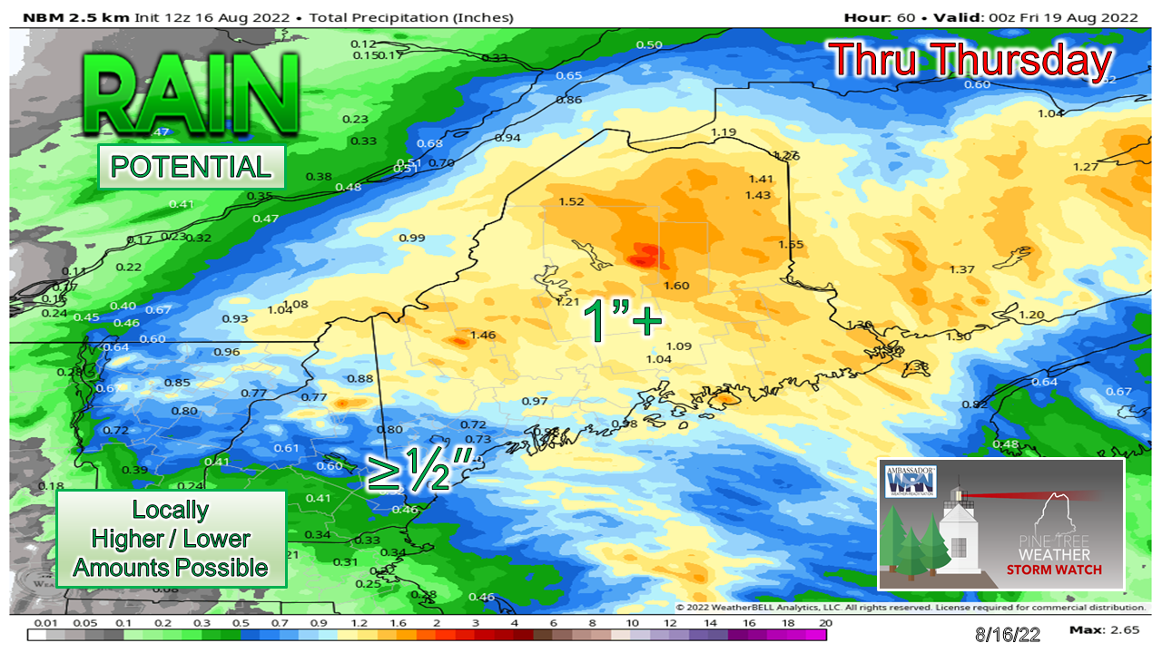 For most of the state, a solid run at an inch of rain is a fair bet, with higher amounts on the eastern flank of the system. Southern areas will need to see some overperformance from Wednesday into Wednesday night to have a chance to cash in on the rain bounty. Flash flooding is on the low end of concern for areas in the drought, although localized downpours may cause some street flooding and standing water on roadways. The moisture rich north has a better chance of seeing the chance for localized flooding there. Since this storm is expected to bottom out greater than 1000mb, I don't see any major concerns for wind. It may gust upwards of 30mph which may blow a few loose objects and may cause isolated outages from weak tree limbs that may fall. What rain that falls here will have to sustain us for now as a drier, warmer pattern awaits heading into the weekend. Thank you for supporting this community-based weather information source which operates by financial contributions from people like you. TWITTER UPDATES ON WEDNESDAY Stay updated, stay on alert, and stay safe! - Mike NOTE: The forecast information depicted on this platform is for general information purposes only for the public and is not designed or intended for commercial use. For those seeking pinpoint weather information for business operations, you should use a private sector source. For information about where to find commercial forecasters to assist your business, please message me and I will be happy to help you. |

Mike Haggett
|


