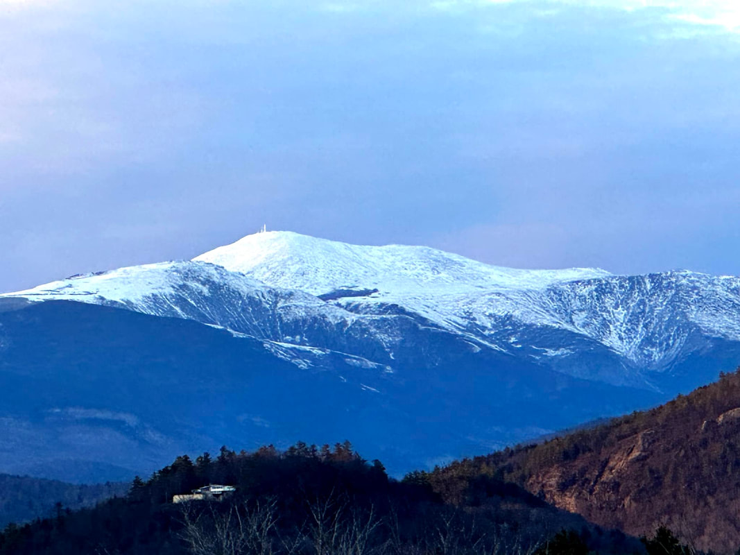
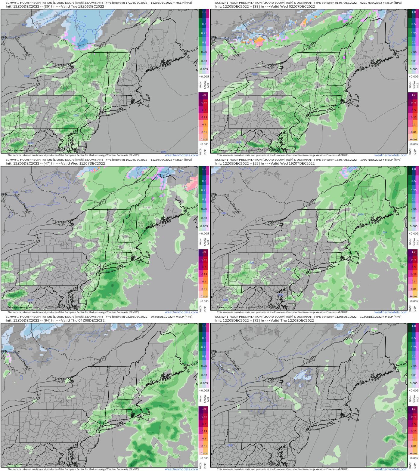
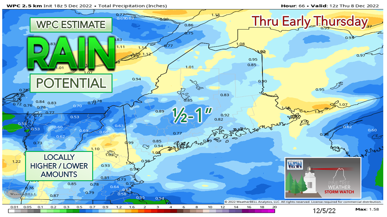
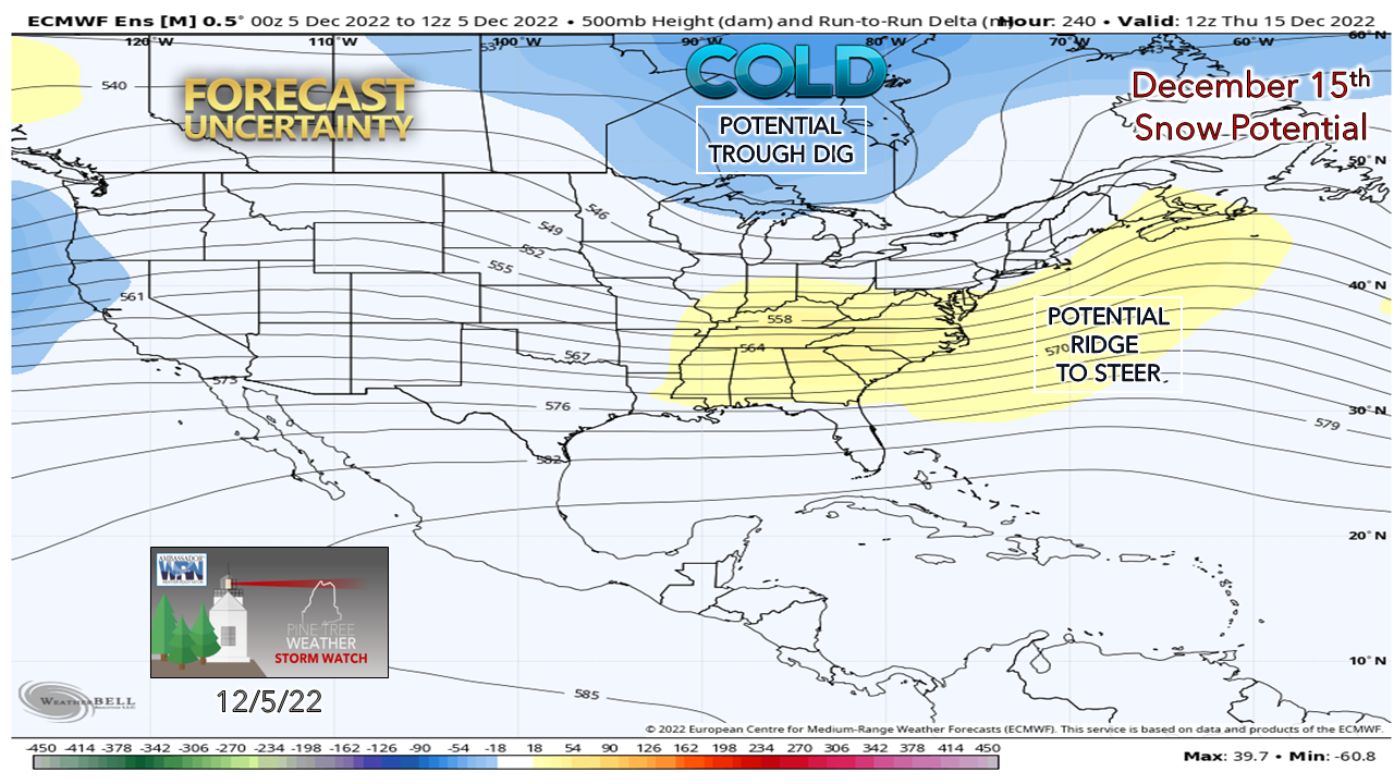
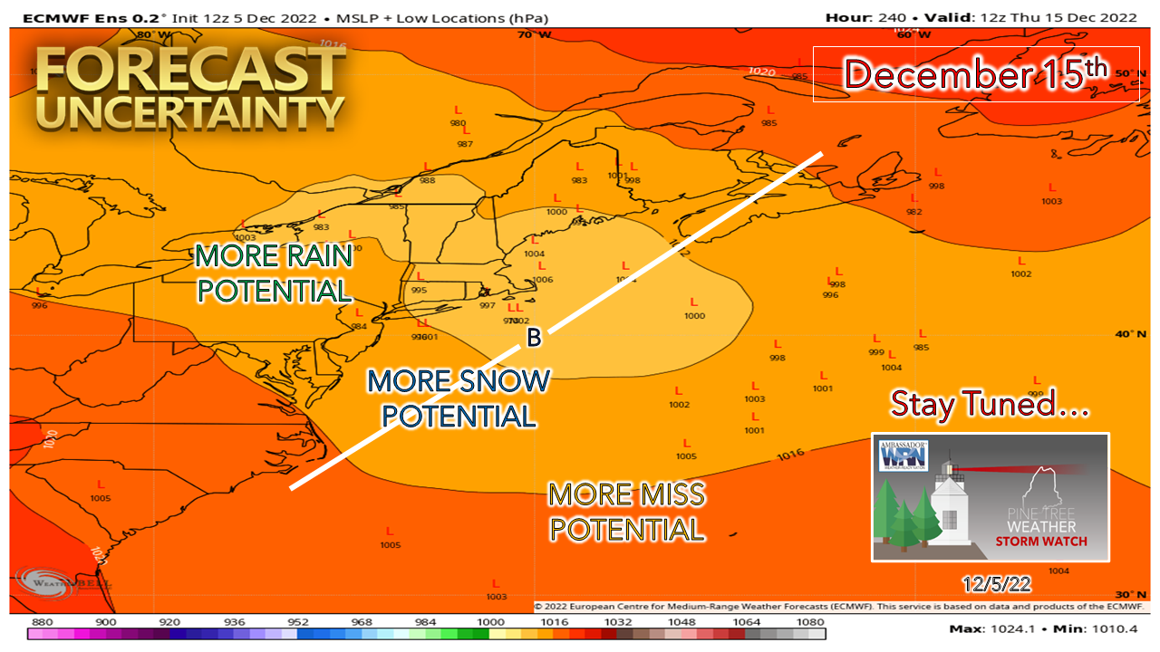
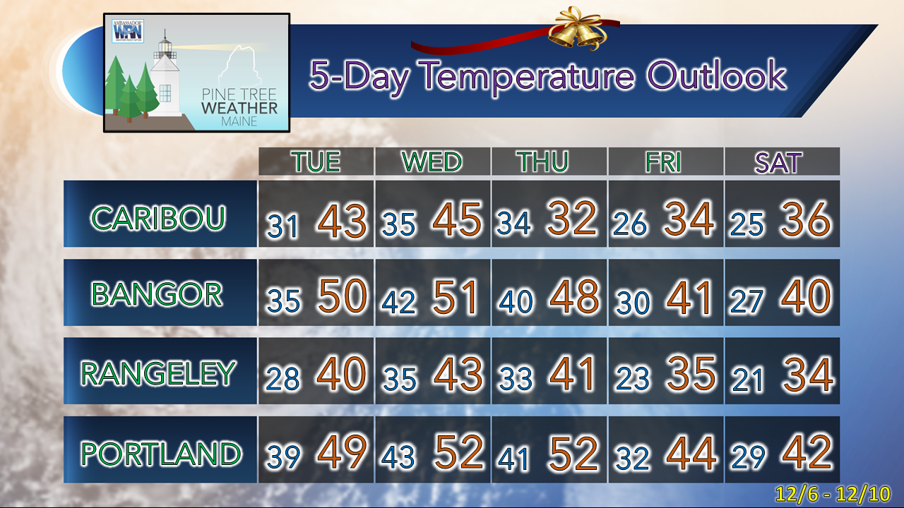
Mount Washington's signalAs my wife and I travelled from the coast to the mountains on Friday, we caught the view of the summit in North Conway on a rare cloudless day. It was good to see some snow. It's been a slow, if not painful start to winter for the snow lovers. I hear it where ever I go. "Hey Mike, when are we getting snow?!?!" coupled with "Is this rain ever going to end?!?!" I feel your angst. Snow is such a key part of the Maine winter economy, that regardless if you like it or not, it's necessary. The Rockpile photo here proves that winter has started in the higher elevations, and it will trickle down to the lower levels, perhaps as soon as next week. Ahead of that, more rain. Showers Tuesday through early ThursdayTuesday 1 PM to Thursday 7 AM - For a primarily a rain event, this is pretty much a "ho-hummer." Higher elevations may see a bit of a mix of snow, sleet, and freezing rain, but that won't last long. Northwestern areas of The County around the Allagash may pick up a sloppy inch or two of snow before it flips to rain overnight into Wednesday. Not much wind with this on the front side, but the breeze picks up on the backside Thursday into Friday. There could be some fog around in the mountains, some reduction in visibility in steadier rain in the Wednesday evening hours, but this isn't a big deal. While rain won't help the snowpack on the ski hills, I don't see where this storm will hurt the work the snowmakers have done to keep the slopes going all that much. Yep, it's liquid, but it's not a gully washer. If anything, it adds ice to the base and helps in the long run. This will be easy to shovel. About next week...I suspect the hype train will kick into gear over the social mediums, so I will do my due diligence and get out ahead of it. I am going to say there is a chance for a snow maker, but I will throw caution flags all over the place since it is 9 days out. Models do a good job selling storms that end up being a pipe dream at this distance. The fact is energy associated with this is half way around the hemisphere over western Asia. Two things are necessary for big snow event: cold air and a steering ridge. We haven't exactly seen deep cold yet (10-20° below average). There are glimpses that the steering ridge may form, but the cold has been missing in action to this point in winter, and I question how models are depicting it, as I always do, because they tend to miss it or over amplify it, especially in the long range. Cold air is like kicking a brick.. it doesn't go very far, yet guidance likes to move it like butter on hot mashed potatoes. Is there a chance cold will be in place? I think the mountains & north have the better chance. South of there, I am not sure yet. Ensemble ideas are widely scattered, which is typical this far out. While I pick up the sense that this may end up being a coastal hugger IF all the moving pieces line up, it's way to early to know. There will be plenty of time to watch this one, as this is the only storm of potential widespread impact after Wednesday's rain event on the radar for now. Stay tuned... Current deficit for 2023 = $1750Temperature outlook through SaturdayThe normal high and low for December 5th for Caribou is 31° and 17°. For Portland, 42° and 26°. Temperatures are expected to run above normal through the period. Thank you as always for your support! Stay updated, stay on alert, and stay safe! - Mike NOTE: The forecast information depicted on this platform is for general information purposes only for the public and is not designed or intended for commercial use. For those seeking pinpoint weather information for business operations, you should use a private sector source. For information about where to find commercial forecasters to assist your business, please message me and I will be happy to help you. |
Mike Haggett
|

