
Rain Showers Overnight Saturday and into Sunday Morning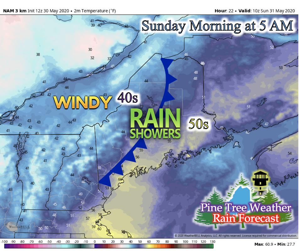 A secondary cold front is making its way into Maine Saturday night, bringing colder temperatures and widespread rain showers. Overnight temperatures are expected to drop from the upper-50s down to mid- to low-40s across central northwest and northern Maine. Coastal areas and southern Maine is expected to drop about 10 degrees, from mid- to low-60s down to low-50s as Sunday begins. 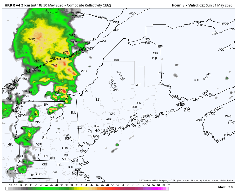 The GIF above runs from 9 PM Saturday evening to 12 PM Sunday. The cold front pushes through the night, bringing widespread showers and some isolated thunderstorms embedded in the band. Behind this front, wind gusts reaching up to 30 mph can be possible in central western Maine as this boundary moves through. Monday Early Morning: Frost Concern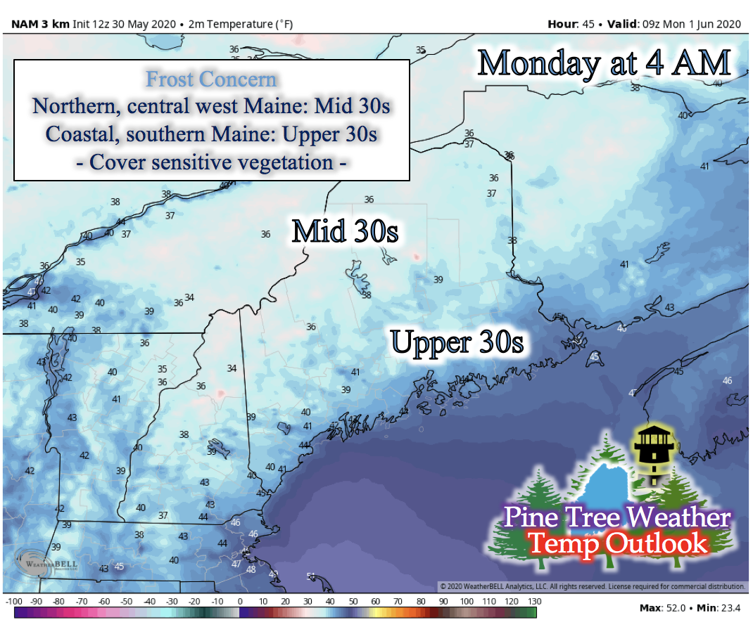 An upper level trough will be traveling over Maine Sunday night into Monday morning, helping to bring colder air into Maine with the help of northwesterly winds. Light/calm winds and clear skies help aid in the decrease in temperatures early Monday morning. Northern and central western Maine is expected to drop to the mid-30s, with some isolated, higher elevated areas having potential to drop into the low-30s. Coastal and southern Maine is expected to drop into the upper-30s, with some areas right next to the ocean staying in the low-40s. This is because of the warmer waters aiding to keep temperatures form dropping further (ocean waters are in the 50s). Monday during the Day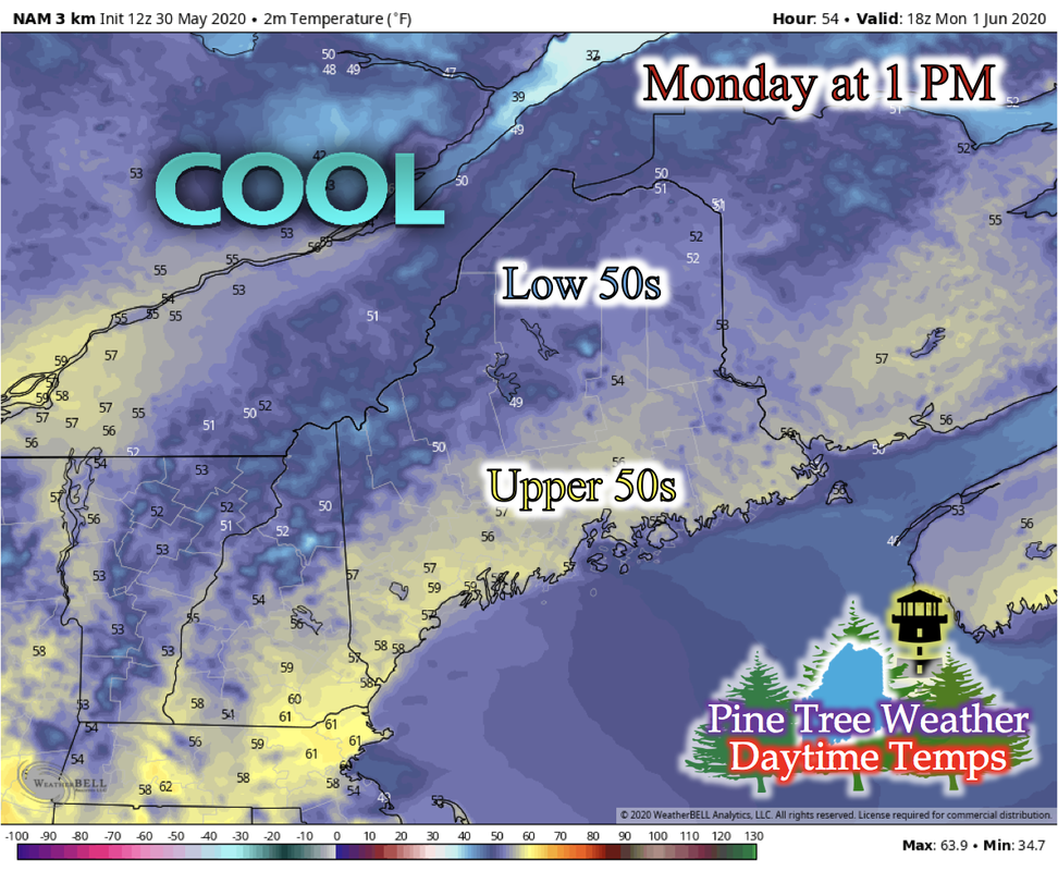 Monday during the day will be a lot cooler than the past few days due to the recent cold front and the northwesterly winds. Accompanying cooler temperatures will be partly cloudy skies and light northwesterly winds. No precipitation is expected on Monday. Looking Ahead into Next Week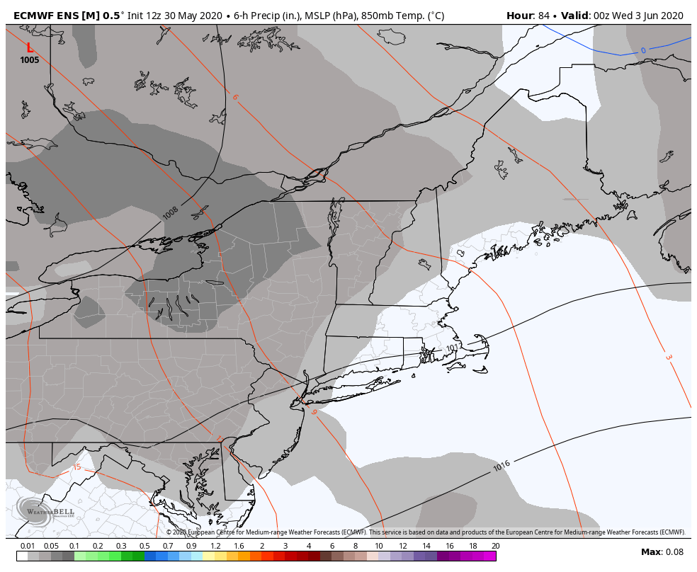 The next time any precipitation looks to occur is between Wednesday and Thursday. The GIF above runs from 7 AM Wednesday to 7 AM Friday, where some chances of rain looks to sweep over Maine. There looks to be a low pressure system making its way across southern Canada, and to affect Maine mid-week, much like the rain we'll be seeing tonight. Locations and timing is still up in the air, and updates will be posted when more information becomes available. Flash Flood Safety Reminder: Turn Around, Don't Drown!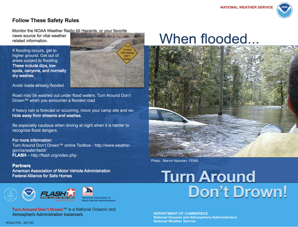 As severe weather season progresses, Maine is not immune to what these severe storms can bring. One of the many dangers is flash flooding, where 1 to 3 inches of rain falls in an hour. If you have to commute via vehicle during a storm, and you see a road flooded, turn around immediately and seek a different route. It only takes 12 inches of water to sweep a car away, and only 6 inches of water to sweep you off your feet if you were to try and wade through it. When you see a flooded road, turn around, don't drown! Stay informed!
For more information, please follow Pine Tree Weather on Facebook and Twitter.
Thank you for supporting this community based weather information source that is funded by your financial contributions. Stay on alert, stay updated, and stay safe! Have a great weekend and happy June! - Kaitlyn |

Mike Haggett
|


