
Storms to be isolated statewide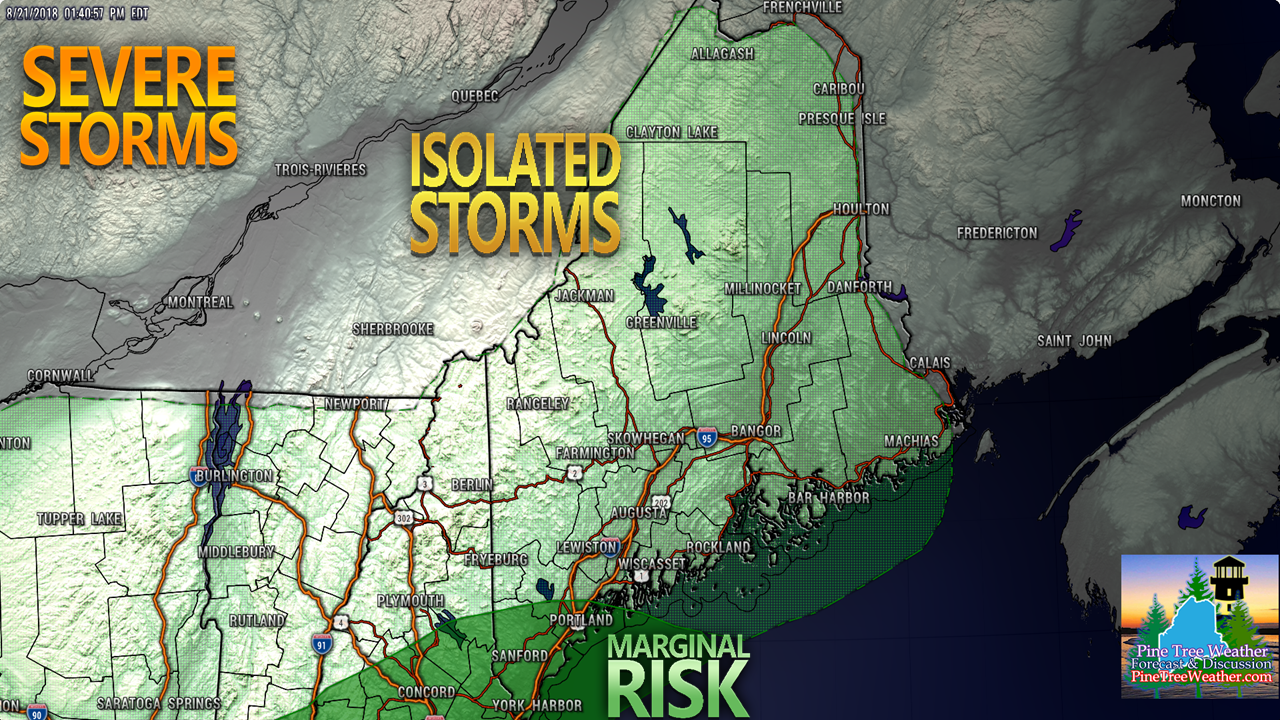 POTENTIAL IMPACTS: Lightning, gusty winds, downpours, and small hail. Reduced visibility in heavy rain. Any flash flooding / urban street flooding likely to be localized. The severe threat overall appears to be isolated at best with this system. Best chance will be for southern areas from Fryeburg over to Casco to Portland and points south and west. That chance comes in the afternoon after the warm front moves into eastern Maine and the sky begins to clear over southern areas. With the track of the system, I do think there is good chance for an isolated strong to severe storm to impact southern areas towards evening. The day won't be a complete washoutFuturecast radar loop idea from the NAM-WRF model from 6 PM Tuesday through midnight Thursday shows scattered showers and storms crossing the state during the day, becoming widely scattered from west to east as we head towards evening. Outside of a few isolated rain showers overnight, the precipitation ends for most by late evening. Humidity makes a brief visitThis NAM-WRF model forecast shows the humidity surge back into the area during the day on Wednesday as the warm front approaches. Dew point temperatures could reach into the 70s once again during the day as the warm front passes through. This will be a short stay as dry air behind the cold front passes clears out the humidity Wednesday night into early Thursday. The muggy conditions are on track to exit the coast around daylight Thursday morning. Outlook for the weekend... splendid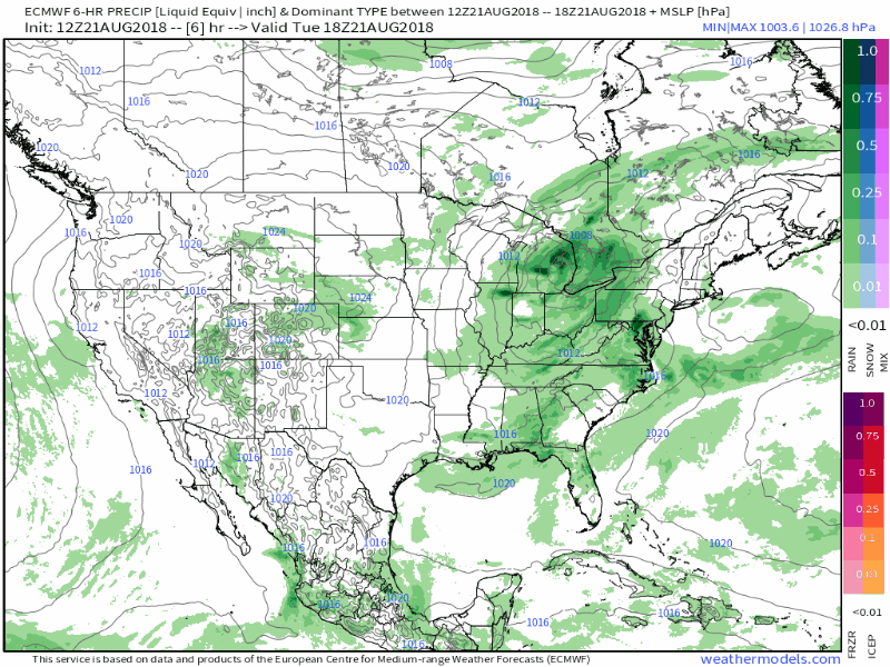 After the showers and storms pass through Wednesday, high pressure moves over the region and takes control for the rest of the week. The high will move offshore late Saturday / early Sunday and a southwest flow will develop and carry a warm front into the region late in the day, which may touch off a shower or thunderstorm over mainly western and northern areas towards late afternoon and into the evening. Temperatures appear to range from the 70s on Thursday, with 70s/80s Friday, Saturday, and Sunday. The humidity from Thursday through Saturday appears comfortable, and then will begin to increase Sunday as the southwest flow pumps moisture back into the area. This round of sticky air could hang around for at least the first couple of days next week. More updates on this to come. Please Support Pine Tree Weather For those who have already donated through my Patreon page or have contacted me via message through Facebook or Twitter about mailing a check, I sincerely appreciate it. Much of the support has come from long time followers from when I first began with Western Maine Weather years ago, along with a few newcomers as well. Not only do I appreciate your contributions, but your words of thanks, appreciation and encouragement mean the world to me. Currently, I am at about 30% funding of $3,300 for the year to operate this entity. I am in need of $2,310 to reach my goal, and that is just to pay my bills. Those bills begin to come due in October. All I am asking for is $1 a month pledge ($12 per year) to help keep this website going. Winter is coming, and I want to be here for you to help guide you through it, just as I have for the past several years. I would appreciate your support. Stay Weather Aware!For the latest forecast information, bulletins and advisories, please check in with the National Weather Service in Gray for western and southern areas, or Caribou for eastern and northern parts of Maine.
- Mike |

Mike Haggett
|


