
Dry but a bit breezy for Saturday 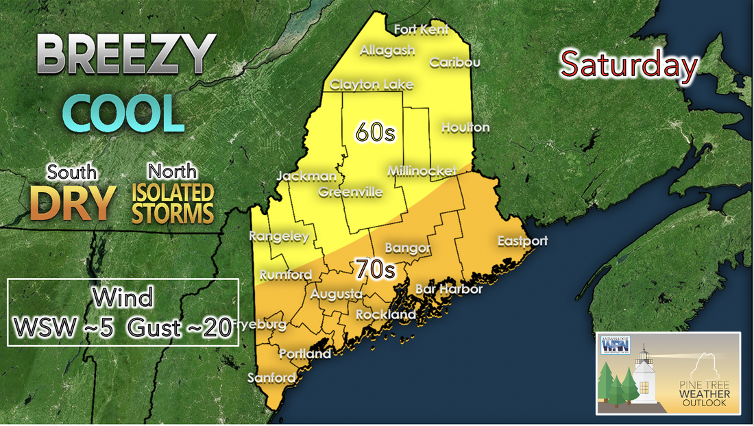 Saturday will likely be drier and cooler overall as the only chance of rain and storms comes with a low pressure system that may skim by the north of Maine in the North Woods, St John Valley, and Central Aroostook areas. Some CAPE and higher lapse rates in the afternoon give way for a slight change of thunder along the western edge of Central Aroostook. Otherwise, the state should remain rather dry, and this dry air should keep skies relatively clear. Cool air behind the low pressure system should cause temperatures for the day to be in the upper 60s to mid 70s at a maximum. 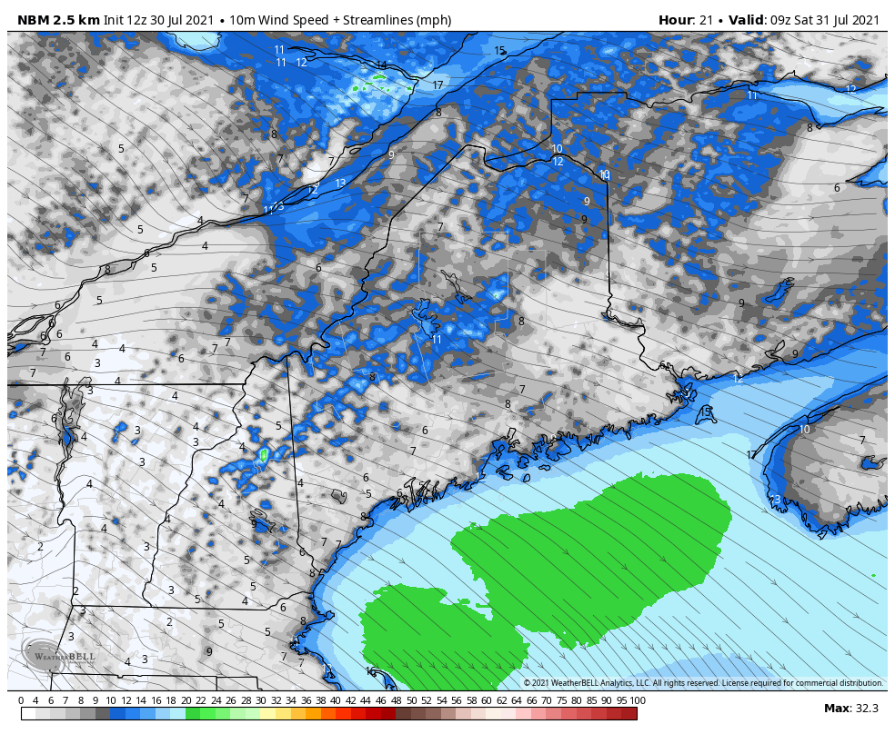 With the exit of the low pressure system on Saturday winds from the west-northwest are expected to pick up. The above graphic predicts that winds will begin and end the day at around 5 mph with winds picking up into the double digits and gusts up to 20 mph expected. These higher wind speeds will give an overall cooling effect to the region. Rain returning on Sunday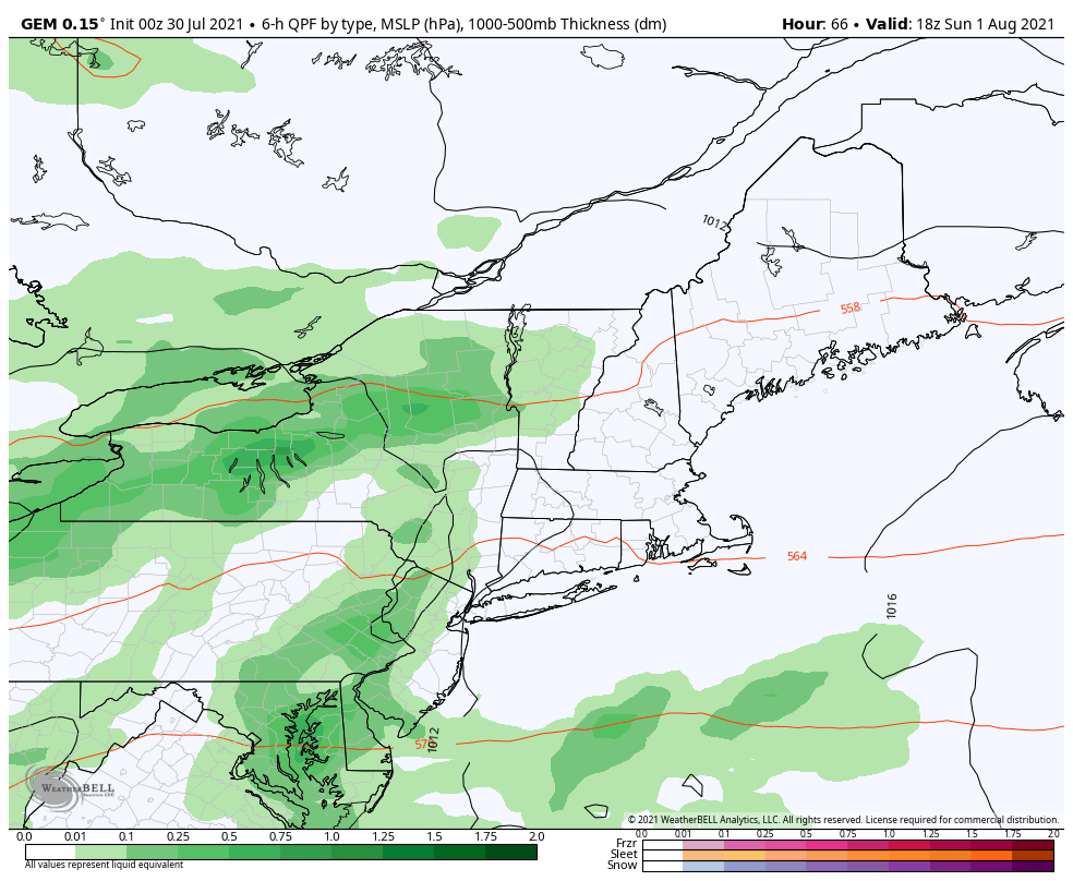 The clearing of clouds and precipitation from Saturday will not last very long as a new low pressure system crosses our path. Early Sunday will likely remain relatively nice due to clearing from the previous night and rain is forecasted to pick up by the afternoon. The incoming shortwave and driving warm front coming in from the west could cause areas of locally heavy rainfall and rainy conditions elsewhere. Warm air associated with the frontal feature should begin to increase temperatures and give us highs for the day in the low to mid 70s across the state. Potential for higher intensity rainfall rises Sunday night as the low continues to overtake the region. 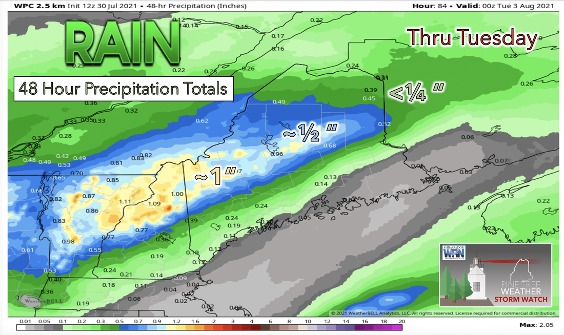 The incoming shortwave trough comes through the region with strength on its side this Sunday. This type of strength in an upper level low is uncharacteristic for early August. The arrival of rain and some storms is likely to occur sparsely in the late afternoon and become more widespread as early evening and the overnight roll around. The location of the rain shield at this time is still uncertain but models seem to favor the rain shield staying to the north. Highest precipitation totals are expected to be centered over the southwest and central part of the state. Temperatures heating up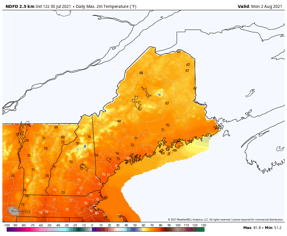 A warming trend is forecasted to begin this workweek after the seasonally cool temperatures that were experienced in the week before. On Monday we should expect temperatures to be in the high 60s to low 70s for the south and reach just above the mid 70s for the south. These temperatures are still considered to be relatively cool for this season however this is likely to change in the days ahead. As the graphic above shows, average maximum daily temperatures start from below average for this time of year in the low 70s range and make it all the way up to the near 80s in the south of the state. These higher temperatures are expected for this time of year and are likely to be achieved later in the upcoming week starting by Thursday afternoon. A drier workweek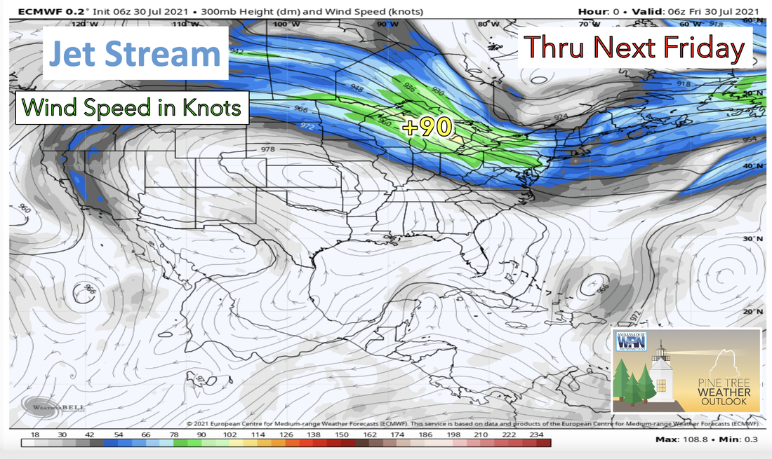 Not much activity is expected for the week ahead in the way of showers and storms, so each day this week should be relatively calm. This gives us the chance to turn our attention to the upper air pattern and in locations to our west. The upper air pattern this upcoming week looks to be quite zonal and the placement of the jet-stream is right over the northernmost parts of the US. This means that weather features that make it into the upper levels of the atmosphere can be quickly transported from the northwest to the northeast. 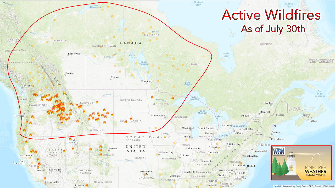 Smoke watch is back in action as the potential to see smoke from western wildfires rises up once more. As shown in the image above, current wildfires in the west seem to be populating the northern half of the region more rapidly. This coupled with the forecasted upper air pattern that was mentioned earlier can only mean one thing. More smoke and a decrease in air quality may be in the forecast for the northeast by the end of the week ahead. Hurricane Preparedness 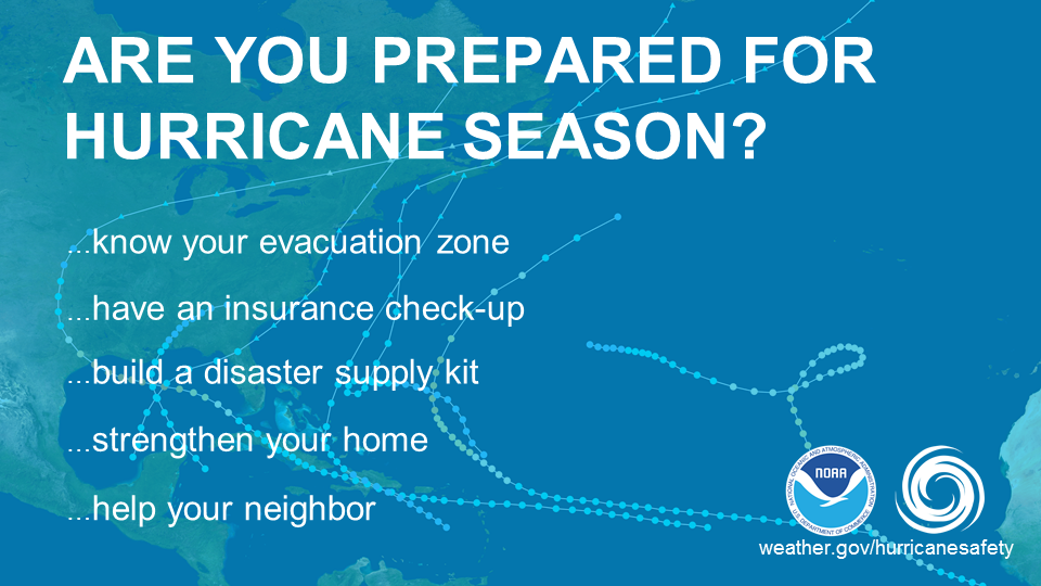 This August marks the 30th anniversary of the most recent hurricane to make landfall in Maine, Hurricane Bob. Are you prepared for hurricane season? Find out how you can prepare and know your evacuation zone. Visit flash.org/hurricanestrong to find out more! Temperature OutlookTemperatures through the end of July following the cooling trend are seasonally quite cool reaching maximum daily temperatures only into the 70s for the end of this week. As the upcoming week and the August begins temperatures begin to rise again with daily maximums starting to reach into the 80s once again. 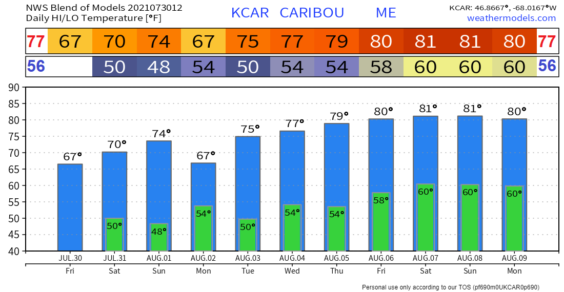 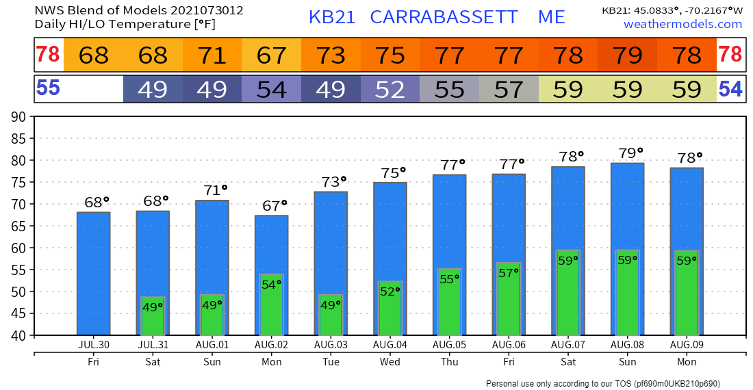 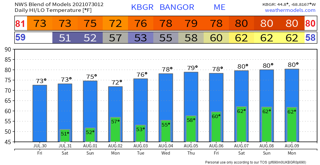 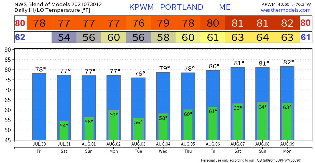 Be prepared to receive alerts and stay updated  BE PREPARED WITH A NOAA Weather Radio. For $20-$40, it could provide vital information to you when you need it. The weather bands are standard on most public safety scanners, and newer scanner models. Weather radios can be programmed for auto alert. Click here for more information.  ► ► For the latest official forecasts, bulletins, and advisories, please check in with the National Weather Service in Gray for western and southern areas, or Caribou for northern and eastern parts of Maine. 
|

Mike Haggett
|


