
Storm moves east, but lingers close by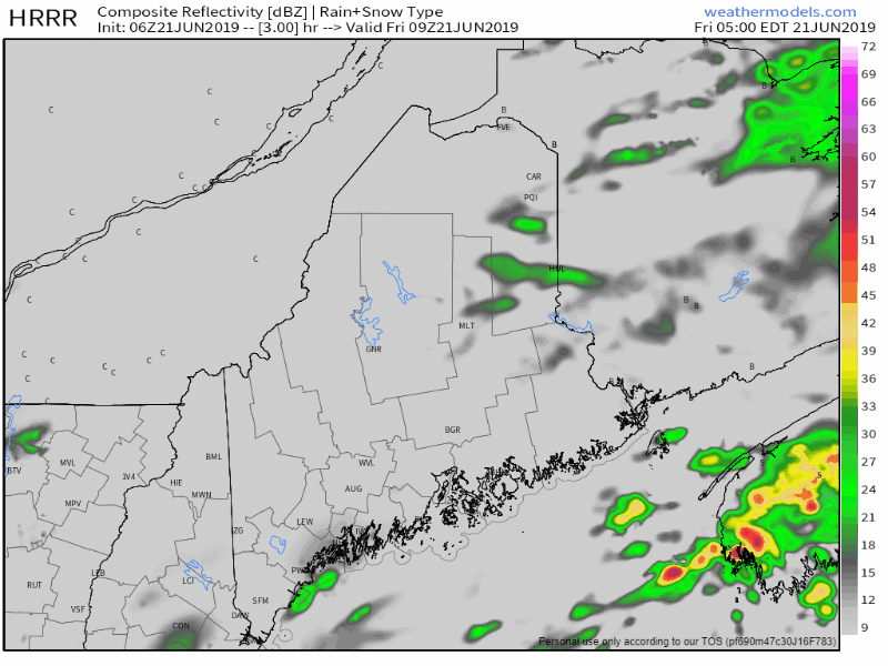 For all areas but eastern zones, the steadier rain is over with just light showers possible through Friday morning. As the storm slides east, the DownEast region will see steady rain end and taper to showers later in the afternoon. The storm will intensify as it moves into the Canadian Maritimes, and a gusty northwest wind will be the main weather feature for the region over the weekend. An upper level low will back into the region Saturday, which will bring a chance for a pop up shower and/or thunderstorm. Any thunderstorms that develop may contain gusty winds and small hail. Severe storm risk is very low. The upper low and surface low move eastward Saturday night. Sunday will feature mainly sunny skies, warmer temperatures, but will remain breezy. Regional Outlook through midweek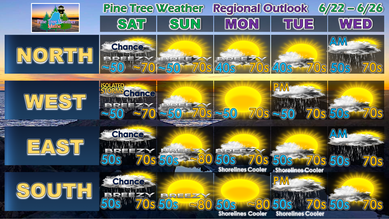 A cold front approaches the region on Tuesday which may bring afternoon showers to western and southern areas. Showers overspread the state Tuesday night, and appear to exit eastern and northern areas Wednesday morning. Rain is also possible statewide for Thursday.
Have a great weekend! ► ► For the latest official forecasts, bulletins and advisories, please check in with the National Weather Service in Gray for western and southern areas, or Caribou for northern and eastern parts of Maine. Please consider supporting Pine Tree Weather ► ► Your financial donations are much appreciated to keep this site funded and for further development. I sincerely appreciate your support not only financially, but also in sharing my efforts with others. For more information from me, please check the Pine Tree Weather Facebook page as well as my Twitter feed. Always stay weather aware! - Mike |

Mike Haggett
|


