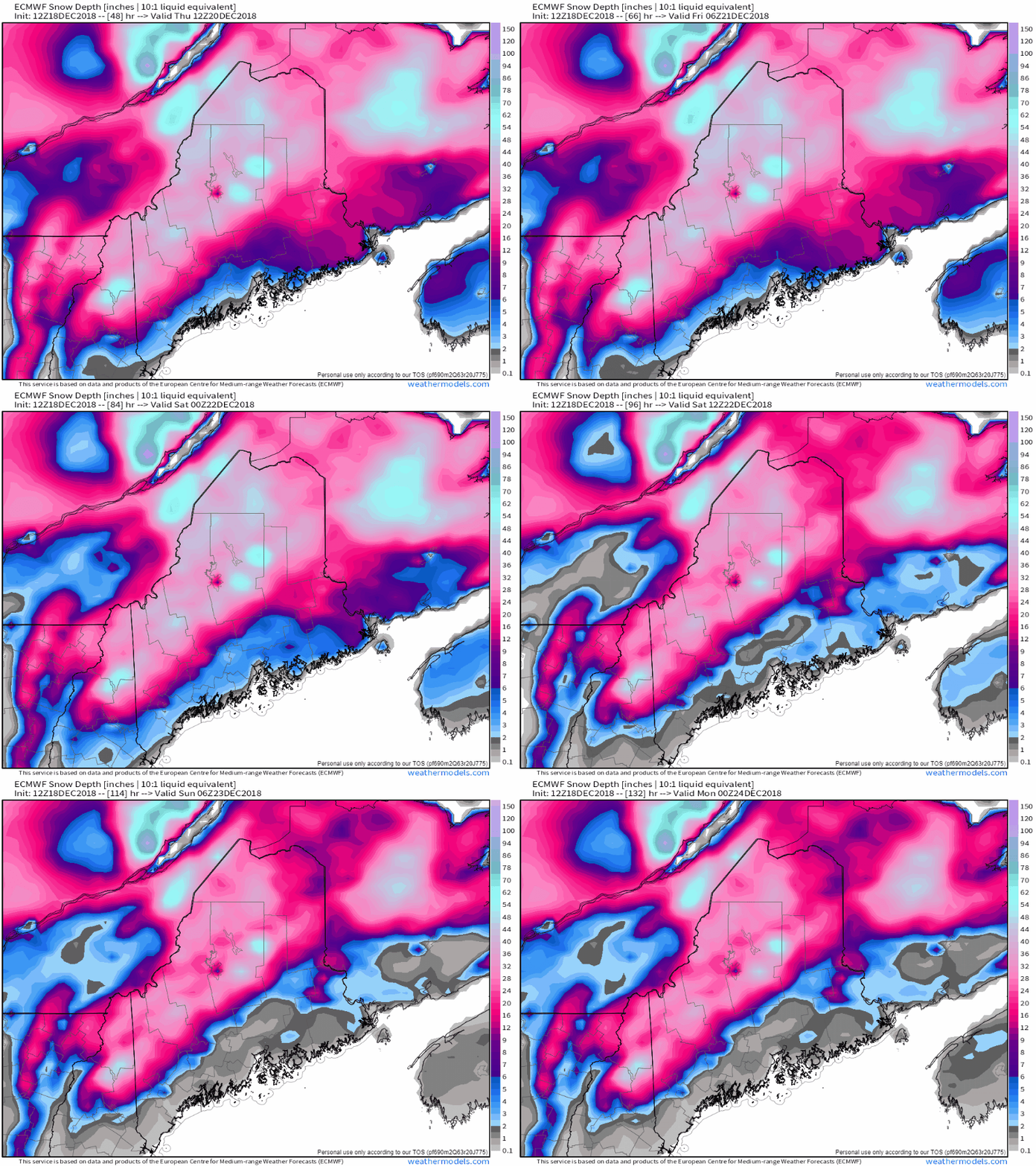
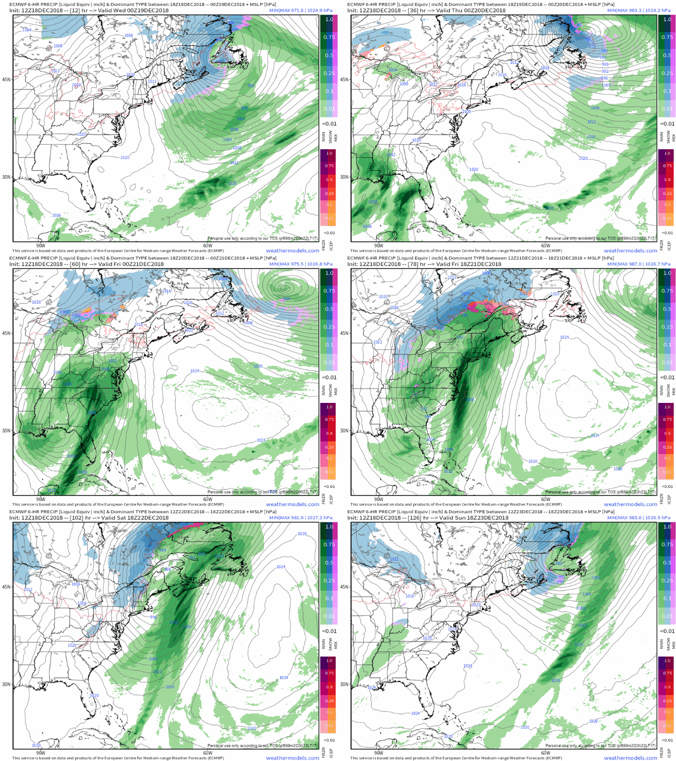
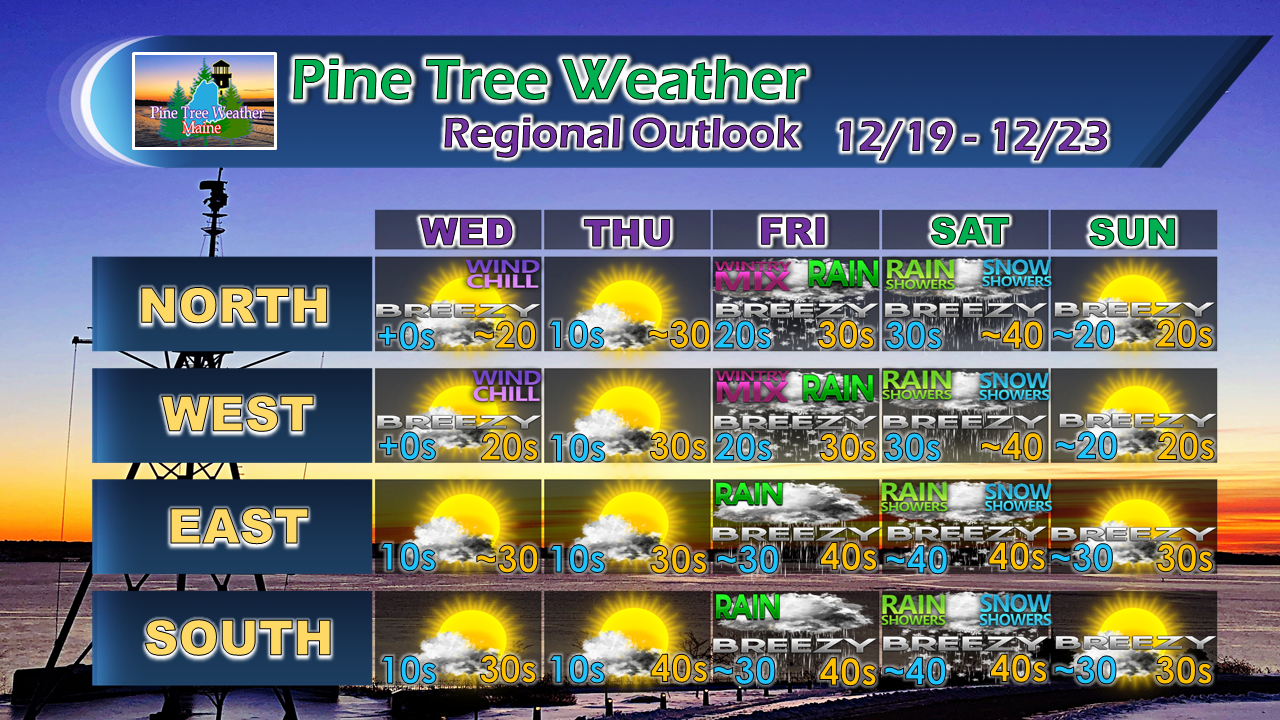
Snow pack to take a hitWhile for snow lovers this may come as a disappointment, the one thing that is working in your favor is the region has experienced significant snowfall early. It's that heavy snow over the interior that will protect the base, and may play a factor in how liquid precipitation makes contact with it. For folks along the coastal plain, what snow is on the ground may not last the weekend, other than where the banks are. There will be a lot more brown than white on the ground by Saturday noon. Track and timing coming into focusAn incredibly deep trough over the central part of the country dips into the Gulf of Mexico and scoops up tropical moisture and spins it northward into Maine Friday into Saturday. Taking a look at the surface loop, this is a similar pattern we would see in summer with a strong Bermuda high acting as a spoke wheel as an atmospheric river launches up the east coast corridor. A rough estimate on rain amounts appear to be in the 1-2" range with lesser amounts for areas along the international border with Quebec. The heaviest amount of rainfall appears to fall along the coastal plain and shorelines. If the track was further west, this could have been real bad for ski and snowmobile country. Fortunately this will move along rather briskly and a trailing cold front that sweeps through on its heels Saturday will cool things down to stop the melting. The key for the interior where the deepest snow pack is located is the chance for a period of icing early Friday which may also help reduce the damage of the expected rainfall. I know many of you grumble when ice comes, but it may be your best friend in this case pending on how this plays out. With the below normal cold as of late, rivers and streams have frozen in areas, as has ground surfaces. With this kind of rainfall, ice jams in tributaries and urban street flooding from poor drainage areas is likely to be a concern. Of course anytime there is tropical moisture involved, there runs a risk of thunderstorms with downpours which could cause flash flood concerns. It's going to be a mess as any rain event is in the middle of winter, and this is no exception. Stay tuned for more details as we approach late week. Outlook through SundayFor those that are bummed of the snow melt especially along the coast, some snow showers late Saturday may add a touch of white in spots, and another round of snow showers may freshen up a few areas for Christmas Eve. I will continue to track and advise on that.
For the latest official forecasts, bulletins and advisories, please check in with the National Weather Service in Gray for western and southern areas, or Caribou for northern and eastern parts of Maine. Pine Tree Weather is now 90% funded to get through October of 2019. My anticipated current deficit now stands at $380 remaining to be raised to reach my goal. I am sincerely blessed and humbled by your financial contributions, cards, and messages of encouragement. It's been an amazing journey over the past 7 years, and to see my efforts appreciated by those that follow is a wonderful reward for my work. I have asked simply for $1 per month / $12.00 per year through my Patreon page or by sending me a message on Facebook or Twitter to mail a check. The popular contribution has been $5 per month / $60 per year on Patreon, and the check donations average out to same amount as well. I would sincerely appreciate your support in order to be fully funded by the end of the year. For more information from me, please follow the Pine Tree Weather Facebook page and my Twitter feed. Always stay weather aware, and thank you for your support! - Mike |
Mike Haggett
|


