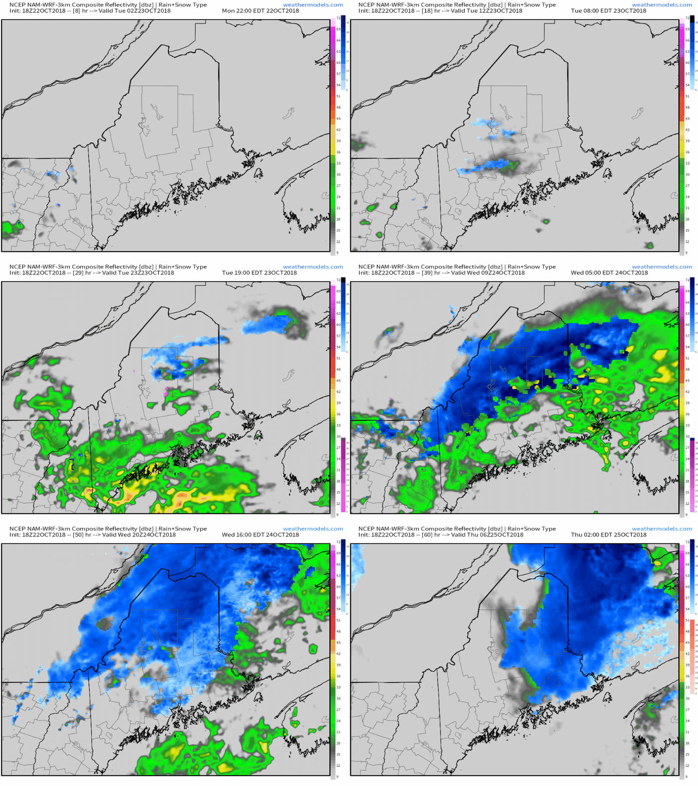
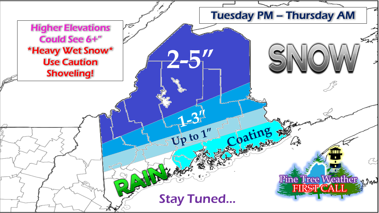
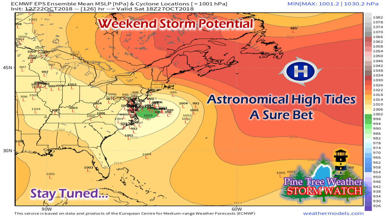
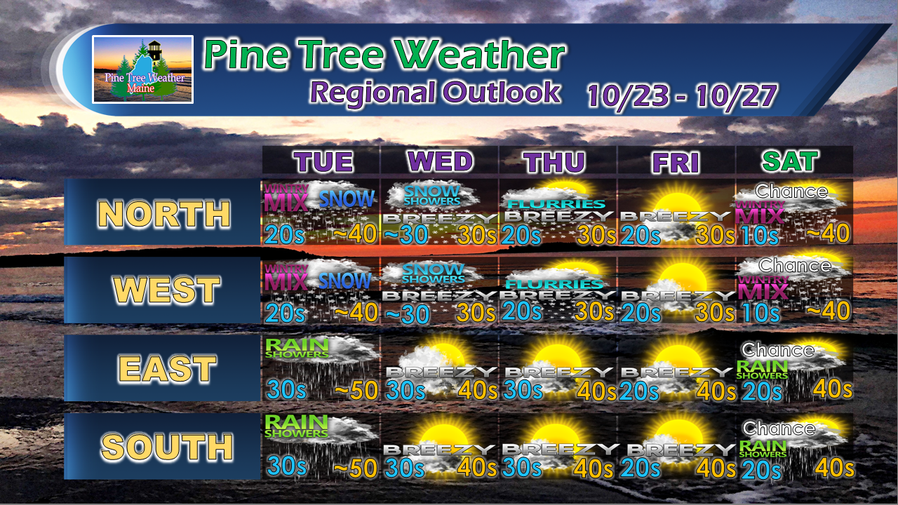
A messy couple of days for the interiorA warm front noses into the region Monday night into early Tuesday which may bring some flurries to the higher terrain. Low pressure forms in the Gulf of Maine and brings a rainy start over the interior and then switches to snow overnight Tuesday into Wednesday morning. Snow continues over northeastern Maine as the storm stalls near the Gaspe Peninsula before moving east Wednesday night. First crack at snowfall amountsMy thoughts have not changed much on this as the best accumulations will be in the higher terrain. Most of ski country should see a half a foot or more at the summits. The foothills could see 1-3" which may slick the roads up a bit. I think most of the accumulation that comes southeast of the north country ends up on grassy surfaces. MidCoast and DownEast areas may pick up a coating or a bit more as the storm moves north through New Brunswick and hauls cold air to the coast. I will note that these types of storms that bring dynamic cooling are a bit of a gamble. As I mentioned in my previous updates, the cold that comes from this originated with a big storm from Alaska that has raced southeastward over the past few days. This adds to the intrigue. The ground temperature hasn't reached freezing yet. Some of this will melt. With the moisture being brought in from the ocean as the storm intensifies, this will be of the heavy and wet variety with large flakes likely. This may skew totals a bit. There will be locally higher and lower amounts, as usual. I will update on snow amounts, if they need adjustment, tomorrow. Ocean storm possible this weekendGuidance is beginning to get a handle on a potential NorEaster for the weekend, but it is still early and there is many moving parts to this to get into specifics. Folks along the shorelines should be advised that tides will be astronomically high this weekend with the full moon. That is the certainty for now. High pressure to the east will play a factor in the track of the storm, either pushing it westward through New Hampshire / Vermont which would put the region in the wet and windy side, or more to the east which could put Maine on the cold side. I am not buying much into the hype of some model ideas just yet. The southern component and the timing of it's arrival holds the keys to how this will play out. Outlook through SaturdayAfter the storm passes through high pressure will try to work into the region which will up the breeze more as we head into the later part of the week. Saturday is my best estimate for potential for now, but that is all dependent on timing and track.
More updates to come. For the latest official forecasts, bulletins and advisories, please check in with the National Weather Service in Gray for western and southern areas, or Caribou for northern and eastern parts of Maine. For more information from me, please follow the Pine Tree Weather Facebook page and my Twitter feed. Thanks as always for your support! Please consider making a donation to keep Pine Tree Weather going through the year ahead. Check out the donate page on how to contribute. Always stay weather aware! - Mike |
Mike Haggett
|


