|
Once again I would like to thank those who have passed along financial donations in order to keep this operation going. The words of encouragement and appreciation that have been attached to them make it worth my while to get out of bed at foolishly early hours of the morning to formulate and construct a forecast that is beneficial to you. PTW is 65% funded for the year, running about $950 behind. A simple $5 per month donation on Patreon goes a long way to help me formulate a predictable budget. For a one-time donation, VENMO is the preferred method. Sending a check via the post office is a bit perilous but is also an option. For more information on how to contribute, click on the banner below or the DONATE page here on the website. I sincerely appreciate your support going into the tenth year! A quiet but cloudy Sunday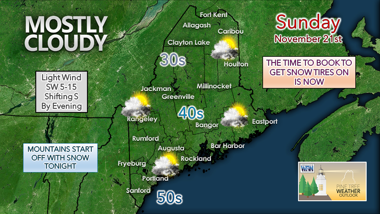 The day appears dry for most. The DownEast shorelines may get clipped with a shower later in the afternoon, but the rain appears to hold off until after sunset. It's on track to be a mild day for latter part of November, and a good day to finish up yard cleaning and wood stacking.  Sunday 6 PM to Monday 6 AM - A warm front moves in from the southwest and brings snow to the mountains and Quebec border regions to the north at the onset, then flips to rain by Monday morning. For the rest of the region, rain develops over the state through the evening, covering the region by midnight to 1 AM.  Monday 6 AM to Tuesday Midnight - A cold front approaches the region from the west and sweeps out the rain. Steady rain ends over southern and western areas Monday morning, with a spot rain or snow shower in the afternoon. It will be in the afternoon toward evening for precipitation to become scattered for northern and eastern areas, and could end as snow showers as cold air filters in. Wind speeds from the south appear to be in the 5-15 mph range with gusts in the 20-30 mph range, with higher end speeds for the shorelines and mountains. Way DownEast areas may see gusts reach 35 mph as the front approaches. Snow showers may pick up for the mountains as a northwest breeze picks up heading into Tuesday. 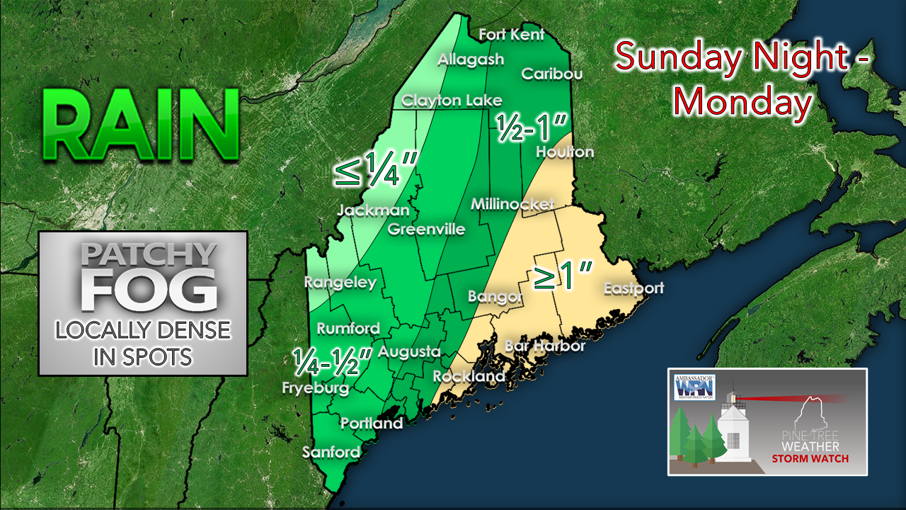 Northern and eastern areas are likely to see the most rain from this event, with lesser amounts to the south and west. Patchy fog may reduce visibility in spots, so be prepared if driving for changing conditions through Monday. The outlook for Tuesday is breezy and chilly along with a chance for snow showers. High pressure settles in for Wednesday. Thanksgiving Day looks generally quiet and a bit warmer.  Storm late week? Thursday 7 PM - Sunday 7 PM - I could have just closed out this discussion by mentioning a potential storm late week with high level of uncertainty and ended it, but I wanted to pass along a few thoughts on this. Mid-range modeling in the day five range and beyond by deterministic models has been terrible as of late. As what was seen with the storm approaching the region Sunday into Monday, that was a formidable idea with big wind and potentially big snow for interior areas early last week, and that idea faded out as the week progressed. The loop from the European model depicted above from the 7 PM (00z) data run last night shows a potential mess Friday into Saturday. 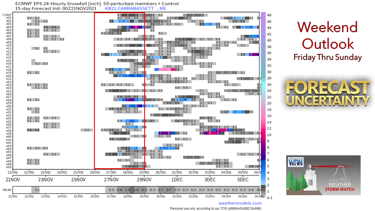 Looking at the snow angle on this from the European ensembles for Carrabassett Valley, it certainly shows a chance for snow, but most of the members show light accumulations for now. 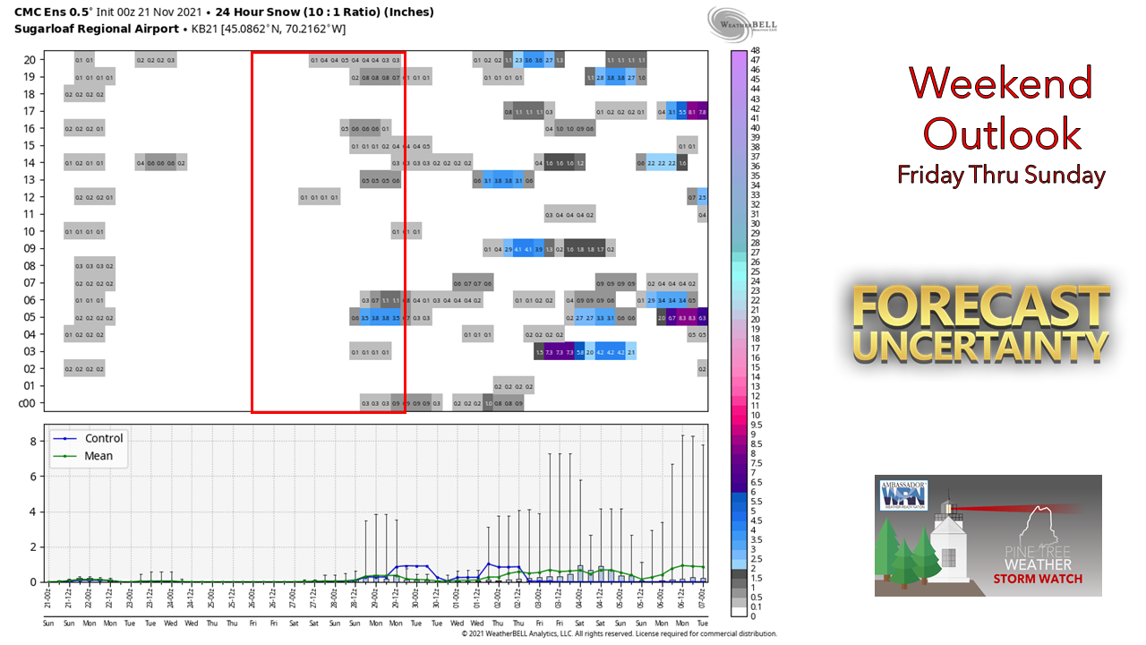 Looking at Canadian ensembles for the same period show less of a chance. In simple terms, the trend I am seeing in the long range an overamplification of energy in upper-level troughs which some deterministic ideas latch onto and creates feedback and thus skews the outcome. I've said this before and will say it again, mid-range deterministic models are like shady used car salespeople. They cannot be trusted. That is always important for responsible forecasters to look under the hood of the car and check the engine to see what is driving the ideas. A look at precipitation charts such as these is just one way of many angles to look at when forecasting, but unfortunately, they are shared on social media in ways that are misleading and confusing. Regardless, it will be something to watch this week. 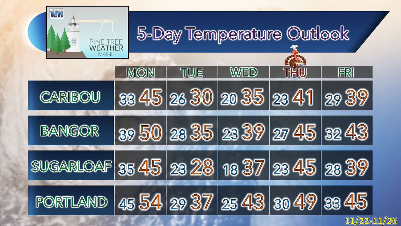 Driving in Patchy Fog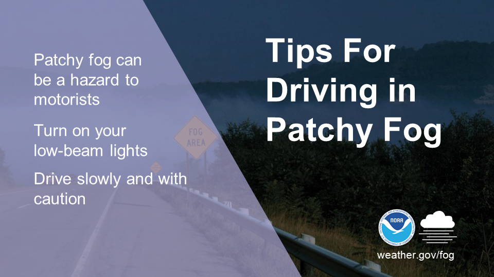 Driving in fog can be dangerous. Be on the lookout for sudden changes in visibility. The patchy nature of fog can lower visibility quickly and unexpectedly, especially if you are driving fast, so be sure to slow down. Visibility may also be lower near rivers. weather.gov/safety/fog Be prepared to receive alerts and stay updated!
 For more information in between posts, please follow Pine Tree Weather on Facebook and Twitter.
Thank you for supporting this community-based weather information source which operates by reader supported financial contributions. Stay updated, stay on alert, and stay safe! - Mike |

Mike Haggett
|