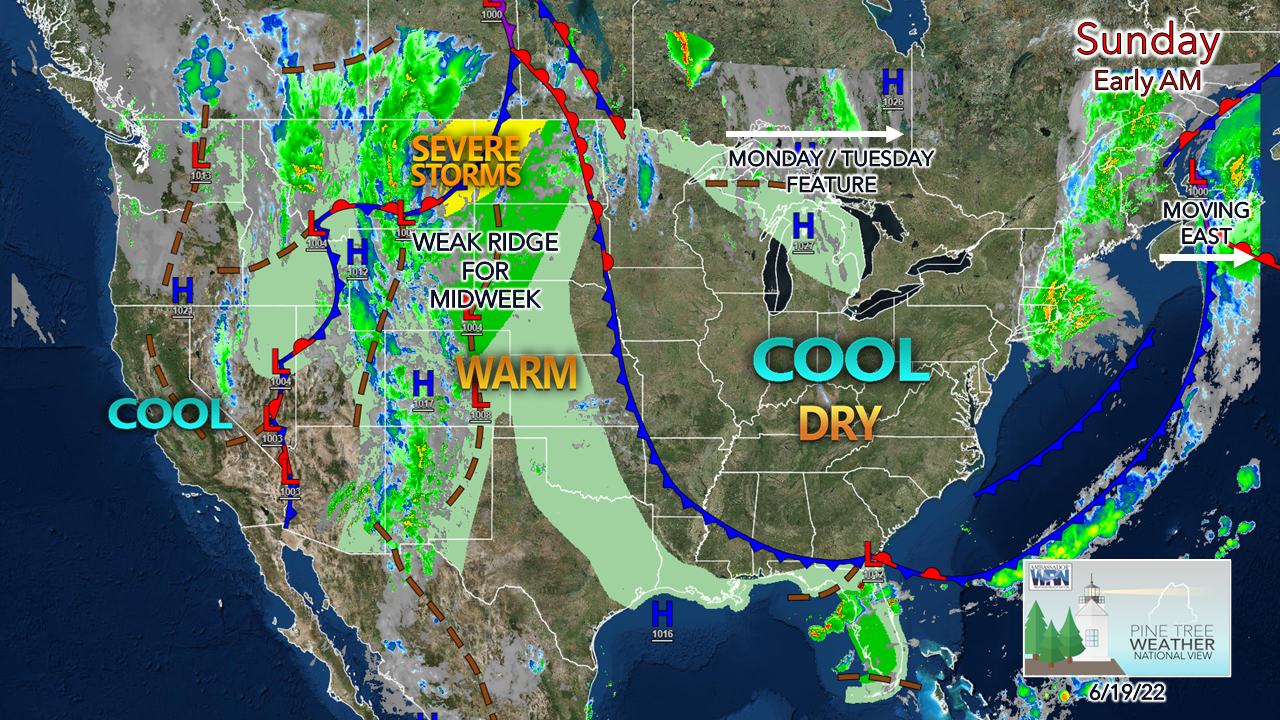
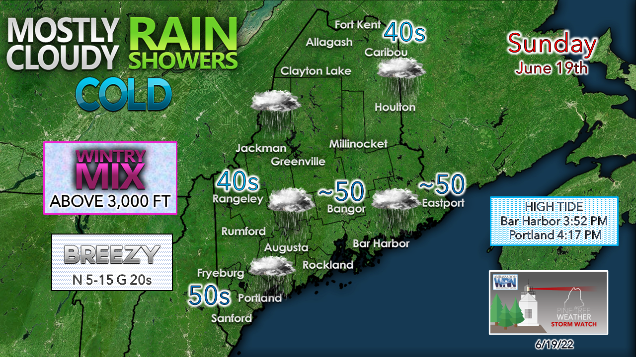
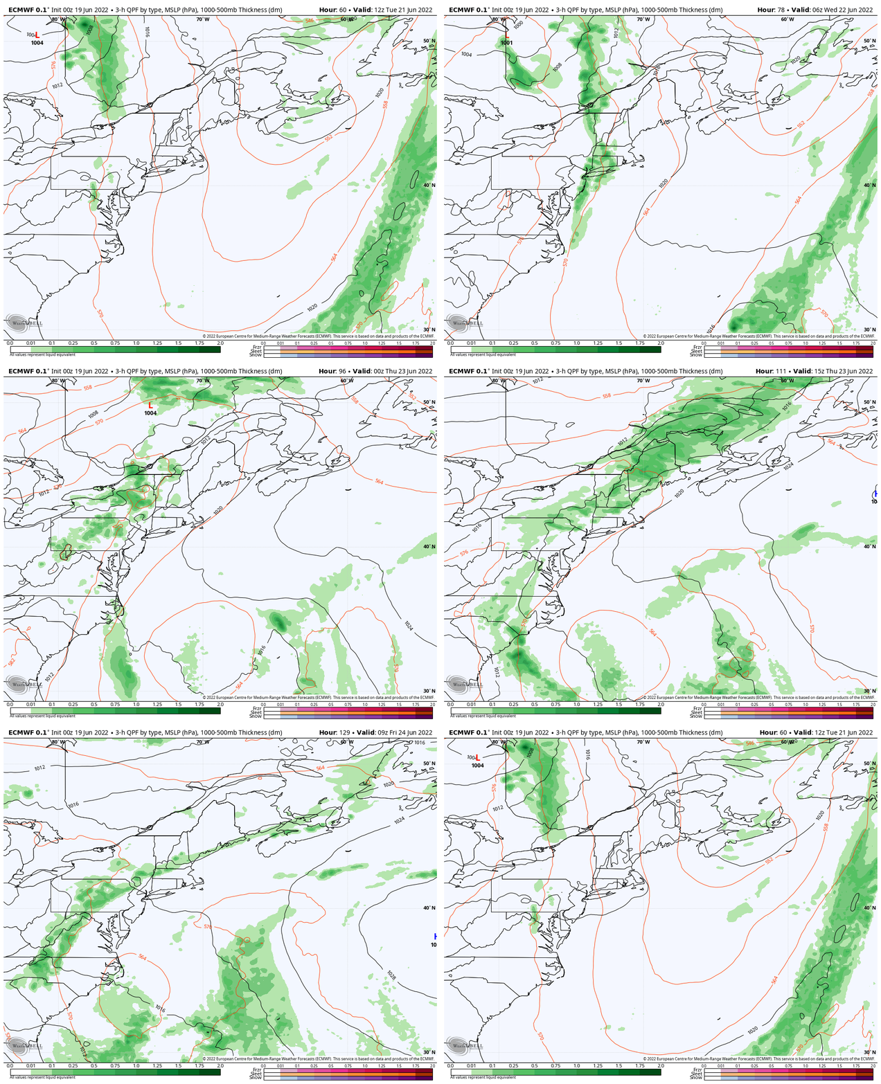
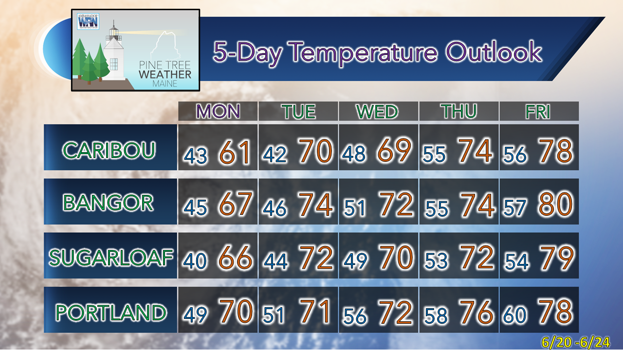
Looks a lot like mid-AprilWith the first day of summer approaching on Tuesday, I look at the surface map and chuckle. It's not often deep troughs occur like this in June. Folks in the southeast are enjoying the lower dew points that they don't often get this time of the year. Even the west coast is cool. The aggressive heat is squashed into Central America. Monsoon season has engaged over the desert southwest. For us in Maine for Father's Day / Juneteenth, it will feel like mid-April, minus the frost threat at night, which for the farmers is a relief. How cold is it? There is a good chance that a new record low high temperature is set for Caribou and possibly Bangor for the day. The coldest high temp for June 19th was 52° set in 1962 for Caribou, and 55° was the low mark for Bangor set in 1947. How cold is the air aloft? Feel free to check in with the latest observations from Mount Washington whereas at 5 AM the peak received over an inch of snow overnight, the actual temperature was 27° and the wind chill was 5°. Full winter gear required for mountain hiking today. Expected to get pelted with sleet and freezing rain if you're headed up the high hills. Rain showers are the key feature for the day for those of us below the higher elevations. Potential enhancement off the ocean discussed previously has engaged. A north wind will make an already cool day feel colder. The surface low moves to the east Sunday night, and improvement is on the way to start the week. Outlook through FridayTuesday 8 AM to Friday 8 PM - The key feature I am keeping an eye on in the long term is the upper-level low situated just south of the region Sunday morning. While this is a surface loop map you are looking at, you can see the upper-level features highlighted by the red contours that shows the upper low drifting east of Nova Scotia, then is anticipated to drift southwest to the Carolinas late week. I do expect dry conditions for Maine Monday and Tuesday. The weak ridge out west approaches the region on Wednesday, which may bring a shower over the western half of the state. Low pressure in northern Quebec is expected to drag a cold front through the region Thursday and bring showers to the region and may linger into Friday. I am curious to see how the upper low interacts with the front for late week, and how the feature may impact the outlook into the weekend. The ideas presented at this point are a bit close for comfort, and if I had to hedge a bet right now, I would anticipate shower potential into next weekend. Time will tell. Thank you for supporting this community-based weather information source which operates by financial contributions from people like you. Stay updated, stay on alert, and stay safe! Have a great day! - Mike NOTE: The forecast information depicted on this platform is for general information purposes only for the public and is not designed or intended for commercial use. For those seeking pinpoint weather information for business operations, you should use a private sector source. For information about where to find commercial forecasters to assist your business, please message me and I will be happy to help you. |
Mike Haggett
|


