Mother Nature forgot what month it is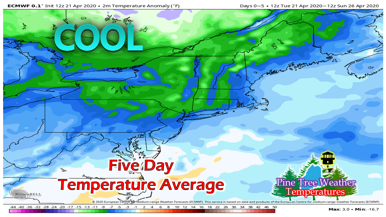 I mentioned it here the other day and will reiterate the fact the pattern we're in resembles that of January. The sober reality is that this is not going to go away anytime soon. If you check the CPC Outlook page, this is likely going to continue through the remainder of the month. Looking further than that, this trend may continue into toward the middle part of May. What does this mean? Snow chances continue for the mountains and north. Frost / freeze advisories/warnings are possible as growing season commences. This extended late winter after what appeared to be a promising early spring is a tough pill to swallow given the pandemic. 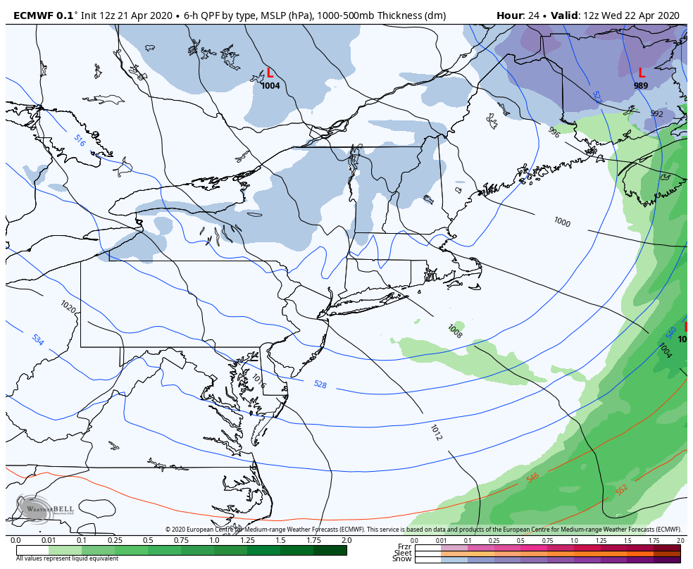 After the Tuesday storm departs, Canadian high pressure parks over eastern Quebec. Northern New England will be on the fringe of it. Warm air tries to surge northeastward, but ends up hitting the blocking high. Southern areas may get some rain shower activity on Friday, but other than that, the rest of the week appears dry for most, outside of the chance of snow showers and flurries in the north and mountains. Upper air disturbances will bring varying amounts of clouds at times through Wednesday. Thursday appears mostly sunny for all but far northern and far southern areas. Clouds increase Thursday night over the coastal plain. The low skirts offshore Friday, with the best chance for sun in the north and mountains, where coastal areas deal with clouds and possible showers south. Saturday appears to be a mainly sunny day at this point. Chilly starts through Friday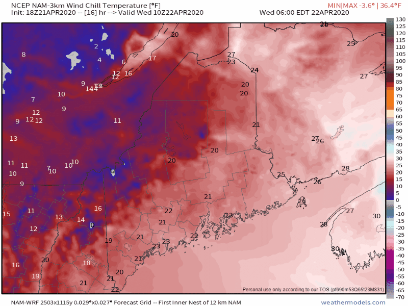 Wednesday morning will feel like February with wind chills in the single digits / teens in the north and 20s along the coast. With the northwest breeze continuing all day and clouds around, the feels like temperatures aren't going to change a whole lot. 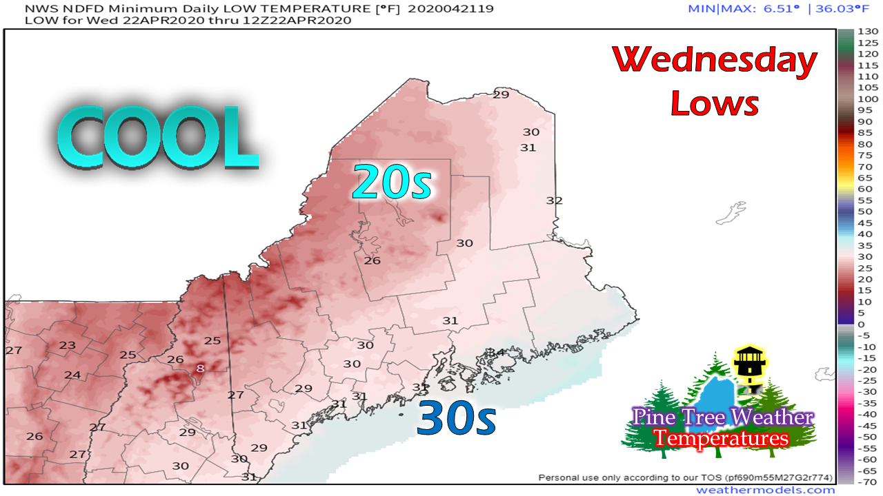 To start Wednesday, knock 10-15° off the projected lows for what it will feel like. 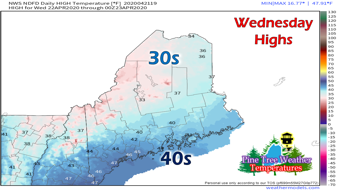 The mountain tops won't break 30° for highs. Down sloping northwest winds will raise the thermometer along the coastal plain, but I'd go with the choice of the insulated windbreaker while out for a walk. 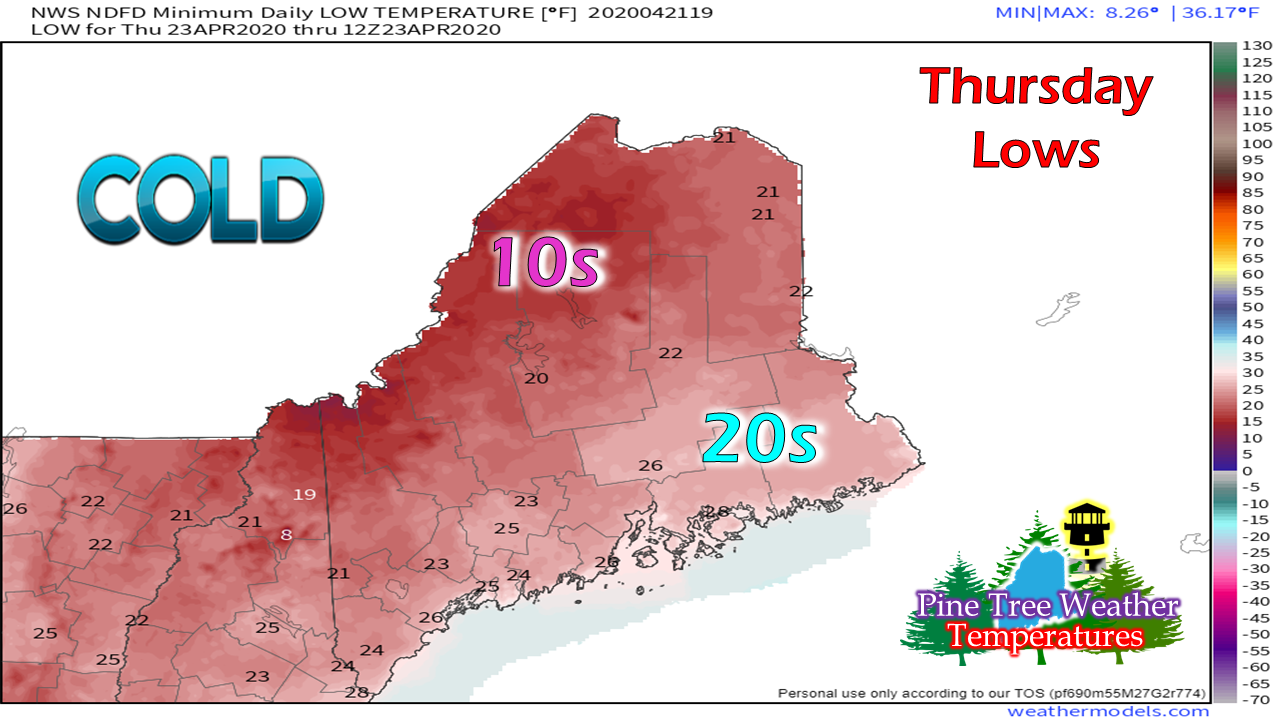 On April 23, 1994 Caribou set a record low of 21°. There is a good chance that may fall as the wind settles Wednesday night. 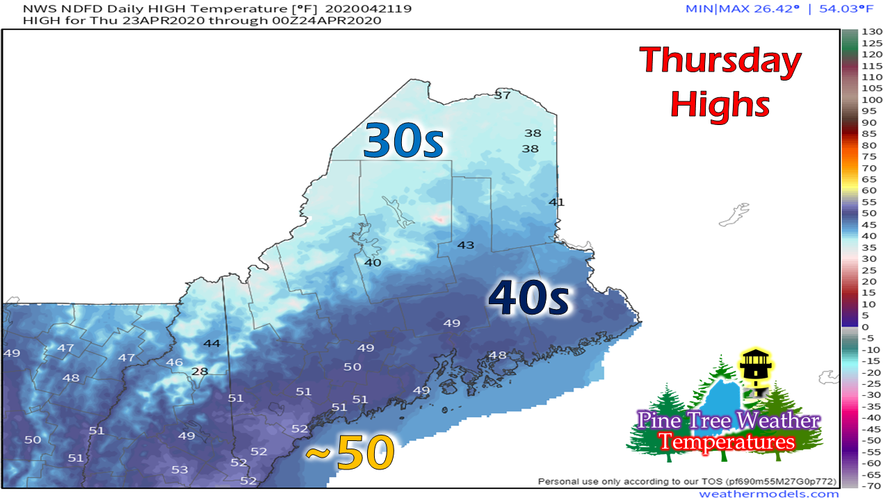 With the sun and less breeze, temperatures come up a bit, but 10-15° below normal in the north and close to normal south. 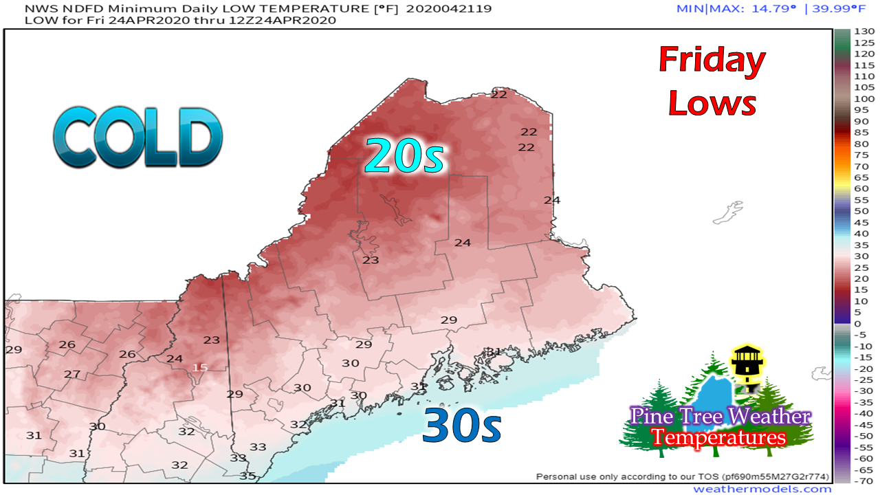 On April 24, 2004, Caribou set a record low of 20°. There is a possibility that could be broken to start Friday morning. For folks eager to get the vegetable garden going, you may want to wait unless you are properly prepared to battle these cold nights still to come. Help the weather community and stay informed!
► ► For the latest official forecasts, bulletins and advisories, please check in with the National Weather Service in Gray for western and southern areas, or Caribou for northern and eastern parts of Maine.
Thanks as always for your support! - Mike |

Mike Haggett
|