
A taste of spring comes with a cost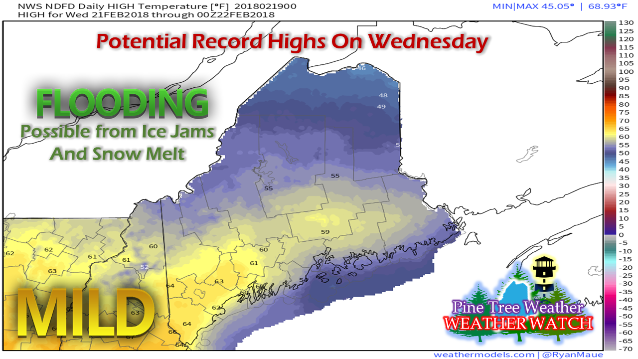 While the winter weary members of the population are likely to embrace the forecast, this is one that certainly comes with side effects. Anytime warm air of this form comes with a snow pack and frozen rivers, flood potential is the first red flag that is raised. A good portion of southern and western areas could see as long as 72 hours of above freezing temperatures, which makes the potential flood threat even greater. With some rivers already jammed with ice from the January thaw, the abnormally warm air along with its duration could pose problems to tributaries through the middle part of the week. For those who live or work near rivers, brooks or streams, it would be wise to pay attention for rising water and ice jam potential that could make flood potential a reality. Also, for those who travel in low lying areas that are susceptible to spring or heavy rain flooding should think of possible alternate routes through later in the week. With all of this melting, the frost heaves and mud could make for rough and messy travel in areas as well. And then winter returns...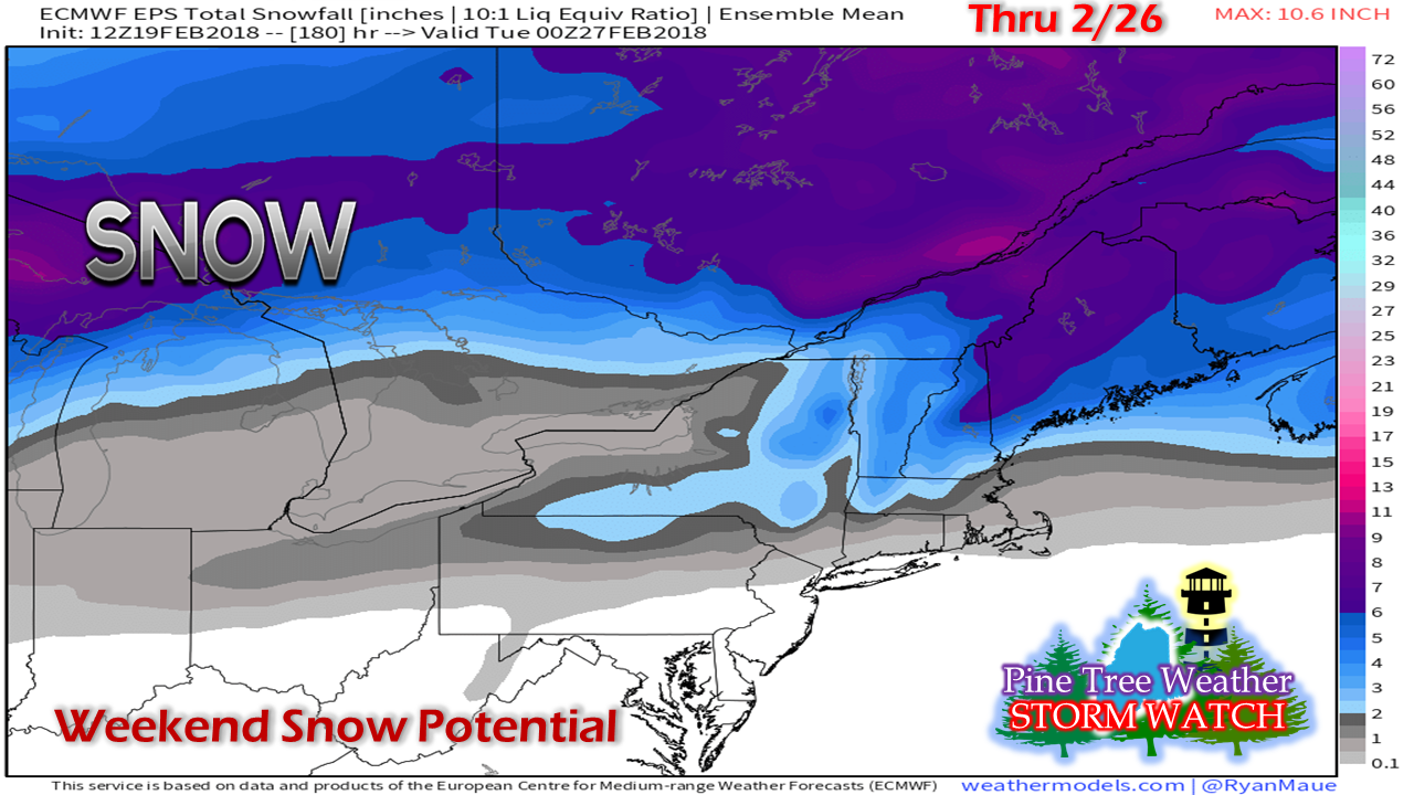 While it is early to get into specifics, it would be wise to pay attention to the forecast in the coming days for a couple rounds of snow. The first would be for the mountains and north country Friday into Saturday, and then everyone gets in on the game Sunday into Monday. It all depends on actual storm track and storm intensity. For now, it is strictly an idea, and one to keep an eye on. Status Update The last couple of weeks have been rather hectic at times in preparation to relocate this spring. Between the work on the purchase of one home and the selling of our current dwelling, my time has been very limited for weather updates and information. At this time, we are not exactly sure when moving day will come. When time permits, I will post some sort of an update to keep you abreast of potential weather concerns and a better timeline of when the move south to Kennebunk will occur.
You can always follow me on Twitter for any brief snippets of information that I may be able to pass along. I apologize in advance in case I do not respond to comments or messages on Facebook or tweets in a timely manner. I appreciate your patience while this process continues. Please stay updated on the forecast and any bulletins through the National Weather Service and/or the local broadcast media. - Mike |

Mike Haggett
|


