Red flag warnings continue for Tuesday, unsettled period starts Wednesday into the weekend4/27/2021 Hold off on the burning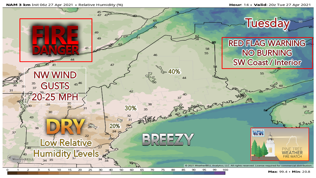 It does not appear to be as windy for Tuesday, but the combination of very dry air and breezy conditions is enough to trigger a Red Flag Warning for much of the southwest part of the state and all of New Hampshire. 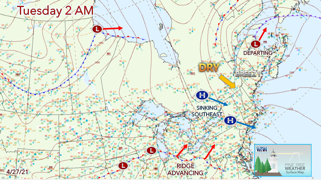 The breeze continues because of a slow-moving storm just to the east of the Gaspe Peninsula and high pressure moving southeast to the west of Maine. This pattern funnels very dry air into the region from Quebec, hence the threat for wildfires. Please use caution with any open flame through this evening. Upper ridge advances in for Wednesday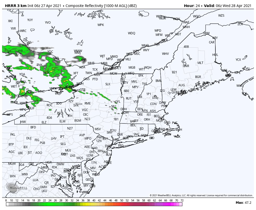 An upper air ridge to the southwest advances northeast Tuesday. A weak disturbance forms along it, which could bring a chance for showers over southwestern areas early Wednesday. A stronger wave is expected bring more shower activity Wednesday afternoon, which could bring a rumble of thunder along with it. The northern most extent of the shower activity is in question. Some short-term guidance is a bit more progressive with the ridge and could bring showers as far north as Millinocket and would include Bangor and DownEast areas. The more conservative idea from the 06z HRRR model is displayed here. Northern areas escape rainfall and enjoy a dry and pleasant day. Pattern turns unsettled into the weekend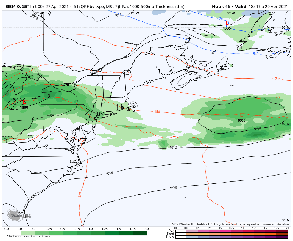 Thursday starts off dry for the region. We once again play the timing phase game of the northern and southern streams for rain chances Thursday night into Friday. Given the timing of the forecast period, it's fair bet the region sees beneficial rain out of the system. 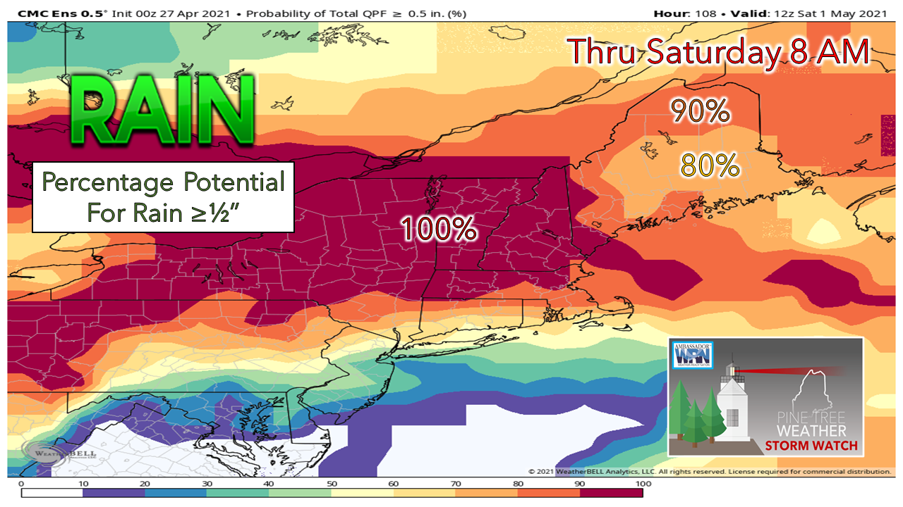 The state has a high chance of receiving at least ½" of rainfall as a sum of all activity from Wednesday onward into early Saturday. 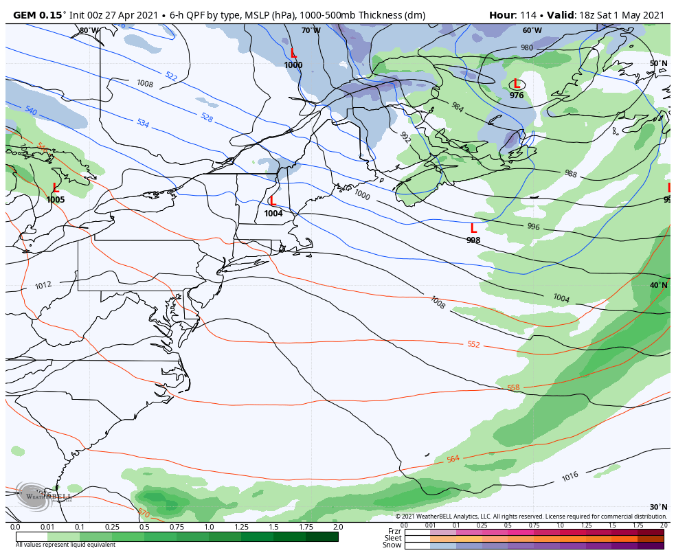 While Saturday appears breezy and fair overall, Sunday could bring another round of rain and potentially mountain snow. Forecast confidence is low on details and will be fine-tuned in the coming days. What are the Hazards of Severe Weather?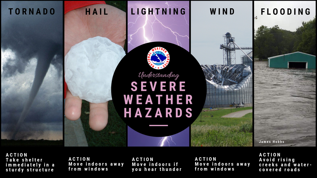 Tornadoes, large hail, high winds, heavy rain, and lightning are all hazards associated with severe weather. Severe weather has been reported in all 50 states, so no matter where you are, make sure you are prepared! weather.gov/safety/thunderstorm Seven-day temperature outlook through Monday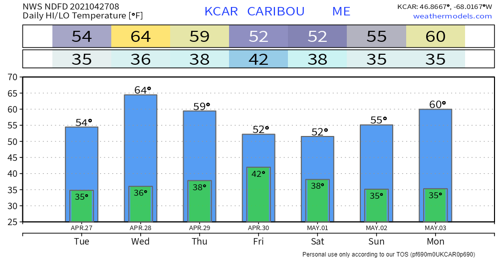 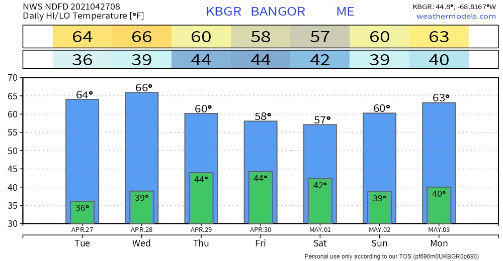 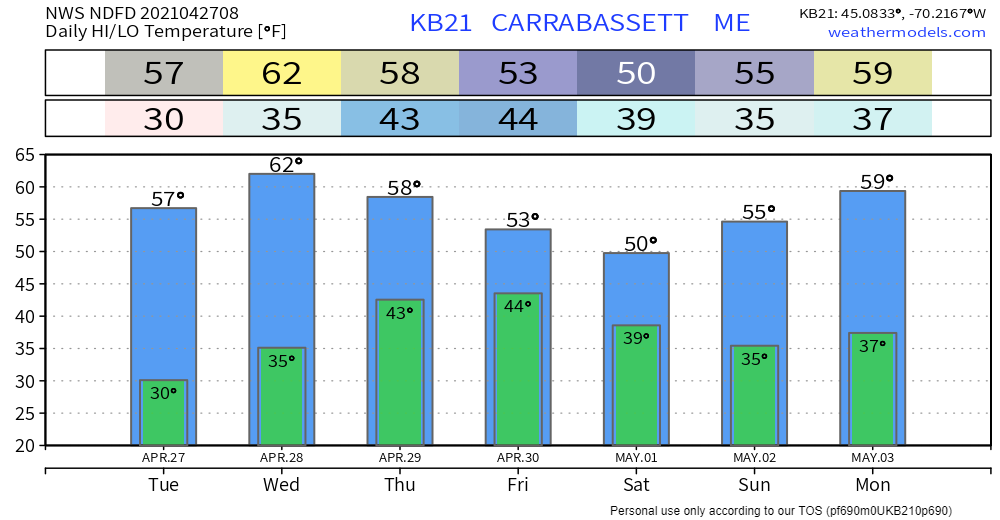 Be prepared to receive alerts and stay updated!
For more information in between posts, please follow Pine Tree Weather on Facebook and Twitter.
Thank you for supporting this community-based weather information source which operates by reader supported financial contributions. Stay updated, stay on alert, and stay safe! Thank you as always for your support! - Mike |

Mike Haggett
|