
Chance for lingering precipitation this afternoon and into tonight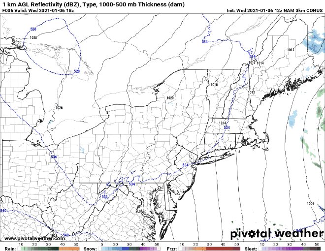 The above GIF shows precipitation from the NAM model and runs from 1pm today to 7am tomorrow morning. A couple passing flurries will sweep through the state today into tonight as the same low pressure system continues to make its way out to sea. Flurries will start this afternoon in Eastern regions of the state. Any accumulations associated with the flurries will stay low, only about a dusting to an inch. As the band moves closer to the coast, those areas will likely be warm enough to see a mix or potentially all rain. Sleet is likely along the Downeast and central coastal plain. Please take caution when traveling during rush hour tonight, as roads could be slippery! Quiet outlook for the next few days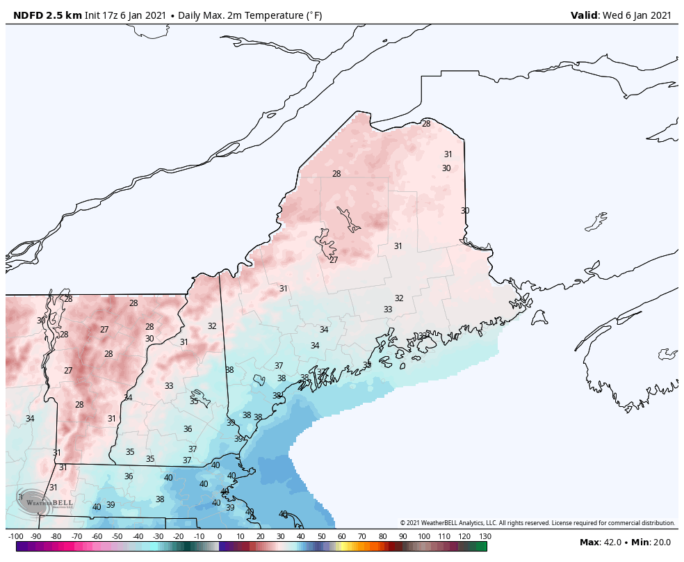 The GIF above shows maximum temperatures from today through Sunday. Temperatures will linger in the 20s and low 30s through Sunday. Skies will likely be partly cloudy over the next few days with a low threat for precipitation. An upper-level low will makes its way through on Friday, but otherwise fair and chilly weather is expected for the next few days. 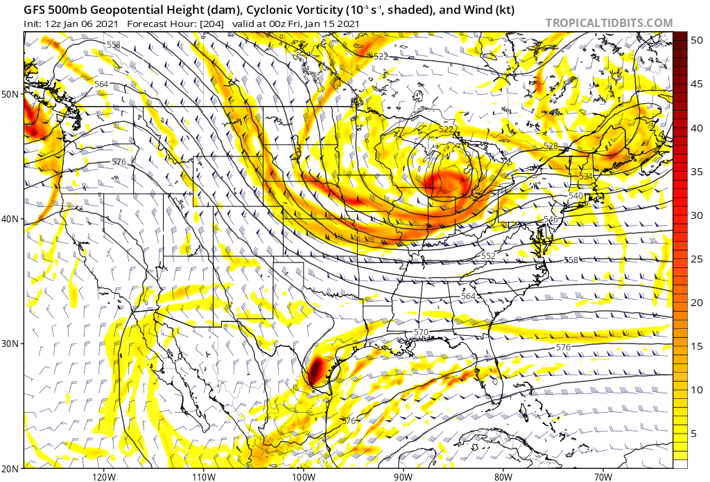 The above GIF shows 500mb heights and vorticity from Thursday at 1pm to Wednesday at 7pm. An upper-level low will move from the Great Lakes Region into Maine through late Friday, bringing clouds and the potential for some light snow showers in the higher elevations and northern portions of the state on Saturday. The system may struggle to retain moisture, so any accumulations will stay near a dusting to an inch. Another upper-level trough approaches for Monday, but the impacts associated with that system is uncertain as of the moment. Looking ahead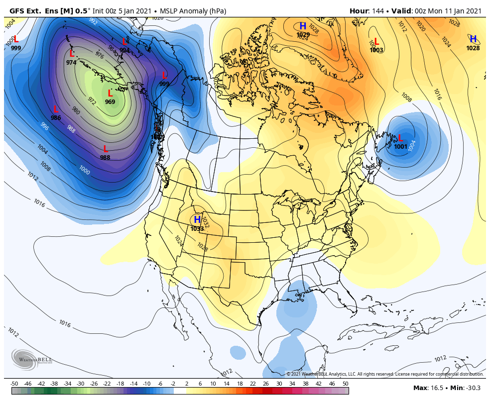 The GIF above shows surface pressure anomaly from Monday to next Sunday. High pressure in Canada and north keeps the pattern relatively quiet throughout New England. Maine stays in a general region of high pressure until late next week when a large area of low pressure forms and makes its way into the Maine. Until then, the upper-level pattern will dominate the weather in Maine. Be prepared to receive alerts and stay updated!
For more information, please follow Pine Tree Weather on Facebook and Twitter.
** FUNDING NEEDED FOR 2021 ** Thank you for supporting this community based weather information source that is funded by your financial contributions. Stay updated, stay on alert, and stay safe! Have a wonderful rest of your week! - Alex |

Mike Haggett
|


