Temperatures cool down through Thursday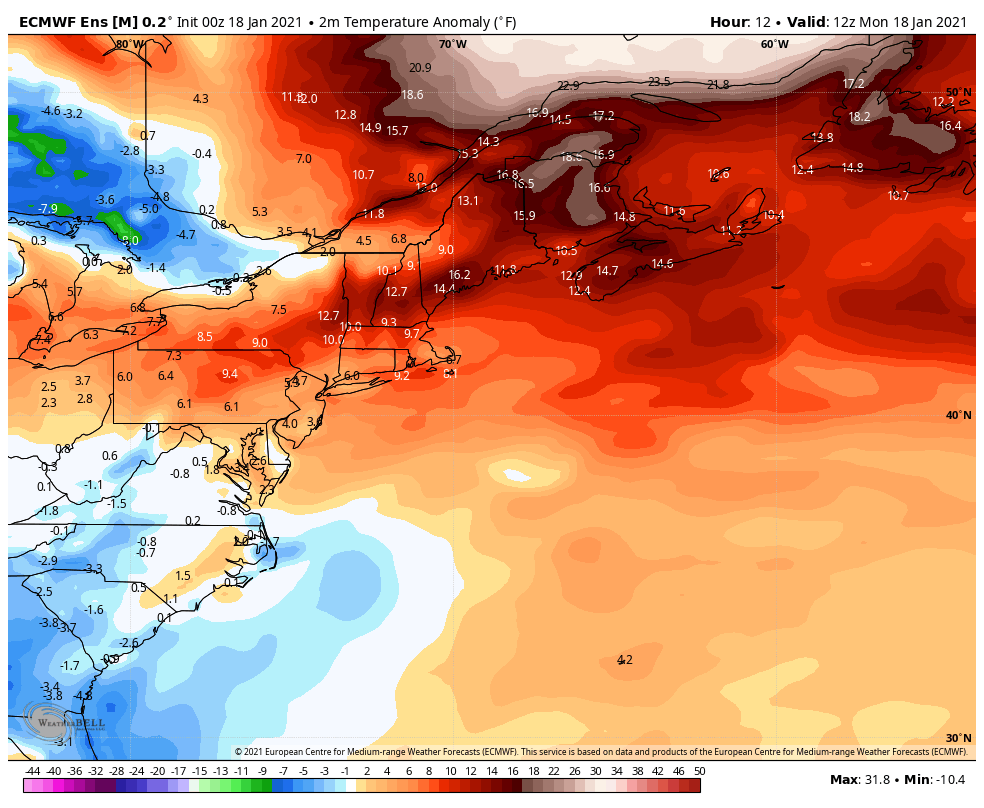 For a winter that has been very warm as compared to season average, that will change as the week rolls on. As a chunk of cold air from Siberia breaks off and moves southeast, it appears that for much of the region it could be well below normal Thursday, and that may feel like a shock compared to what it has been like. We are approaching the time for our coldest average temperatures for the season. It appears at this point where the cold will be on again and off again, with no prolonged stretch of below normal cold as head into late January. Check your wood supplies and/or your oil and kerosene tanks to be prepared as it the trend gets colder. Precipitation chances low through Friday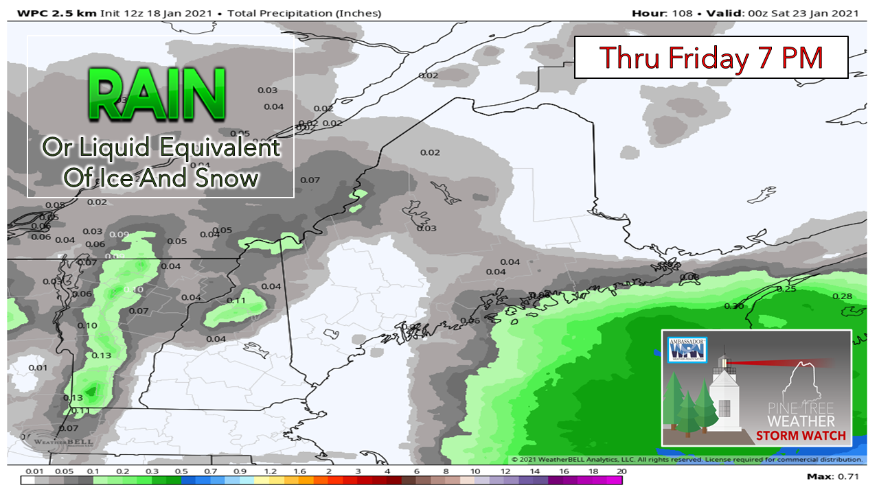 Not a whole lot of storm activity this week. Tuesday appears to be the pick of the week for sun. We'll be dealing weak, moisture starved cold fronts that will chip away at the warmer ridge and that will bring variable amounts of clouds at times through the week. Notice that strip of precipitation in WPC's outlook that runs roughly from Jackman to Bar Harbor. This is where our chance for light snow comes in later in the week. 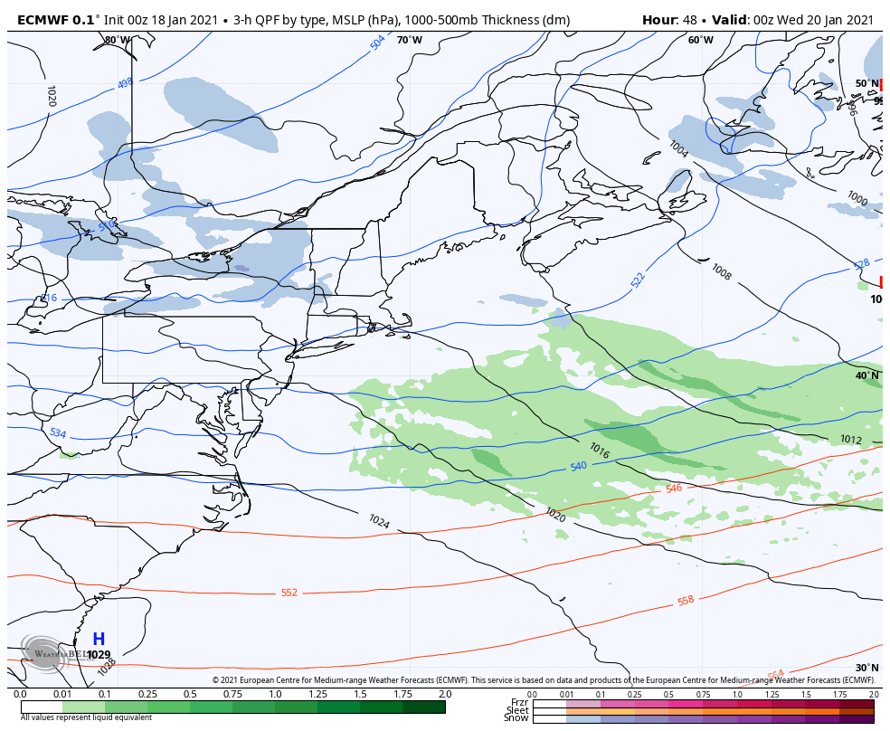 As the upper level trough works into the area, disturbances pass generally underneath of it. This is where it gets a bit interesting as it sets up potential for inverted troughs with the weak waves passing through. It appears at this point the best chance for that is Thursday night into Friday, but there is a slight chance for snow showers associated with the waves at times Wednesday through late week. While it is not expected to be a major impact, it could be enough snow to dust up the landscape and slick the roads up a bit. There is always the chance for a bit of a surprise with these, so it should be monitored. A look at deterministic versus ensembles for next weekI was on record last week on Twitter saying there could be some activity around January 25th. I was watching the trends around the southern coast of Alaska which raised my eyebrow a bit and made me think it was possible. For now, my hunch remains possible. It may be a couple of days later than that, but for now there isn't much ensemble model support. Since the pattern is quiet for the next week, it allows me to show you folks something about long term forecasting and models in general. 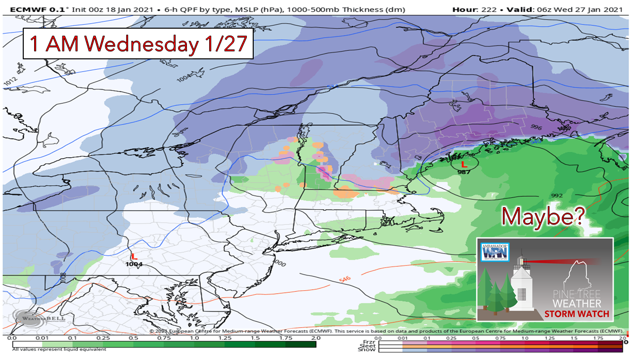 Here's a classic situation where the European deterministic model has latched onto an idea for a storm next week. These are the types of charts that spread like wildfire on social media, usually with no context and by folks that like to spread fear or joy and bring attention to themselves. In the truth of full transparency, I was one of those types years ago, but I realized that 90% or more of the time they were science fiction rather than truth. Once I realized this, I backed off showing them because integrity mattered more than ego, and I wanted to be a source people could trust. As I continue my course work through Penn State, I see more and more the value of ensemble ideas on the long range. I also understand that those also can vary at times due to initialization and other errors. What you see on these charts are numbers gathered from many sources that are put through physics equations to generate an image. Deterministic charts such as this are a one trick pony. In the numerical processing of retrieved data, this is the idea it comes up with. Boom, there is it. It is also worthy to note that deterministic ideas fail often 7-10 days out. The average validation rates are 40% or less. When you see long term ideas like this, think "Ok, there is a 40% chance or less of that." Food for thought, something to keep watch, but nothing to get excited about. There is more to the story than these one trick pony images, and that is where ensembles come in. 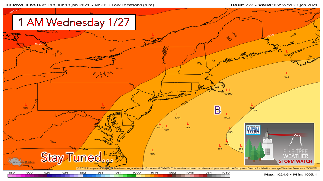 For example, the European model has 51 ensemble members. Looking at the chart above, to have a consensus idea that this storm could be reality, I would want to see as many "L" locations close to the deterministic idea. In this case, there isn't a one with 150 miles from that spot. There are only a handful of ideas out of 51 that even support the idea of a storm even being in the neighborhood at this point. All this means is there is a very low chance of that deterministic idea validating. 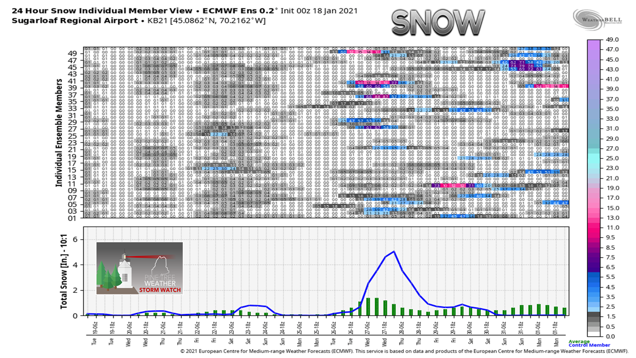 Going a step further and looking into the individual ensemble output, there are a grand total of 5 members that indicate a decent snowfall event for Sugarloaf that day. Not quite 10%. This is why it is important to understand that what one deterministic idea does not tell the whole story, which is why it should never be viewed as a sure bet beyond 168 hours. For you astute model watchers, I see where the 00z GFS deterministic is selling the same idea for the same day. That doesn't mean much at this point other than an idea and trend to watch. I do think the pattern is going to shift to a more stormier one, but it will be at least week before that happens. These ideas could be right, but for now, they do not have much ensemble support to back up what they are selling. Please understand that when deterministic long range images are spread on social media, there is a whole lot going on that you aren't being shown. Trust your sources, and be wary of science fiction. Temperature outlook through SundayNormal highs and lows for Caribou are 19° and 0°. For Portland, 31° and 13°. The nights remain generally above normal and the days generally below normal through the week. 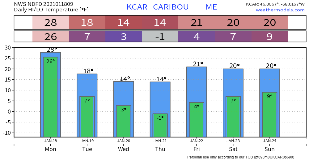 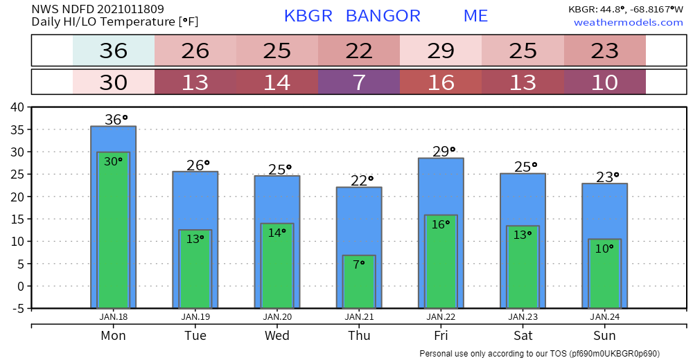 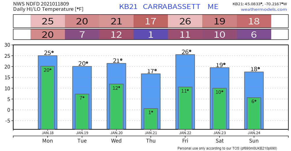 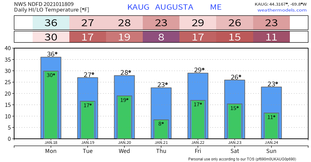 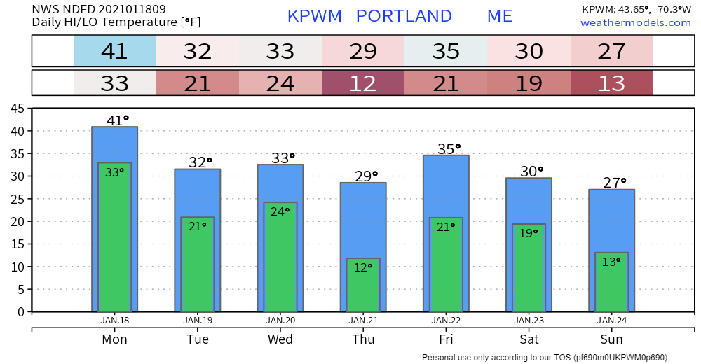 Be prepared to receive alerts and stay updated!
For more information in between posts,
please follow Pine Tree Weather on Facebook and Twitter. Thank you for supporting this community based weather information source operates by financial contributions. Stay updated, stay on alert, and stay safe! - Mike |

Mike Haggett
|