Last day of heat and humidity Friday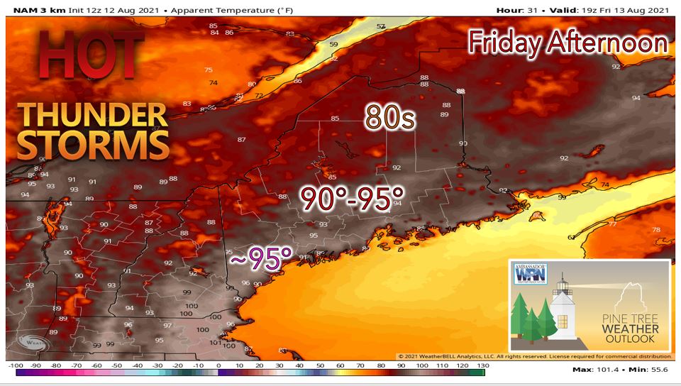 Any remaining thunderstorms Thursday evening should move off to the east and weaken through the overnight. It will be muggy with temperatures only bottoming out in the upper 60's to lower 70's around sunrise statewide. Friday will thankfully be the last in a string of oppressively hot and humid days we have seen in Maine this week. "Feels like temperatures" on Friday will be a few degrees cooler than Thursday with heat indices in the mid to upper 90's expected in southern Maine and 80's and lower 90's further north. There is a heat advisory in effect for much of southern Maine including the SW coast until 8pm Friday due to the combination of high heat and humidity. High temperatures on Friday will be around the 90 degree mark for interior southern Maine with 80's expected in the mountains of western Maine as well as for many of the coastal locations. Cold front with thunderstorms ushers in cooler airmass Saturday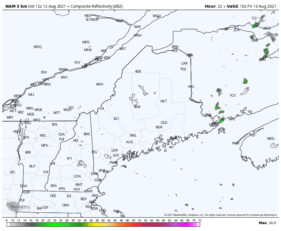 There will be a chance of isolated thunderstorms on Friday which would be favored over the higher terrain across western Maine. The Storm Prediction Center has put out a marginal risk of severe weather across far western Maine on Friday afternoon and evening for the potential of locally heavy rainfall and gusty winds there. High pressure poking north into Maine from the Hudson Valley will likely suppress most of the convection across the rest of the state on Friday. Friday night will be the last muggy and warm night with lows dropping into the upper 60's to mid 70's statewide. A cold front will begin to progress across the state Friday night with scattered but weakening showers and thunderstorms. During the day on Saturday, thunderstorms will likely develop in Central Maine along the cold front and move to the east through the evening. The cold front along with the thunderstorms should exit off the coast by Saturday night. Behind the cold front, there will be clearing skies and much cooler temperatures in the 50's to lower 60's Saturday night. Quiet and comfortable early next week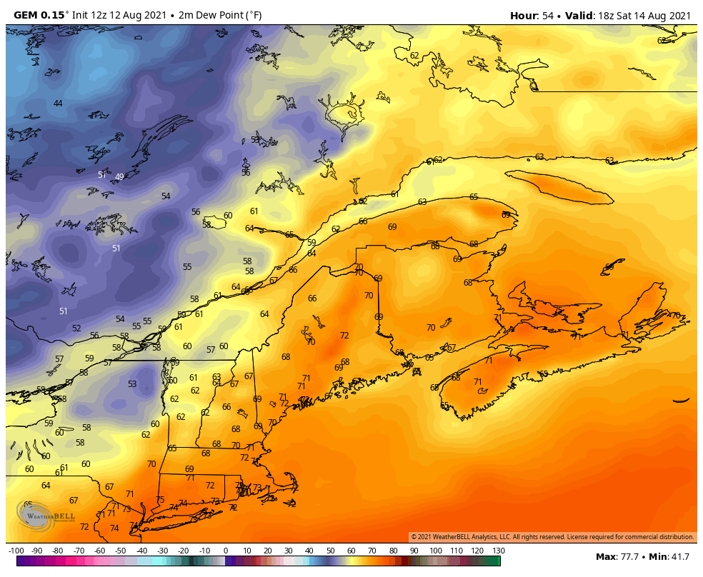 From Sunday into the middle part of next week, we can expect plentiful sunshine each day with little in the way of precipitation chances for Maine as high pressure settles in over eastern Canada. Temperatures will hover near to slightly above normal next week with high temperatures in the 70's to lower 80's likely most days. Dewpoints will also be quite comfortable next week in the 50's and 60's making it feel cooler as well. Our next chance of precipitation likely arrives next Thursday or Friday as an area of low pressure approaches us from the south. Long range outlook into next week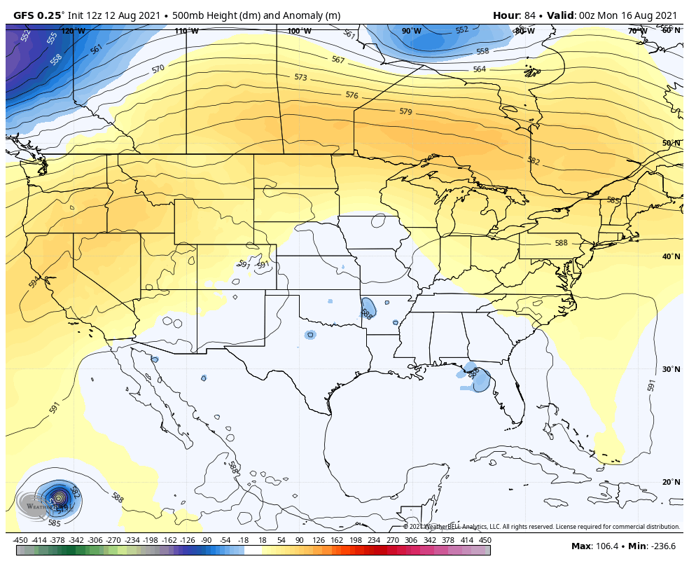 We will be in primarily a westerly to southwesterly flow with slightly above average temperatures heading into next week. This is thanks to the Bermuda High as well as a ridge over eastern Canada. However, the dewpoints will remain much lower than this week without the southerly flow transporting tropical air from the Gulf of Mexico northward making it feel more comfortable. Drought Monitor Thursday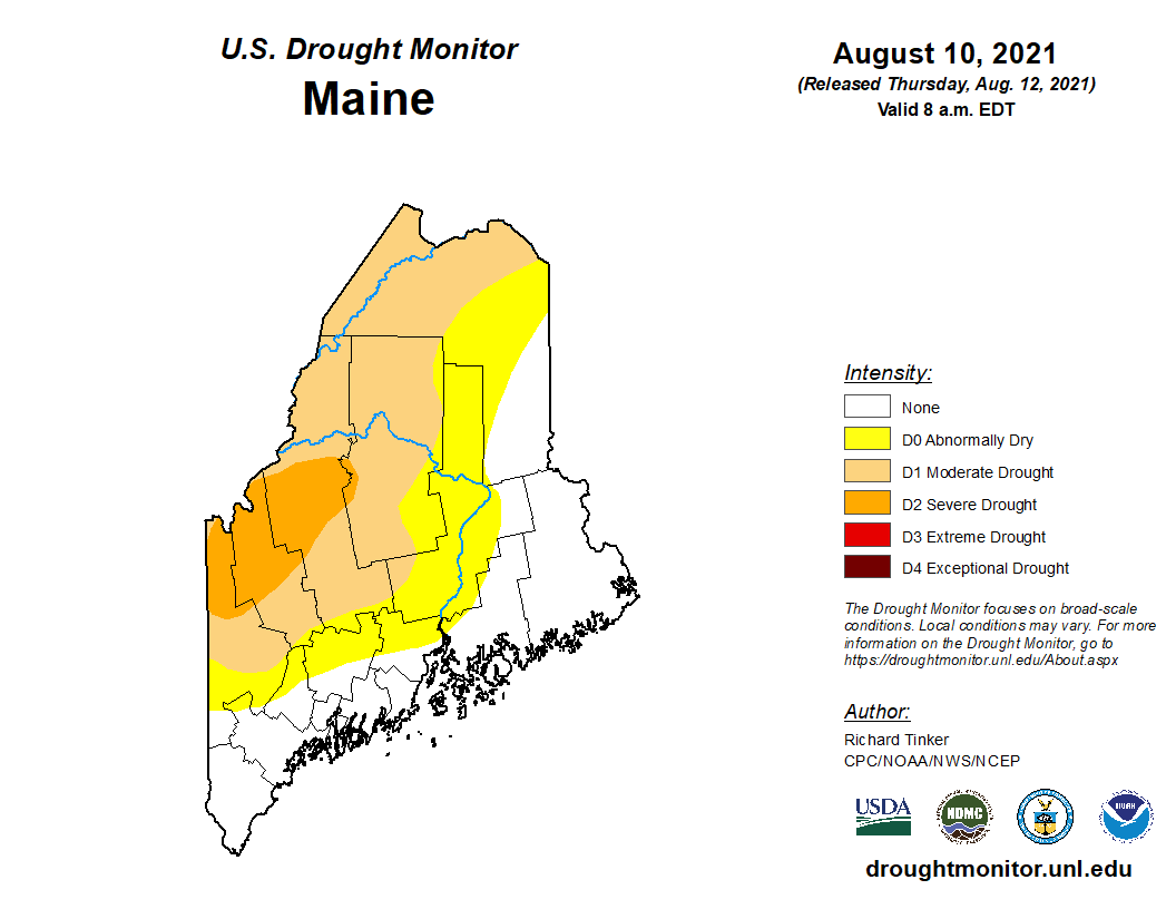 The latest Drought Monitor update displays varying levels of drought throughout the state. The coastal region of Maine is not experiencing any form of drought likely as a result of the plentiful amounts of rain seen there in July which erased any long term rainfall deficits. Many of the western and northern areas of the state are still experiencing drought. The worst drought in the state is currently in portions of Oxford, Franklin, and Somerset counties which are seeing severe drought as indicated by the dark orange color. There is a moderate drought for much of Aroostook County and for locations like Fryeburg, Clayton, and Allagash as indicated by the light orange color. The yellow shade indicates areas that are abnormally dry but not yet in a drought. 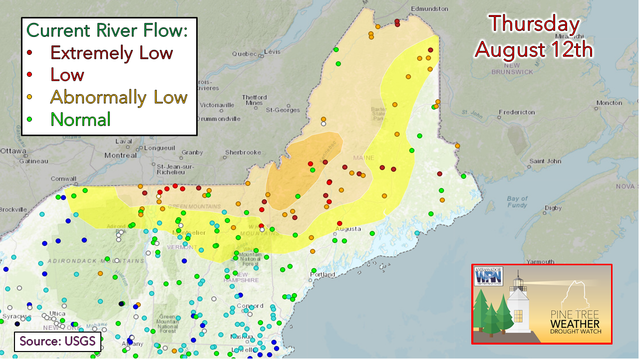 Because of the drought in the western and northern portions of the state, the river gauges there indicate low water levels as well as low water flow. This is indicated by the red and dark red dots on the map. 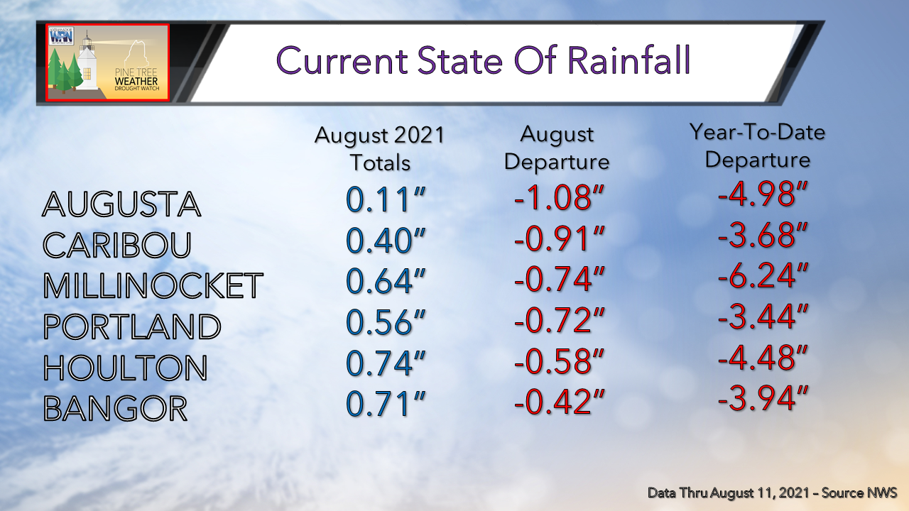 August is off to a dry start across much of the state with all locations seeing rainfall deficits for the month of almost an inch. In addition, all locations are still 3-6" below normal for the year which is not helping to alleviate the long term drought situation in the western half of the state. 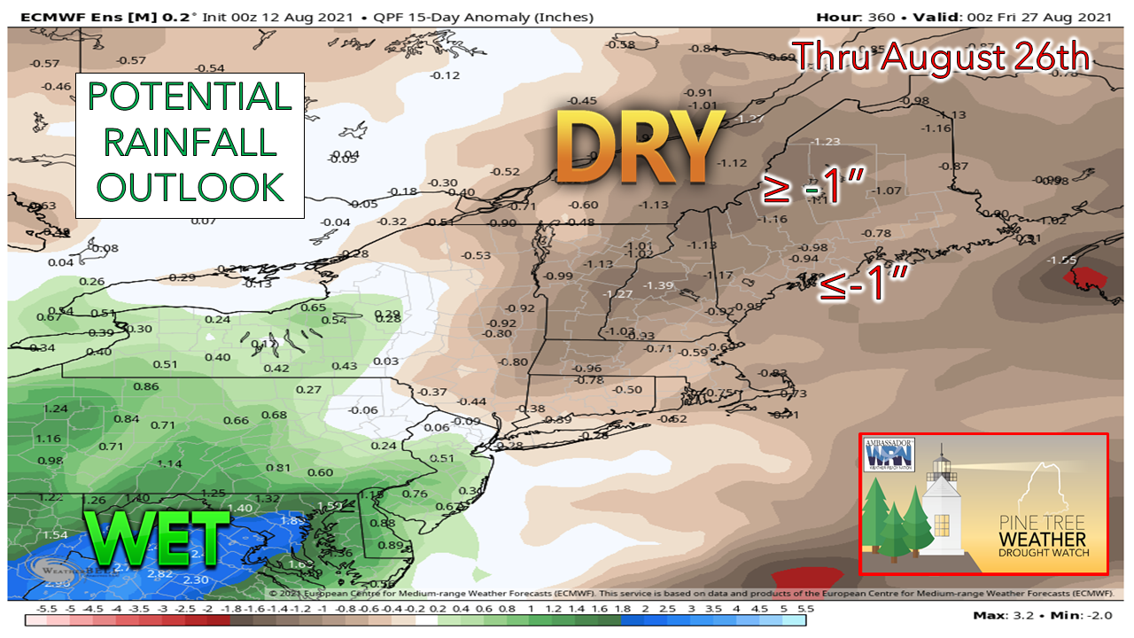 There is likely to be little in the way of drought relief over the next several weeks due to a lack of precipitation chances. This will only exacerbate the drought situation across western Maine. Are you having issues with your well water? Please click here to report your dry well to the Maine Emergency Management Agency. It is completely anonymous, and the information is invaluable to better understand the impacts being felt my Mainers. Drought Climate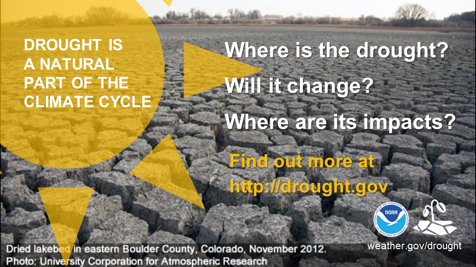 Drought is a normal feature of our climate. Caused by a deficit of rain or snow over an extended period, it can happen nearly everywhere. In some cases, drought can develop relatively quickly and last only for a very short period of time, exacerbated by extreme heat and/or wind. For other cases, drought can span multiple years or even decades. Where is the drought? Will it change? What are its impacts? Find answers to these questions at drought.gov Temperature outlook into late AugustThe plots below show the projected daily high/low temperatures for Carrabassett, Bangor, Caribou, and Portland over the next week and a half. After temperatures Friday that will be 10-15+ degrees above average once again, our temperatures will likely drop to more seasonable levels for the weekend. We will likely still be a few degrees above normal as we will be under the influence of a ridge in eastern Canada as well as the Bermuda High as we head into the middle and latter parts of next week. 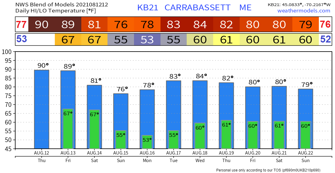 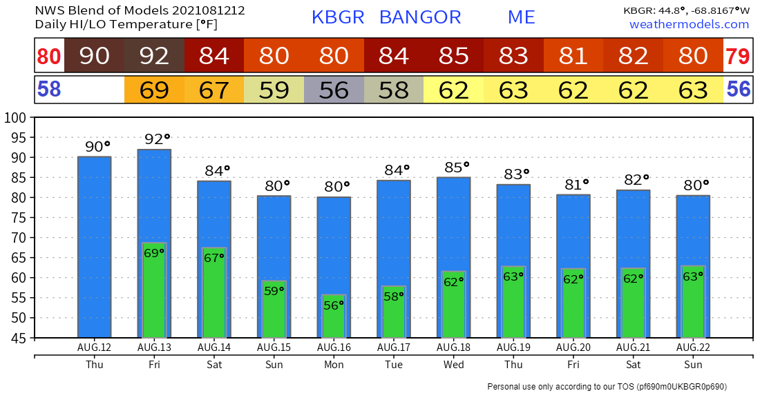 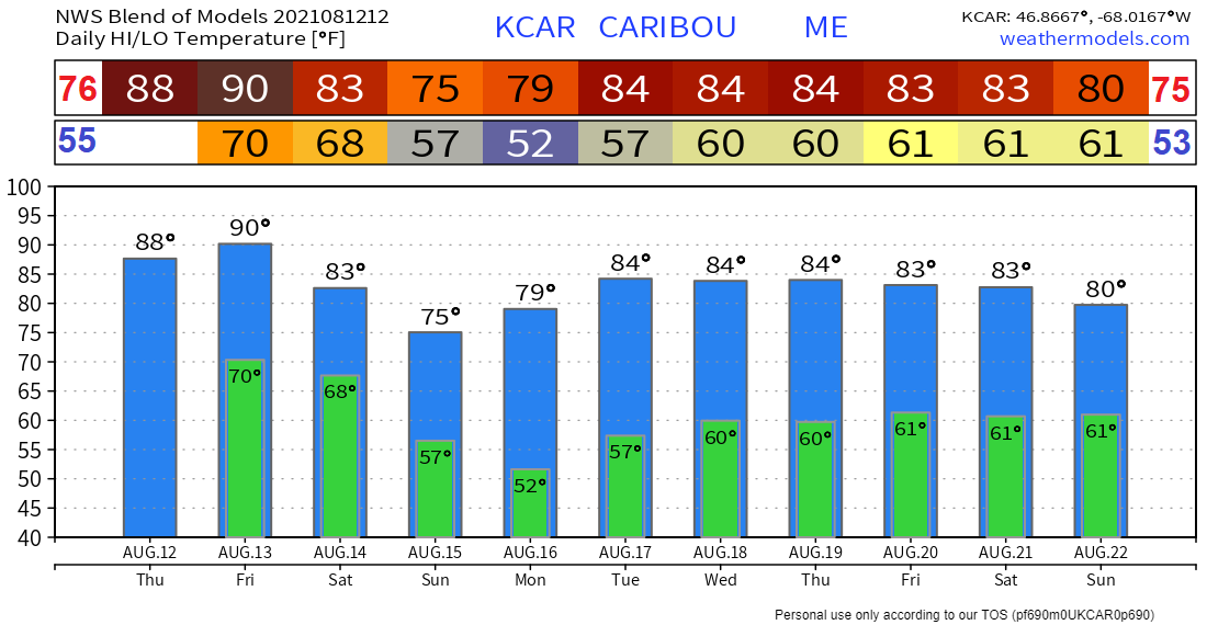 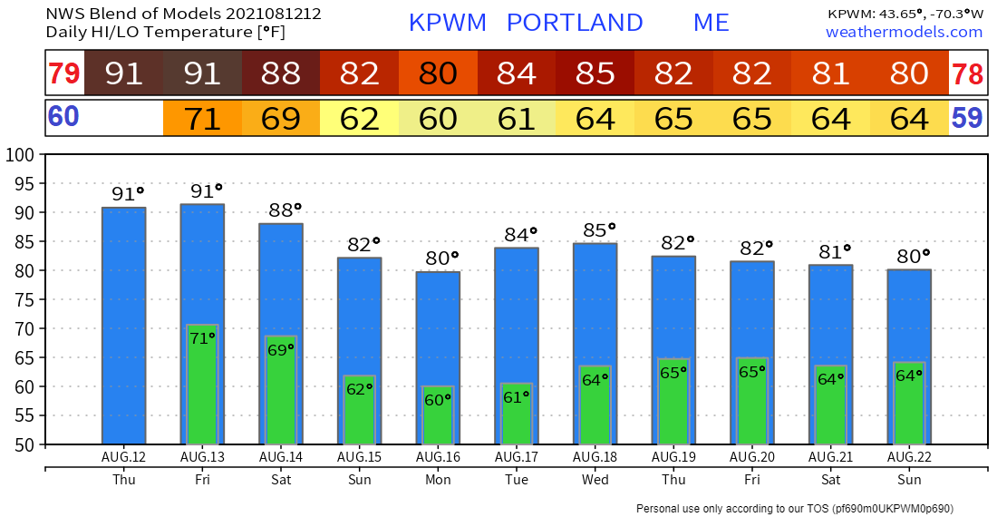 Be prepared to receive alerts and stay updated!
For more information in between posts, please follow Pine Tree Weather on Facebook and Twitter.
Thank you for supporting this community-based weather information source which operates by reader supported financial contributions. Stay updated, stay on alert, and stay safe! |

Mike Haggett
|