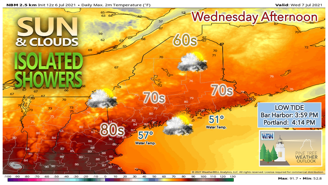
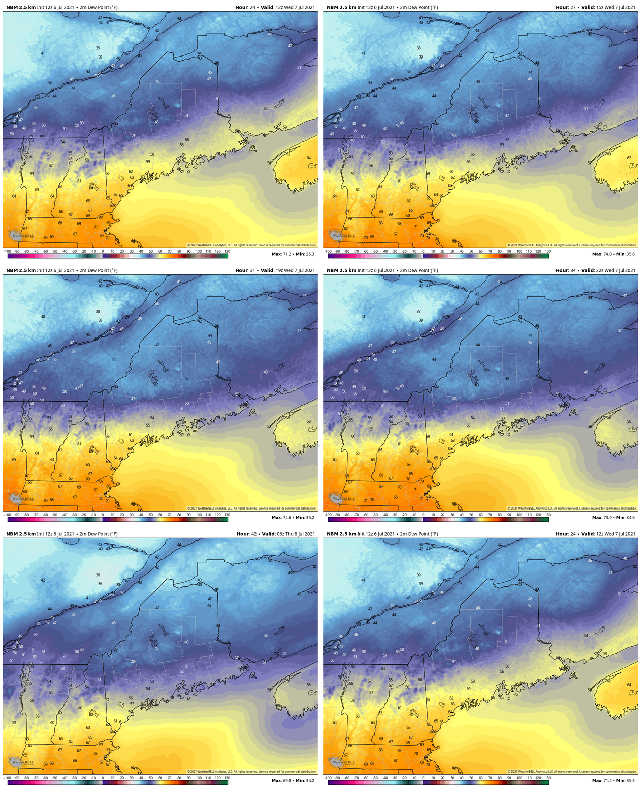
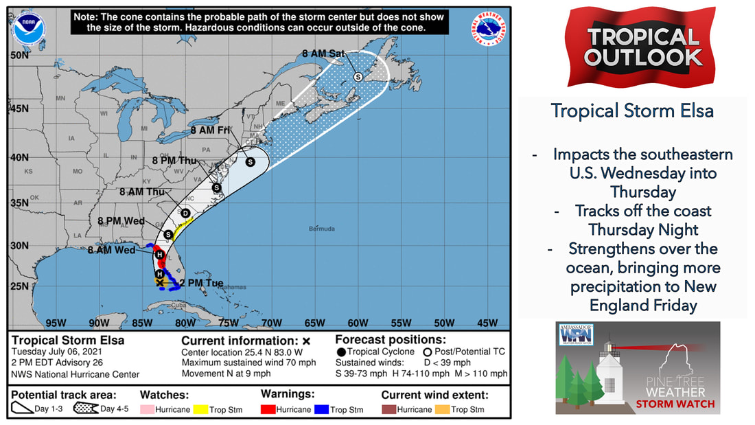
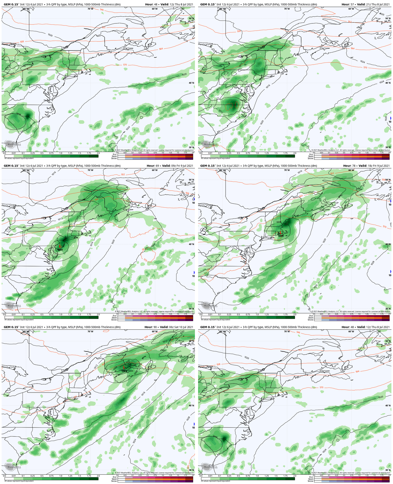
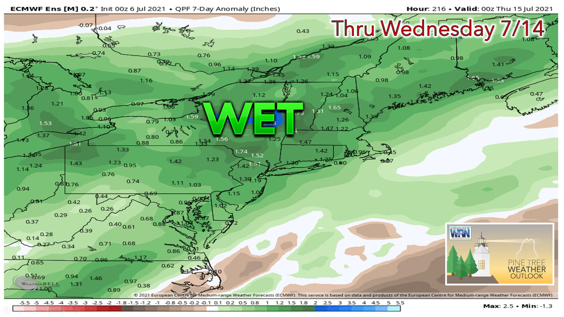
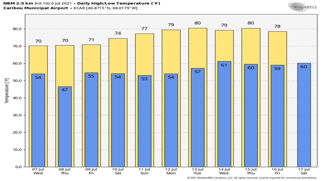
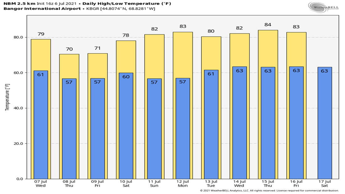
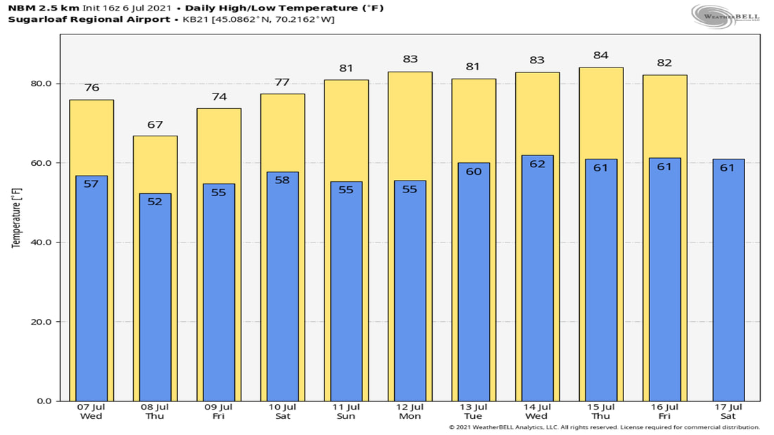
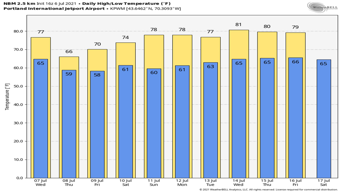
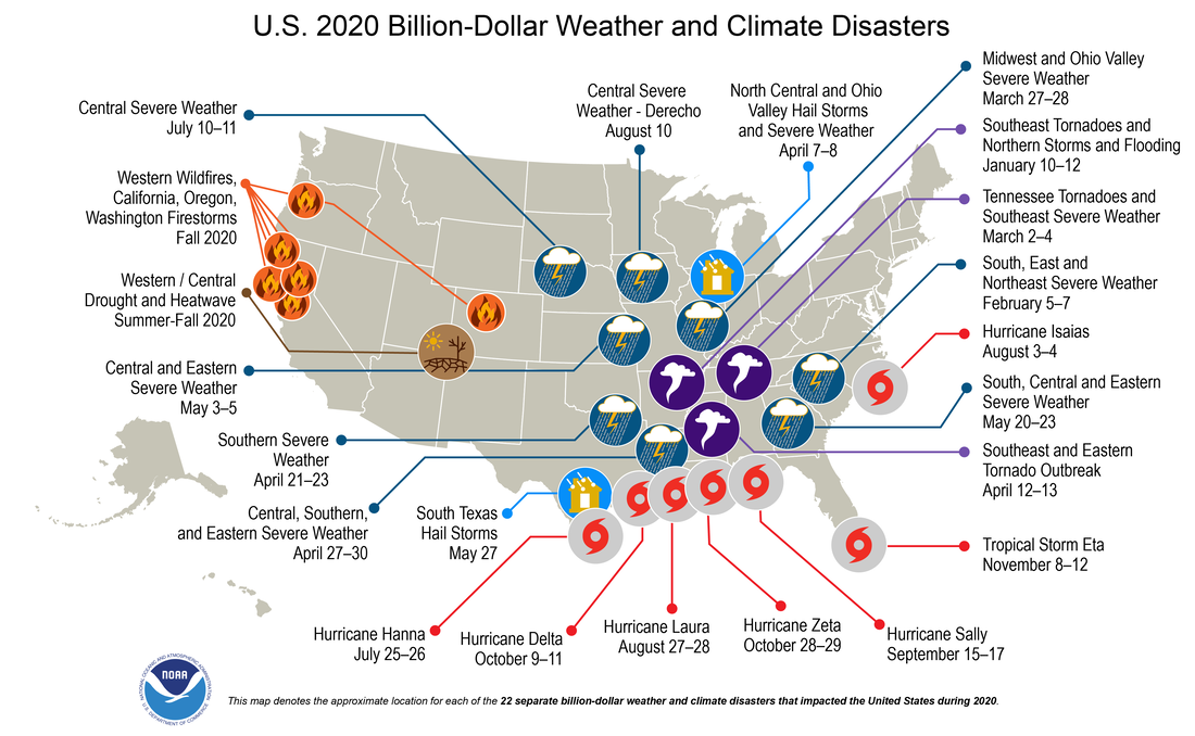
Seasonable temperatures expected WednesdayA mixture of sun and clouds is likely on Wednesday as a cold front stalls just off the coast. The front tries to lift back north during the day on Thursday as a low-pressure system rides up along the front bringing rain to the region by the latter half of the week. A cold front that passes through the area Tuesday night into Wednesday likely lingers off the coast during the day Wednesday. This allows the clouds to linger in southern and coastal parts of the state. The further north you head in the state during the day Wednesday, the more sunshine you are likely to see. High temperatures Wednesday will likely climb into the 70s for much of the state, with upper 60s expected in places furthest north, to lower 80s in southwestern Maine where they hang onto the humidity during the day. Dew points likely continue to drop during the day Wednesday, with much of the state feeling the relief from the humidity by the dinner hour on Wednesday. The southern part of the state, mainly York and Cumberland counties will continue to hang on to the humidity on Wednesday, with dew points there expected to remain in the lower to mid 60s through the afternoon. It's not until the overnight Wednesday into Thursday that dew points in those locations finally drop back into the upper 50s. The best chance of seeing any isolated showers during the day Wednesday will likely be where dew points remain high through the afternoon and evening. This places the southern tip of the state in the best chance of seeing any showers or rumbles of thunder during the afternoon Wednesday. Tropical Storm ElsaTropical Storm Elsa continues to batter the western half of Florida with heavy rain. As it begins to make its way north and east during the day on Wednesday, it's expected to make landfall during the morning hours on Wednesday. It likely continues to weaken to a tropical depression by the time it gets to the Carolina's by Thursday morning, however it appears to strengthen once again when it gets back out over open water. By the time we get to Friday, the storm looks to be off the coast of southern New England, with a projected path continuing to bring it northeast, this will help to influence our weather heading into the latter half of the week. Cooler and damp conditions by late weekThe cold front that stalled off the coast Wednesday will try to lift back to the north as a warm front on Thursday, this will likely result in more clouds overspreading the area during the day on Thursday. A low pressure system to our west will likely ride up along the front during the afternoon and evening hours Thursday, bringing with it widespread showers to the area. As the remnants of Elsa move up and along the coast, the rain associated with that system likely moves into the region during the daytime on Friday. This likely gives us another good soaking rain just before the weekend. 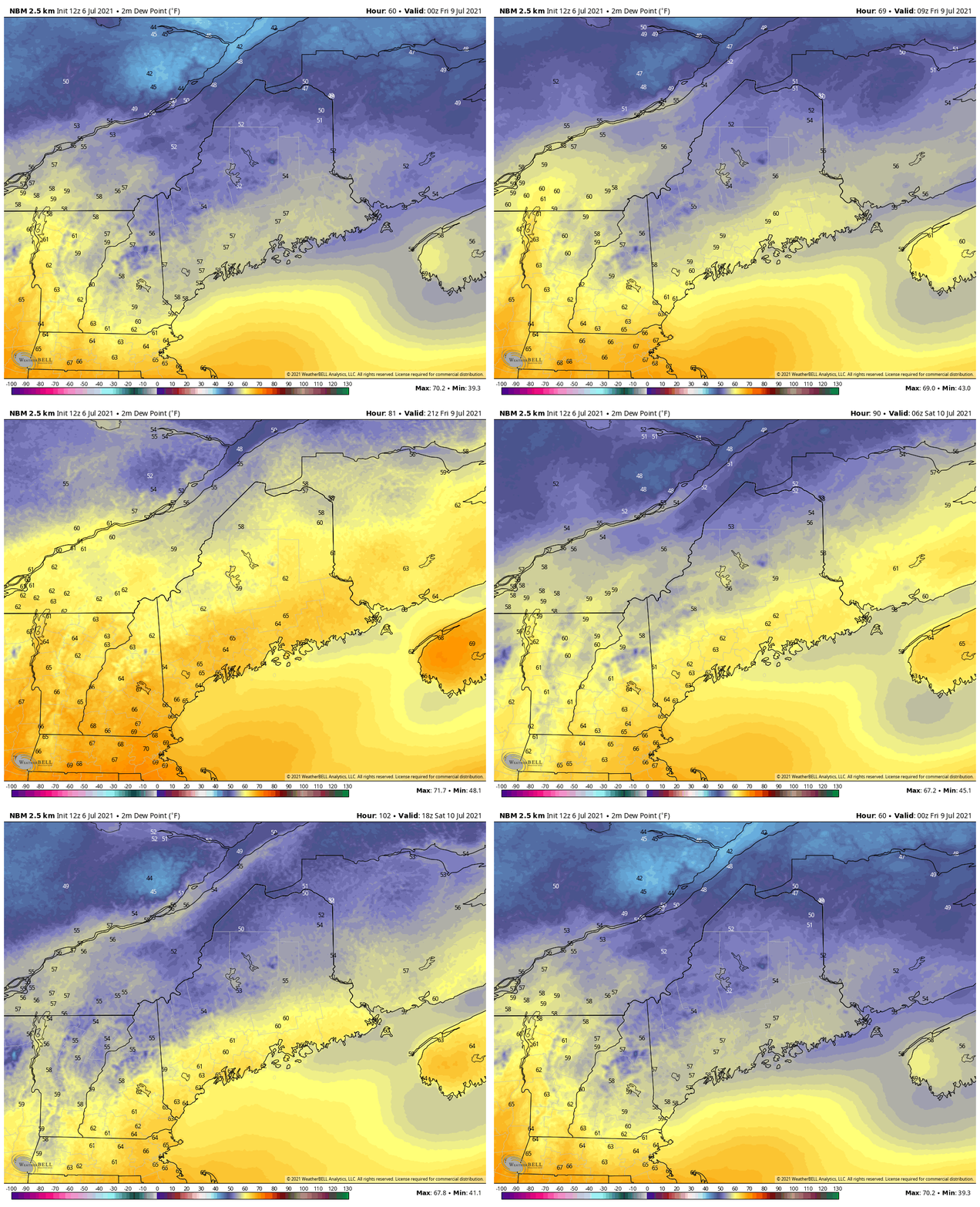 While dew points in the southern half of the state start to creep back up Thursday night, they won't climb back into the 70s, with most dew points topping out in the mid 60s on Friday. While this won't feel as nice as the air mass in place during the day on Thursday, it won't feel as humid heading into Friday as it has in previous humid stretches. Saturday sees the dew points fall back a few degrees, but it looks like dew points in the 60s will be sticking around, at least through early next week. Much needed rain on the wayThe good news with the moisture threat from Elsa, is that it will help to put a dent in our drought. Most places across the state are still dealing with very dry conditions, so any rain at this point is very beneficial. While the main rain threat through next Wednesday remains the precipitation we see Thursday and Friday, the chance remains for scattered showers on Saturday, with more clearing likely by Sunday. Temperature outlook through next SaturdayAlthough most places see a cooldown for Thursday and Friday, temperatures remain closer to average heading through the rest of the forecast stretch. By the time we get into early next week, high temperatures are expected to climb into the upper 70s and lower 80s, whereas low temperatures likely fall back into the upper 50s and lower 60s. Billion-Dollar Weather Events: 2020In 2020, there were 22 weather/climate disaster events with losses exceeding $1 billion each to affect the United States. These events included 1 drought event, 13 severe storm events, 7 tropical cyclone events, and 1 wildfire event. Overall, these events resulted in the deaths of 262 people and had significant economic effects on the areas impacted. The 1980–2020 annual average is 7.0 events (CPI-adjusted); the annual average for the most recent 5 years (2016–2020) is 16.2 events (CPI-adjusted). ncdc.noaa.gov/billions/ Be prepared to receive alerts and stay updated!
For more information in between posts, please follow Pine Tree Weather on Facebook and Twitter.
Thank you for supporting this community-based weather information source which operates by reader supported financial contributions. Stay updated, stay on alert, and stay safe! |
Mike Haggett
|

