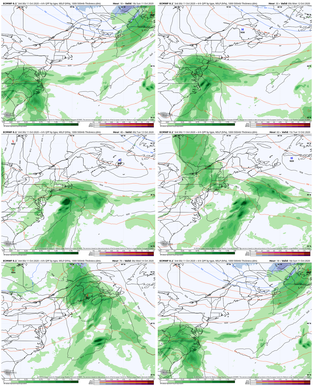
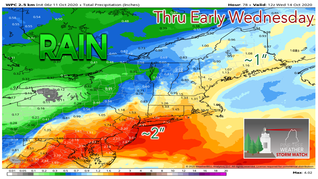
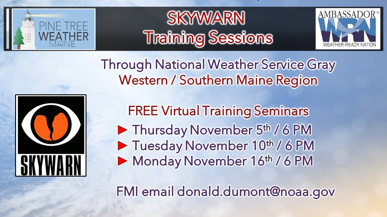
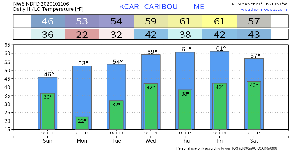
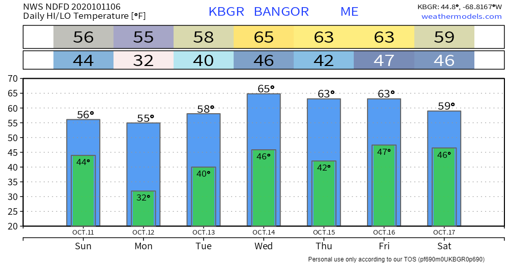
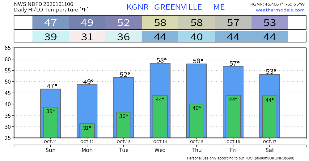
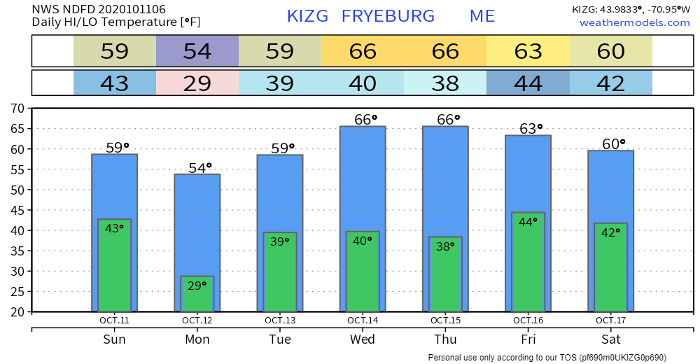
Not a drought buster, but it helpsHigh pressure takes control of our weather for Sunday and Monday. By doing so, it keeps the bulk of the remnant moisture from Delta to the south at the onset on Monday. As high pressure moves eastward, a cold front moves in from the west. Low pressure forms along the boundary and passes through the region on Tuesday into early Wednesday. Rain develops from southwest to northeast, entering the state in time for the morning commute Tuesday for southern and western areas, then overspreads into northern and eastern areas by early afternoon. Showers taper south and west Tuesday afternoon, and end over northern and eastern areas Tuesday night into the wee hours of Wednesday. The rain forecast from the Weather Prediction Center indicates roughly 1" of rain is expected statewide, with higher amounts possible for the coastal plain on up into the central highlands. Looking over operational models and ensemble ideas, this is roughly the happy medium of the group, and a fair appraisal at this point on what to expect. Winter SKYWARN Virtual Spotter Training in NovemberFor those in Oxford, Franklin, Somerset, Kennebec, Lincoln, Knox, Waldo, Sagadahoc, Androscoggin, Cumberland and York Counties, here's your opportunity to get involved with the weather community. Have you ever wondered where TV meteorologists get their storm reports? They get some from their fans, but many of the reports come from SKYWARN spotters that pass along that information to the National Weather Service, which is then shared with the media. Learn how to properly measure snow to improve forecast verification. Report different accumulation types, weather damage reports, and other important information. I know a few of you went through spring training for severe weather. This is the other half to complete your training. There is no cost to do this session, and no equipment to buy. All you need is your eyes and a way to pass along a report. This is a fun way to get your kids involved, also. I've trained my family to be on the lookout for storm damage, and to check snowfall accumulations. If you are interested in training for either of the above dates, please email Donald Dumont at the National Weather Service Gray office at [email protected] and tell him Mike at Pine Tree Weather sent you. He'll send you the Go To Webinar link to register for the time that works for you. No matter where you are, your reports are invaluable and helpful to the future of forecasting! Your financial support of Pine Tree Weather is needed!It's hard to believe but I am about to start my 9th year of my public weather forecasting journey in January. A solid core of 1500 of you joined me when I started Western Maine Weather in 2012, and continue to encourage and support what I do here as I went statewide in 2016 through the Bangor Daily News, and started this site after the October Gale in 2017. For years I funded this pursuit out of my own pocket, which isn't cheap. I spent over $10,000 of my own money for the data needed to forecast the right way. It came to the point where it was going to sink or swim, and I asked for financial help from followers like you to support it. Over 80 of you responded the first year, and a few more did last year. I know we are in the midst of a pandemic, and budgets for many are razor thin, if not running a deficit. For those that can, I would appreciate a few dollars to keep this going. I continue to do this because of the financial support of those who chip in for it. As long as my bills are paid, I have no problem continuing. I'd rather not go subscription based, and want to keep it public. You can VENMO me @PineTreeWeather, donate a few bucks per month through Patreon, or you can message me on Facebook or Twitter to send me a check. For those who have sent checks in the past, my address in Kennebunk remains the same. If you can't donate, I would appreciate shares of my work through social media so I can reach more people. Tell your friends about what I do. Mainers know that the best sales pitch is from word of mouth, rather than some flashy ad. Thank you for your encouragement, your interactions and support. It makes getting up at 2 AM in winter to forecast a snow event worth it. I love what I do, but I need you to help me out anyway you can. Temperature outlook through SaturdayAfter a below normal temperatures through Tuesday, the mercury rises above normal as we head into midweek. The thermometer modifies to near normal temperatures by next weekend. Our next chance for rain appears at this point to be Friday into Saturday. Why have a NOAA Weather Radio?It's important to have multiple ways of receiving life-saving weather warnings and NOAA Weather Radio is one great option. The program includes 1025 transmitters, covering all 50 states, coastal waters, Puerto Rico, the US Virgin Islands, & US Pacific Territories. For more information ► nws.noaa.gov/nwr/ Be prepared to receive alerts and stay updated!
For more information, please follow Pine Tree Weather on Facebook and Twitter.
** FUNDING NEEDED FOR 2021 ** Thank you for supporting this community based weather information source that is funded by your financial contributions. Stay updated, stay on alert, and stay safe! - Mike |
Mike Haggett
|

