|
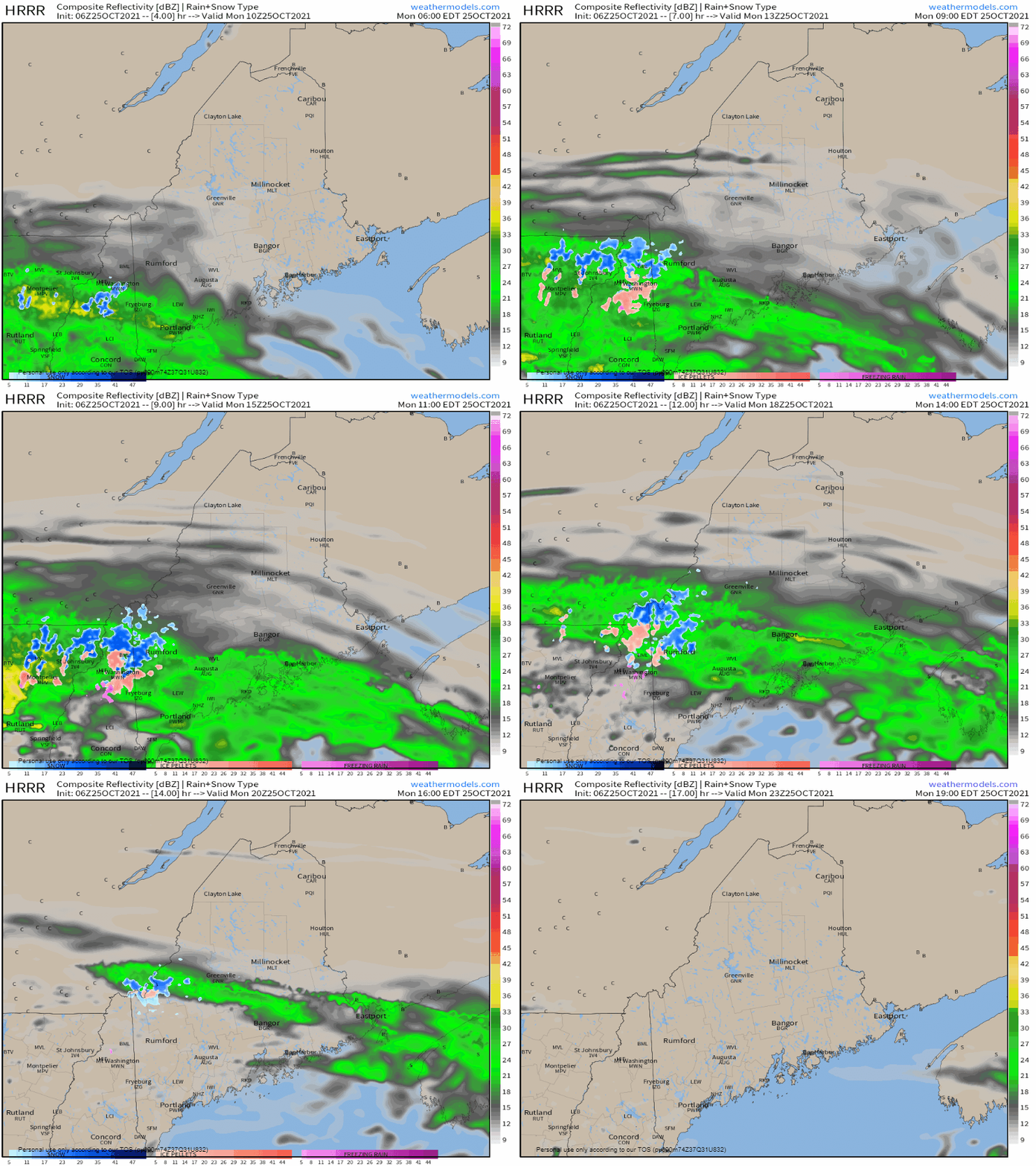
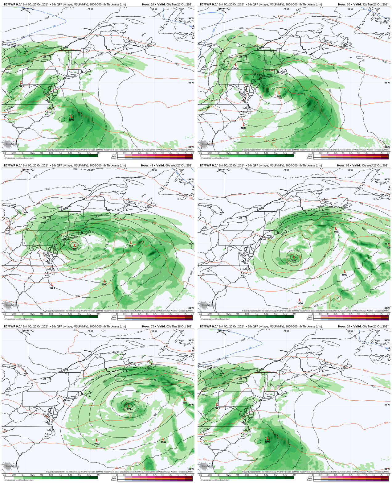
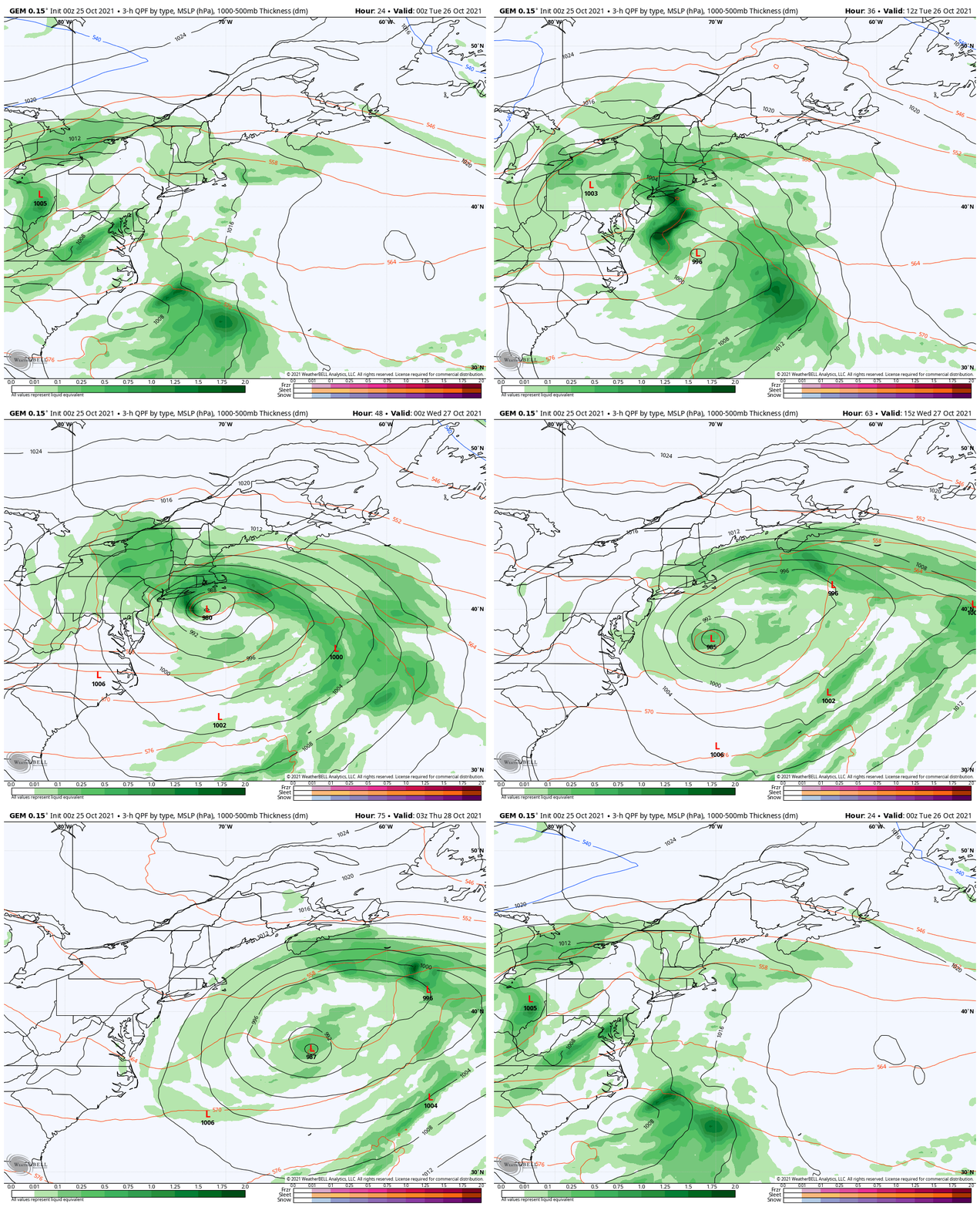
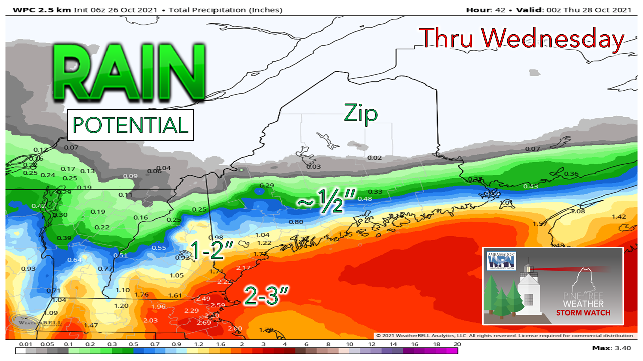
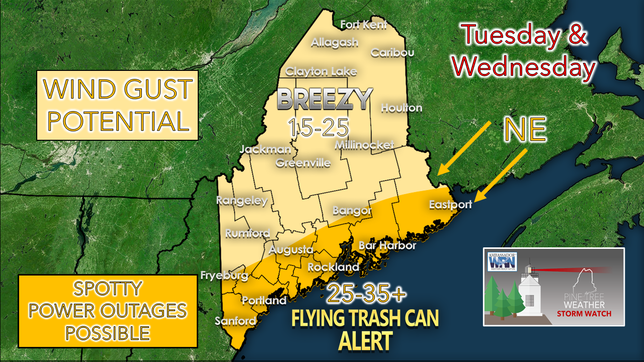
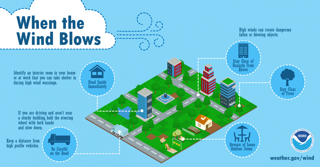
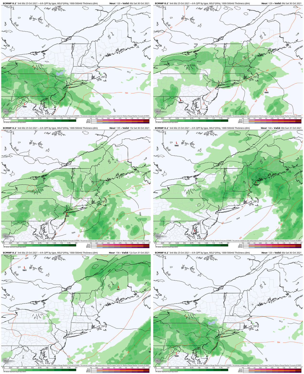
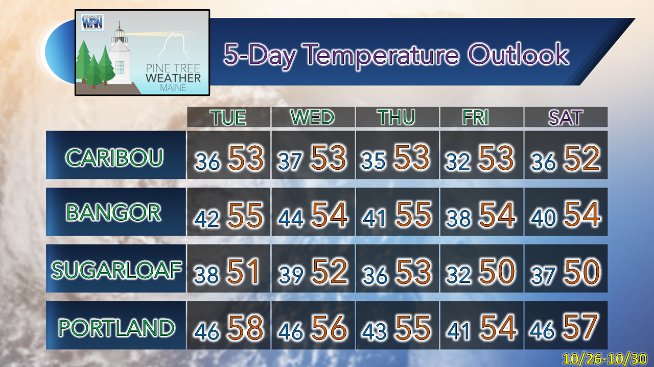
While weather forecasting is a day-by-day affair, there are times where that is truly the case when it comes to complicated storms. Retrograding areas of low pressure with cold air aloft over warm oceans have an element of surprise to them, and this is what we are dealing with here. Add and injection of tropical moisture, a blocking pattern, and all of it adds to the mystery. Coastal areas are likely to see the most impacts, and York County is likely to be the jackpot area of rainfall and high wind speeds as of early Monday morning. This is a forecast you want to keep updated on the further south you are located. Light shower activity for MondayMonday 6 AM - 7 PM: A warm front brings shower activity for all but northern areas for the day. The western hilltops higher than 2500 feet have a chance to see some measurable snow, with a risk of spotty freezing rain or sleet. It could be large flakes and sticky snow where it falls. It will be a cool, raw day as highs will be in the 40s for most, and the northeast wind picks up heading into the afternoon into the evening. The first round of precipitation shuts off around noon for southern areas, and by mid to late afternoon for western and eastern areas. Coastal areas to see impacts Tuesday & WednesdayGiven the uncertainty that continues to affect the forecast, I am going to present two possible scenarios in how this storm could play out and the impacts each could create. As I said in the open, retrograding areas low pressure have an element of surprise, and it is important to relay on potential in order to prepare accordingly. European Monday 8 PM - Thursday 8 AM: The idea here is the strongest storm, longest in duration and consequently the most impactful of the two. This "worst-case" scenario shows the storm rapidly developing over the Atlantic, upper-level blocking tracks the storm to the northwest south of Long Island by Tuesday afternoon, then drifts south Tuesday night before moving east on Wednesday. Rain and gusty wind persists well into Wednesday. For impacts, 2-4" of rainfall for southern areas which could bring some minor flooding and wind gusts 35-45 mph are possible, which may cause some power outages. Canadian Monday 8 PM - Thursday 8 AM: The suggestion here is the ocean low forms and retrogrades south of Rhode Island by Tuesday afternoon and is not nearly as strong with intensity. As the storm drifts to the south, precipitation tapers off early on Wednesday. Consequently, the impacts are less, with 1-3" of rainfall for southern areas and wind gusts peaking in the 30-mph range. The rain forecast from the Weather Prediction Center takes into consideration both scenarios. The flood risk is dependent on velocity of heavy rainfall. Given the dry month that it has been, there is plenty of room to absorb the accumulation on the way. Downpours may cause localized street flooding from clogged drains due to leaf drop, and may cause standing water on roadways. The intensity of the storm and position of the low will be imperative of how strong the wind speeds range. At the very least, the shorelines and islands will see the highest wind speeds. gale watch is in effect for the ocean, with potential wind gusts to 50 mph Tuesday afternoon into the evening. Seas in the 9-13 foot range may cause some minor beach erosion and splash-over in susceptible areas. Tides are at their low point in the astronomical cycle, and flooding is not of big concern. When the Wind BlowsHigh winds can be dangerous! If possible, stay inside. When driving, slow down, keep both hands on the wheel, and keep away from high profile vehicles. Be aware of loose outdoor items and stay clear of trees. Visit weather.gov/wind for more information. Weekend storm remains a possibilityFriday 8 PM - Sunday 8 PM: The rain received from the storm early in the week may determine any flood threat later in the week. Saturday appears to be a washout at this point, and Halloween appears to be a breezy one. Expect updates on this as the week continues. Be prepared to receive alerts and stay updated!
For more information in between posts, please follow Pine Tree Weather on Facebook and Twitter.
Thank you for supporting this community-based weather information source which operates by reader supported financial contributions. Stay updated, stay on alert, and stay safe! - Mike |
Mike Haggett
|

