
The heat of summer My hope is everyone is prepared for the heat on the way. Although there is a slight modification to the forecast that I will discuss, it will get uncomfortable for many. Check in with your family, friends, neighbors and keep close watch on young children, our beloved senior citizens, and the pets. I suspect cooling centers will move into operation as we head into next week. The ocean and lakes are still on the chilly side, but this burst of heat will raise the water temperatures to more comfortable levels. Changes to the forecastThe pattern the northeast region has dealt with for much of the spring has been cold air lurking over eastern Canada. It has suppressed the heat in the south, which has put the region in a west to east zonal flow. The results have been generally dry conditions and cool to seasonable temperatures. Cold air works the same in summer as it does in winter. While not as cold, it does fool models a bit, and it's done so again as we head into the weekend. 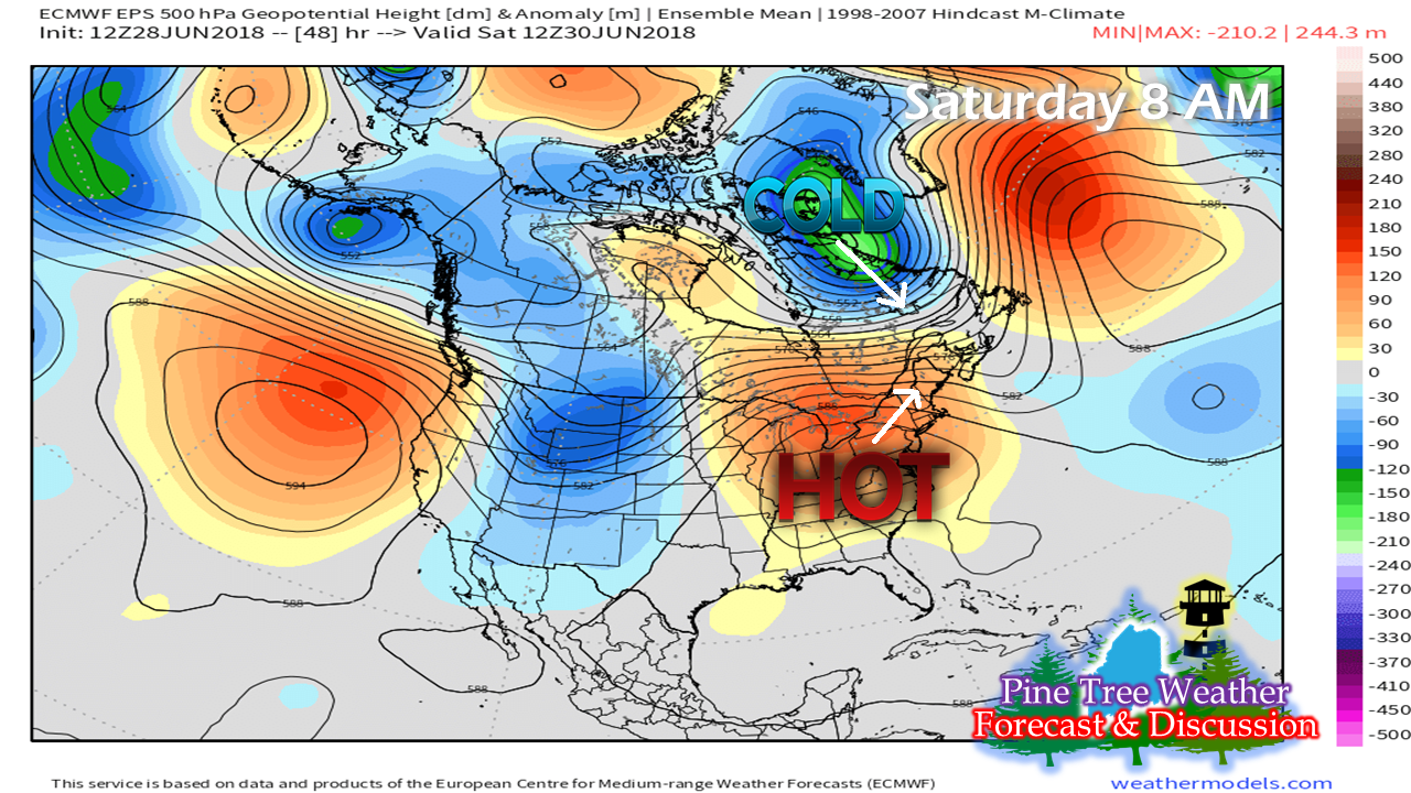 The blistering hot air over the southeast is trying to nose into the northeast, but it's running into a road block. Winter like cold near Greenland continues to spin around and is preventing it's advancement. I feel kind of foolish not to pick up on this sooner than I did. This is going to be a factor as we head into the weekend. 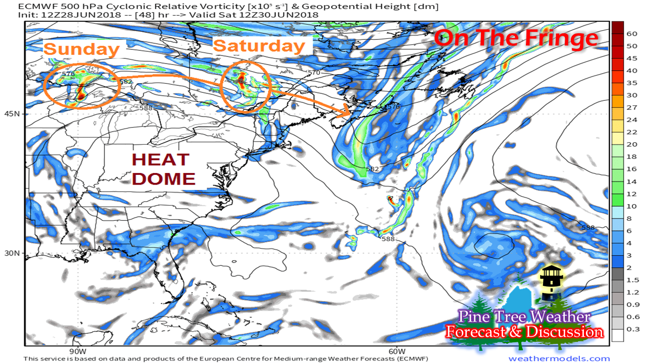 Essentially Maine ends up on the fringe of the heat dome. The cold to the north is strong enough to keep the heat to the south to start off the weekend. Since we're on the outer boundary, we'll have to deal with a couple of disturbances Saturday and Sunday that may bring some scattered showers and perhaps a thunderstorm to the north and mountains, and a few may impact eastern and southern areas. 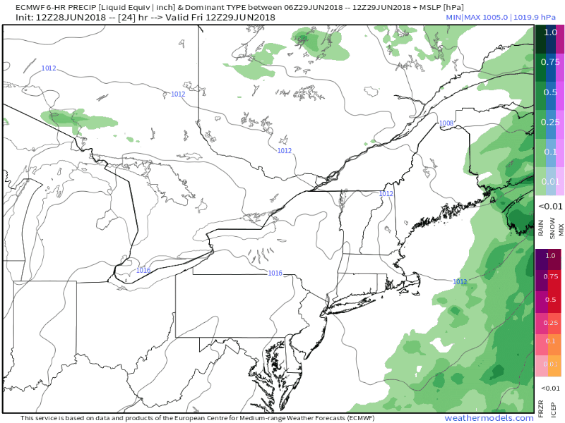 This European model idea shows the two disturbances working through the region. While it looks a bit on the rainy side, this isn't really going to amount to a whole lot. Another front approaches the state Tuesday which may bring a few scattered showers and perhaps a rumble to the north country, but it loses moisture as it heads for the coast. 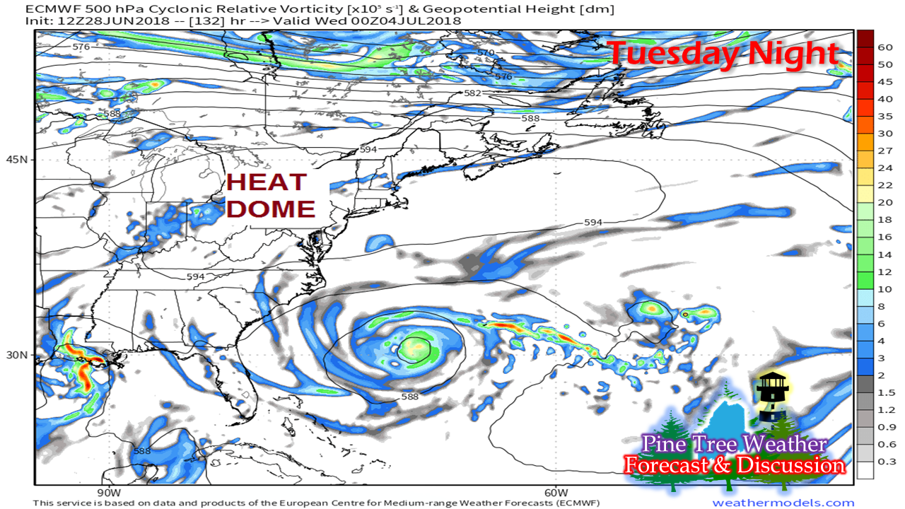 The heat arrives in earnest statewide by Tuesday night. The cold to the north retreats, the pattern flattens out, allowing the heat dome to move northeast and give us a hot Fourth of July holiday. Let's talk temperaturesI've mentioned the fact that coastal areas will be on the cooler side in my previous updates. I wanted to take a look at this a bit further. What I am presenting here are ensemble mean ideas from the European model. This does not include the heat index. This is also for discussion purposes only. Let's take a look at the southwest coast, first/ 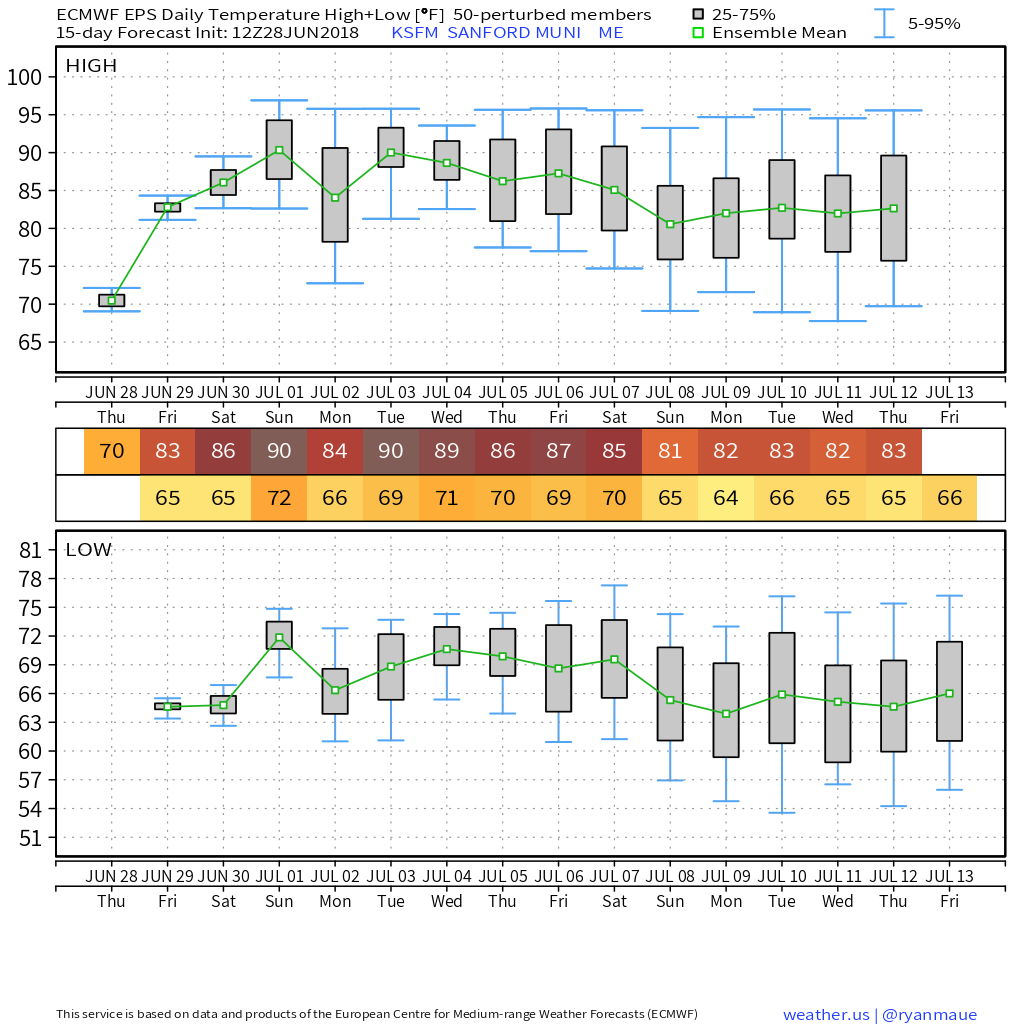 Sanford tends to be one of the hot spots in the state when we get these kind of warm ups, and this one is no different. The mean temperature appears to hover around the 90° mark, and with the humidity, it will likely push triple digits. Go 20 miles east, we find a different story... 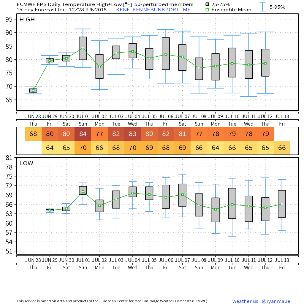 In Kennebunkport, the coast is cooler thanks to the ocean temperatures in the 50s and the influence of an onshore wind flow. Time will tell, but I think these temperatures are bit overdone. Clouds from a disturbance passing through on Sunday may cut these temperatures down also. Now, we'll head up the coast... 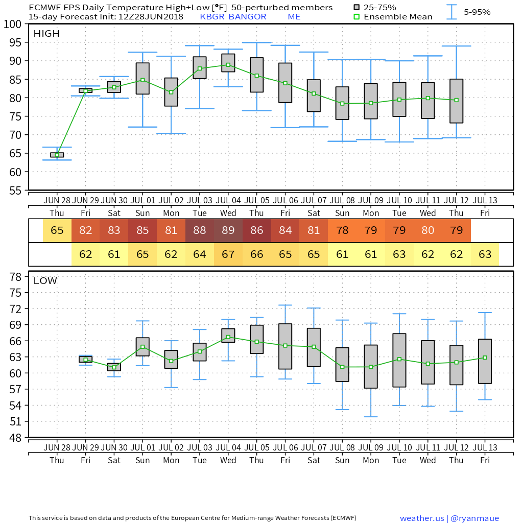 Bangor shows the real heat not arriving until midweek. Regardless, it will be plenty uncomfortable with the humidity elevated. South of there in Trenton... 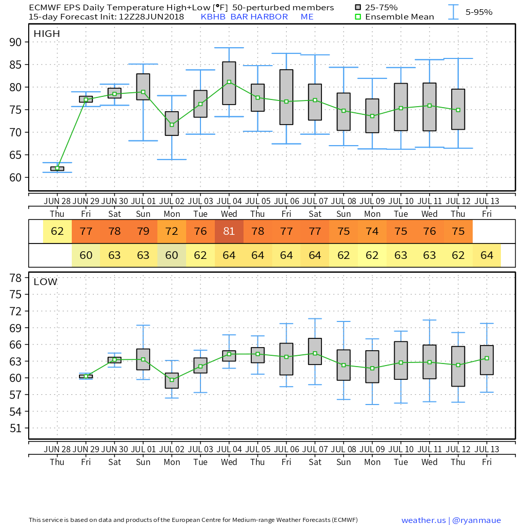 Outside of it being on the sticky side, temperatures appear to be much cooler than the city to the north. The place to be if you want to escape the heat all together... 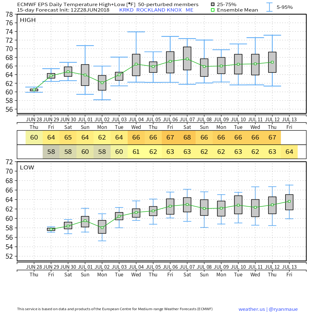 Rockland. Now I understand there is a discrepancy between the airport where this idea comes from and downtown, but the islands along the MidCoast will be the coolest of anywhere in the state due to the onshore air flow over the next several days. Final area to look at, Greenville... 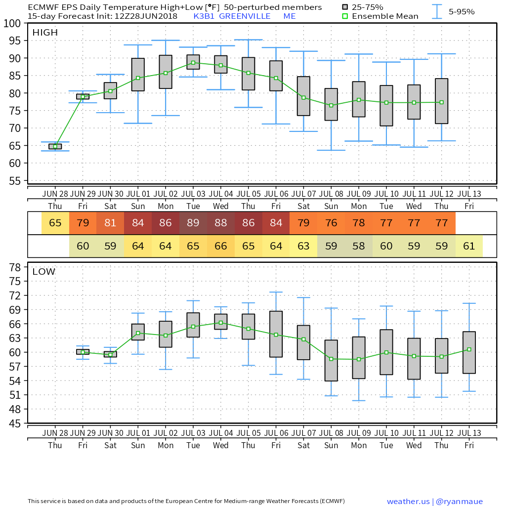 While it will take a couple of days for the heat to build into Moosehead country, it will certainly be a bit toasty for a few days. To tie all of this together, ensemble ideas are not without their own errors. Some areas could be warmer, others cooler, pending on the day, cloud cover and wind pattern. Also note that the state becomes cooler after the Fourth heading into the following weekend. The mountains and north will see some drier air work in which will bring more comfortable sleeping conditions next weekend. With lows in the 60s and dew points right around the same temperature point, it will be sticky at night for most areas in the foreseeable future. Regional outlook through Tuesday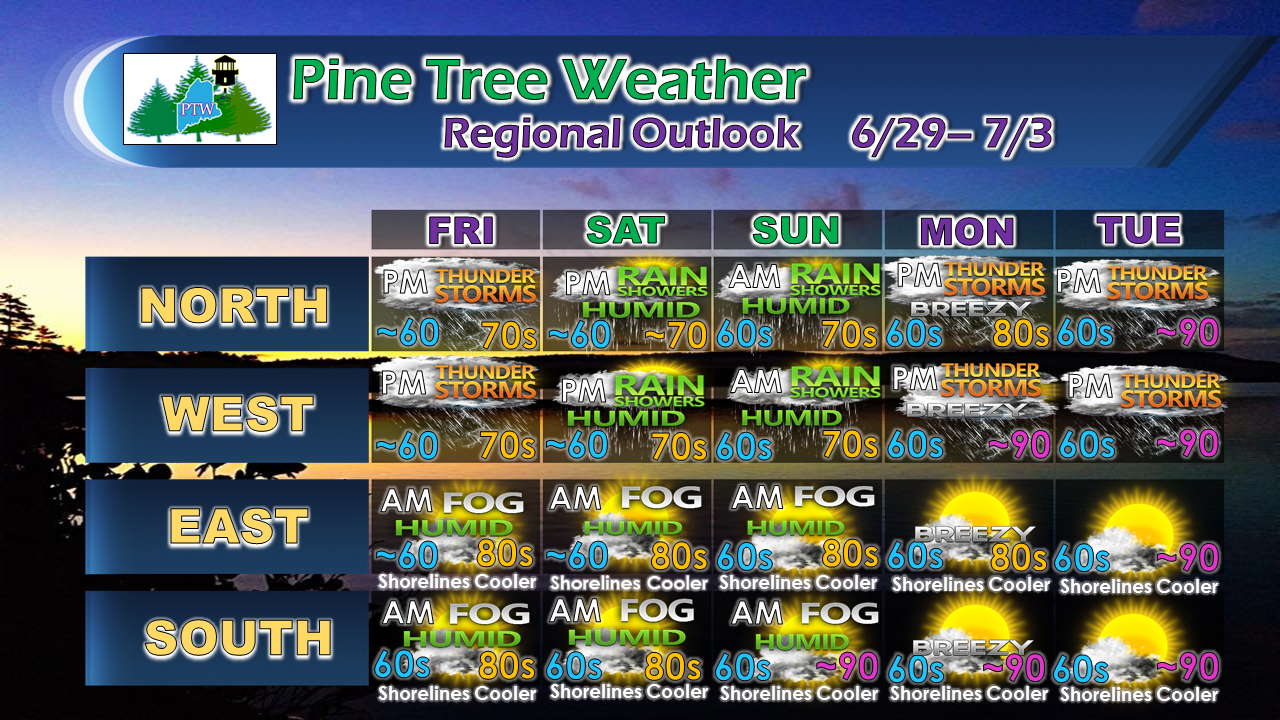 Each day brings the risk of a shower or thunderstorm to all areas of the state, but the north country has a better chance. Temperatures reflected do not include the heat index, so it could be warmer pending on the amount of sun. By Tuesday, the state appears to be roasting from the south north to the Crown.
Stay in touch with the National Weather Service in Caribou for eastern and northern Maine, and Gray for western and southern areas for the latest forecast, bulletins, and advisories. Given my schedule, I do not plan on issuing another full update until Monday. Have a great weekend, and thank you for your support! - Mike |

Mike Haggett
|


