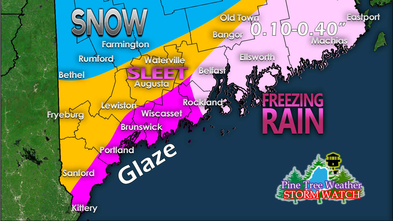
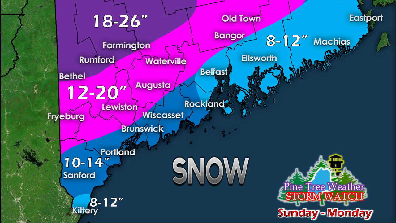
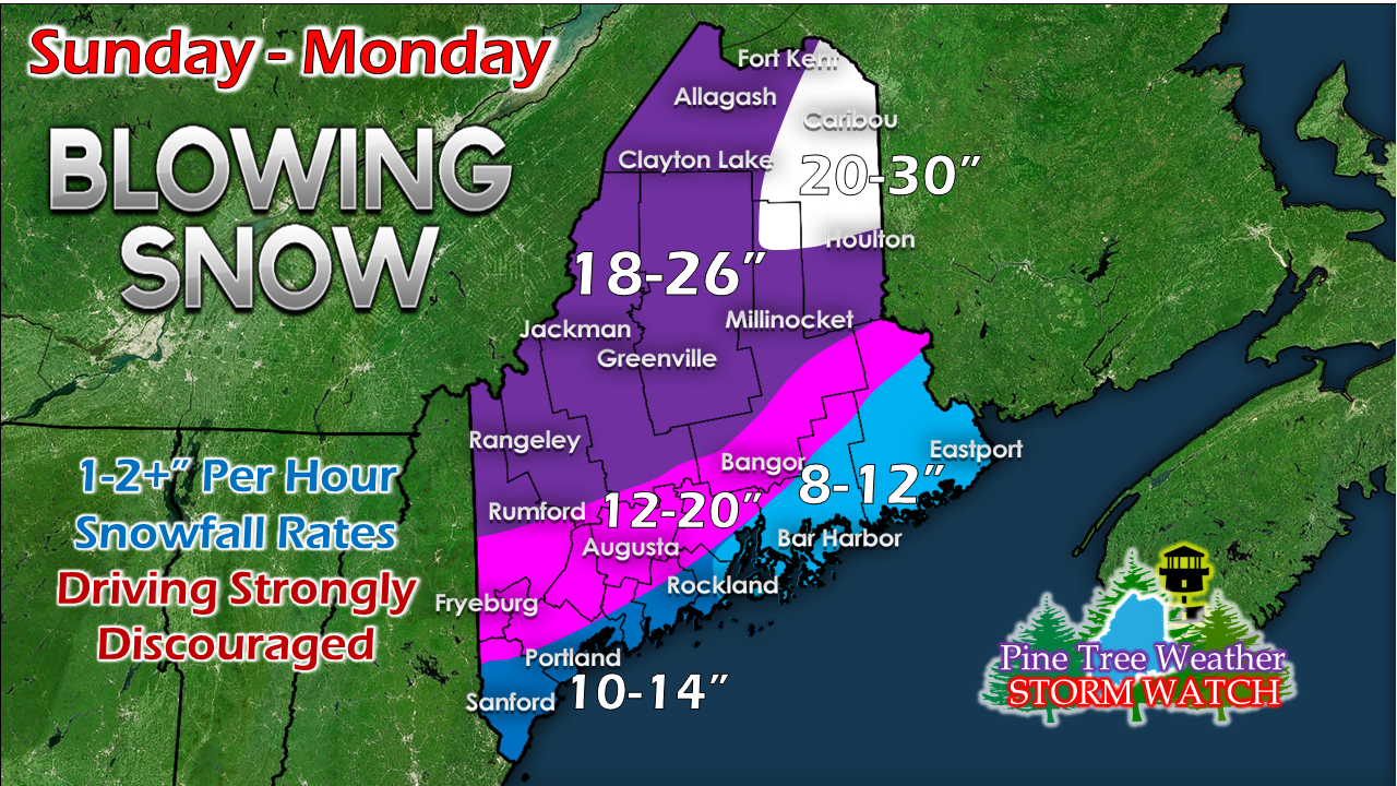
Coastal front to have impactsProjected forecast track has shifted more to the west, so some additional tweaking has been done to the potential outcome. Keep in mind that this comes AFTER the initial drop of snow, so this will on top of what comes. There could be a decent crust of ice over for the Penobscot Bay region over into DownEast areas, with the Greater Bangor region included with that. With addition of ice and concern for wind Sunday afternoon, power outages could be an issue where ice accumulates in DownEast areas. The snow is still relatively dry in nature, and should not cling to trees and power lines all that much. Adjustments to snowfall ideaA zoom in on the southern half of the state here to show the changes. The tail end of York County and the Penobscot Bay / DownEast regions have been adjusted downward slightly. Portland area should still think of a foot of snow, with sleet and freezing rain on top of that. Also understand there will be more snow on the backside of this after the storm passes to the northeast. This is still a two day event! The jackpot region has now shifted northward into northeastern Aroostook County. Ski hills in western areas could push 30" by the time this is over.
Could there still be changes? Absolutely. There is always the element of surprise in major events. Timing is still on track as well as coastal flood concerns posted in the update here earlier today. More updates coming. Stay Tuned! ► ► For the latest official forecasts, bulletins and advisories, please check in with the National Weather Service in Gray for western and southern areas, or Caribou for northern and eastern parts of Maine. For more information from me, please follow the Pine Tree Weather Facebook page and my Twitter feed. ► Your financial donations are much appreciated to keep this site funded and for further development. I sincerely appreciate your support not only financially, but also in sharing my efforts with others. Always stay weather aware! - Mike |
Mike Haggett
|


