
Flood watch in effect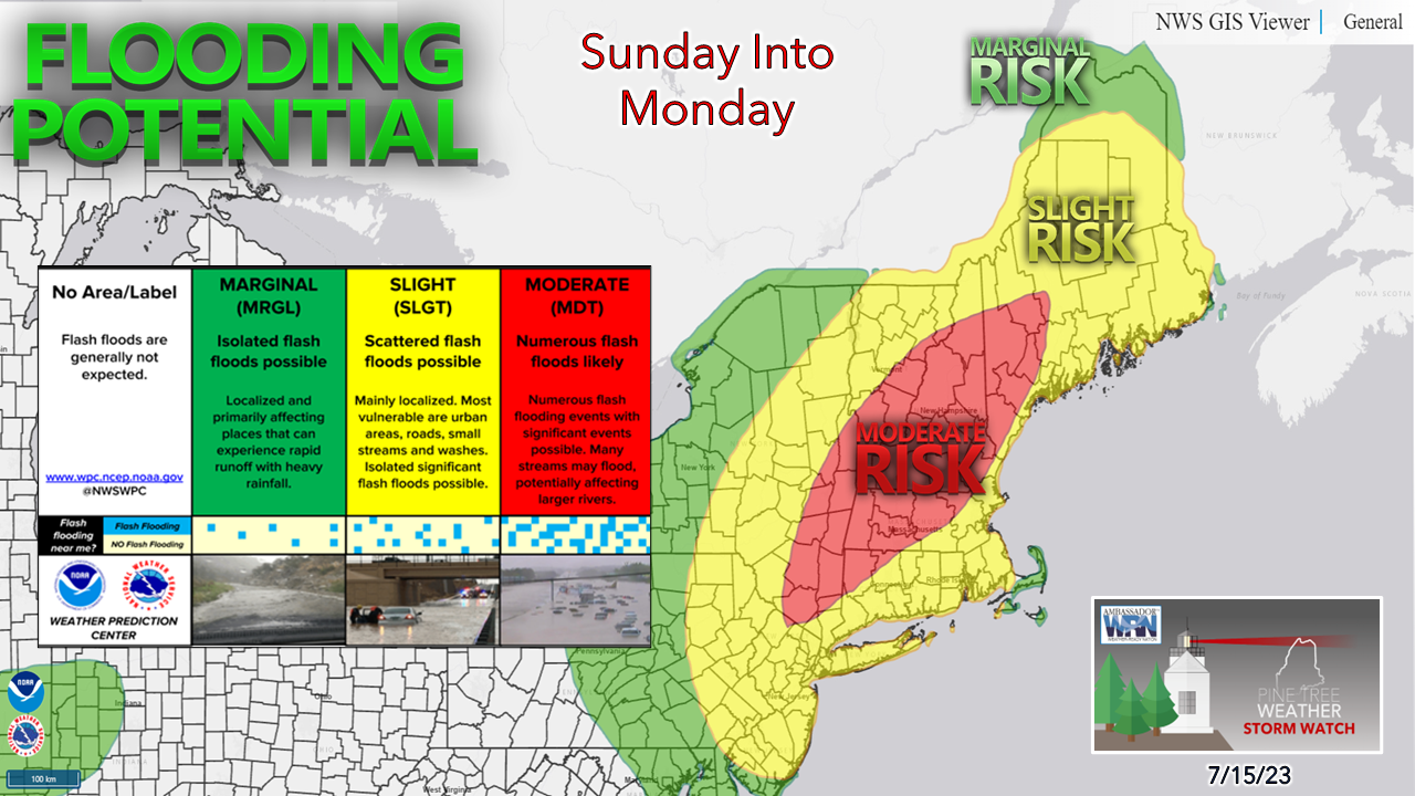 As of 6 AM Saturday morning, the National Weather Service has posted an areal flood watch for parts of western Maine and all of New Hampshire, Connecticut, Rhode Island, most of Massachusetts and Vermont ahead of the next round of torrential rain for Sunday into Monday. The Weather Prediction Center is expecting widespread flash flood potential as indicated in the red moderate risk region. There is a real concern for road washouts, urban street flooding, and potential for river flooding as most in the red area are at their high point. With precipitable water amounts in the 2-2½" range and dew points in the 70s, the air is expected to be more than ripe to dump a lot of rain with high rainfall rates. This will cause travel problems by car and may impact air travel. Oh, and there is a chance for severe weather, too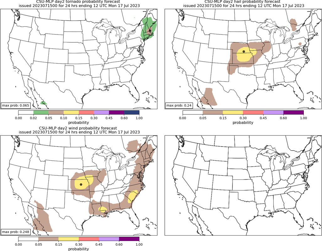 Courtesy of the Colorado State University Machine-Learning A hat tip to Chris Legro of the National Weather Service Gray for pointing this out in the area forecast discussion posted early Saturday morning. While the flood threat is a real one, this system is tropical in nature and does pose a severe thunderstorm threat. There are healthy dynamics of a strong low-level jet that will not only pump copious amounts of moisture, but also create spin in the atmosphere, which could cause tornadic activity. It is important to note that the severe threat is sun dependent, and that may be hard to come by. As I have been saying ad nauseum for the past few days, if the sun gets out, expect the thunder guns to come out. There is also the threat of damaging wind in torrential downpours, regardless of if thunderous or not, due to the amplified low-level jet. Some showers and storms around Saturday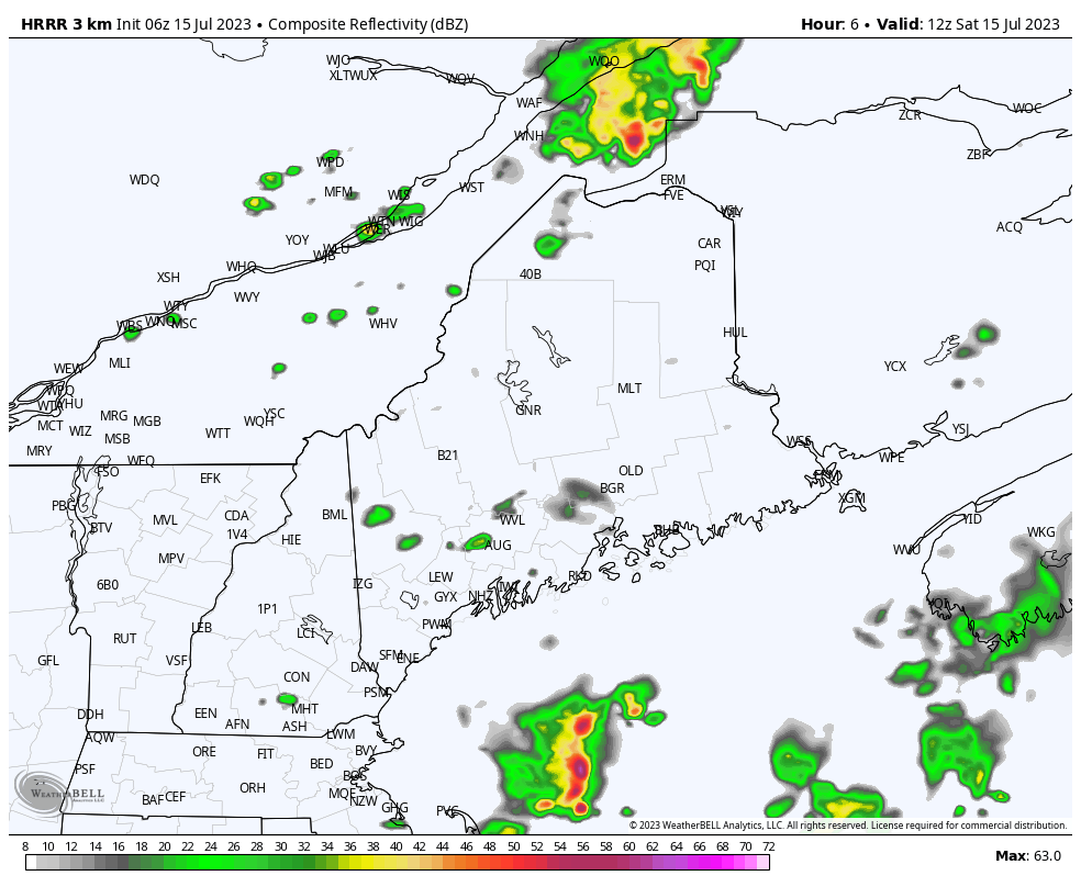 Saturday 8 AM to Sunday Midnight - Widely scattered showers and storms are expected for the state through the day and into the evening. Not all areas could get wet, but there is the chance for the entire region to get a shower. The deluge comes in Sunday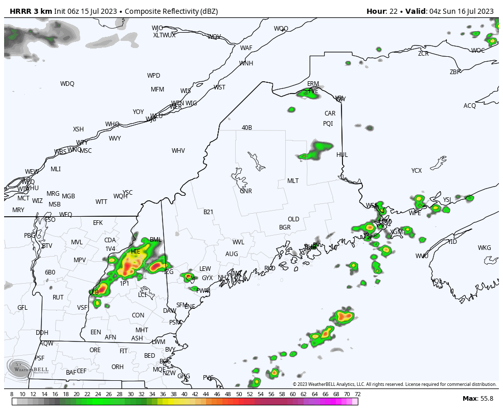 Sunday Midnight to Monday 2 AM - For folks in eastern areas, you'll be fortunate to have a mainly dry day unless you are close to the shorelines dealing with fog and drizzle. Scattered showers with a rumble or two are possible elsewhere in the morning before the heavy rain arrives in the afternoon. Steady rain proceeds from southwest to northeast during the afternoon. A cold front approaches from the northwest Sunday night into Monday, which will keep the threat of showers and storms around overnight and into the day. General idea on rainfall amounts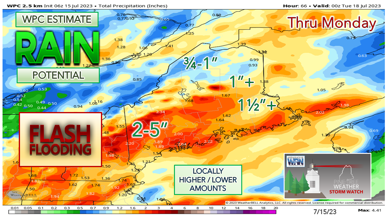 I stress the word "general" here given the nature of the tropical fire hose that we are dealing with here. The western foothills and mountains are expected to receive the higher amounts given the wind direction and the result of orographic lift. This is where the main concern is for potential road washouts. Will this be as bad as what Vermont went through earlier in the week? Doubtful. That said, it is likely to bring its own share of problems. Stay on alert, make sure you have multiple ways to receive alerts, take appropriate action and never drive over a flooded roadway. Turn around and don't drown.  Pine Tree Weather is funded from followers like you. I would appreciate your financial support. Click here for how you can contribute. You may not like the weather, but I hope you like what I do, and support my efforts. Thank you! Stay updated, stay on alert, and stay safe! - Mike NOTE: The forecast information depicted on this platform is for general information purposes only for the public and is not designed or intended for commercial use. For those seeking pinpoint weather information for business operations, you should use a private sector source. For information about where to find commercial forecasters to assist your business, please message me and I will be happy to help you. |

Mike Haggett
|


