
Overview from the steering level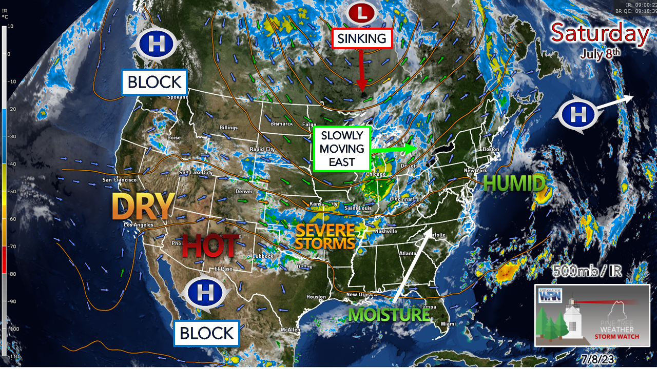 I've mentioned this in the past and will say it again, this is a classic evolving El Niño pattern going on here. While each of ENSO (El Niño Southern Oscillation) patterns are unique with their subtle quirks, the consistent set up of strong ridging to the west and a troffy pattern to the east is pronounced. The good news is that the fires in Canada are getting into the moisture now and will extinguish most of the flames where they have been burning, but there is potential for more to rise up over British Columbia and the Yukon given the blocking going on there. The upper low over Hudson Bay will raise havoc with severe weather over the south as it sinks downward. The slow-moving frontal boundary near the Great Lakes will crawl east and impact the state the first of next week. A few showers and isolated storms possible Saturday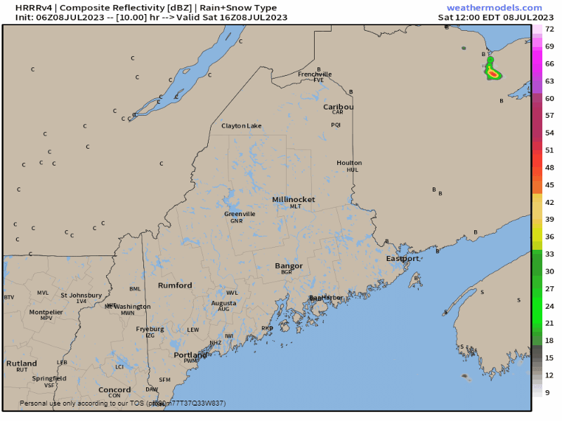 Saturday Noon to Sunday Midnight - With the region in between the frontal boundary to the west and high pressure to the east, we're kind of stuck in no man's land for the day. The high will flex itself a bit and pump moisture in from the southwest, which will generate cloud cover and fog across much of the coastal plain for the day. From the western foothills on over to Bangor and points north, there is a chance for a widely scattered shower and/or thunderstorm in the afternoon, tapering off overnight. 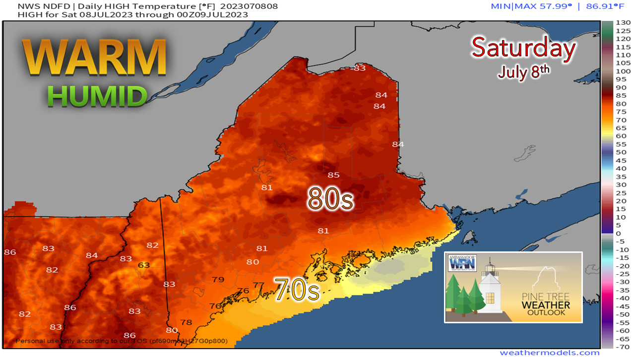 High temperatures for the day will depend on the amount of sun, which is expected to be more prevalent over the interior. Temperatures rise into the 80s there, with heat indices pushing 90° with humidity. For the coast, 70s are the top out point, although the islands and shoreline areas of the MidCoast east may not get that high pending on pockets of dense fog, where 60s will be the high point there. Sunday appears to be a virtual carbon copy of Saturday, but with more cloud cover pushing into the interior and cooler temperatures. The shower and storm risk is once again minimal. Folks along the coastal plain may get a light shower or two, but nothing to dampen any outdoor plans for most. Shoreline areas east of Portland may be socked in with fog and areas of drizzle, however. Outlook through Wednesday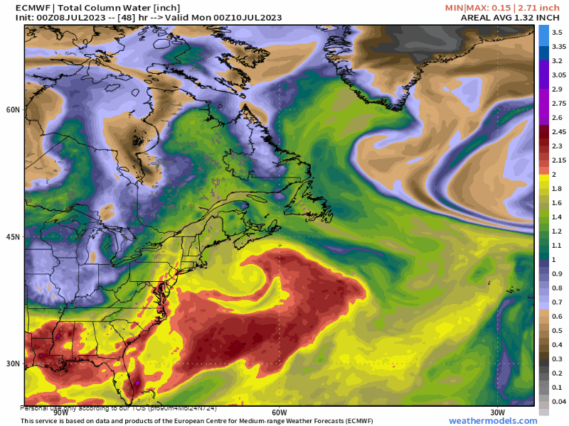 Sunday 8 PM to Tuesday 8 PM - A look here at the forecast loop for precipitable water values, which indicates the amount of moisture in the air column. The browns indicate dry air, the reds and purples the tropical air. This loop paints a great picture of the sinking upper-low over Ontario, the progression of the slow-moving frontal boundary bringing the surge in higher dew points, and an upper-low pivoting southwest of Greenland. It's the surge of moisture that is the concern for torrential rain and severe weather potential for the region from Monday into Tuesday. The region appears to get a slight reduction in the humidity for Wednesday, but that will be short lived as dew points rise up the rest of the week. 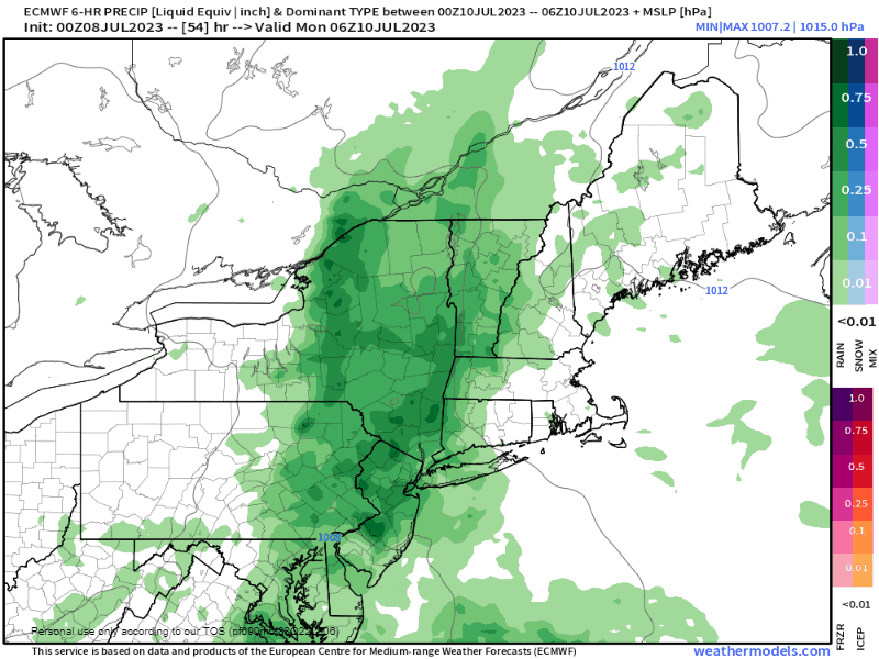 Monday 2 AM to Wednesday 2 AM - I haven't talked about potential rainfall amounts up until now due to the fact that the heavy rain that comes is likely to be localized. All areas can expect some rain out this, and the main focal areas for the heaviest are for the western foothills and eastern areas northward. For southern areas it is a bit of a coin toss. The Storm Prediction Center has the state covered with an isolated severe storm threat. The Weather Prediction Center has the state covered with an isolated flash flood risk. All of that is understandable given the very juicy air. What will tip the scale will be the amount of sun, which may not be much, if any, and the threat of elevated thunderstorms to develop, which appears to be the better bet. The localized threat of 3-5"+ of rain and damaging wind is on the discussion board where convection takes place. For now, it is wait and see. Some areas will get hosed, others may escape. Stay tuned! Click here for the old school Weather Channel Local ForecastScroll to the bottom and click on Hazardous Weather, scroll back up, enter your town, then click go! Pine Tree Weather is funded from followers like you. I would appreciate your financial support. Click here for how you can contribute. You may not like the weather, but I hope you like what I do, and support my efforts. Thank you! Stay updated, stay on alert, and stay safe! - Mike NOTE: The forecast information depicted on this platform is for general information purposes only for the public and is not designed or intended for commercial use. For those seeking pinpoint weather information for business operations, you should use a private sector source. For information about where to find commercial forecasters to assist your business, please message me and I will be happy to help you. |

Mike Haggett
|


