
Relatively quiet pattern ahead High pressure over New England slides offshore Wednesday night. A weak warm front sneaks in overnight, followed by a weak cold front passing through the area Thursday. Canadian high pressure moves eastward for the weekend. Best chance for showers north and west Thursday Any chance for a light shower would be remote for most of the morning. The front approaches Thursday afternoon bringing scattered showers for the north and mountains, and widely scattered showers for the south and east. Precipitation ends from northwest to southeast early to late evening Thursday night. Finish stacking the firewood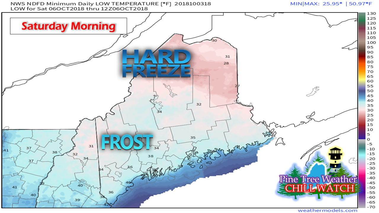 We've already had a couple of chilly mornings over the state, and there will be a couple more on the way this weekend. Friday morning starts off with 30s over the northern and western areas. Saturday morning features 20s for a fair amount of the interior and 30s close to the shorelines. If you are still growing, plan on covering your plants Thursday and Friday nights. High pressure keeps Leslie out to sea After the cold front passes through Thursday night, high pressure takes over Friday and Saturday. A weak front may bring some isolated shower activity Saturday night into Sunday morning, but the rain risk appears very low. Another Canadian high trails the front, bringing another cool night Sunday and dry conditions for Monday. As I mentioned in last night's update, surf from Leslie is likely to affect the New England shorelines this weekend. With astronomical high tides from the approaching new moon, splash over and minor flooding is possible. Stay tuned for possible statements from the National Weather Service. It may be late next week before another widespread rain event of any substance affects the region. On a side note, there is a chance for something tropical to generate over the southeast and western Caribbean given the pattern. Keep tabs on all things tropical with the National Hurricane Center. Five Day Outlook through Columbus Day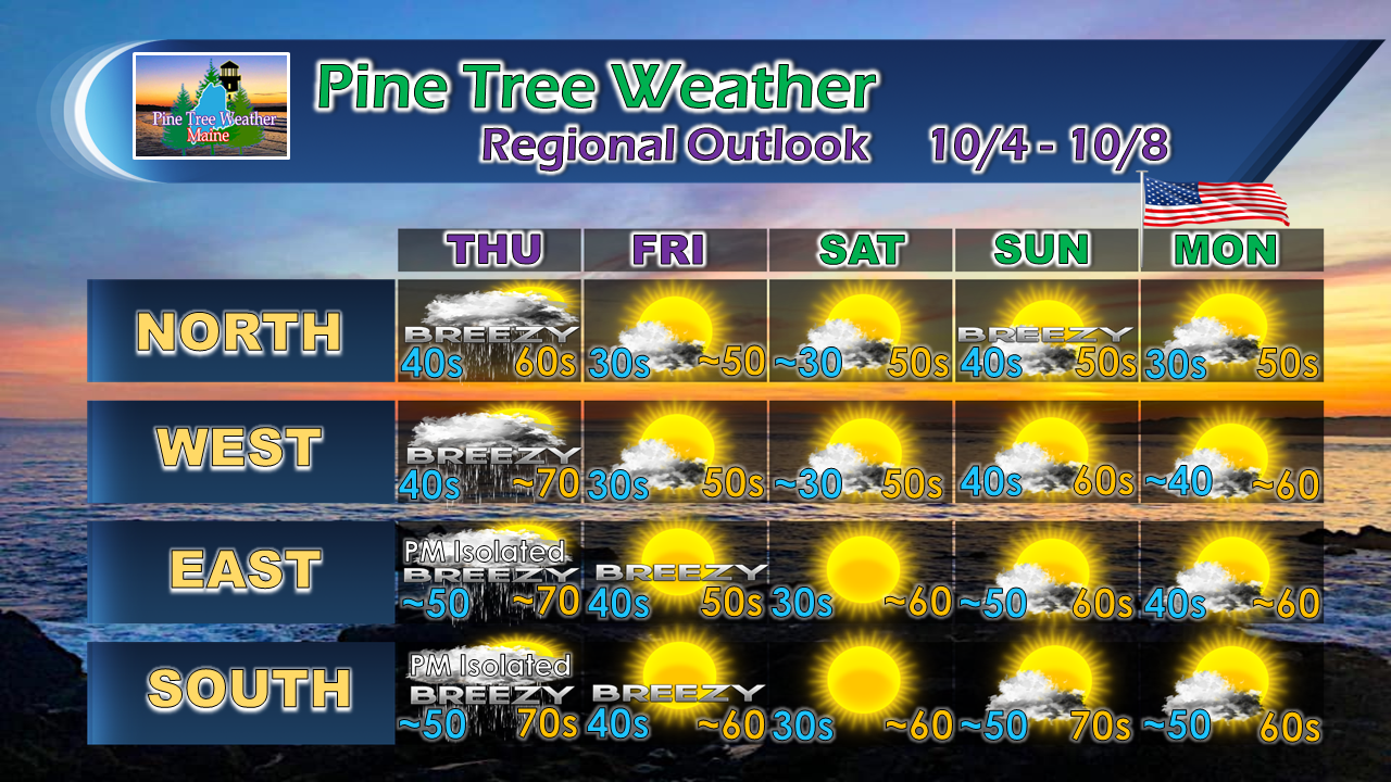 For the latest official forecasts, bulletins and advisories, please check in with the National Weather Service in Gray for western and southern areas, or Caribou for northern and eastern parts of Maine.
For more information from me, please follow the Pine Tree Weather Facebook page and my Twitter feed. Thanks as always for your support! Please consider making a donation to keep Pine Tree Weather going. Check out the donate page on how to contribute. Always stay weather aware! - Mike |

Mike Haggett
|


