
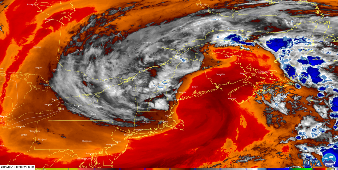
 As I was watching the storm round the horn of Cape Cod headed for Penobscot Bay, it was neat to see a rare August NorEaster unfold. I monitored precipitation amounts and wind gusts through the day thought this was one behaved itself. Downpours were isolated. For most it was a slow, steady rainfall which allowed it to absorb into the ground which given the drought is what was needed. DownEast areas faired very well, with observations in the 2-3" range in spots. For western areas, totals were less than an inch by-in-large, but some isolated amounts were buoyed up thanks to the showers around Tuesday afternoon. With the latest weekly update from Drought Monitor due out by 9 AM Thursday, I expect that it may look grave for the MidCoast and southwest coast as the totals of this rain won't be factored in until next week's update. A look at the low-level water vapor image shows that the storm has become vertically stacked with low pressure centers aligned from high altitude to the surface and thus spinning itself out. Dry air as indicated by the oranges and reds is taking over, and that is the main weather story for the day. Scattered showers through the day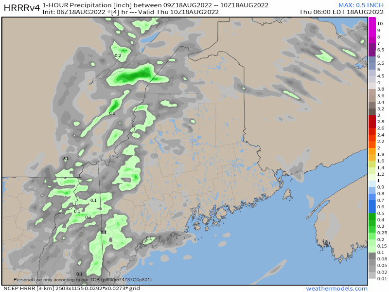 Thursday 6 AM to Friday Midnight - The area of low pressure is easily defined in this loop. The dry air continues to work into the occluded system and thus ends the steady rainfall over western and southern areas and changes it to widely scattered showers Thursday afternoon. What is left of the storm moves northeastward into New Brunswick Thursday night into Friday morning. 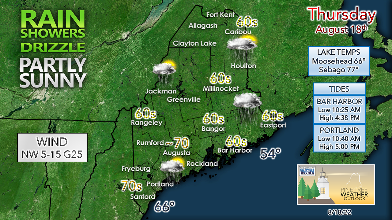 The best chance for sun is for southwestern areas in the afternoon. Far eastern areas may not see the sun at all. Where the sun gets out, temperatures rise into the 70s. The mountains are the cool spot, and that area may struggle to get to 60°. Expect the breeze to be strongest over southwestern areas in the afternoon, then slowly diminish overnight. Tropical update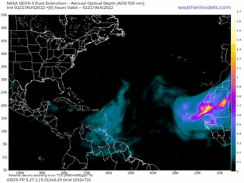 I mentioned last week that wind shear has been an issue for the lack of tropical storm development, the other factor is Saharan dust. You may see or hear the acronym SAL get tossed around in tropical discussions, and that means the Saharan Air Layer. It is hot, dry air with tiny grains of sand that enter the upper level of the atmosphere, and by doing so, neutralizes any ability for storms of any major impact or concern. This has kept the area around Cape Verde quiet to this point. The Gulf of Mexico and western Caribbean is the key area to watch in the short term, but shear is keeping storms from organizing there. 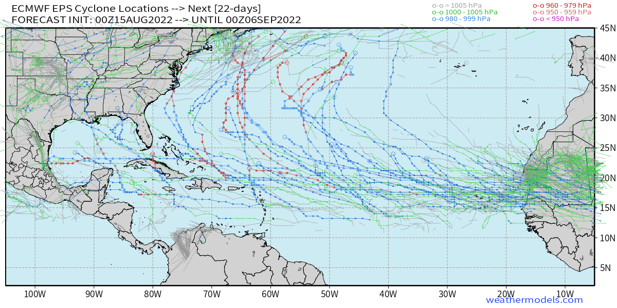 Looking ahead over the next couple of weeks into early September, there are signals that the SAL dissipates, the shear drops, and the tropical Atlantic could erupt. For now, the idea of potential storm tracks is strictly model fantasy. I am already seeing images of some long-term GFS ideas for major hurricanes being spread around. What is important to understand here is that time is approaching peak season. Just because it has been quiet doesn't mean it will stay that way. The images being passed along simply indicate potential, and it is something to consider as you survey your yard and start thinking about fall which isn't far away. Outlook into early next week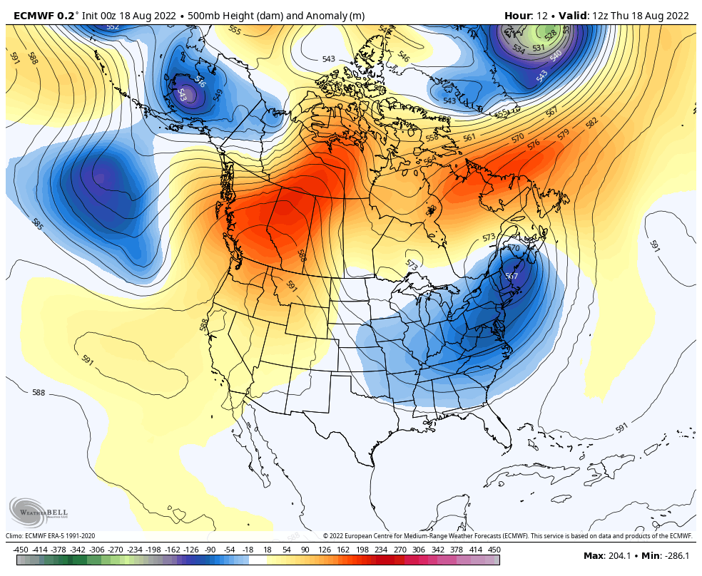 Thursday 8 AM to Sunday 8 PM - A look at the 500mb steering level in the atmosphere shows the trough that spun up the recent rain moving to the northeast and fizzling out. Summer returns for the weekend as a ridge builds in from the southeast. The first half of the weekend appears warm but with dew point temperatures at comfortable levels. That changes heading into Sunday as a southwest flow develops and begins to pump moisture in. There is a slight chance of showers and storms for the mountains and north for Sunday as a cold front approaches from the west. Guidance at this point is inconclusive as to the timing of it. The next chance for rain appears to be Monday night / Tuesday, but that penciled in for now and is subject to change. 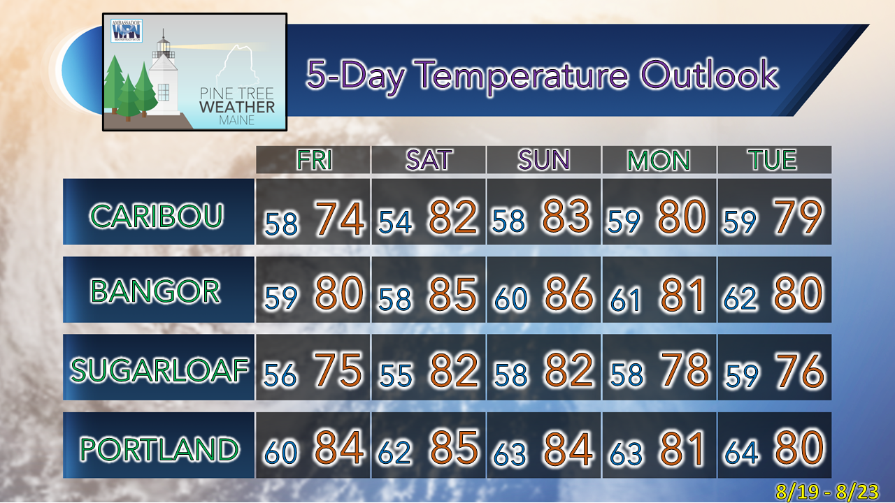 Thank you for supporting this community-based weather information source which operates by financial contributions from people like you. TWITTER UPDATES THRU THE WEEKEND NEXT SCHEDULED POST HERE MONDAY Stay updated, stay on alert, and stay safe! - Mike NOTE: The forecast information depicted on this platform is for general information purposes only for the public and is not designed or intended for commercial use. For those seeking pinpoint weather information for business operations, you should use a private sector source. For information about where to find commercial forecasters to assist your business, please message me and I will be happy to help you. |

Mike Haggett
|


