Finally, some rain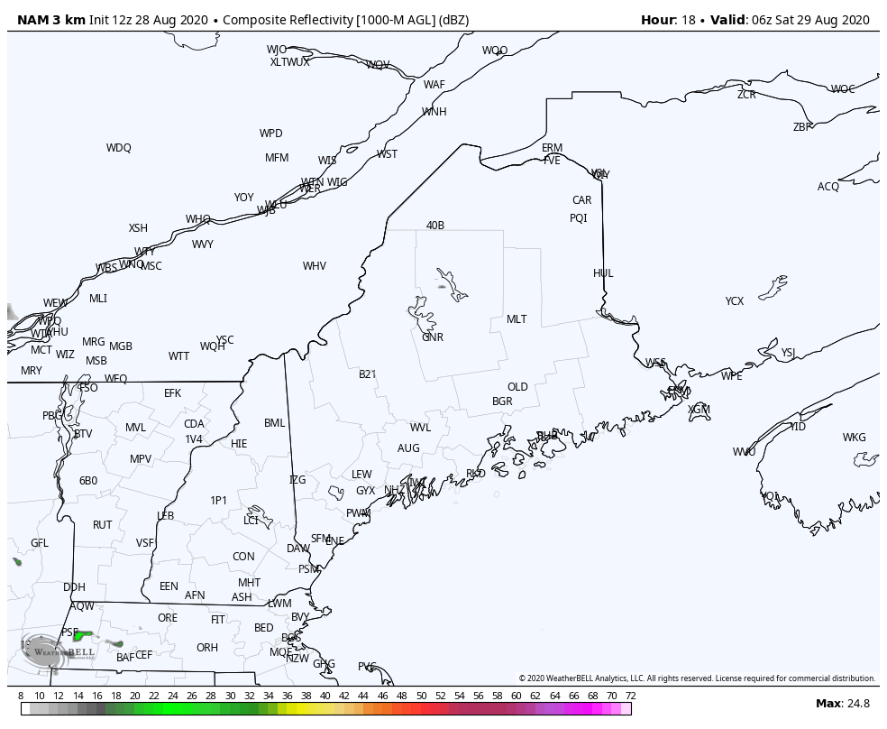 I think the important word of the headline is "some" rain. The concern I have voiced in the discussions here over the past couple of days about the timing phasing of the northern and southern jet streams in time for a "soaker" has come true. It won't happen in time. We'll take what we can get out of this, which will generally be a half inch. The mountains and where there are thunderstorms will get more, some areas will get less. Showers spread over southern and western areas Saturday morning, and move into northern and eastern areas in the afternoon. The steady shower activity is over for southern areas by midday. Steady showers give way to scattered showers and potential storms Saturday afternoon, into the evening for northern areas. 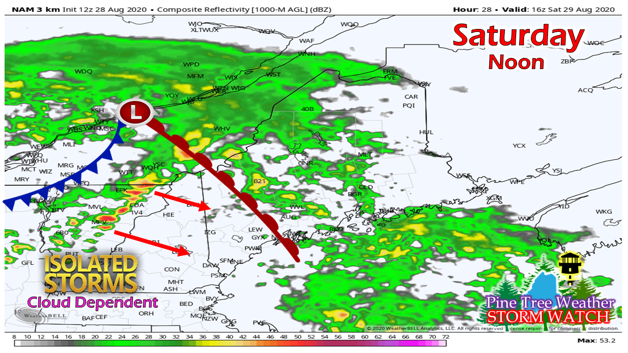 As a warm front moves northeastward Saturday afternoon, this is where the forecast gets a bit tricky. Cloud cover is going to dictate storm potential as a cold front approaches from the northwest. The saying goes, "If the sun comes out, look out!" Humidity levels appear to rise mainly over southwestern areas, with dew points potentially in the upper 60s to around 70° Saturday afternoon. If sun does come out, isolated spicy storms are possible with heavy downpours, damaging wind potential, hail and a chance for a tornado. If the clouds hold on, then that will diminish the storm threat, but isolated showers are possible until the cold front clears Saturday night. Sunday a breezy affair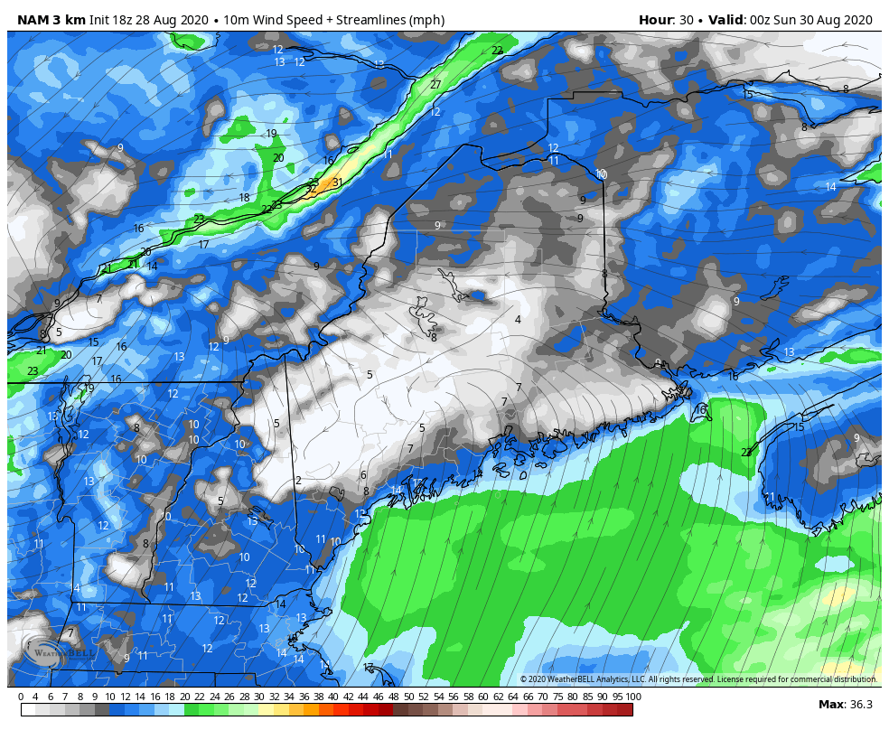 After the cold front passes through the state, wind will increase from the west / northwest overnight into Sunday as the Saturday storm begins to intensify on its way to Newfoundland. Wind speeds could reach 30+ mph, especially in the higher elevations. The wind begins to settle from west to east late afternoon for western and southern areas, overnight into Monday for eastern and northern areas. The next chance for rain appears to be midweek. Temperature outlook 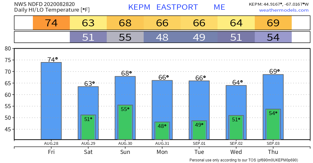 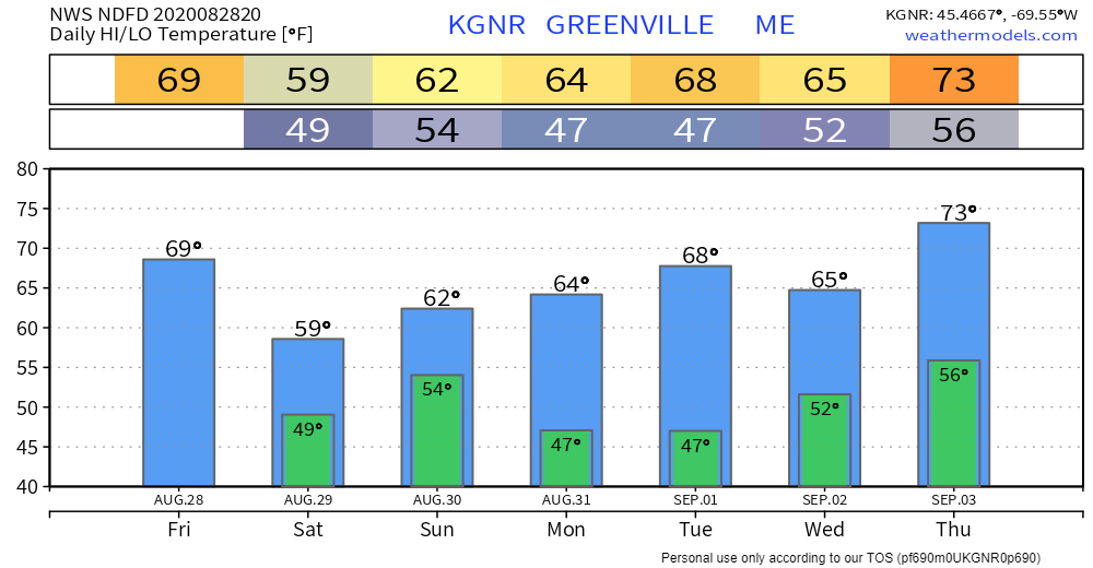 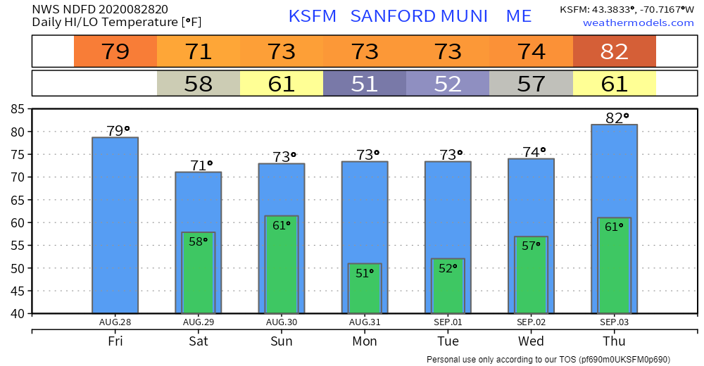 Be ready for the next big storm! Be ready for alerts and stay updated!
For more information, please follow Pine Tree Weather on Facebook and Twitter.
Thank you for supporting this community based weather information source that is funded by your financial contributions. Stay updated, stay on alert, and stay safe! - Mike |

Mike Haggett
|